- Clay County, Missouri
-
Clay County, Missouri 
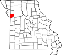
Location in the state of Missouri
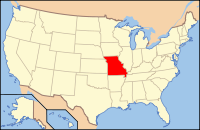
Missouri's location in the U.S.Founded January 2, 1822 Seat Liberty Area
- Total
- Land
- Water
408.86 sq mi (1,059 km²)
396.35 sq mi (1,027 km²)
12.52 sq mi (32 km²), 2.78%Population
- (2010)
- Density
221,939
558/sq mi (216.7/km²)Time zone Central: UTC-6/-5 Website claycountymo.gov Clay County is a county located in the U.S. state of Missouri. It is the seventh most populous county in Missouri. As of 2010, the population was 221,939.[1] Its county seat is Liberty[2]. The county was organized in 1822 and was named in honor of U.S. Representative Henry Clay from Kentucky, later member of the United States Senate and United States Secretary of State.
Clay County is part of the Kansas City Metropolitan Area.
Contents
History
Clay County was settled primarily from migrants from the Upper South states of Kentucky, Tennessee, and Virginia. They brought slaves and slaveholding traditions with them, and quickly started cultivating crops similar to those in Middle Tennessee and Kentucky: hemp and tobacco. Clay was one of several counties settled mostly by southerners to the north and south of the Missouri River. Given their culture and traditions, this area became known as Little Dixie. In 1860 slaves made up 25 percent or more of the county's population.[3] Residents generally supported the Confederacy during the Civil War.
Many members of the Latter Day Saint movement found refuge in Clay County in November 1833. In 1836 mobs drove the members of the church from the county.[4] Leaders of this church, most notably church President Joseph Smith, Jr. were imprisoned for some months in Clay county, in the jail at Liberty (see Liberty Jail).
Historical populations
In 1930 Clay county had 26,811 residents.[5]
Geography
According to the 2000 census, the county has a total area of 408.86 square miles (1,058.9 km2), of which 396.35 square miles (1,026.5 km2) (or 96.94%) is land and 12.52 square miles (32.4 km2) (or 3.06%) is water.[6]
Adjacent counties
- Clinton County (north)
- Ray County (east)
- Jackson County (south)
- Wyandotte County, Kansas (southwest)
- Platte County (west)
Major highways
 Interstate 29
 Interstate 35
 Interstate 435
 U.S. Route 69
 U.S. Route 71
 U.S. Route 169
 Route 1
 Route 9
 Route 10
 Route 33
 Route 92
 Route 152
 Route 210
 Route 291
Midwest National Air Center
Clay County owns and operates the Midwest National Air Center located at 13106 Rhodus Rd., Excelsior Springs, MO.
Demographics
As of the census[7] of 2010, there were 221,939 people, 72,558 households, and 50,137 families residing in the county. The population density was 558 people per square mile (216/km²). There were 93,918 housing units at an average density of 236 per square mile (91/km²). The racial makeup of the county was 87.46% White, 5.18% African American, 0.53% Native American, 2.05% Asian, 0.26% Pacific Islander, 1.77% from other races, and 2.75% from two or more races. 5.9% of the population were Hispanic or Latino of any race. As of the census[7] of 2000 23.3% were of German, 14.5% American, 11.0% English, 10.8% Irish and 5.6% Italian ancestry according to Census 2000.
There were 72,558 households out of which 33.80% had children under the age of 18 living with them, 55.40% were married couples living together, 10.20% had a female householder with no husband present, and 30.90% were non-families. 25.20% of all households were made up of individuals and 7.40% had someone living alone who was 65 years of age or older. The average household size was 2.50 and the average family size was 3.00.
In the county the population was spread out with 25.80% under the age of 18, 8.70% from 18 to 24, 32.30% from 25 to 44, 22.30% from 45 to 64, and 10.80% who were 65 years of age or older. The median age was 35 years. For every 100 females there were 94.60 males. For every 100 females age 18 and over, there were 91.80 males.
The median income for a household in the county was $48,347, and the median income for a family was $56,772. Males had a median income of $40,148 versus $27,681 for females. The per capita income for the county was $23,144. About 3.80% of families and 5.50% of the population were below the poverty line, including 6.40% of those under age 18 and 5.50% of those age 65 or over.
There are 151,042 registered voters.[8]
Notable residents
- Jesse James was born in Clay County in 1847.
- Frank James was born in Clay County in 1843.
Cities and towns
See also
- List of counties in Missouri
- Missouri census statistical areas
- Mormon War (1838)
- National Register of Historic Places listings in Clay County, Missouri
References
- ^ "2010 Census Data". U.S Census Bureau. http://2010.census.gov/2010census/data/. Retrieved 2010-03-05.
- ^ "Find a County". National Association of Counties. http://www.naco.org/Counties/Pages/FindACounty.aspx. Retrieved 2011-06-07.
- ^ T. J. Stiles, Jesse James: The Last Rebel of the Civil War, New York: Vintage Books, 2003, pp.10-11
- ^ Jenson, Andrew. Encyclopedic History of the Church of Jesus-Christ of Latter-day Saints (Salt Lake City: Deseret News Press, 1941) p. 144-145
- ^ Jenson. Encyclopedic History. p 144
- ^ "Census 2000 U.S. Gazetteer Files: Counties". United States Census. http://www.census.gov/tiger/tms/gazetteer/county2k.txt. Retrieved 2011-02-13.
- ^ a b "American FactFinder". United States Census Bureau. http://factfinder.census.gov. Retrieved 2008-01-31.
- ^ Registered Voters in Missouri 2008
External links
Coordinates: 39°19′N 94°25′W / 39.31°N 94.42°W
- Clay County government's website
- Clay County Economic Development Council website
- Digitized 1930 Plat Book of Clay County from University of Missouri Division of Special Collections, Archives, and Rare Books

Clinton County 
Platte County 
Ray County  Clay County, Missouri

Wyandotte County, Kansas Jackson County Kansas City Metropolitan Area's cities and counties Central city 
Largest cities (over 100,000 in 2000) Medium-sized cities (10,000 to 100,000 in 2000) Blue Springs • Belton • Excelsior Springs • Gladstone • Grandview • Lansing • Leawood • Leavenworth • Lee's Summit • Lenexa • Liberty • Merriam • Ottawa • Prairie Village • Raymore • Raytown • ShawneeCounties Municipalities and communities of Clay County, Missouri Cities Avondale | Excelsior Springs‡ | Gladstone | Glenaire | Holt‡ | Independence‡ | Kansas City‡ | Kearney | Liberty | Lawson‡ | Missouri City | Mosby | North Kansas City | Pleasant Valley | Smithville‡ | Sugar Creek‡
Villages Birmingham | Claycomo | Excelsior Estates‡ | Oaks | Oakview | Oakwood | Oakwood Park | Prathersville | Randolph
Townships Chouteau | Fishing River | Gallatin | Kearney | Liberty | Platte | Washington
Unincorporated
communityFootnotes ‡This populated place also has portions in an adjacent county or counties
Categories:- Missouri counties
- Clay County, Missouri
- Little Dixie (Missouri)
- 1822 establishments in the United States
- Populated places established in 1822
- Missouri counties on the Missouri River
Wikimedia Foundation. 2010.


