- Daviess County, Missouri
-
Daviess County, Missouri 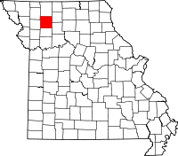
Location in the state of Missouri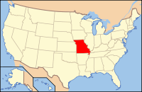
Missouri's location in the U.S.Founded 1836 Named for Col. Joseph H. Daviess of Kentucky, who fell in 1811 at the Battle of Tippecanoe Seat Gallatin Largest city Gallatin Area
- Total
- Land
- Water
569.07 sq mi (1,474 km²)
566.97 sq mi (1,468 km²)
2.11 sq mi (5 km²), 0.37Population
- (2000)
- Density
8,016
5/sq mi (14/km²)Time zone Central: UTC-6/-5 Website www.grm.net/~daviess/ This page is about the county in Missouri. For other counties with similar names, see Daviess County.
Daviess County is a county located in the U.S. state of Missouri. As of 2000, the population was 8,016. Its county seat is Gallatin[1]. The county was organized in 1836 and is named after Col. Joseph Hamilton Daviess of Kentucky, who was killed in 1811 at the Battle of Tippecanoe.
Contents
History
Jamesport includes the largest Amish community in Missouri.
According to Mormon founder Joseph Smith, Jr., Adam-ondi-Ahman, situated in the central part of the county, was where Adam and Eve relocated after being banished from the Garden of Eden. According to LDS tradition, the site is to be a gathering spot prior to the Second Coming of Jesus Christ.
Joseph Smith's revelation which came in 1838 -- two years after the county was organized -- spurred in an influx of Mormon settlers. Non-Mormon residents feared they were going to lose control of the county and attempted to prevent Mormons voting in the Gallatin election day battle. This was to be the first skirmish in the Mormon War, in which Missouri evicted the Mormons after arresting Joseph Smith and other leaders of the church.
The County played a major role in the history of the outlaw James-Younger Gang. The first confirmed bank robbery involving Jesse James occurred on December 7, 1869 at the Daviess County Savings Association in Gallatin. In the process the bank cashier John W. Sheets was killed by Jesse James, who believed Sheets was Samuel P. Cox, who had killed James's bushwhacker Bloody Bill Anderson during the American Civil War. On July 15, 1881, the gang was believed to have been responsible for the robbery of the Rock Island Line at Winston in which a conductor and passenger were killed.
After Jesse was murdered in St. Joseph, Missouri, Frank James surrendered in 1882 to face Daviess County charges in connection with the train robbery/murder as well as murder charges in the 1869 robbery. Frank James was tried from August 20 through September 6, 1883. Interest was so intense that the trial was moved to the Gallatin Opera House to accommodate the crowds. James was found not guilty of involvement in both crimes. Charges were made that the jury was filled with Southern sympathizers who refused to convict one of their own.[1]
The Daviess County Savings Association and the Gallatin Opera House have since been torn down although the Winston Rock Island Line train station still stands and is used by the historical society.
Daviess County has one of only three Rotary Jails still in existence. Also known as the "Squirrel Cage Jail" [2], it is now a museum and is on the National Register of Historic Places.
Notable natives and residents
- Phog Allen - University of Kansas coach called the "Father of Basketball Coaching"
- Conrad Burns - Senator from Montana
- Samuel P. Cox - American Civil War officer who killed Bloody Bill Anderson
- Webster Davis - Mayor of Kansas City, Missouri
- Alexander Monroe Dockery - Missouri Governor
- Larry Holley - Head men's basketball coach at William Jewell College.
- William Thornton Kemper, Sr. - Patriarch of the Missouri Kemper financial family
- Jerry Litton - Congressman who died in a plane on the night he won the 1976 Democratic primary for U.S. Senate
- Johnny Ringo - outlaw who briefly lived in the town
- Martha Scott - Academy Award nominated actress
Geography
According to the 2000 census, the county has a total area of 569.07 square miles (1,473.9 km2), of which 566.97 square miles (1,468.4 km2) (or 99.63%) is land and 2.11 square miles (5.5 km2) (or 0.37%) is water.[2]
Adjacent counties
- Harrison County (north)
- Grundy County (northeast)
- Livingston County (southeast)
- Caldwell County (south)
- DeKalb County (west)
- Gentry County (northwest)
Major highways
Demographics
Historical populations Census Pop. %± 1900 21,325 — 1910 17,605 −17.4% 1920 16,641 −5.5% 1930 14,424 −13.3% 1940 13,398 −7.1% 1950 11,180 −16.6% 1960 9,502 −15.0% 1970 8,420 −11.4% 1980 8,905 5.8% 1990 7,865 −11.7% 2000 8,016 1.9% As of the census[3] of 2000, there were 8,016 people, 3,178 households, and 2,265 families residing in the county. The population density was 14 people per square mile (5/km²). There were 3,853 housing units at an average density of 7 per square mile (3/km²). The racial makeup of the county was 98.68% White, 0.05% Black or African American, 0.39% Native American, 0.07% Asian, 0.19% Pacific Islander, 0.21% from other races, and 0.41% from two or more races. 0.69% of the population were Hispanic or Latino of any race.
There were 3,178 households out of which 31.50% had children under the age of 18 living with them, 60.80% were married couples living together, 7.50% had a female householder with no husband present, and 28.70% were non-families. 25.70% of all households were made up of individuals and 13.20% had someone living alone who was 65 years of age or older. The average household size was 2.50 and the average family size was 3.02.
In the county the population was spread out with 27.00% under the age of 18, 7.60% from 18 to 24, 24.10% from 25 to 44, 23.70% from 45 to 64, and 17.60% who were 65 years of age or older. The median age was 39 years. For every 100 females there were 92.90 males. For every 100 females age 18 and over, there were 90.90 males.
The median income for a household in the county was $30,855, and the median income for a family was $35,585. Males had a median income of $24,888 versus $18,397 for females. The per capita income for the county was $15,953. About 11.40% of families and 15.20% of the population were below the poverty line, including 21.30% of those under age 18 and 13.20% of those age 65 or over.
Cities and towns
See also
- National Register of Historic Places listings in Daviess County, Missouri
- Daviess County Sheriff's Office
References
- ^ "Find a County". National Association of Counties. http://www.naco.org/Counties/Pages/FindACounty.aspx. Retrieved 2011-06-07.
- ^ "Census 2000 U.S. Gazetteer Files: Counties". United States Census. http://www.census.gov/tiger/tms/gazetteer/county2k.txt. Retrieved 2011-02-13.
- ^ "American FactFinder". United States Census Bureau. http://factfinder.census.gov. Retrieved 2008-01-31.
External links
- Digitized 1930 Plat Book of Daviess County from University of Missouri Division of Special Collections, Archives, and Rare Books

Gentry County Harrison County Grundy County DeKalb County 
 Daviess County, Missouri

Caldwell County Livingston County Municipalities and communities of Daviess County, Missouri Cities Coffey | Gallatin | Gilman City‡ | Jamesport | Pattonsburg

Villages Altamont | Jameson | Lock Springs | Winston
Townships Benton | Colfax | Grand River | Harrison | Jackson | Jamesport | Jefferson | Liberty | Lincoln | Marion | Monroe | Salem | Sheridan | Union | Washington
Footnotes ‡This populated place also has portions in an adjacent county or counties
Categories:- Missouri counties
- Daviess County, Missouri
- Significant places in Mormonism


Wikimedia Foundation. 2010.