- Raytown, Missouri
Infobox Settlement
official_name = Raytown, Missouri
settlement_type =City
nickname =
motto =
imagesize =
image_caption =
image_
imagesize =
image_caption =
image_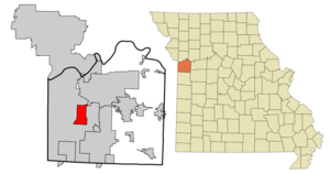
mapsize = 250px
map_caption = Location of Raytown in Jackson County and Missouri
mapsize1 =
map_caption1 =subdivision_type = Country
subdivision_name =United States
subdivision_type1 = State
subdivision_name1 =Missouri
subdivision_type2 = County
subdivision_name2 = Jackson
government_footnotes =
government_type =
leader_title =
leader_name =
leader_title1 =
leader_name1 =
established_title =
established_date =unit_pref = Imperial
area_footnotes =area_magnitude =
area_total_km2 = 25.7
area_land_km2 = 25.7
area_water_km2 = 0.1
area_total_sq_mi = 9.9
area_land_sq_mi = 9.9
area_water_sq_mi = 0.0population_as_of = 2000
population_footnotes =
population_total = 30388
population_density_km2 = 1183.8
population_density_sq_mi = 3065.9timezone = Central (CST)
utc_offset = -6
timezone_DST = CDT
utc_offset_DST = -5
elevation_footnotes =
elevation_m = 309
elevation_ft = 1014
latd = 38 |latm = 59 |lats = 42 |latNS = N
longd = 94 |longm = 27 |longs = 56 |longEW = Wpostal_code_type =
ZIP code s
postal_code = 64129, 64133, 64138
area_code = 816
blank_name = FIPS code
blank_info = 29-60788GR|2
blank1_name = GNIS feature ID
blank1_info = 0735817GR|3
website =
footnotes =Raytown is a city in Jackson County,
Missouri ,United States , and is a suburb of Kansas City. The population was estimated at 28,577 in 2006. [http://factfinder.census.gov/servlet/GCTTable?_bm=y&-geo_id=04000US29&-_box_head_nbr=GCT-T1-R&-ds_name=PEP_2006_EST&-_lang=en&-format=ST-9S&-_sse=on United States Census Estimates 2006] The mayor of Raytown is David Bower.History
The area where Raytown now lies was developed throughout the 1800s and early 1900s as pioneers moved westward along the Three Trails in search of available fertile lands and water. It was added to the state of Missouri at a cost of $800 by a treaty signed in 1826. Jackson County, named after President
Andrew Jackson , was formed in 1827. A large area of the county, Township 49, was accidentally not offered for sale when the other townships were, and so was called "The Lost Township". People moved into the township and squatted until the township was surveyed and the land sold in1843 . The pioneers and travelers moving westward down the Three Trails discovered an area of high, wooded ridges, in the Raytown area, that reminded them of their former homes in the Blue Ridge Mountains. The land was named Blue Ridge, with the bordering bodies of waters called the Big Blue and the Little Blue rivers.The [http://www.cavespring.org/rice-tremonti_home.htm Rice-Tremonti Home] , which still stands in Raytown today, was built on the
Santa Fe Trail in1844 by Archibald Rice and his family.In
1860 , residents of Jackson County petitioned the county for a better road to connect southern Jackson County with Independence in northern Jackson County. The result was Raytown Road, which led north from High Grove Road, crossed theLittle Blue River at the "rockford" (now inundated byLongview Lake ) and joined the Santa Fe Trail at William Ray's blacksmith shop. Many portions of the original Raytown Road still are used today.William Ray established a
blacksmith shop on the Santa Fe Trail in Jackson County in about1848 .The settlement around the blacksmith shop was known first as "Ray's Town" and later as "Raytown".There is now a historical marker in Raytown at the corner of 63rd Street and Raytown Road showing the location of William Ray's shop.
"Source: [http://raytownkc.com/history.html History of Raytown] ""Source: [http://www.raytownchamber.com/custom2.asp?pageid=1295#b] "
Geography
Raytown is located at coor dms|38|59|42|N|94|27|56|W|city (38.994873, -94.465444)GR|1.
According to the
United States Census Bureau , the city has a total area of 9.9square mile s (25.7km² ), of which, 9.9 square miles (25.7 km²) of it is land and 0.04 square miles (0.1 km²) of it (0.30%) is water.Demographics
As of the
census GR|2 of 2000, there were 30,388 people, 12,855 households, and 8,304 families residing in the city. Thepopulation density was 3,065.9 people per square mile (1,183.9/km²). There were 13,309 housing units at an average density of 1,342.8/sq mi (518.5/km²). The racial makeup of the city was 84.22% White, 11.74% African American, 0.43% Native American, 0.77% Asian, 0.15% Pacific Islander, 0.86% from other races, and 1.83% from two or more races. Hispanic or Latino of any race were 2.34% of the population.There were 12,855 households out of which 27.1% had children under the age of 18 living with them, 48.6% were married couples living together, 12.6% had a female householder with no husband present, and 35.4% were non-families. 30.3% of all households were made up of individuals and 13.3% had someone living alone who was 65 years of age or older. The average household size was 2.32 and the average family size was 2.88.
In the city the population was spread out with 22.6% under the age of 18, 7.8% from 18 to 24, 27.9% from 25 to 44, 22.5% from 45 to 64, and 19.3% who were 65 years of age or older. The median age was 40 years. For every 100 females there were 88.7 males. For every 100 females age 18 and over, there were 83.6 males.
The median income for a household in the city was $41,949, and the median income for a family was $50,952. Males had a median income of $33,828 versus $26,745 for females. The
per capita income for the city was $21,634. About 3.1% of families and 5.0% of the population were below thepoverty line , including 6.0% of those under age 18 and 2.6% of those age 65 or over.References
ee also
*Raytown High School
*Raytown South High School External links
* [http://www.raytown.mo.us/ The City of Raytown web site]
* [http://www.raytownchamber.com/ Raytown Area Chamber of Commerce]
* [http://www.raytown.k12.mo.us/ Raytown C-2 School District]
* [http://www.raytownfire.com Raytown Fire Protection District]
* [http://raytownhistoricalsociety.org/_wsn/page2.html/ Raytown Historical Society History of Raytown]
* [http://www.communitynewsforyou.com/Main.asp?SectionID=63&TM=83219.51 The Raytown Tribune]
* [http://www.raytown-post.com The Raytown Post]
Wikimedia Foundation. 2010.