- Cooper County, Missouri
-
Cooper County, Missouri 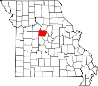
Location in the state of Missouri
Missouri's location in the U.S.Founded December 17, 1818 Named for Sarshall Cooper, frontier settler, who was killed by Indians near Arrow Rock in 1814 Seat Boonville Largest city Boonville Area
- Total
- Land
- Water
570.22 sq mi (1,477 km²)
565.03 sq mi (1,463 km²)
5.19 sq mi (13 km²), 0.91Population
- (2010)
- Density
17,601
31/sq mi (12.03/km²)Time zone Central: UTC-6/-5 Cooper County is a county located in the U.S. state of Missouri. In 2010, the population was 17,601. Its county seat is Boonville[1]. The county was organized in 1818 and is named for Sarshall Cooper, a frontier settler who was killed by Indians near Arrow Rock in 1814.
Contents
Geography
According to the 2000 census, the county has a total area of 570.22 square miles (1,476.9 km2), of which 565.03 square miles (1,463.4 km2) (or 99.09%) is land and 5.19 square miles (13.4 km2) (or 0.91%) is water.[2]
Adjacent counties
- Howard County (north)
- Boone County (northeast)
- Moniteau County (southeast)
- Morgan County (south)
- Pettis County (west)
- Saline County (northwest)
Major highways
 Interstate 70
 U.S. Route 40
 U.S. Route 50
 Missouri Route 5
 Missouri Route 41
 Missouri Route 87
 Missouri Route 98
 Missouri Route 135
 Missouri Route 179
National protected area
- Big Muddy National Fish and Wildlife Refuge
Demographics
As of the 2000 census[3], there were 16,670 people, 5,932 households and 4,140 families residing in the county. The population density was 30 per square mile (11/km²). There were 6,676 housing units at an average density of 12 per square mile (5/km²). The racial makeup of the county was 89.05% White, 8.96% Black or African American, 0.36% Native American, 0.23% Asian, 0.02% Pacific Islander, 0.28% from other races, and 1.11% from two or more races. 0.86% of the population were Hispanic or Latino of any race. 38.1% were of German, 18.7% American, 8.1% English and 8.0% Irish ancestry according to Census 2000.
There were 5,932 households, of which 31.80% had children under the age of 18 living with them, 57.40% were married couples living together, 9.00% had a female householder with no husband present, and 30.20% were non-families. 26.10% of all households were made up of individuals and 12.60% had someone living alone who was 65 years of age or older. The average household size was 2.46 and the average family size was 2.97.
Age distribution was 22.80% under the age of 18, 14.00% from 18 to 24, 27.40% from 25 to 44, 20.60% from 45 to 64, and 15.20% who were 65 years of age or older. The median age was 35 years. For every 100 females there were 117.40 males. For every 100 females age 18 and over, there were 120.00 males.
The median household income was $35,313, and the median family income was $41,526. Males had a median income of $28,513 versus $20,965 for females. The per capita income for the county was $15,648. About 8.30% of families and 10.70% of the population were below the poverty line, including 12.80% of those under age 18 and 8.30% of those age 65 or over.
Communities
Cities
Villages
Unincorporated communities
- Clifton City
- Speed
Townships
Cooper County is divided into fourteen townships:
- Blackwater
- Boonville
- Clark Fork
- Clear Creek
- Kelly
- Lamine
- Lebanon
- North Moniteau
- Otterville
- Palestine
- Pilot Grove
- Prairie Home
- Saline
- South Moniteau
See also
References
- ^ "Find a County". National Association of Counties. http://www.naco.org/Counties/Pages/FindACounty.aspx. Retrieved 2011-06-07.
- ^ "Census 2000 U.S. Gazetteer Files: Counties". United States Census. http://www.census.gov/tiger/tms/gazetteer/county2k.txt. Retrieved 2011-02-13.
- ^ "American FactFinder". United States Census Bureau. http://factfinder.census.gov. Retrieved 2008-01-31.
External links
- Cooper County Information from MO-River.Net
- Digitized 1930 Plat Book of Cooper County from University of Missouri Division of Special Collections, Archives, and Rare Books

Saline County Howard County Boone County Pettis County 
 Cooper County, Missouri

Morgan County Moniteau County Municipalities and communities of Cooper County, Missouri Cities Blackwater | Boonville | Bunceton | Otterville | Pilot Grove | Prairie Home

Villages Townships Blackwater | Boonville | Clark Fork | Clear Creek | Kelly | Lamine | Lebanon | North Moniteau | Otterville | Palestine | Pilot Grove | Prairie Home | Saline | South Moniteau
Unincorporated
communitiesClifton City | Speed
Categories:- Missouri counties
- Cooper County, Missouri
- 1818 establishments in the United States
- Populated places established in 1818
- Missouri counties on the Missouri River


Wikimedia Foundation. 2010.