- Otterville Township, Cooper County, Missouri
-
Otterville Township — Township — Location in Cooper County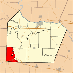
Coordinates: 38°42′49″N 93°00′48″W / 38.71361°N 93.01333°WCoordinates: 38°42′49″N 93°00′48″W / 38.71361°N 93.01333°W Country  United States
State  Missouri
County Cooper Area – Total 27.24 sq mi (70.56 km2) – Land 27.24 sq mi (70.55 km2) – Water 0.01 sq mi (0.02 km2) 0.03% Elevation 725 ft (221 m) Population (2000) – Total 913 – Density 33.5/sq mi (12.9/km2) Time zone CST (UTC-6) – Summer (DST) CDT (UTC-5) ZIP codes 65276, 65301, 65348 GNIS feature ID 0766534 Otterville Township is one of fourteen townships in Cooper County, Missouri, USA. As of the 2000 census, its population was 913.[1]
Contents
Geography
According to the United States Census Bureau, Otterville Township covers an area of 27.24 square miles (70.56 square kilometers); of this, 27.24 square miles (70.55 square kilometers, 99.99 percent) is land and 0.01 square miles (0.02 square kilometers, 0.03 percent) is water.
Cities, towns, villages
Unincorporated towns
(This list is based on USGS data and may include former settlements.)
Adjacent townships
- Clear Creek Township (north)
- Lebanon Township (east)
- Richland Township, Morgan County (south)
- Smithton Township, Pettis County (southwest)
- Bowling Green Township, Pettis County (west)
- Heath Creek Township, Pettis County (northwest)
Cemeteries
The township contains these two cemeteries: Saint Josephs and Shackleford.
Major highways
School districts
- Otterville R-Vi
- Pilot Grove C-4
- Smithton R-Vi
Political districts
- Missouri's 6th congressional district
- State House District 117
- State House District 118
- State Senate District 21
- State Senate District 28
References
- United States Census Bureau 2008 TIGER/Line Shapefiles
- United States Board on Geographic Names (GNIS)
- United States National Atlas
External links

Heath Creek Township, Pettis County Clear Creek Township Bowling Green Township, Pettis County 
Lebanon Township  Otterville Township

Smithton Township, Pettis County Richland Township, Morgan County Municipalities and communities of Cooper County, Missouri Cities Blackwater | Boonville | Bunceton | Otterville | Pilot Grove | Prairie Home

Villages Townships Blackwater | Boonville | Clark Fork | Clear Creek | Kelly | Lamine | Lebanon | North Moniteau | Otterville | Palestine | Pilot Grove | Prairie Home | Saline | South Moniteau
Unincorporated
communitiesClifton City | Speed
Categories:- Townships in Cooper County, Missouri


Wikimedia Foundation. 2010.