- National Register of Historic Places listings in Cooper County, Missouri
-
This is a list of properties and historic districts in Cooper County, Missouri, that are listed on the National Register of Historic Places. .
Contents: Counties in Missouri A–B · C · D–I · J–K · L–N · O–St. · St. Louis · Ste.–Z -
- This National Park Service list is complete through NPS recent listings posted November 10, 2011.[1]
Current listings
Landmark name Image Date listed Location City or Town Summary 1 Andrews-Wing House March 16, 1990 733 Main St.
38°58′17″N 92°44′33″W / 38.97139°N 92.7425°WBoonville 2 Arrow Rock 
October 15, 1966 Arrow Rock State Park
39°4′0″N 92°56′41″W / 39.066667°N 92.94472°WArrow Rock 3 William S. and Mary Beckett House March 16, 1990 821 Third St.
38°58′8″N 92°44′43″W / 38.96889°N 92.74528°WBoonville 4 Blackwater Commercial Historic District January 20, 2005 100 Blk. of Main St., except for 118,120 and 122 Main St.
38°58′57″N 92°59′26″W / 38.9825°N 92.99056°WBlackwater 5 Blackwater Residential Historic District September 5, 2009 Parts of the 300-400 block of Trigg Ave., 300 block of Scott Ave. and the 300 block of Main St.
38°58′49.14″N 92°59′27.54″W / 38.9803167°N 92.9909833°WBlackwater 6 Albert Gallatin Blakey House March 16, 1990 226 W. Spring St.
38°58′24″N 92°45′10″W / 38.97333°N 92.75278°WBoonville 7 Boller House August 2, 1977 223 E. Spring St.
38°58′30″N 92°44′50″W / 38.975°N 92.74722°WBoonville Demolished.[2] 8 Cobblestone Street March 16, 1990 100 Main St.
38°58′41″N 92°44′40″W / 38.97806°N 92.74444°WBoonville 9 John S. Dauwalter House March 16, 1990 817 Seventh St.
38°58′11″N 92°44′20″W / 38.96972°N 92.73889°WBoonville 10 Dick-Kobel Homestead September 9, 1982 W of Jamestown
38°44′48″N 92°35′33″W / 38.74667°N 92.5925°WJamestown 11 Duke and Mary Diggs House March 16, 1990 1217 Rural St.
38°58′48″N 92°43′59″W / 38.98°N 92.73306°WBoonville 12 Fessler-Secongost House March 16, 1990 119 W. Morgan St.
38°58′32″N 92°45′2″W / 38.97556°N 92.75056°WBoonville 13 Andrew Gantner House March 16, 1990 1308 Sixth St.
38°57′52″N 92°44′18″W / 38.96444°N 92.73833°WBoonville 14 Hamilton-Brown Shoe Company Building March 16, 1990 First St.
38°58′29″N 92°45′0″W / 38.97472°N 92.75°WBoonville 15 Harley Park Archeological Site 
October 15, 1970 Address Restricted Boonville 16 Historic District A January 24, 1983 Vine and 2nd Sts.
38°58′15″N 92°44′48″W / 38.97083°N 92.74667°WBoonville 17 Historic District B January 24, 1983 4th and E. Spring Sts.
38°58′26″N 92°44′40″W / 38.97389°N 92.74444°WBoonville 18 Historic District C January 24, 1983 E. High and 4th Sts
38°58′33″N 92°44′48″W / 38.97583°N 92.74667°WBoonville 19 Historic District D January 24, 1983 High and Main Sts.
38°58′32″N 92°44′37″W / 38.97556°N 92.74361°WBoonville 20 Historic District E January 24, 1983 High, Spring and Morgan Sts.
38°58′38″N 92°44′25″W / 38.97722°N 92.74028°WBoonville 21 Historic District F January 24, 1983 Extends North and South along 6th and 7th Sts.
38°58′20″N 92°44′24″W / 38.97222°N 92.74°WBoonville 22 Historic District H January 24, 1983 SE corner of E. Morgan St. and Reformatory Dr.
38°58′35″N 92°43′50″W / 38.97639°N 92.73056°WBoonville 23 Imhoff Archeological Site August 7, 1972 Address Restricted Blackwater 24 Juliet Trigg Johnson House March 16, 1990 1304 Main St.
38°57′50″N 92°44′24″W / 38.96389°N 92.74°WBoonville 25 Wilbur T. and Rhoda Stephens Johnson House March 16, 1990 821 Main
38°58′12″N 92°43′50″W / 38.97°N 92.73056°WBoonville 26 Lyric Theater May 21, 1969 NE corner of Main and Vine Sts.
38°58′26″N 92°44′33″W / 38.97389°N 92.7425°WBoonville 27 Meierhoffer House March 16, 1990 120 E. High St.
38°58′34″N 92°45′1″W / 38.97611°N 92.75028°WBoonville 28 Meierhoffer Sand Company Office Building March 16, 1990 201 Second St.
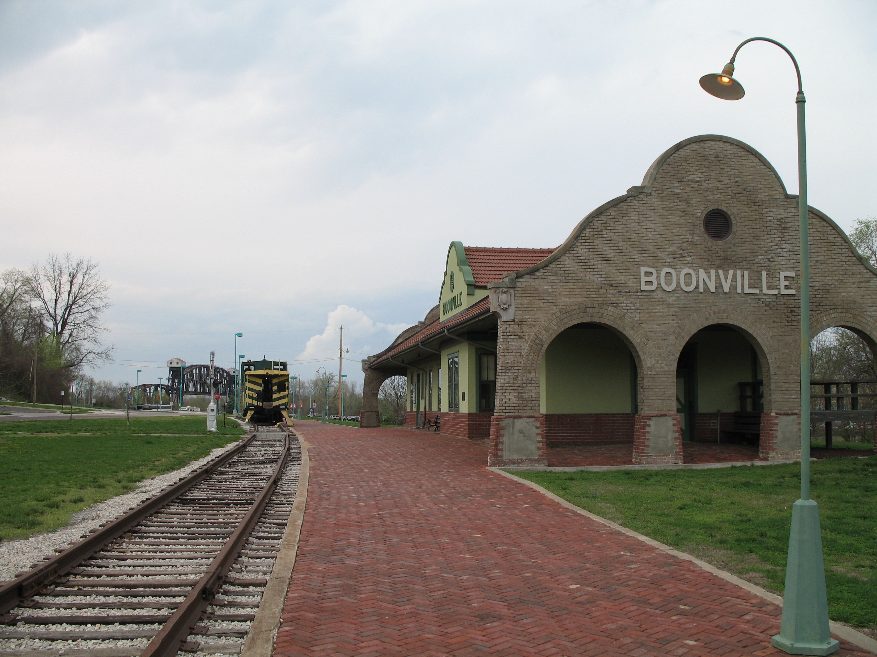
38°58′33″N 92°45′1″W / 38.97583°N 92.75028°WBoonville 29 Mellor Village and Mounds Archeological District May 21, 1969 Address Restricted Lamine Boundaries increased on August 7, 1974 30 Missouri, Kansas and Texas Railroad Depot 
March 16, 1990 320 First St.
38°58′30″N 92°44′57″W / 38.975°N 92.74917°WBoonville 31 Morton-Myer House March 16, 1990 1000 Eleventh St.
38°58′10″N 92°43′51″W / 38.96944°N 92.73083°WBoonville 32 Mount Nebo Baptist Church May 23, 1986 MO 135/E
38°48′12″N 92°53′22″W / 38.80333°N 92.88944°WPilot Grove 33 Thomas Nelson House March 16, 1990 700 Tenth St.
38°58′26″N 92°44′5″W / 38.97389°N 92.73472°WBoonville 34 New Lebanon Cumberland Presbyterian Church and School July 9, 1979 MO A
38°45′53″N 92°56′20″W / 38.76472°N 92.93889°WNew Lebanon 35 New Lebanon Historic District June 11, 1998 Roughly, Area W and SE of jct of MO A and New Lebanon Loop
38°46′28″N 92°56′21″W / 38.77444°N 92.93917°WNew Lebanon 36 Josephine Trigg Pigott House March 16, 1990 1307 Sixth St.
38°57′51″N 92°44′20″W / 38.96417°N 92.73889°WBoonville 37 Pleasant Green July 29, 1977 8 miles SW of Pilot Grove on U.S. 135
38°48′11″N 92°59′15″W / 38.80306°N 92.9875°WPilot Grove 38 Prairie View 
September 20, 1982 E of Pleasant Green off MO 135
38°47′36″N 92°55′51″W / 38.79333°N 92.93083°WPleasant Green 39 Ravenswood 
February 24, 1975 NW of Bunceton on MO 5
38°49′19″N 92°50′17″W / 38.82194°N 92.83806°WBunceton 40 Roeschel-Toennes-Oswald Property July 7, 1983 515 W. Spring
38°58′21″N 92°45′21″W / 38.9725°N 92.75583°WBoonville 41 St. Matthew's Chapel A.M.E. Church March 16, 1990 309 Spruce St.
38°58′14″N 92°44′40″W / 38.97056°N 92.74444°WBoonville 42 Summer Public School March 16, 1990 321 Spruce St.
38°58′14″N 92°44′38″W / 38.97056°N 92.74389°WBoonville 43 Wooldridge Archeological Site December 2, 1970 Address Restricted Wooldridge References
- ^ "National Register of Historic Places: Weekly List Actions". National Park Service, United States Department of the Interior. Retrieved on November 10, 2011.
- ^ http://www.dnr.mo.gov/shpo/Cooper.htm
Municipalities and communities of Cooper County, Missouri Cities Blackwater | Boonville | Bunceton | Otterville | Pilot Grove | Prairie Home

Villages Townships Blackwater | Boonville | Clark Fork | Clear Creek | Kelly | Lamine | Lebanon | North Moniteau | Otterville | Palestine | Pilot Grove | Prairie Home | Saline | South Moniteau
Unincorporated
communitiesClifton City | Speed
U.S. National Register of Historic Places Topics Lists by states Alabama • Alaska • Arizona • Arkansas • California • Colorado • Connecticut • Delaware • Florida • Georgia • Hawaii • Idaho • Illinois • Indiana • Iowa • Kansas • Kentucky • Louisiana • Maine • Maryland • Massachusetts • Michigan • Minnesota • Mississippi • Missouri • Montana • Nebraska • Nevada • New Hampshire • New Jersey • New Mexico • New York • North Carolina • North Dakota • Ohio • Oklahoma • Oregon • Pennsylvania • Rhode Island • South Carolina • South Dakota • Tennessee • Texas • Utah • Vermont • Virginia • Washington • West Virginia • Wisconsin • WyomingLists by territories Lists by associated states Other Categories:- Cooper County, Missouri
- National Register of Historic Places in Missouri
-


Wikimedia Foundation. 2010.