- National Register of Historic Places listings in Jefferson County, Kentucky
-
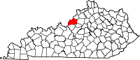
 Location of Jefferson County in Kentucky
This is a list of the National Register of Historic Places listings in Jefferson County, Kentucky. It is intended to be a complete list of the properties and districts on the National Register of Historic Places in Jefferson County, Kentucky, United States. The locations of National Register properties and districts for which the latitude and longitude coordinates are included below, may be seen in a Google map.[1]
There are 465 properties and districts listed on the National Register in the county, 8 of which are National Historic Landmarks. Properties in Downtown Louisville and many other parts of the city are listed separately:
See also: National Register of Historic Places listings in Downtown Louisville-
- This National Park Service list is complete through NPS recent listings posted November 10, 2011.[2]
Contents
Listings county-wide
[3] Landmark name[4] Image Date listed Location City or Town Summary 1 Abell House December 5, 1980 12210 Old Shelbyville Rd.
38°14′38″N 85°31′41″W / 38.24389°N 85.52806°WMiddletown 2 Adath Israel Cemetery June 22, 1982 2716 Preston St.
38°12′32″N 85°44′26″W / 38.20889°N 85.74056°WLouisville 3 Allison-Barrickman House July 12, 1983 6909 Wolf Pen Branch Rd.
38°19′13″N 85°37′8″W / 38.32028°N 85.61889°WHarrods Creek 4 Altawood Historic District May 2, 2001 Altawood Ct.
38°18′5″N 85°30′19″W / 38.30139°N 85.50528°WLouisville 5 Arcadia Apartments November 15, 2010 68 Apartments in the vicinity of Arcade and Utah Aves.
38°12′23″N 85°47′5″W / 38.20639°N 85.78472°WLouisville 6 Ashbourne July 12, 1983 Upper River Rd.
38°19′33″N 85°38′3″W / 38.32583°N 85.63417°WHarrods Creek 7 Atherton Carriage House August 16, 1983 3204 Woodside Rd.
38°17′40″N 85°38′49″W / 38.29444°N 85.64694°WNortheast Louisville 8 Audubon Park Historic District 
April 18, 1996 Roughly bounded by Hess Ln. and Cardinal Dr. between Eagle Pass and Preston St.
38°12′18″N 85°43′38″W / 38.205°N 85.72722°WAudubon Park 9 B.F. Avery and Sons Industrial District December 21, 1990 1721-1821 7th St.
38°13′17″N 85°46′23″W / 38.22139°N 85.77306°WLouisville 10 Aydelott House December 5, 1980 6814 Bethany Lane
38°6′12″N 85°53′48″W / 38.10333°N 85.89667°WValley Station 11 Rogers Clark Ballard Memorial School December 8, 1983 4200 Lime Kiln Ln.
38°18′46″N 85°38′45″W / 38.31278°N 85.64583°WNortheast Louisville 12 Bank of Middletown July 12, 1983 11615 Main St.
38°14′44″N 85°32′25″W / 38.24556°N 85.54028°WMiddletown 13 Martin Jeff (M.J.) Bannon House December 29, 2006 5112 Bannon Crossing
38°10′52″N 85°37′46″W / 38.18111°N 85.62944°WLouisville 14 Patrick Bannon House December 5, 1980 4518 Bardstown Rd.
38°10′57″N 85°37′42″W / 38.1825°N 85.62833°WBuechel 15 Barber-Barbour House December 5, 1980 6415 Transylvania Ave.
38°20′14″N 85°38′6″W / 38.33722°N 85.635°WHarrods Creek 16 Levin Bates House December 5, 1980 7300 Bardstown Rd.
38°8′28″N 85°35′0″W / 38.14111°N 85.583333°WBuechel 17 Bayly-Schroering House November 14, 1978 1012 S. 4th St.
38°14′18″N 85°45′37″W / 38.23833°N 85.76028°WLouisville 18 Beech Lawn December 5, 1980 8000 Six Mile Lane
38°11′54″N 85°36′28″W / 38.19833°N 85.60778°WJeffersontown 19 Beechland July 12, 1983 8500 Six Mile Lane
38°11′42″N 85°35′53″W / 38.195°N 85.59806°WJeffersontown 20 Willam R. Belknap School August 12, 1982 1800 Sils Ave.
38°13′19″N 85°41′22″W / 38.22194°N 85.68944°WThe Highlands 21 Belleview April 2, 1992 6600 Upper River Rd.
38°19′56″N 85°38′14″W / 38.33222°N 85.63722°WHarrods Creek 22 Bellevoir-Ormsby Village December 5, 1980 Whipps Mill Rd.
38°16′1″N 85°34′33″W / 38.26694°N 85.57583°WLyndon 23 Berry Hill July 12, 1983 Dunraven Ct.
38°17′44″N 85°38′28″W / 38.29556°N 85.64111°WGlenview 24 Beynroth House May 31, 1984 11503 Main St.
38°14′41″N 85°32′36″W / 38.24472°N 85.54333°WMiddletown 25 Bingham-Hilliard Doll House December 5, 1980 5001 Avish Lane
38°19′14″N 85°38′13″W / 38.32056°N 85.63694°WHarrods Creek 26 Blankenbaker Station December 5, 1980 21 Poplar Hill Rd.
38°17′41″N 85°39′53″W / 38.29472°N 85.66472°WSt. Matthews 27 Board of Extension of the Methodist Episcopal Church, South June 3, 1983 1115 S. 4th St.
38°14′12″N 85°45′33″W / 38.23667°N 85.75917°WLouisville 28 Temple Bodley Summer House March 29, 1985 Off Riva Ridge Rd. southwest of Palatka Rd.
38°8′59″N 85°47′45″W / 38.14972°N 85.79583°WLouisville 29 Bowman Field Historic District 
November 10, 1988 Taylorsville Rd. and Peewee Reese Boulevard
38°13′25″N 85°39′58″W / 38.22361°N 85.66611°WThe Highlands 30 Bradford Mills October 6, 1982 1034 E. Oak St.
38°13′45″N 85°44′23″W / 38.22917°N 85.73972°WLouisville 31 Brass Finishing Building, Standard Sanitary Manufacturing Company March 15, 2005 1547 S. 7th St.
38°13′37″N 85°46′11″W / 38.22694°N 85.76972°WLouisville 32 Bray Place August 11, 1980 2227 Bashford Manor Lane
38°12′17″N 85°39′39″W / 38.20472°N 85.66083°WLouisville 33 James Brown House July 12, 1983 Browns Lane
38°14′22″N 85°37′54″W / 38.23944°N 85.63167°WSt. Matthews 34 Theodore Brown House July 12, 1983 Browns Lane
38°14′29″N 85°38′14″W / 38.24139°N 85.63722°WSt. Matthews 35 Buildings at 900-906 East Main Street August 3, 2005 900-906 E. Main St.
38°15′15″N 85°44′8″W / 38.25417°N 85.73556°WButchertown/Clifton 36 William Bull House December 5, 1980 11918 Old Shelbyville Rd.
38°14′38″N 85°32′0″W / 38.24389°N 85.533333°WMiddletown 37 Bullock-Clifton House 
May 6, 1982 1824 Rosedale Ave.
38°13′27″N 85°42′14″W / 38.22417°N 85.70389°WThe Highlands 38 Cornelia Bush House May 6, 1982 316 Kenwood Dr.
38°9′30″N 85°46′9″W / 38.15833°N 85.76917°WSouth End Louisville 39 S.S. Bush House April 30, 1979 230 Kenwood Hill Rd.
38°9′22″N 85°46′20″W / 38.15611°N 85.77222°WSouth End Louisville 40 Butchertown Historic District 
August 11, 1976 Roughly bounded by Main, Hancock, Geiger, Quincy Sts., U.S. Route 42, S. Fort Beargrass Creek, and Baxter Ave.
38°15′20″N 85°43′47″W / 38.25556°N 85.72972°WButchertown/Clifton 41 Calvary Episcopal Church January 18, 1978 821 S. 4th St.
38°14′35″N 85°45′31″W / 38.24306°N 85.75861°WLouisville 42 Cardinal Hill Reservoir December 5, 1980 Cardinal Hill Rd.
38°8′47″N 85°48′15″W / 38.14639°N 85.80417°WLouisville 43 Carmichael House July 12, 1983 Off KY 155
38°10′12″N 85°25′23″W / 38.17°N 85.42306°WFisherville 44 John B. Castleman Monument 
July 17, 1997 Junction of Cherokee Rd. and Willow Ave.
38°14′9″N 85°42′32″W / 38.23583°N 85.70889°WThe Highlands 45 Cave Hill Cemetery 
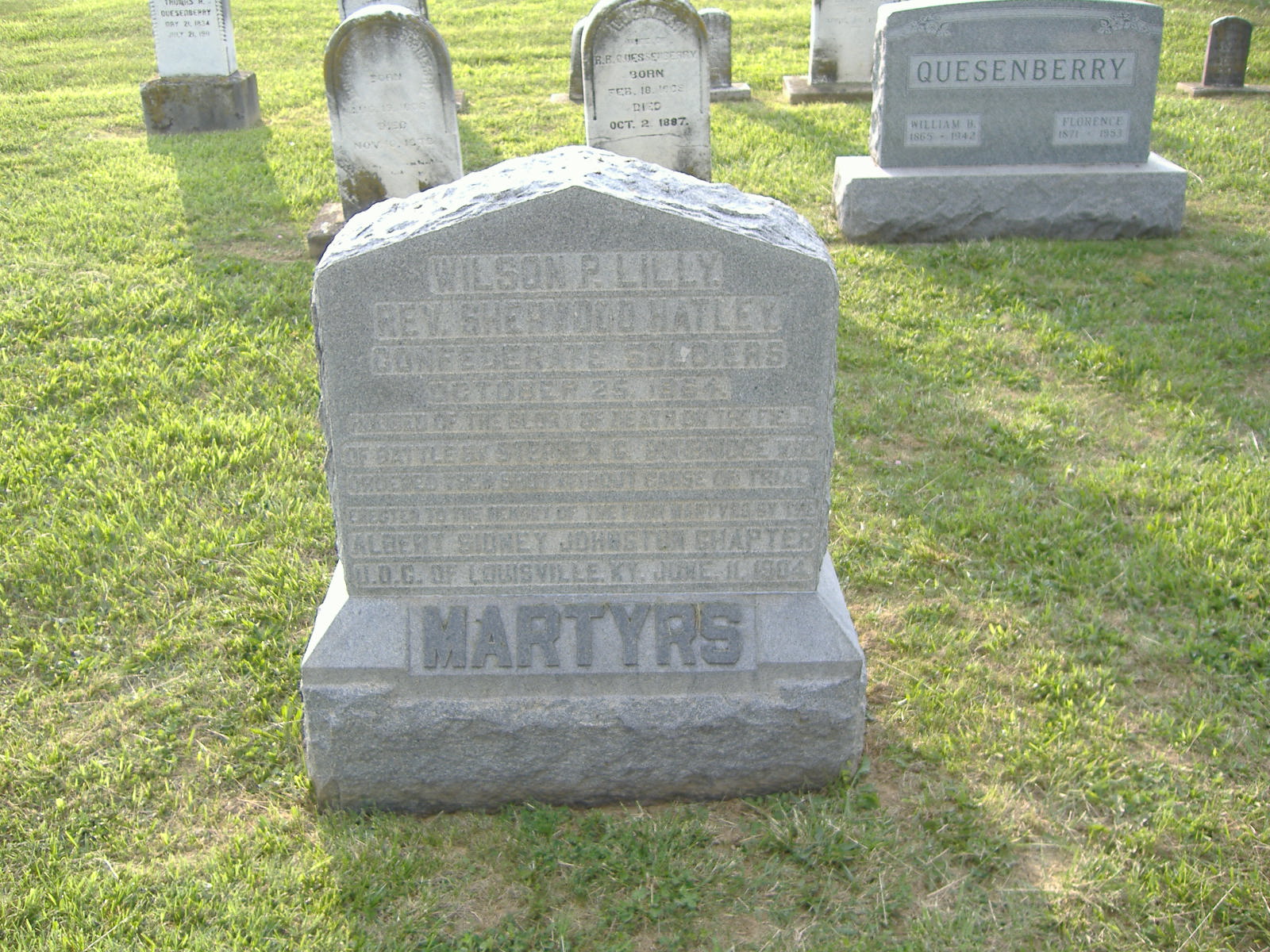
December 11, 1979 701 Baxter Ave.
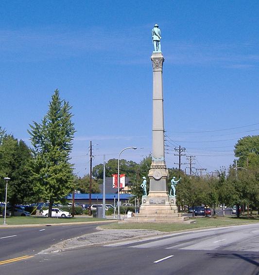
38°14′44″N 85°42′56″W / 38.24556°N 85.71556°WThe Highlands 46 Cave Hill National Cemetery 
September 3, 1998 701 Baxter Ave.
38°15′2″N 85°43′16″W / 38.25056°N 85.72111°WThe Highlands 47 Cedarbrook Farm December 21, 1990 4800 Springdale Rd.
38°18′50″N 85°35′35″W / 38.31389°N 85.59306°WLouisville 48 Central Colored School September 13, 1976 542 W. Kentucky St.
38°14′22″N 85°45′46″W / 38.23944°N 85.76278°WLouisville 49 Chenoweth Fort-Springhouse July 1, 1975 Avoca Rd.
38°15′41″N 85°30′21″W / 38.26139°N 85.50583°WMiddletown 50 Chenoweth House December 5, 1980 255 Chenoweth Lane
38°15′42″N 85°39′37″W / 38.26167°N 85.66028°WSt. Matthews 51 Cherokee Triangle Area Residential District June 30, 1976 Roughly bounded by Bardstown Rd., Sherwood Rd., and Broadway, east to the junction of Grinstead Dr. and Cherokee Parkway
38°14′21″N 85°42′42″W / 38.23917°N 85.71167°WLouisville 52 Chestnut Street Baptist Church December 3, 1980 912 W. Chestnut St.
38°14′58″N 85°46′1″W / 38.24944°N 85.76694°WLouisville 53 Chrisler House December 5, 1980 4508 Upper River Rd.
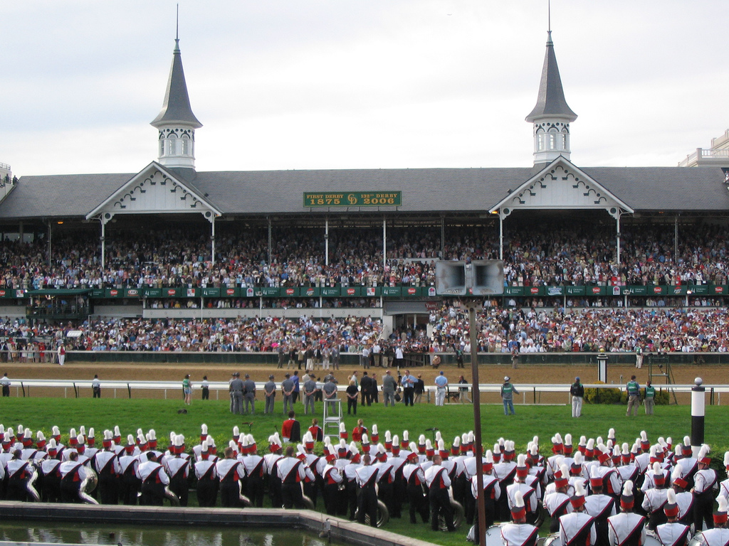
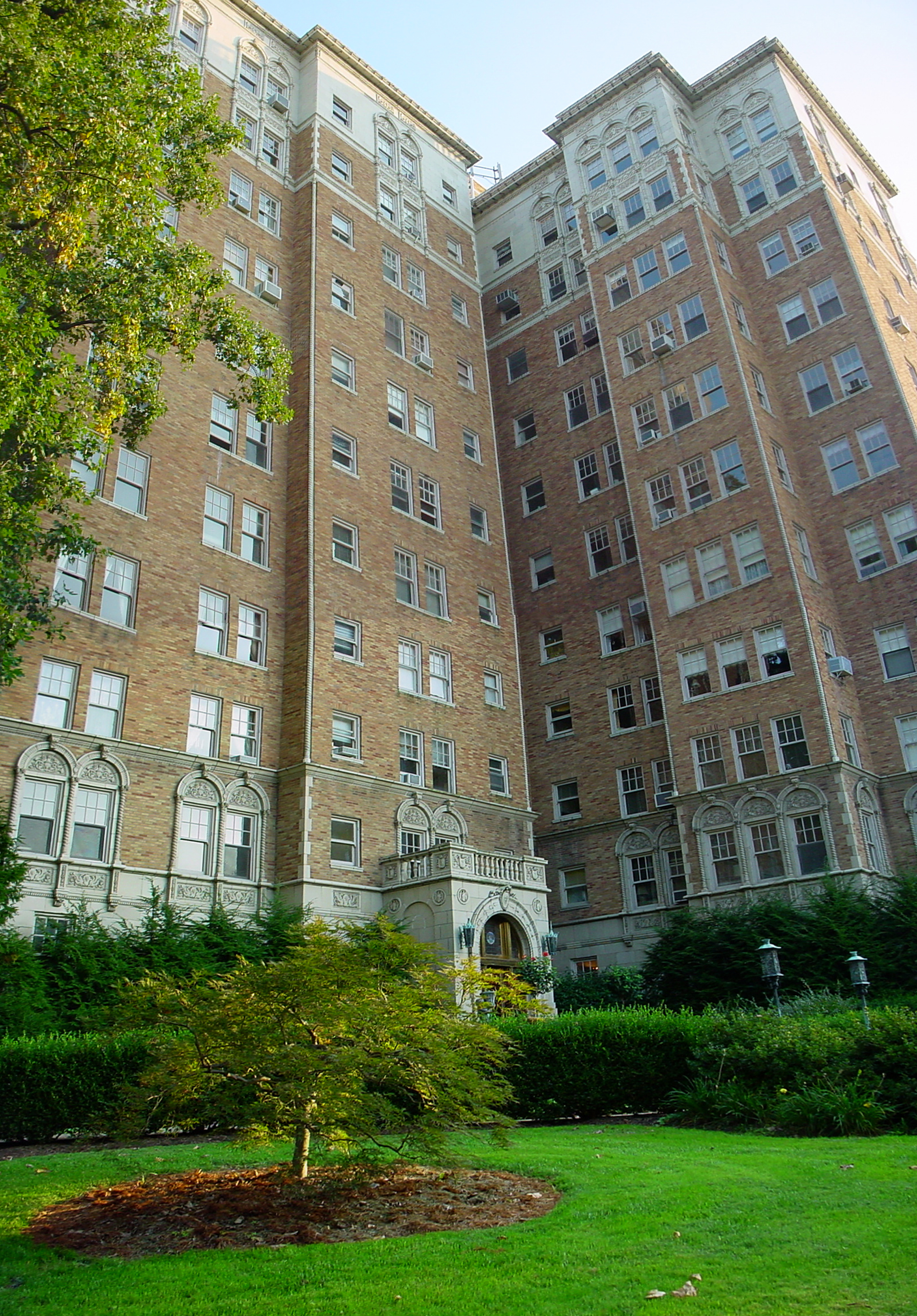
38°18′2″N 85°39′51″W / 38.30056°N 85.66417°WHarrods Creek 54 Churchill Downs 
November 15, 1978 700 Central Ave.
38°12′6″N 85°46′16″W / 38.20167°N 85.77111°WSouth End Louisville 55 Clifton Historic District 
August 29, 1983 Roughly bounded by Brownsboro Rd., William and E. Main Sts., Frankfort and N. Ewing Aves.; also roughly bounded by CSX railroad tracks, Ewing Ave. alley, Interstate 64, and Mellwood Ave.
38°15′24″N 85°42′36″W / 38.25667°N 85.71°WButchertown/Clifton Second group of addresses represents a boundary increase 56 James Clore House November 15, 1984 North of Prospect off Kentucky Route 329KY 329
38°21′30″N 85°36′28″W / 38.35833°N 85.60778°WProspect 57 Clover Hill 
July 17, 1978 2618 Dixie Highway
38°12′43″N 85°47′52″W / 38.21194°N 85.79778°WLouisville 58 College Street Presbyterian Church November 29, 1978 113 W. College St.
38°14′36″N 85°45′18″W / 38.24333°N 85.755°WLouisville 59 Commodore Apartment Building 
April 29, 1982 2140 Bonnycastle Ave.
38°13′58″N 85°42′2″W / 38.23278°N 85.70056°WThe Highlands 60 Confederate Martyrs Monument in Jeffersontown 
July 17, 1997 City Cemetery, 0.1 miles south of the junction of Billtown and Maple Rds.
38°11′25″N 85°34′8″W / 38.19028°N 85.56889°WJeffersontown 61 Confederate Monument in Louisville 
July 17, 1997 Junction of 2nd and 3rd Sts.
38°13′6″N 85°45′43″W / 38.21833°N 85.76194°WLouisville 62 Conrad-Seaton House and Archeological Site 
August 18, 2011 Address Restricted Louisville 63 Cooper Memorial Church December 5, 1980 9900 Preston Highway
38°6′23″N 85°40′28″W / 38.10639°N 85.67444°WOkolona 64 Cornwall and Brown Houses July 19, 1978 957 S. 4th St.
38°14′23″N 85°45′33″W / 38.23972°N 85.75917°WLouisville 65 Country Estates of River Road April 29, 1999 Roughly along River Rd. and Wolf Pen Branch Rd. fron Longview Ln. to 500 feet west of U.S. Route 42
38°18′48″N 85°38′38″W / 38.31333°N 85.64389°WGlenview 66 Carrie Gaulbert Cox and Attilla Cox, Jr. House August 3, 2005 389 Mockingbird Valley Rd.
38°16′12″N 85°40′51″W / 38.27°N 85.68083°WLouisville 67 Crescent Hill Branch Library March 10, 1981 2762 Frankfort Ave.
38°15′16″N 85°41′29″W / 38.25444°N 85.69139°WButchertown/Clifton 68 Crescent Hill Historic District 
November 12, 1982 Roughly bounded by Brownsboro and Lexington Rds, Peterson, Zorn, and Frankfort Aves., and Crabbs Lane
38°15′15″N 85°41′19″W / 38.25417°N 85.68861°WButchertown/Clifton 69 Crescent Hill Reservoir September 10, 1979 Reservoir Ave.
38°15′25″N 85°40′46″W / 38.25694°N 85.67944°WButchertown/Clifton 70 The Cumberland March 14, 1996 201 York St.
38°14′35″N 85°45′20″W / 38.24306°N 85.75556°WLouisville 71 Davis Tavern July 12, 1983 11180 Shelbyville Rd.
38°14′43″N 85°32′14″W / 38.24528°N 85.53722°WMiddletown 72 Diamond Fruit Farm July 12, 1983 8101 Six Mile Lane
38°12′4″N 85°36′18″W / 38.20111°N 85.605°WJeffersontown 73 Anton Diebold House September 8, 1983 4303 W. Broadway
38°15′28″N 85°50′0″W / 38.25778°N 85.833333°WLouisville 74 District #1 June 3, 1983 S. Brook and E. Breckinbridge St.
38°14′31″N 85°45′7″W / 38.24194°N 85.75194°WLouisville 75 District #2 June 3, 1983 W. Breckinridge St. and S. 2nd St.
38°14′31″N 85°45′19″W / 38.24194°N 85.75528°WLouisville 76 William J. Dodd Residence August 5, 2010 1448 St. James Court
38°13′37″N 85°45′49″W / 38.22694°N 85.76361°WLouisville 77 Peter C. Doerhoefer House September 8, 1983 4422 W. Broadway
38°15′0″N 85°49′34″W / 38.25°N 85.82611°WLouisville 78 Dogwood Hill February 26, 1993 7001 U.S. Route 42
38°18′53″N 85°37′41″W / 38.31472°N 85.62806°WLyndon 79 Stuart E. and Annie L. Duncan Estate March 12, 2003 404 Mockingbird Valley Rd.
38°16′31″N 85°41′24″W / 38.27528°N 85.69°WLouisville 80 Eclipse Woolen Mill December 22, 1978 1044 E. Chestnut St.
38°14′57″N 85°43′56″W / 38.24917°N 85.73222°WButchertown/Clifton 81 Edgewood August 16, 1983 3605 Glenview Ave.
38°18′6″N 85°38′39″W / 38.30167°N 85.64417°WNortheast Louisville 82 Eight-Mile House 
March 26, 1976 North of Louisville on Shelbyville Rd.
38°14′56″N 85°36′11″W / 38.24889°N 85.60306°WLouisville 83 Emerson School May 3, 1982 1100 Sylvia Ave.
38°13′17″N 85°44′23″W / 38.22139°N 85.73972°WLouisville 84 Engelhard House December 5, 1980 1080 Baxter Ave.
38°14′17.7″N 85°43′21.792″W / 38.23825°N 85.72272°WLouisville 85 Epworth Methodist Evangelical Church September 6, 1983 412 M. St.
38°11′27″N 85°45′57″W / 38.19083°N 85.76583°WSouth End Louisville 86 D.H. Ewing & Sons Creamery June 3, 1983 981 S. 3rd St.
38°15′26″N 85°45′24″W / 38.25722°N 85.75667°WLouisville 87 Falls City Jeans and Woolen Mills October 6, 1982 1010 S. Preston St.
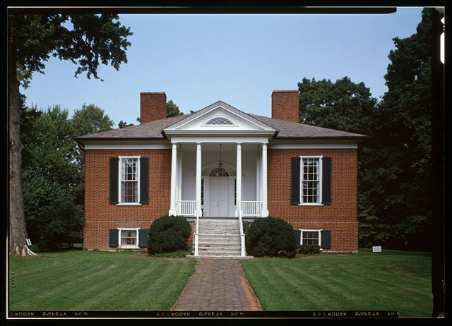
38°13′58″N 85°44′6″W / 38.23278°N 85.735°WLouisville 88 Farmington 
October 18, 1972 3033 Bardstown Rd.
38°12′52″N 85°40′6″W / 38.21444°N 85.66833°WThe Highlands 89 David Farnsley House July 12, 1983 4816 Cane Run Rd.
38°11′0″N 85°51′21″W / 38.183333°N 85.85583°WLouisville 90 Farnsley-Moremen House 
April 20, 1979 West of Louisville at 10908 Lower River Rd.
38°5′52″N 85°53′51″W / 38.09778°N 85.8975°WLouisville 91 Fincastle March 24, 2000 7501 Wolf Pen Branch Rd.
38°19′47″N 85°36′23″W / 38.32972°N 85.60639°WProspect 92 J. Finzer and Brothers Company Building April 18, 2003 419 Finzer St.
38°14′36″N 85°44′49″W / 38.24333°N 85.74694°WLouisville 93 Nicholas Finzer House May 9, 1979 1212 Hull St.
38°14′52″N 85°43′43″W / 38.24778°N 85.72861°WThe Highlands 94 First Christian Church July 16, 1979 850 S. 4th St.
38°14′32″N 85°45′35″W / 38.24222°N 85.75972°WLouisville 95 First Street District July 14, 1984 Roughly bounded by E. Breckinridge, E. Kentucky, and Interstate 65
38°9′29″N 85°45′20″W / 38.15806°N 85.75556°WSouth End Louisville 96 Fisher House July 12, 1983 Old Taylorsville Rd.
38°11′26″N 85°27′48″W / 38.19056°N 85.46333°WFisherville 97 Fishpool Plantation July 12, 1983 9710 Preston Highway
38°6′26″N 85°40′52″W / 38.10722°N 85.68111°WLouisville 98 Fitzhugh House July 12, 1983 6401 Wolf Pen Branch Rd.
38°22′10″N 85°37′25″W / 38.36944°N 85.62361°WHarrods Creek 99 Ford Motor Company, Louisville Plant November 25, 2005 2500 S. 3rd St.
38°12′54″N 85°45′46″W / 38.215°N 85.76278°WLouisville 100 Fourth Avenue Methodist Episcopal Church July 16, 1979 318 W. St. Catherine St.
38°14′13″N 85°45′34″W / 38.23694°N 85.75944°WLouisville 101 Henry Frank House December 5, 1980 Madison Ave.
38°14′31″N 85°32′21″W / 38.24194°N 85.53917°WMiddletown 102 Mary Alica Hadley House July 10, 2008 1638 Story Ave.
38°15′35.82″N 85°43′12.432″W / 38.25995°N 85.72012°WButchertown/Clifton 103 Harriet Funk House December 5, 1980 9316 Hurstbourne
38°13′8″N 85°35′10″W / 38.21889°N 85.58611°WJeffersontown 104 James H. Funk House December 5, 1980 9000 Taylorsville
38°12′53″N 85°35′35″W / 38.21472°N 85.59306°WJeffersontown 105 Gaar-Fenton House July 12, 1983 4124 Nachand Lane
38°11′8″N 85°37′3″W / 38.18556°N 85.6175°WBuechel 106 Gaffney House December 8, 1983 River Rd.
38°18′8″N 85°39′48″W / 38.30222°N 85.66333°WLouisville 107 Gardencourt Historic District December 1, 1988 1010 Alta Vista Rd.
38°14′20″N 85°41′14″W / 38.23889°N 85.68722°WThe Highlands 108 German Evangelical Church of Christ Complex May 21, 1987 1236 E. Breckinridge St.
38°14′23″N 85°43′52″W / 38.23972°N 85.73111°WThe Highlands 109 Givens Headley and Co. Tobacco Warehouse September 8, 1983 1119-1121 W. Main St.
38°15′29″N 85°46′4″W / 38.25806°N 85.76778°WLouisville 110 Glenview Historic District August 16, 1983 Glenview Ave.
38°18′30″N 85°38′56″W / 38.30833°N 85.64889°WNortheast Louisville 111 Cornelia Gordon House May 6, 1982 308 Kenwood Hill Rd.
38°9′31″N 85°46′18″W / 38.15861°N 85.77167°WSouth End Louisville 112 Green Tree Manor Residential Historic District November 21, 1991 107 Fenley Ave.
38°15′21″N 85°40′10″W / 38.25583°N 85.66944°WLouisville 113 Greve, Buhrlage, and Company September 8, 1983 1501 Lytle St.
38°15′41.4″N 85°46′28″W / 38.2615°N 85.77444°WLouisville 114 Benjamin Grove House 
November 15, 1984 518 N. 26th St.
38°16′12″N 85°47′27″W / 38.27°N 85.79083°WLouisville 115 Haldeman House December 8, 1983 3609 Glenview Ave.
38°17′18.6″N 85°38′14.424″W / 38.2885°N 85.63734°WLouisville 116 Harrods Creek Historic District November 22, 1991 Junction of Upper River and Wolf Pen Branch Rds.
38°19′19″N 85°38′13″W / 38.32194°N 85.63694°WHarrods Creek 117 Hayfield August 19, 1980 1809 Tyler Lane
38°12′28″N 85°41′10″W / 38.20778°N 85.68611°WThe Highlands 118 Head House June 28, 1974 Main St.
38°14′43″N 85°32′29″W / 38.24528°N 85.54139°WMiddletown 119 Herr-Rudy Family Houses May 19, 1978 520 Old Stone Lane, 4319 and 4417 Westport Rd., 612 Rudy Lane, 726 Waterford Rd., 1823 Ballard Mill Lane, and 1705 Lynn Way
38°16′16″N 85°37′52″W / 38.27111°N 85.63111°WLouisville 120 John H. Heywood Elementary School September 6, 1983 422 Heywood Ave.
38°11′18″N 85°46′1″W / 38.18833°N 85.76694°WLouisville 121 Highlands Historic District 
February 11, 1983 Roughly bounded by Barrett Ave., Eastern Parkway, and Fernwood, Bardstown, Woodbourne, Ellerbee, and Sherwood Aves.
38°14′6″N 85°42′40″W / 38.235°N 85.71111°WThe Highlands 122 Hikes Family Houses March 21, 1978 4118 Taylorsville Rd., 2806 Meadow Dr., 3026 Hikes Lane
38°12′51″N 85°38′9″W / 38.21417°N 85.63583°WLouisville 123 Hikes-Hunsinger House October 10, 1975 2834 Hikes Lane
38°12′27″N 85°38′48″W / 38.2075°N 85.64667°WLouisville 124 Abraham Hite House December 5, 1980 Starlight Lane
38°11′11″N 85°37′18″W / 38.18639°N 85.62167°WBuechel 125 Hite-Chenoweth House December 5, 1980 4219 Starlight Lane
38°11′10″N 85°37′15″W / 38.18611°N 85.62083°WBuechel 126 Andrew Hoke House July 14, 1983 2700 Llandovery Dr.
38°12′20″N 85°34′15″W / 38.20556°N 85.57083°WJeffersontown 127 Holy Name Church Rectory, Convent and School May 13, 1982 2920 and 2914 S. 3rd St. and 2911 and 2921 S. 4th St.
38°14′34″N 85°45′49″W / 38.24278°N 85.76361°WLouisville 128 Hook and Ladder Company No. 2 November 7, 1980 221 S. Hancock St.
38°15′11″N 85°44′31″W / 38.25306°N 85.74194°WButchertown/Clifton 129 Hook and Ladder Company No. 3 November 7, 1980 Frankfort Ave. and Pope St.
38°15′25″N 85°43′0″W / 38.25694°N 85.716667°WLouisville 130 Hook and Ladder Company No. 5 November 7, 1980 1824 Garland Ave.
38°15′15″N 85°41′44″W / 38.25417°N 85.69556°WLouisville 131 Hope Worsted Mills January 19, 1996 942 E. Kentucky St.
38°14′8″N 85°44′14″W / 38.23556°N 85.73722°WLouisville 132 Robert Hord House July 12, 1983 U.S. Route 60
38°14′7″N 85°27′32″W / 38.23528°N 85.45889°WEastwood 133 Horner House August 16, 1983 3509 Woodside
38°18′7″N 85°39′4″W / 38.30194°N 85.65111°WNortheast Louisville 134 Howard-Gettys House February 8, 1978 1226 Bates Ct.
38°13′50″N 85°43′28″W / 38.23056°N 85.72444°WLouisville 135 Humphrey-McMeekin House 
March 20, 1986 2240 Douglass Boulevard
38°13′42″N 85°41′9″W / 38.22833°N 85.68583°WThe Highlands 136 Immanuel Chapel Protestant Episcopal Church September 6, 1983 410 Fairmont Ave.
38°11′42″N 85°46′3″W / 38.195°N 85.7675°WSouth End Louisville 137 Jeffersontown Colored School March 29, 1985 10400 Shelby St.
38°11′48″N 85°33′53″W / 38.19667°N 85.56472°WJeffersontown 138 J. Stoddard Johnston Elementary School December 3, 2008 2301 Bradley Boulevard
38°12′52.272″N 85°44′54.24″W / 38.21452°N 85.7484°WLouisville 139 Jones House July 12, 1983 4998 Valley Station Rd.
38°6′13″N 85°51′15″W / 38.10361°N 85.85417°WValley Station 140 Judge Kirby House July 12, 1983 Kirby Lane
38°11′15″N 85°35′48″W / 38.1875°N 85.59667°WJeffersontown 141 Kennedy-Hunsinger Farm July 12, 1983 4334 Taylorsville Rd.
38°12′55″N 85°36′34″W / 38.21528°N 85.60944°WJeffersontown 142 Kentucky Street School June 3, 1983 119 E. Kentucky St.
38°14′19″N 85°45′11″W / 38.23861°N 85.75306°WLouisville 143 Kentucky Wagon Works September 6, 1983 2601 S. 3rd St.
38°11′35″N 85°45′41″W / 38.19306°N 85.76139°WSouth End Louisville 144 Kosmosdale Depot April 9, 1984 Off Dixie Highway
38°1′56″N 85°54′27″W / 38.03222°N 85.9075°WValley Station 145 KYANG Site (15JF267) September 12, 1972 Address Restricted Louisville 146 Ladless Hill August 16, 1983 6501 Longview Lane
38°17′59″N 85°39′38″W / 38.29972°N 85.66056°WNortheast Louisville 147 Landward House September 20, 1973 1385-1387 S. 4th St.
38°13′46″N 85°45′39″W / 38.22944°N 85.76083°WLouisville 148 Leatherman House December 5, 1980 3606 College Dr.
38°11′31″N 85°34′1″W / 38.19194°N 85.56694°WJeffersontown 149 Addison W. Lee House August 2, 2000 4218 Upper River Rd.
38°17′36″N 85°40′29″W / 38.29333°N 85.67472°WLouisville 150 Dr. John Lewis House April 9, 1984 220 Ridgeway Ave.
38°15′21″N 85°38′57″W / 38.25583°N 85.64917°WSt. Matthews 151 Lewiston House 
December 5, 1980 4902 Ranchland
38°10′20″N 85°49′47″W / 38.17222°N 85.82972°WValley Station 152 Limerick Historic District 
September 13, 1978 Roughly bounded by Breckinridge, Oak, 5th, and 8th Sts.
38°13′59″N 85°45′49″W / 38.23306°N 85.76361°WLouisville 153 Lincliff August 16, 1983 6100 Longview Lane
38°17′47″N 85°39′46″W / 38.29639°N 85.66278°WNortheast Louisville 154 Lindenberger-Grant House July 25, 1996 8200 Railroad Ave.
38°15′45″N 85°36′8″W / 38.2625°N 85.60222°WLyndon 155 Little Loomhouses 
June 30, 1975 328 Kenwood Hill Rd.
38°9′28″N 85°46′15″W / 38.15778°N 85.77083°WSouth End Louisville 156 Locust Avenue July 12, 1983 1814 Fern Valley Rd.
38°9′20″N 85°40′0″W / 38.15556°N 85.666667°WLouisville 157 Locust Grove 
March 11, 1971 561 Blankenbaker Ln.
38°17′19″N 85°39′40″W / 38.28861°N 85.66111°WNortheast Louisville 158 Long Run Baptist Church and Cemetery August 6, 1975 Long Run Rd.
38°15′17″N 85°24′47″W / 38.25472°N 85.41306°WEastwood 159 Louisville Cotton Mills October 6, 1982 1008 Goss Ave.
38°13′45″N 85°44′23″W / 38.22917°N 85.73972°WThe Highlands 160 Louisville Free Public Library 
March 27, 1980 301 W. York St.
38°14′40″N 85°45′28″W / 38.24444°N 85.75778°WLouisville 161 Louisville Male High School April 18, 1979 911 S. Brook St.
38°14′25″N 85°45′5″W / 38.24028°N 85.75139°WLouisville 162 Louisville War Memorial Auditorium December 27, 1977 970 S. 4th St.
38°14′21″N 85°45′36″W / 38.23917°N 85.76°WLouisville 163 Louisville Water Company Pumping Station 
November 11, 1971 Zorn Ave.
38°16′50″N 85°42′5″W / 38.28056°N 85.70139°WButchertown/Clifton 164 James Russell Lowell Elementary School 
September 6, 1983 4501 Crittenden Dr.
38°11′17″N 85°44′59″W / 38.18806°N 85.74972°WSouth End Louisville 165 Lyndon Cottage May 30, 1990 Terminus of Hurstbourne Country Club Dr.
38°14′22″N 85°35′25″W / 38.23944°N 85.59028°WLouisville 166 Lynnford-Lyndon Hall April 18, 1985 8222 Shelbyville Rd.
38°14′23″N 85°35′27″W / 38.23972°N 85.59083°WLyndon 167 Maghera Glass-Ormsby Hall December 5, 1980 8521 La Grange Rd.
38°16′20″N 85°35′46″W / 38.27222°N 85.59611°WLyndon 168 Jefferson Marders House July 12, 1983 211 Madison Ave.
38°14′55″N 85°32′22″W / 38.24861°N 85.53944°WMiddletown 169 Dr. J.B. Marvin House June 3, 1983 809 S. 4th St.
38°14′41″N 85°45′29″W / 38.24472°N 85.75806°WLouisville 170 Masonic Hall July 12, 1983 15116 Old Taylorsville Rd.
38°11′21″N 85°27′42″W / 38.18917°N 85.46167°WFisherville 171 Masonic Widows and Orphans Home 
September 6, 2002 3701 Frankfort Ave.
38°15′16″N 85°40′3″W / 38.25444°N 85.6675°WLouisville 172 McBride's Harrods Creek Landing February 11, 2011 5913 River Rd.
38°19′20″N 85°38′38″W / 38.32222°N 85.64389°WHarrods Creek vicinity 173 McClure House July 28, 1984 North of Westport Rd.
38°16′46″N 85°35′52″W / 38.27944°N 85.59778°WLyndon 174 Merriwether House March 22, 1989 6421 Upper River Rd.
38°19′41″N 85°37′50″W / 38.32806°N 85.63056°WLouisville 175 Middletown Inn April 9, 1984 11705 Main St.
38°14′44″N 85°32′22″W / 38.24556°N 85.53944°WMiddletown 176 Middletown United Methodist Church December 5, 1980 Madison and Main Sts.
38°14′42″N 85°32′21″W / 38.245°N 85.53917°WMiddletown 177 Midlands August 16, 1983 25 Poplar Hill Rd.
38°17′33″N 85°39′44″W / 38.2925°N 85.66222°WNortheast Louisville 178 Mockingbird Valley Historic District April 13, 2007 Roughly bounded by River Rd., Indian Hills Trail, Fairway, Swing, Brownsboro, Jarvis, and Green Ridge Ln.
38°16′21″N 85°40′56″W / 38.2725°N 85.68222°WLouisville 179 Simeon Moore House December 5, 1980 17317 Taylorsville Rd.
38°9′29″N 85°26′4″W / 38.15806°N 85.43444°WFisherville 180 Most Blessed Sacrament School February 11, 2011 1128 Berry Blvd.
38°11′46″N 85°46′48″W / 38.19611°N 85.78°WLouisville 181 Municipal College Campus, Simmons University November 21, 1976 1018 S. 7th St.
38°14′22″N 85°45′56″W / 38.23944°N 85.76556°WLouisville 182 Dr. John Murray Farm July 12, 1983 Murray Hill Pike
38°17′26″N 85°35′13″W / 38.29056°N 85.58694°WLyndon 183 Nitta Yuma Historic District February 10, 1983 5028, 5040, 5044, and 5051 Nitta Yuma
38°19′19″N 85°37′39″W / 38.32194°N 85.6275°WHarrods Creek 184 Oakdale District September 6, 1983 Roughly bounded by Terrace Park, Southern Parkway, 4th and Kenton Sts.
38°11′59″N 85°46′0″W / 38.19972°N 85.766667°WSouth End Louisville 185 Old Louisville Residential District February 7, 1975 Irregular pattern roughly bounded by S. 7th St. on the west, North-South Expressway (Interstate 65) on the east, Kentucky St. on the north, and Avery St. on the south
38°13′46″N 85°45′33″W / 38.22944°N 85.75917°WLouisville 186 Olmsted Park System May 17, 1982 Algonquin, Cherokee, Eastern, Southern, North, and South Western Parkways
38°12′55″N 85°46′34″W / 38.21528°N 85.77611°WLouisville 187 Omer/Pound House July 12, 1983 6609 Billtown Rd.
38°8′55″N 85°32′34″W / 38.14861°N 85.54278°WLouisville 188 Oxmoor 
July 13, 1976 7500 Shelbyville Rd.
38°14′15″N 85°36′30″W / 38.2375°N 85.60833°WLouisville 189 Paget House and Heigold House Facade November 17, 1978 1562 Fulton St. and River Rd.
38°15′53″N 85°43′40″W / 38.26472°N 85.72778°WButchertown/Clifton 190 Parkland Evangelical Church September 8, 1983 1102 S. 26th St.
38°14′25″N 85°47′47″W / 38.24028°N 85.79639°WLouisville 191 Peaslee-Gaulbert Warehouse September 8, 1983 1427 Lytle St.
38°15′41″N 85°47′50″W / 38.26139°N 85.79722°WLouisville 192 Pennsylvania Run Presbyterian Church July 12, 1983 Vaughn's Mill Rd.
38°7′37″N 85°37′46″W / 38.12694°N 85.62944°WOkolona 193 Peterson Avenue Hill March 24, 1980 Peterson Ave.
38°14′58″N 85°41′49″W / 38.24944°N 85.69694°WButchertown/Clifton 194 Peterson-Dumesnil House 
October 31, 1975 310 S. Peterson Ave.
38°15′3″N 85°41′47″W / 38.25083°N 85.69639°WButchertown/Clifton 195 Phoenix Hill Historic District 
January 10, 1983 Roughly bounded by Main, Campbell, Jefferson, Chestnut, Broadway, Hancock, Walnut, Shelby, Market, and Floyd Sts.
38°14′59″N 85°44′24″W / 38.24972°N 85.74°WButchertown/Clifton 196 Pirtle House August 16, 1983 5803 Orion Rd.
38°18′18″N 85°38′49″W / 38.305°N 85.64694°WNortheast Louisville 197 Porter-Todd House April 30, 1979 929 S. 4th St.
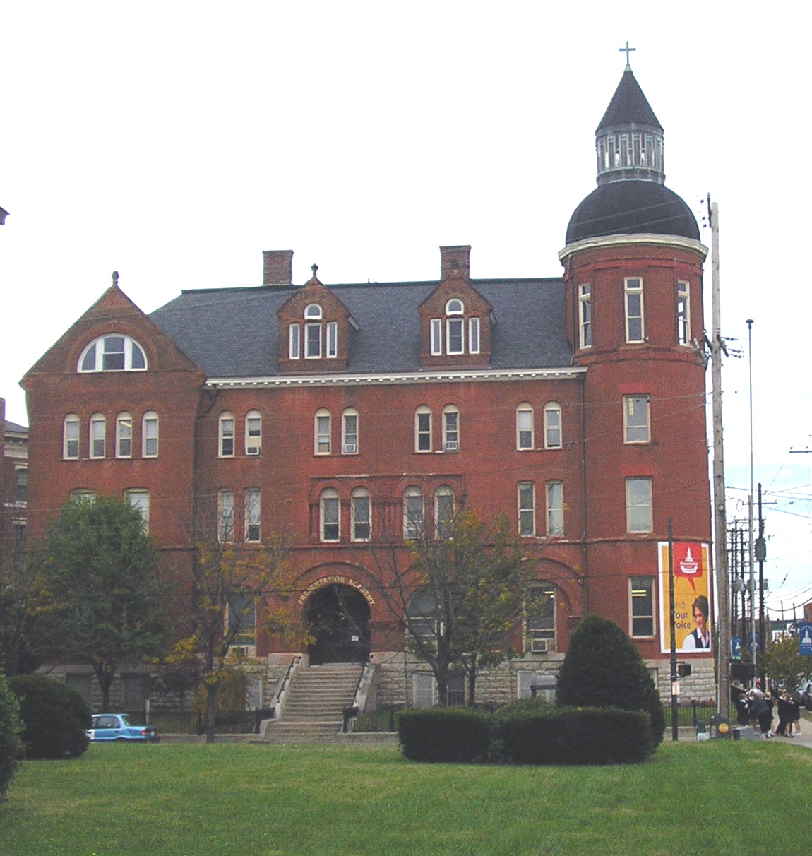
38°14′29″N 85°45′33″W / 38.24139°N 85.75917°WLouisville 198 Presentation Academy 
December 22, 1978 861 S. 4th St.
38°14′31″N 85°45′32″W / 38.24194°N 85.75889°WLouisville 199 Preston-St. Catherine Street Historic District May 2, 1985 Roughly bounded by Roland, Preston, Jackson, St. Catherine, and Floyd Sts.
38°14′11″N 85°44′58″W / 38.23639°N 85.74944°WLouisville 200 J.V. Reed and Company September 8, 1983 1100 W. Main St.
38°15′29″N 85°46′4″W / 38.25806°N 85.76778°WLouisville 201 Repton May 13, 1982 314 Ridgedale Rd.
38°15′38″N 85°41′47″W / 38.26056°N 85.69639°WButchertown/Clifton 202 Ridgeway 
April 11, 1973 4095 Massie Ave.
38°15′50″N 85°38′53″W / 38.26389°N 85.64806°WLouisville 203 Rockdale July 12, 1983 12109 Taylorsville Rd.
38°12′20″N 85°31′39″W / 38.20556°N 85.5275°WJeffersontown 204 Rockledge August 16, 1983 4810 Upper River Rd.
38°18′20″N 85°39′11″W / 38.30556°N 85.65306°WNortheast Louisville 205 Rose Hill December 3, 1980 1835 Hampden Ct.
38°13′42″N 85°41′54″W / 38.22833°N 85.69833°WThe Highlands 206 St. Anthony's Roman Catholic Church, Rectory, Convent, and School March 1, 1982 2222-233 W. Market St.
38°15′30″N 85°47′18″W / 38.25833°N 85.78833°WLouisville 207 St. Bartholomew Parish School August 5, 2010 2036 Buechel Bank Rd.
38°11′3″N 85°38′53″W / 38.18417°N 85.64806°WLouisville 208 St. Bonifacius Kirche Complex October 29, 1982 501-531 E. Liberty St.
38°14′41″N 85°45′5″W / 38.24472°N 85.75139°WLouisville 209 St. Cecilia School Building November 26, 2004 2530 Slevin St.
38°15′54″N 85°47′30″W / 38.265°N 85.79167°WLouisville 210 St. Columba Catholic Campus April 5, 2005 3514 W. Market
38°15′38″N 85°48′34″W / 38.26056°N 85.80944°WLouisville 211 St. Elizabeth of Hungary Roman Catholic Church May 6, 1982 1024-1028 E. Burnett St.
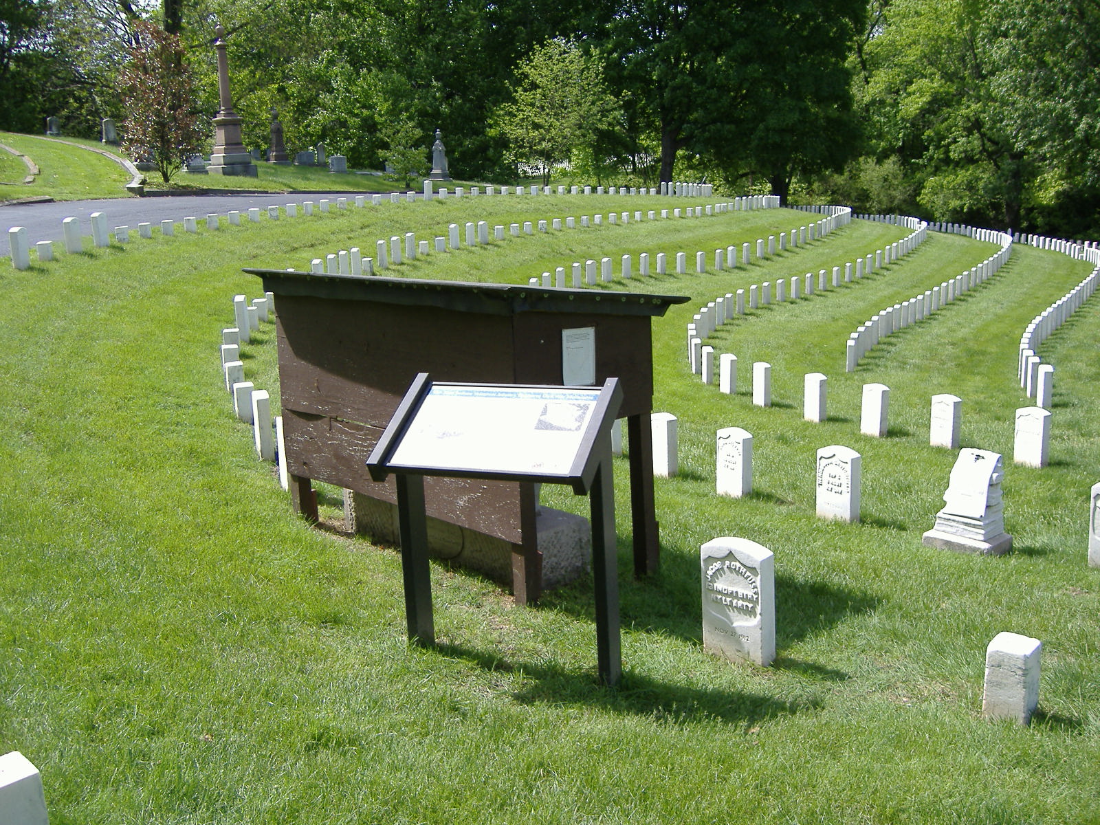
38°13′22″N 85°44′23″W / 38.22278°N 85.73972°WLouisville 212 Saint Frances of Rome School March 26, 1987 2105-2117 Payne St.
38°12′55″N 85°42′27″W / 38.21528°N 85.7075°WThe Highlands 213 Saint Francis of Assisi Complex May 29, 1987 1960 Bardstown Rd.
38°13′32″N 85°41′52″W / 38.22556°N 85.69778°WThe Highlands 214 St. James Roman Catholic Church, Rectory, and School March 1, 1982 1430 Bardstown Rd. and 1826 and 1818 Edenside Ave.
38°13′55″N 85°42′40″W / 38.23194°N 85.71111°WThe Highlands 215 St. James-Belgravia Historic District 
December 5, 1972 Roughly bounded by Central Park, S. 4th, S. 6th, and Hill Sts.
38°13′43″N 85°45′47″W / 38.22861°N 85.76306°WLouisville 216 St. Patrick's Roman Catholic Church, Rectory, and School March 1, 1982 1301-1305 W. Market St.
38°15′26″N 85°46′19″W / 38.25722°N 85.77194°WLouisville 217 St. Peter's German Evangelical Church December 4, 1980 1231 W. Jefferson St.
38°15′21″N 85°46′16″W / 38.25583°N 85.77111°WLouisville 218 St. Therese Roman Catholic Church, School, and Rectory July 28, 1975 1010 Schiller Ave.
38°14′8″N 85°43′56″W / 38.23556°N 85.73222°WLouisville 219 St. Vincent DePaul Church, Rectory, School, St. Ursula Home and Convent November 15, 1984 Oak and Shelby Sts., and 1214 Logan St.
38°13′59″N 85°44′27″W / 38.23306°N 85.74083°WLouisville 220 Valentine Schneikert House April 17, 1986 1234 Lexington Rd.
38°14′58″N 85°43′39″W / 38.24944°N 85.7275°WThe Highlands 221 Schuster Building 
March 19, 1980 1500-1512 Bardstown Rd.
38°13′54″N 85°42′34″W / 38.23167°N 85.70944°WThe Highlands 222 Selema Hall 
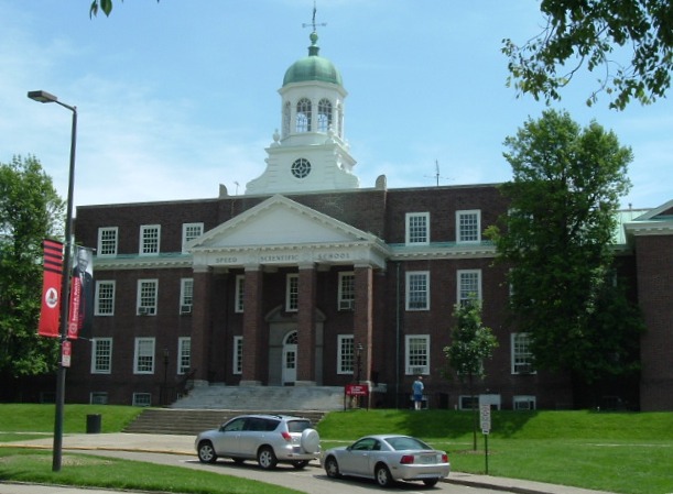
September 6, 1978 2837 Riedling Dr.
38°15′42″N 85°41′32″W / 38.26167°N 85.69222°WButchertown/Clifton 223 Shady Brook Farm August 16, 1983 Avish Lane
38°19′6″N 85°38′22″W / 38.31833°N 85.63944°WHarrods Creek 224 Shelby Park Branch Library December 3, 1980 600 E. Oak St.
38°14′1″N 85°44′44″W / 38.23361°N 85.74556°WLouisville 225 Shwab House August 16, 1983 4812 Upper River Rd.
38°18′28″N 85°39′20″W / 38.30778°N 85.65556°WNortheast Louisville 226 Simeon Lewis Rural Historic District November 25, 2005 5215 Bardstown Rd.
38°10′19″N 85°36′26″W / 38.17194°N 85.60722°WLouisville 227 Smoketown Historic District July 3, 1997 Roughly bounded by Preston, Caldwell, and Jacob Sts., and the alley east of Shelby St.
38°14′27″N 85°44′38″W / 38.24083°N 85.74389°WButchertown/Clifton 228 Snapp House December 5, 1980 8300 Bardstown Rd.
38°7′41″N 85°34′37″W / 38.12806°N 85.57694°WBuechel 229 Soldiers Retreat July 12, 1983 Seaton Springs Parkway
38°14′9″N 85°34′45″W / 38.23583°N 85.57917°WLyndon 230 South Louisville Reformed Church September 6, 1983 1060 Lynnhurst Ave.
38°10′41″N 85°46′54″W / 38.17806°N 85.78167°WSouth End Louisville 231 Southern Heights-Beechmont District September 6, 1983 Roughly bounded by Southern Parkway, 6th St., Ashland, and Southern Heights Aves.
38°11′13″N 85°46′4″W / 38.18694°N 85.76778°WSouth End Louisville 232 Spring Station 
December 12, 1977 3241 Trinity Rd.
38°14′49″N 85°40′9″W / 38.24694°N 85.66917°WLouisville 233 Steam Engine Company No. 3 November 7, 1980 802-804 E. Main St.
38°15′16″N 85°44′14″W / 38.25444°N 85.73722°WButchertown/Clifton 234 Steam Engine Company No. 4 November 7, 1980 1024 Logan St.
38°14′10″N 85°44′23″W / 38.23611°N 85.73972°WButchertown/Clifton 235 Steam Engine Company No. 4 November 7, 1980 1617 W. Main St.
38°15′33″N 85°46′39″W / 38.25917°N 85.7775°WLouisville 236 Steam Engine Company No. 7 
November 7, 1980 821 S. 6th St.
38°14′34″N 85°45′43″W / 38.24278°N 85.76194°WLouisville 237 Steam Engine Company No. 10 November 7, 1980 1419 E. Washington
38°14′46″N 85°43′38″W / 38.24611°N 85.72722°WThe Highlands 238 Steam Engine Company No. 11 November 7, 1980 1122 Rogers
38°15′29″N 85°43′36″W / 38.25806°N 85.72667°WLouisville 239 Steam Engine Company No. 18 November 7, 1980 2600 S. 4th St.
38°13′33″N 85°45′54″W / 38.22583°N 85.765°WLouisville 240 Steam Engine Company No. 20 November 7, 1980 1735 Bardstown Rd.
38°12′41″N 85°45′52″W / 38.21139°N 85.76444°WLouisville 241 Steam Engine Company No. 20 November 7, 1980 1330 Bardstown Rd.
38°13′48″N 85°45′1″W / 38.23°N 85.75028°WLouisville 242 Steam Engine Company No. 22 November 7, 1980 37th and Broadway
38°14′4″N 85°42′59″W / 38.23444°N 85.71639°WThe Highlands 243 Stephen Foster Elementary School April 4, 2006 4020 Garland Ave.
38°14′53″N 85°49′8″W / 38.24806°N 85.81889°WLouisville 244 Arthur P. Stitzel House March 22, 1989 9707 Shelbyville Rd.
38°14′46″N 85°34′27″W / 38.24611°N 85.57417°WLouisville 245 Zodia Stivers House December 5, 1980 Fern Creek
38°11′44″N 85°37′12″W / 38.19556°N 85.62°WBuechel 246 Ben Stout House July 12, 1983 8630 Stout Rd.
38°7′16″N 85°32′12″W / 38.12111°N 85.53667°WJeffersontown 247 Struss House November 7, 2003 1920 Winston Ave.
38°12′52″N 85°40′47″W / 38.21444°N 85.67972°WLouisville 248 Stuart Building March 14, 1985 601 W. Oak St.
38°14′7″N 85°45′50″W / 38.23528°N 85.76389°WLouisville 249 Stucky House December 5, 1980 3504 Marlin Dr.
38°11′27″N 85°34′34″W / 38.19083°N 85.57611°WJeffersontown 250 Sunnyside March 14, 1985 3020 Poppy Way
38°14′51″N 85°40′43″W / 38.2475°N 85.67861°WButchertown/Clifton 251 Taggart House December 5, 1980 5000 Bardstown Rd.
38°10′29″N 85°37′6″W / 38.17472°N 85.61833°WBuechel 252 Zachary Taylor House 
October 15, 1966 5608 Apache Rd.
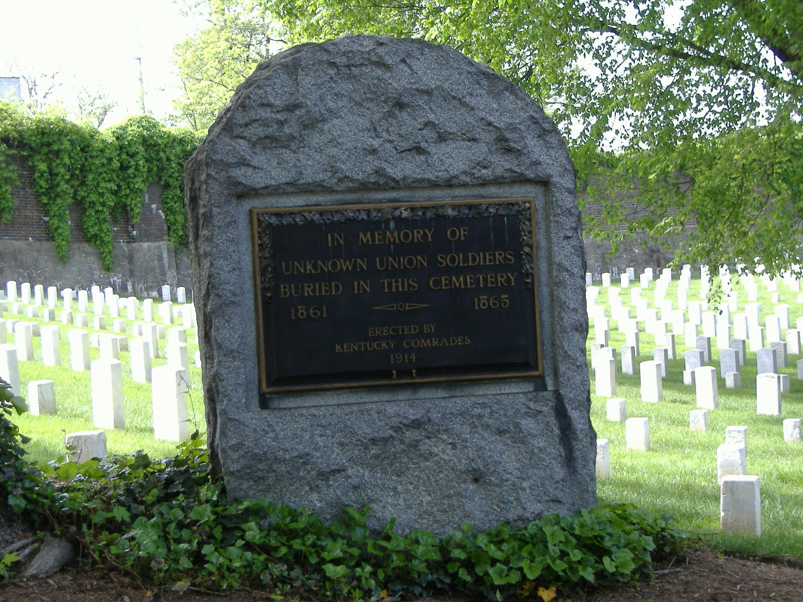
38°16′45″N 85°38′50″W / 38.27917°N 85.64722°WNortheast Louisville 253 Zachary Taylor National Cemetery 
November 3, 1983 4701 Brownsboro Rd.
38°16′39″N 85°38′21″W / 38.2775°N 85.63917°WSt. Matthews 254 Three Mile Tollhouse October 1, 1990 2311 Frankfort Ave.
38°15′13″N 85°42′9″W / 38.25361°N 85.7025°WButchertown/Clifton 255 F.M. Tiller House September 8, 1983 4309 W. Broadway
38°15′28″N 85°50′0″W / 38.25778°N 85.833333°WLouisville 256 George H. Tingley Elementary School July 12, 1984 1311-1317 S. Preston St.
38°13′49″N 85°44′59″W / 38.23028°N 85.74972°WLouisville 257 Tompkins-Buchanan House April 27, 1977 851 S. 4th St.
38°14′32″N 85°45′31″W / 38.24222°N 85.75861°WLouisville 258 James Trigg House December 5, 1980 Covered Bridge Rd.
38°21′12″N 85°36′41″W / 38.35333°N 85.61139°WProspect 259 Hazael Tucker House December 5, 1980 2406 Tucker Station Rd.
38°12′21″N 85°33′1″W / 38.20583°N 85.55028°WJeffersontown 260 Tway House December 5, 1980 1021 Watterson Trail
38°13′54″N 85°33′58″W / 38.23167°N 85.56611°WJeffersontown 261 Tyler Settlement Rural Historic District 
May 1, 1986 Roughly bounded by the Southern railroad line, Taylorsville Rd., and Jeffersontown City
38°11′37″N 85°31′47″W / 38.19361°N 85.52972°WJeffersontown 262 Moses Tyler House July 12, 1983 3200 Tucker Station Rd.
38°11′45″N 85°32′2″W / 38.19583°N 85.53389°WJeffersontown 263 Robert Tylor Place July 12, 1983 12603 Taylorsville Rd.
38°11′28″N 85°31′14″W / 38.19111°N 85.52056°WJeffersontown 264 Union Monument in Louisville 
July 17, 1997 Cave Hill Cemetery, junction of Payne St. and Lexington Rd.
38°14′54″N 85°43′20″W / 38.24833°N 85.72222°WThe Highlands 265 Universal Car Company May 2, 2001 2500 W. Broadway
38°14′57″N 85°47′38″W / 38.24917°N 85.79389°WLouisville 266 University of Louisville Belknap Campus 
June 25, 1976 2301 S. 3rd St.
38°12′56″N 85°45′38″W / 38.21556°N 85.76056°WLouisville 267 Ursuline Academy and Convent June 13, 1978 800 E. Chestnut St.
38°14′48″N 85°44′20″W / 38.24667°N 85.73889°WButchertown/Clifton 268 Virginia Avenue Colored School March 31, 2004 3628 Virginia Ave.
38°14′18″N 85°48′53″W / 38.23833°N 85.81472°WLouisville 269 Von Allmen Dairy Farm House December 11, 2007 5050 Norton Healthcare Boulevard
38°18′47″N 85°34′28″W / 38.31306°N 85.57444°WLouisville 270 Waverly Hills Tuberculosis Sanitarium Historic Buildings 
July 12, 1983 8101 Dixie Highway
38°7′53″N 85°50′28″W / 38.13139°N 85.84111°WLouisville 271 Western Junior High School September 8, 1983 22nd and Main Sts.
38°15′38″N 85°47′13″W / 38.26056°N 85.78694°WLouisville 272 Westwood Farm July 2, 1983 7800 Six Mile Lane
38°11′48″N 85°36′4″W / 38.19667°N 85.60111°WJeffersontown 273 Widman's Saloon and Grocery June 13, 1990 2317-19 Frankfort Ave.
38°15′13″N 85°42′9″W / 38.25361°N 85.7025°WButchertown/Clifton 274 Wilhoyte House December 5, 1980 Covered Bridge Rd.
38°21′20″N 85°35′50″W / 38.35556°N 85.59722°WProspect 275 Abraham L. Williams L & N Guest House December 5, 1980 Murphy Lane
38°16′11″N 85°31′44″W / 38.26972°N 85.52889°WLyndon 276 David Wilson House March 26, 1987 2215 Carolina Ave.
38°13′45″N 85°41′1″W / 38.22917°N 85.68361°WThe Highlands 277 Winchester House July 12, 1983 613 Breckinridge Lane
38°14′37″N 85°38′43″W / 38.24361°N 85.64528°WLouisville 278 Winkworth August 16, 1983 3200 Boxhill Lane
38°18′5″N 85°39′28″W / 38.30139°N 85.65778°WNortheast Louisville 279 Wirth, Lang and Company-The Louisville Leather Company Tannery Building August 2, 2000 711-715 Brent St.
38°14′35″N 85°44′6″W / 38.24306°N 85.735°WLouisville 280 Wolf Pen Branch Mill January 5, 1978 East of Harrods Creek on Wolf Pen Branch Rd.
38°19′48″N 85°35′47″W / 38.33°N 85.59639°WHarrods Creek 281 Woodbourne House February 7, 2008 2024 Woodford Pl.
38°13′33″N 85°41′38″W / 38.22583°N 85.69389°WThe Highlands 282 Woodside/John T. Bate House August 16, 1983 3100 Woodside Rd.
38°17′39″N 85°38′53″W / 38.29417°N 85.64806°WNortheast Louisville 283 Wrampelmeier Furniture Company September 8, 1983 226-228 N. 15th St.
38°15′41″N 85°47′50″W / 38.26139°N 85.79722°WLouisville 284 George B. Yenowine House December 28, 1980 1021 Watterson Trail
38°13′41″N 85°32′53″W / 38.22806°N 85.54806°WMiddletown 285 Yenowine-Kennedy House July 12, 1983 4420 Taylorsville Rd.
38°13′5″N 85°36′12″W / 38.21806°N 85.60333°WJeffersontown Former listings
Landmark name Image Date removed Location City or Town Summary 1 August Bloedner Monument 
November 19, 2010 Cave Hill Cemetery, junction of Payne St. and Lexington Rd.
38°14′54″N 85°43′19″W / 38.24833°N 85.72194°WThe Highlands Listed July 17, 1997 References
- ^ The latitude and longitude information provided in this table was derived originally from the National Register Information System, which has been found to be fairly accurate for about 99% of listings. For about 1% of NRIS original coordinates, experience has shown that one or both coordinates are typos or otherwise extremely far off; some corrections may have been made. A more subtle problem causes many locations to be off by up to 150 yards, depending on location in the country: most NRIS coordinates were derived from tracing out latitude and longitudes off of USGS topographical quadrant maps created under the North American Datum of 1927, which differs from the current, highly accurate WGS84 GPS system used by Google maps. Chicago is about right, but NRIS longitudes in Washington are higher by about 4.5 seconds, and are lower by about 2.0 seconds in Maine. Latitudes differ by about 1.0 second in Florida. Some locations in this table may have been corrected to current GPS standards.
- ^ "National Register of Historic Places: Weekly List Actions". National Park Service, United States Department of the Interior. Retrieved on November 10, 2011.
- ^ Numbers represent an ordering by significant words. Various colorings, defined here, differentiate National Historic Landmark sites and National Register of Historic Places Districts from other NRHP buildings, structures, sites or objects.
- ^ "National Register Information System". National Register of Historic Places. National Park Service. 2008-04-24. http://nrhp.focus.nps.gov/natreg/docs/All_Data.html.
External links
U.S. National Register of Historic Places Topics Lists by states Alabama • Alaska • Arizona • Arkansas • California • Colorado • Connecticut • Delaware • Florida • Georgia • Hawaii • Idaho • Illinois • Indiana • Iowa • Kansas • Kentucky • Louisiana • Maine • Maryland • Massachusetts • Michigan • Minnesota • Mississippi • Missouri • Montana • Nebraska • Nevada • New Hampshire • New Jersey • New Mexico • New York • North Carolina • North Dakota • Ohio • Oklahoma • Oregon • Pennsylvania • Rhode Island • South Carolina • South Dakota • Tennessee • Texas • Utah • Vermont • Virginia • Washington • West Virginia • Wisconsin • WyomingLists by territories Lists by associated states Other Municipalities and communities of Jefferson County, Kentucky Cities Anchorage | Audubon Park | Bancroft | Barbourmeade | Beechwood Village | Bellemeade | Bellewood | Blue Ridge Manor | Briarwood | Broeck Pointe | Brownsboro Farm | Brownsboro Village | Cambridge | Coldstream | Creekside | Crossgate | Douglass Hills | Druid Hills | Fincastle | Forest Hills | Glenview | Glenview Hills | Glenview Manor | Goose Creek | Graymoor-Devondale | Green Spring | Heritage Creek | Hickory Hill | Hills and Dales | Hollow Creek | Hollyvilla | Houston Acres | Hurstbourne | Hurstbourne Acres | Indian Hills | Jeffersontown | Kingsley | Langdon Place | Lincolnshire | Louisville (balance) | Lyndon | Lynnview | Manor Creek | Maryhill Estates | Meadow Vale | Meadowbrook Farm | Meadowview Estates | Middletown | Mockingbird Valley | Moorland | Murray Hill | Norbourne Estates | Northfield | Norwood | Old Brownsboro Place | Parkway Village | Plantation | Poplar Hills | Prospect | Richlawn | Riverwood | Rolling Fields | Rolling Hills | St. Matthews | St. Regis Park | Seneca Gardens | Shively | South Park View | Spring Mill | Spring Valley | Strathmoor Manor | Strathmoor Village | Sycamore | Ten Broeck | Thornhill | Watterson Park | Wellington | West Buechel | Westwood | Wildwood | Windy Hills | Woodland Hills | Woodlawn Park | Worthington Hills
 Categories:
- History of Louisville, Kentucky
- National Register of Historic Places in Jefferson County, Kentucky
- National Register of Historic Places in Kentucky by county
- National Register of Historic Places in Louisville, Kentucky
- Louisville-related lists
-


Wikimedia Foundation. 2010.