- National Register of Historic Places listings in Oldham County, Kentucky
-
 Location of Oldham County in Kentucky
This is a list of the National Register of Historic Places listings in Oldham County, Kentucky. It is intended to be a complete list of the properties and districts on the National Register of Historic Places in Oldham County, Kentucky, United States. The locations of National Register properties and districts for which the latitude and longitude coordinates are included below, may be seen in a Google map.[1]
There are approximately 45 properties and districts listed on the National Register in the county.
-
- This National Park Service list is complete through NPS recent listings posted November 10, 2011.[2]
Listings county-wide
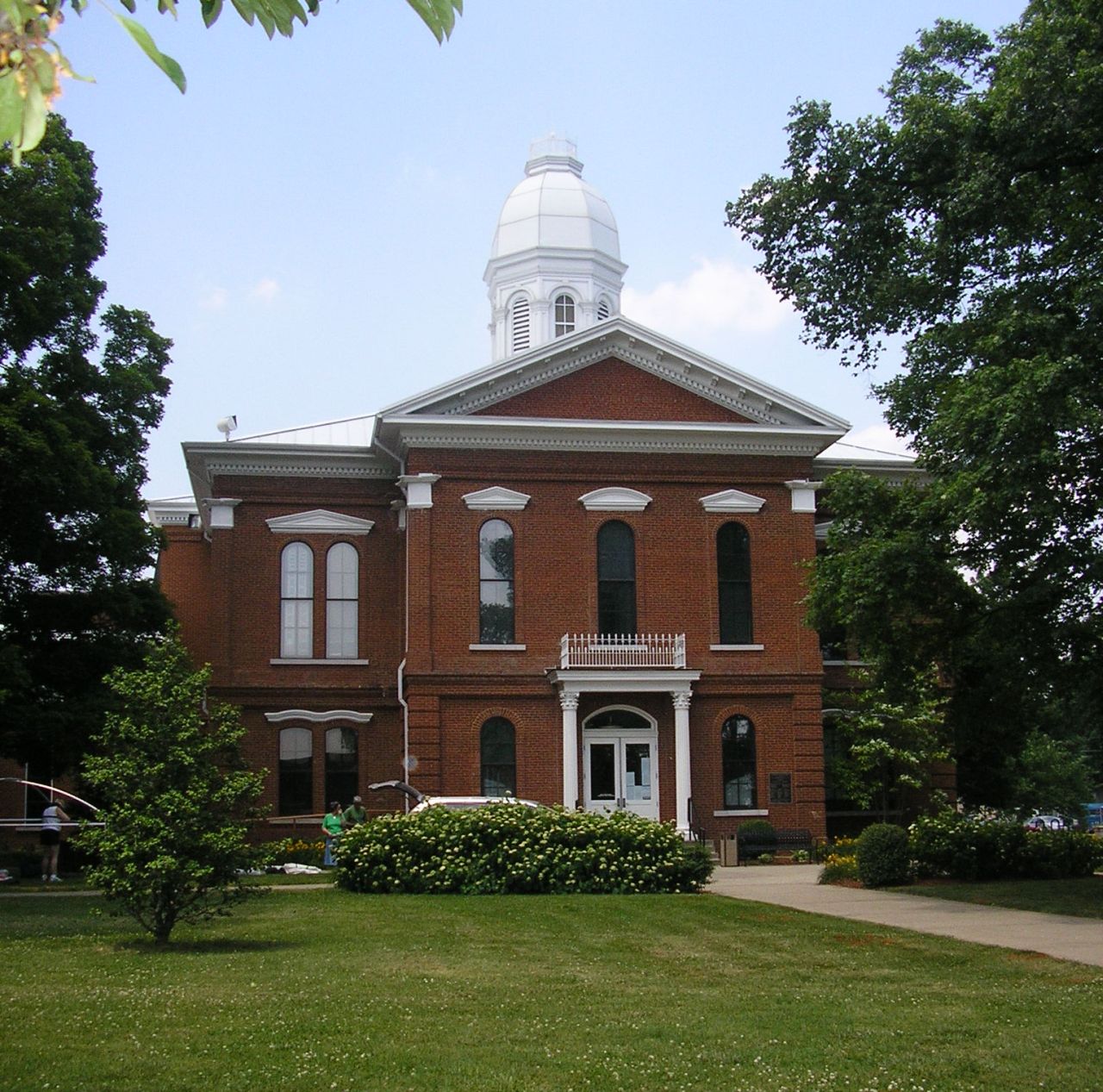
[3] Landmark name Image Date listed Location City or town Summary 1 Ashbourne Farms March 25, 2008 3800 Old Westport Rd.
38°27′03″N 85°25′22″W / 38.450833°N 85.422778°WLa Grange 2 Ashwood Avenue Historic District August 7, 1989 Roughly Ash Ave. from La Grange Rd. to Elm Ave.
38°18′26″N 85°29′19″W / 38.307222°N 85.488611°WPewee Valley 3 John Leslie Bate House January 8, 1987 East of Buckeye Ln. off KY 42
38°25′44″N 85°33′46″W / 38.428889°N 85.562778°WGoshen 4 Bondurant-Hustin House November 27, 1989 104 Castlewood Dr.
38°18′21″N 85°29′45″W / 38.305833°N 85.495833°WPewee Valley 5 Bradshaw-Duncan House July 14, 2005 8502 Todds Point Rd.
38°18′12″N 85°26′03″W / 38.303333°N 85.434167°WCrestwood 6 Building at 301 La Grange Road November 27, 1989 301 La Grange Rd.
38°18′38″N 85°29′14″W / 38.310556°N 85.487222°WPewee Valley 7 Carpenter-Smith House February 25, 1982 Covered Bridge Rd.
38°22′08″N 85°31′46″W / 38.368889°N 85.529444°WCrestwood 8 Central Avenue Historic District 
August 7, 1989 Roughly Central Ave. from Peace Ln. to Mt. Mercy Dr.
38°18′40″N 85°29′35″W / 38.311111°N 85.493056°WPewee Valley 9 Central La Grange Historic District September 8, 1988 Primarily along Washington, Main, and Jefferson Sts., Kentucky Ave., and 1st through 6th Aves.
38°24′25″N 85°22′54″W / 38.406944°N 85.381667°WLa Grange 10 Clifton August 18, 1997 4801 Greenhaven Ln.
38°27′50″N 85°28′55″W / 38.463889°N 85.481944°WGoshen 11 Albert E. Clore House May 26, 1983 6400 Clore Lane
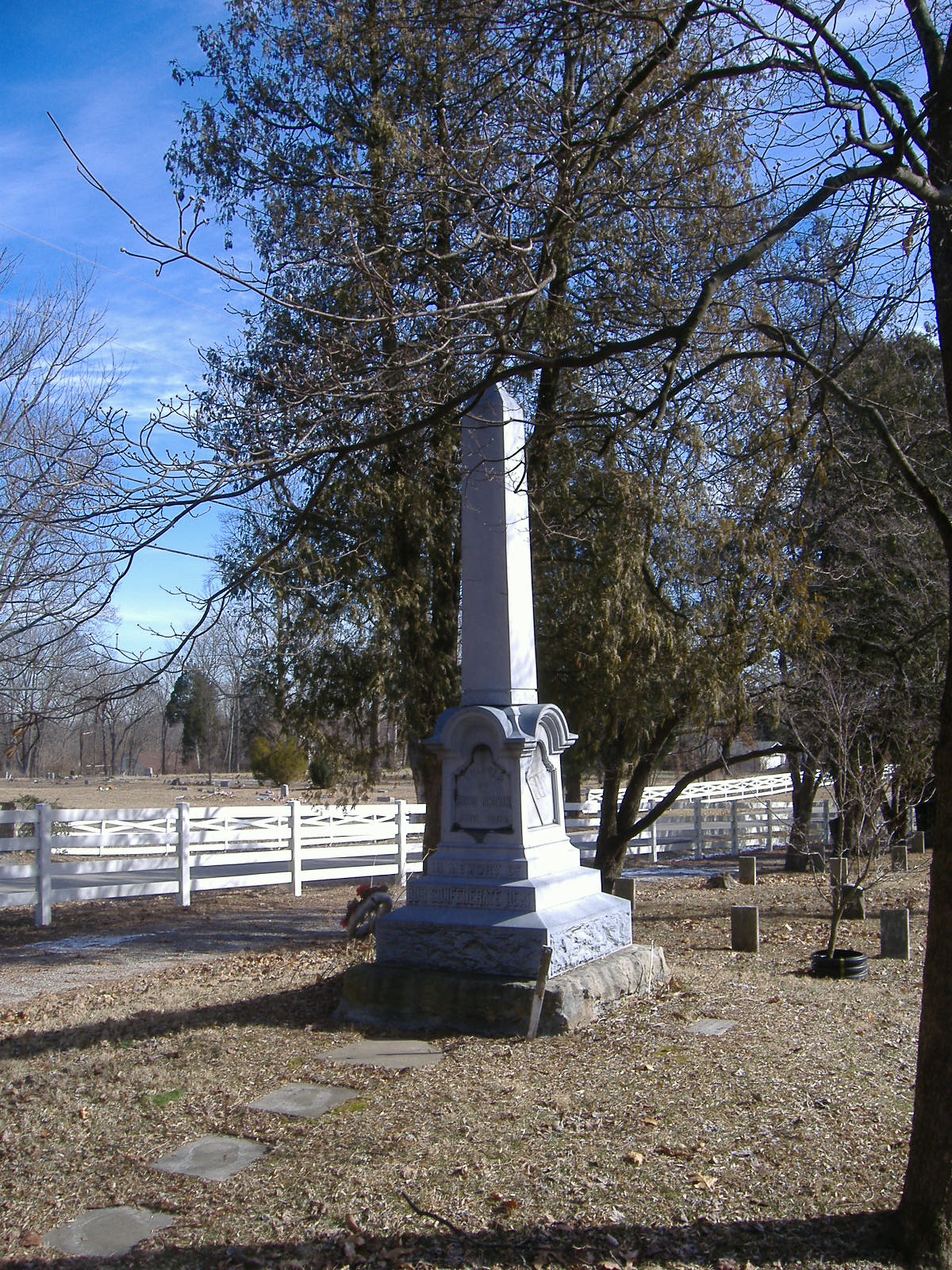
38°19′58″N 85°30′04″W / 38.332778°N 85.501111°WCrestwood 12 Confederate Memorial in Pewee Valley 
July 17, 1997 Confederate Cemetery, junction of Maple Ave. and Old Floydsburg Rd.
38°18′11″N 85°28′32″W / 38.303056°N 85.475556°WPewee Valley 13 Joseph H. Ellis House November 27, 1989 320 Maple Ave.
38°18′20″N 85°28′46″W / 38.305556°N 85.479444°WPewee Valley 14 Forrester-Duvall House November 27, 1989 115 Old Forest Rd.
38°18′12″N 85°29′12″W / 38.303333°N 85.486667°WPewee Valley 15 D. W. Griffith House 
June 3, 1976 206 N. 4th St.
38°24′30″N 85°23′02″W / 38.408333°N 85.383889°WLa Grange 16 Harrods Creek Baptist Church and Rev. William Kellar House September 8, 1976 Northwest of Crestwood on Old Brownsboro Rd.
38°21′32″N 85°30′39″W / 38.358889°N 85.510833°WCrestwood 17 The Hermitage December 2, 1982 Off U.S. Route 42
38°24′51″N 85°32′38″W / 38.414167°N 85.543889°WGoshen 18 William Ingram House August 18, 1983 6800 Shrader Lane
38°24′11″N 85°29′47″W / 38.403056°N 85.496389°WBuckner 19 Abraham Kellar House July 9, 1979 West of Brownsboro off KY 329
38°21′36″N 85°31′26″W / 38.36°N 85.523889°WBrownsboro 20 Locke-Mount House November 24, 1982 South of Goshen off U.S. Route 42
38°21′59″N 85°35′02″W / 38.366389°N 85.583889°WGoshen 21 The Locust July 30, 1975 LaGrange Rd. off KY 146
38°19′12″N 85°29′13″W / 38.32°N 85.486944°WPewee Valley 22 McMahan House May 13, 1982 203 Washington St.
38°24′24″N 85°22′37″W / 38.406667°N 85.376944°WLa Grange 23 William McMakin House January 8, 1987 Off KY 1817
38°22′11″N 85°27′55″W / 38.369722°N 85.465278°WBrownsboro 24 George Miller House November 27, 1989 331 Central Ave.
38°19′05″N 85°29′41″W / 38.318056°N 85.494722°WPewee Valley 25 Dr. Thomas C. Peebles House November 27, 1989 114 Maple Ave.
38°18′35″N 85°28′58″W / 38.309722°N 85.482778°WPewee Valley 26 Pewee Valley Confederate Cemetery 
November 27, 1989 Maple Ave., southeast of its junction with Old Floydsburg Rd.
38°18′12″N 85°28′34″W / 38.303333°N 85.476111°WPewee Valley 27 John Ritter House January 8, 1987 Old Floydsburg Rd. off KY 1408
38°18′39″N 85°27′34″W / 38.310833°N 85.459444°WFloydsburg 28 Russell Court November 10, 1988 Roughly bounded by Madison St., Chestnut St., E. Jefferson St., and Maple St.
38°24′42″N 85°22′19″W / 38.411667°N 85.371944°WLa Grange 29 St. Aloysius Church November 27, 1989 202 Mt. Mercy Dr.
38°18′29″N 85°29′30″W / 38.308056°N 85.491667°WPewee Valley 30 Saint James' Episcopal Church December 5, 1985 401 Old LaGrange Rd.
38°18′47″N 85°29′04″W / 38.313056°N 85.484444°WPewee Valley 31 Reuben Sale House November 24, 1982 3700 Smith Lane
38°28′04″N 85°25′30″W / 38.467778°N 85.425°WLa Grange 32 William Alexander Smith House November 27, 1989 108 Mt. Mercy Dr.
38°18′21″N 85°29′39″W / 38.305833°N 85.494167°WPewee Valley 33 Spring Hill April 2, 1980 South of Ballardsville off KY 53
38°19′56″N 85°20′01″W / 38.332222°N 85.333611°WBallardsville 34 Tanglewood November 27, 1989 417 La Grange Rd.
38°18′52″N 85°29′02″W / 38.314444°N 85.483889°WPewee Valley 35 Phillip R. Taylor House May 24, 1983 Shuler Lane
38°20′18″N 85°34′06″W / 38.338333°N 85.568333°WLouisville 36 Tuliphurst November 27, 1989 115 La Grange Rd.
38°18′18″N 85°29′27″W / 38.305°N 85.490833°WPewee Valley 37 Van Horn-Ross House November 27, 1989 138 Rosswoods Dr.
38°18′50″N 85°29′40″W / 38.313889°N 85.494444°WPewee Valley 38 Waldeck Farm January 4, 2001 5900 W. KY 22
38°19′41″N 85°27′30″W / 38.328056°N 85.458333°WCrestwood 39 Wesley Methodist Church January 8, 1987 Haunz Ln.
38°19′54″N 85°32′07″W / 38.331667°N 85.535278°WAnchorage 40 Wildwood Farm March 30, 2006 3901 Axton Ln.
38°26′55″N 85°32′10″W / 38.448611°N 85.536111°WSkylight 41 Wooldridge-Rose House September 13, 2006 315 Wooldridge Ave.
38°19′03″N 85°29′24″W / 38.3175°N 85.49°WPewee Valley 42 William Woolfolk House January 8, 1987 Off U.S. Route 42
38°26′17″N 85°27′23″W / 38.438056°N 85.456389°WLa Grange 43 Yager House June 17, 1982 Southeast of Goshen on Covered Bridge Rd.
38°22′44″N 85°32′07″W / 38.378889°N 85.535278°WGoshen 44 Yew Dell Farm August 19, 2011 5800 N. Camden Ln.
38°20′21″N 85°27′47″W / 38.339167°N 85.463056°WCrestwood vicinity 45 Yewell-Snyder House November 3, 1983 6206 N. Hitt Lane
38°20′32″N 85°32′46″W / 38.342222°N 85.546111°WBrownsboro See also
- List of National Historic Landmarks in Kentucky
- National Register of Historic Places listings in Kentucky
References
- ^ The latitude and longitude information provided in this table was derived originally from the National Register Information System, which has been found to be fairly accurate for about 99% of listings. For about 1% of NRIS original coordinates, experience has shown that one or both coordinates are typos or otherwise extremely far off; some corrections may have been made. A more subtle problem causes many locations to be off by up to 150 yards, depending on location in the country: most NRIS coordinates were derived from tracing out latitude and longitudes off of USGS topographical quadrant maps created under the North American Datum of 1927, which differs from the current, highly accurate WGS84 GPS system used by Google maps. Chicago is about right, but NRIS longitudes in Washington are higher by about 4.5 seconds, and are lower by about 2.0 seconds in Maine. Latitudes differ by about 1.0 second in Florida. Some locations in this table may have been corrected to current GPS standards.
- ^ "National Register of Historic Places: Weekly List Actions". National Park Service, United States Department of the Interior. Retrieved on November 10, 2011.
- ^ Numbers represent an ordering by significant words. Various colorings, defined here, differentiate National Historic Landmark sites and National Register of Historic Places Districts from other NRHP buildings, structures, sites or objects.
U.S. National Register of Historic Places Topics Lists by states Alabama • Alaska • Arizona • Arkansas • California • Colorado • Connecticut • Delaware • Florida • Georgia • Hawaii • Idaho • Illinois • Indiana • Iowa • Kansas • Kentucky • Louisiana • Maine • Maryland • Massachusetts • Michigan • Minnesota • Mississippi • Missouri • Montana • Nebraska • Nevada • New Hampshire • New Jersey • New Mexico • New York • North Carolina • North Dakota • Ohio • Oklahoma • Oregon • Pennsylvania • Rhode Island • South Carolina • South Dakota • Tennessee • Texas • Utah • Vermont • Virginia • Washington • West Virginia • Wisconsin • WyomingLists by territories Lists by associated states Other Municipalities and communities of Oldham County, Kentucky Cities 
CDP Unincorporated
communitiesBallardsville | Brownsboro | Centerfield | Floydsburg
Categories:- National Register of Historic Places in Kentucky by county
- Oldham County, Kentucky
-


Wikimedia Foundation. 2010.