- National Register of Historic Places listings in Campbell County, Kentucky
-
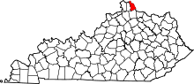 Location of Campbell County in Kentucky
This is a list of the National Register of Historic Places listings in Campbell County, Kentucky. It is intended to be a complete list of the properties and districts on the National Register of Historic Places in Campbell County, Kentucky, United States. The locations of National Register properties and districts for which the latitude and longitude coordinates are included below, may be seen in a Google map.[1]
There are 58 properties and districts listed on the National Register in the county.
-
- This National Park Service list is complete through NPS recent listings posted November 10, 2011.[2]
Listings county-wide
[3] Landmark name Image Date listed Location City or town Summary 1 Peter Barth Farm March 9, 1983 Lower Tug Fork Rd.
39°00′13″N 84°22′44″W / 39.003611°N 84.378889°WAlexandria 2 Baumann House 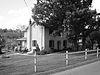
March 9, 1983 Four Mile Pike
38°59′20″N 84°21′49″W / 38.988889°N 84.363611°WCamp Springs 3 Bellevue April 22, 1976 335 E. 3rd St.
39°05′47″N 84°29′33″W / 39.096389°N 84.4925°WNewport 4 Bellevue High School January 9, 1986 Washington and Center Sts.
39°06′08″N 84°28′51″W / 39.102222°N 84.480833°WBellevue 5 Bishoff House March 9, 1983 Upper Eight Mile Rd.
39°00′54″N 84°20′51″W / 39.015°N 84.3475°WCamp Springs 6 Blau's Four Mile House 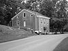
March 9, 1983 Four Mile Pike
38°59′49″N 84°21′46″W / 38.996944°N 84.362778°WCamp Springs 7 Blenk House March 9, 1983 Four and Eight Mile Rd.
38°59′24″N 84°21′25″W / 38.99°N 84.356944°WAlexandria 8 John Braun House March 9, 1983 Eight Mile Rd.
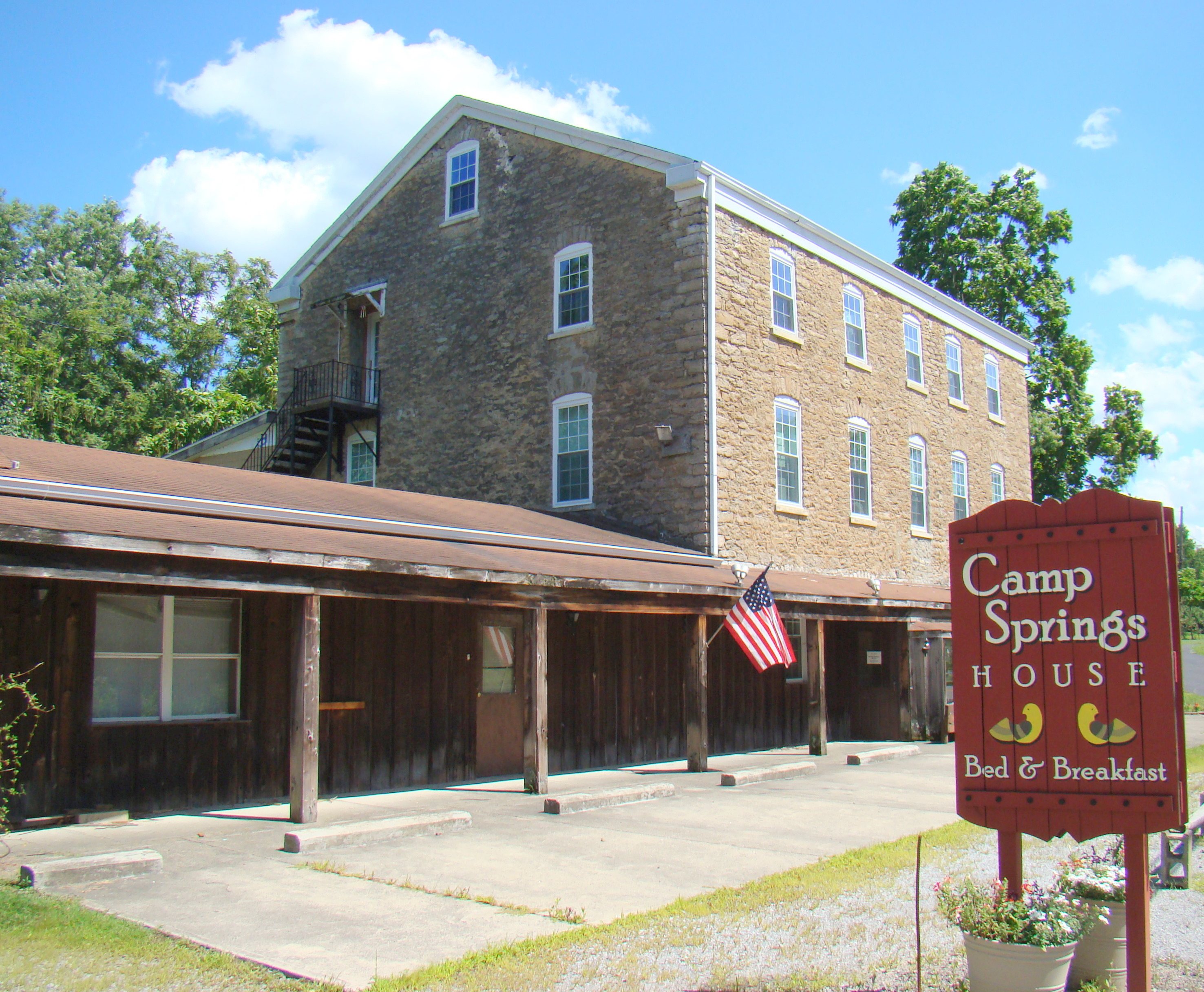
39°00′17″N 84°21′13″W / 39.004722°N 84.353611°WCamp Springs 9 Camp Springs House 
March 9, 1983 Four Mile Pike
39°00′24″N 84°21′59″W / 39.006667°N 84.366389°WCamp Springs 10 Campbell County Courthouse at Newport 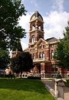
March 8, 1988 4th and York Sts.
39°05′32″N 84°29′53″W / 39.092222°N 84.498056°WNewport 11 Cote Brillante Historic District August 3, 2005 Portions of E. 10th, E. 11th Sts., Park Ave., Camryn Court, Vine, Center, Prospect, and Miller Sts., and Wiedemann Place
39°05′22″N 84°28′52″W / 39.089444°N 84.481111°WNewport 12 Dayton High School July 18, 1985 8th and Walnut Sts.
39°06′33″N 84°27′56″W / 39.109167°N 84.465556°WDayton 13 East Newport Historic District August 25, 1983 Roughly bounded by the C&O railroad line, 6th, Saratoga, and Oak Sts.
39°05′28″N 84°29′13″W / 39.091111°N 84.486944°WNewport 14 John Faha House March 9, 1983 Lower Tug Fork Rd.
39°00′17″N 84°21′13″W / 39.004722°N 84.353611°WAlexandria 15 Fairfield Avenue Historic District February 22, 1988 Fairfield Ave. between LaFayette Ave. and O'Fallon
39°06′33″N 84°28′50″W / 39.109167°N 84.480556°WBellevue 16 Foote-Fister Mansion February 24, 1988 801 Lincoln Rd.
39°06′10″N 84°28′23″W / 39.102778°N 84.473056°WBellevue 17 Fort Thomas Commercial District August 3, 2005 1011-1312 S. Ft. Thomas Ave, 9-11 River Rd., and 12-28 Midway Ct.
39°03′51″N 84°26′49″W / 39.06428°N 84.44698°WFort Thomas 18 Fort Thomas Military Reservation District May 15, 1986 Roughly bounded by Pearson, Alexander and Cochran Aves., River Rd., and S. Fort Thomas Ave.
39°03′55″N 84°26′39″W / 39.065278°N 84.444167°WFort Thomas 19 Gubser-Schuchter Farm March 9, 1983 Four Mile Pike Area
38°59′01″N 84°21′47″W / 38.983611°N 84.363056°WCamp Springs 20 Heiert Farm March 9, 1983 Upper Eight Mile Pike
39°00′18″N 84°20′37″W / 39.005°N 84.343611°WCamp Springs 21 Elijah Herndon House October 29, 1983 Northwest of California on Washington Trace Rd.
38°55′37″N 84°17′40″W / 38.926944°N 84.294444°WCalifornia 22 Hilbert Farm March 9, 1983 Gunkel Rd.
39°00′39″N 84°20′18″W / 39.010833°N 84.338333°WCamp Springs 23 Kort Grocery 
March 9, 1983 Four Mile Pike
39°00′01″N 84°21′49″W / 39.000278°N 84.363611°WCamp Springs 24 Frederich Kremer House March 9, 1983 317 Poplar Ridge Rd.
38°58′59″N 84°22′25″W / 38.983056°N 84.373611°WAlexandria 25 Matthias Kremer House March 9, 1983 Four and Twelve Mile Rd.
38°59′35″N 84°21′45″W / 38.993056°N 84.3625°WCamp Springs 26 Nicholas Kremer House March 9, 1983 Four and Twelve Mile Pike
38°59′21″N 84°21′17″W / 38.989167°N 84.354722°WAlexandria 27 Leick House March 9, 1983 Four Mile Pike
38°59′42″N 84°21′39″W / 38.995°N 84.360833°WCamp Springs 28 Mansion Hill Historic District 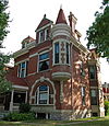
July 17, 1980 Roughly bounded by Interstate 471, Washington Ave., 2nd and 6th Sts.; also roughly bounded by Washington Ave., 6th, Saratoga, and 3rd Sts.
39°05′44″N 84°29′30″W / 39.095556°N 84.491667°WNewport Second set of addresses represents a boundary increase 29 Monmouth Street Historic District July 25, 1996 Monmouth St. between 3rd and 11th Sts.
39°05′22″N 84°29′39″W / 39.089444°N 84.494167°WNewport 30 Newport and Cincinnati Bridge 
April 17, 2001 Over the Ohio River
39°05′41″N 84°29′40″W / 39.094722°N 84.494444°WNewport Also known as the Newport Southbank Bridge; extends into Cincinnati, Ohio 31 Newport Courthouse Square Historic District February 5, 2010 York St., Court Pl., and 4th St.
39°05′32″N 84°29′49″W / 39.092267°N 84.497047°WNewport 32 Ort-Heeb Farm March 9, 1983 Four Mile Pike
38°58′48″N 84°22′01″W / 38.98°N 84.366944°WAlexandria 33 Posey Flats January 29, 1987 101-103 E. 3rd St.
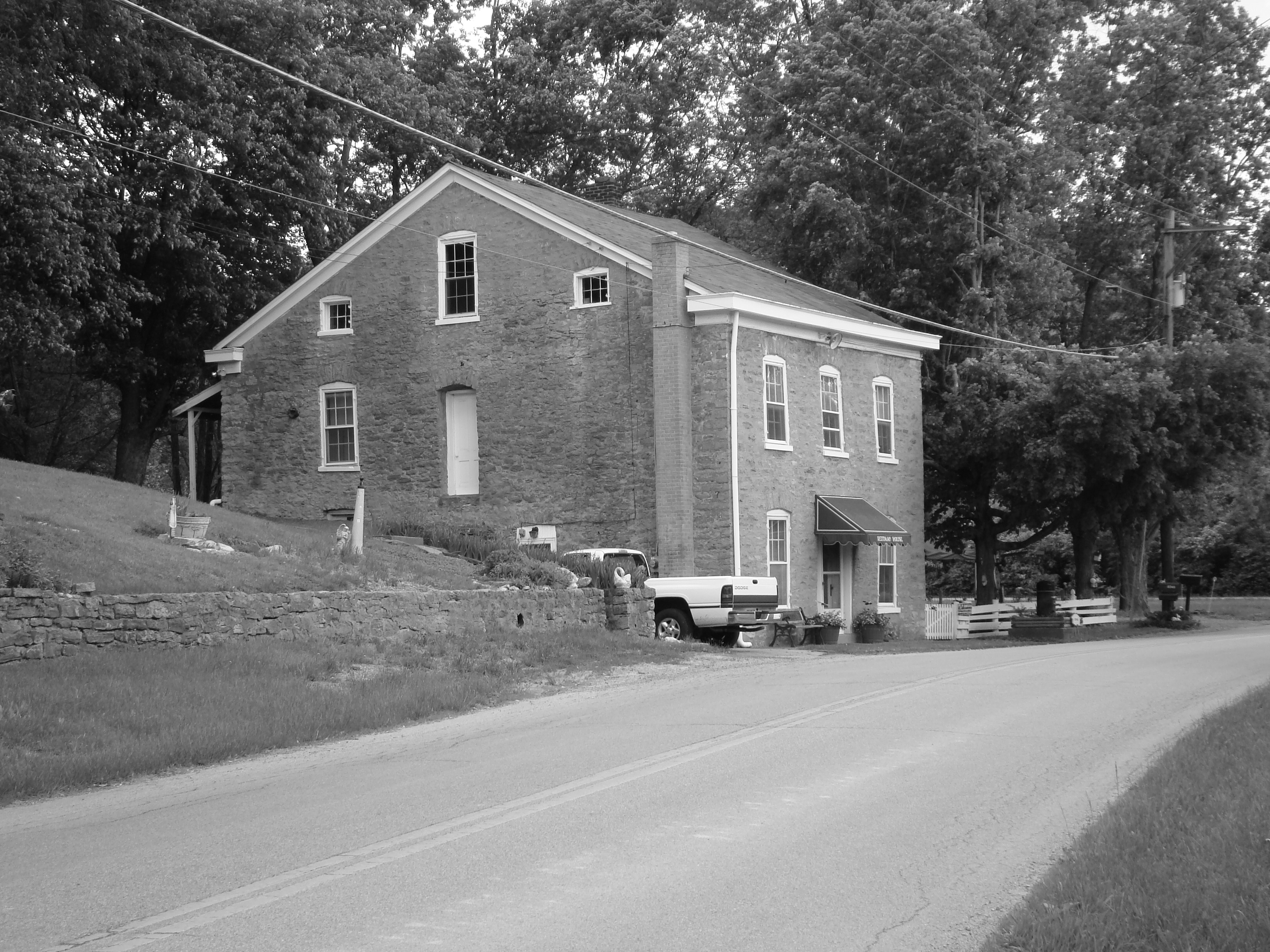
39°05′39″N 84°29′54″W / 39.094167°N 84.498333°WNewport 34 Reitman House March 9, 1983 Reitman Rd.
38°59′43″N 84°22′30″W / 38.995278°N 84.375°WAlexandria 35 Reitman's St. Joseph House March 9, 1983 Four Mile Pike
38°59′43″N 84°21′48″W / 38.995278°N 84.363333°WCamp Springs 36 Andrew Ritter Farm March 9, 1983 Four Mile Pike
38°59′00″N 84°21′29″W / 38.983333°N 84.358056°WAlexandria 37 Roth Farm March 9, 1983 Off Lower Eight Mile Rd.
39°00′45″N 84°21′22″W / 39.0125°N 84.356111°WCamp Springs 38 Sacred Heart Church 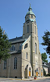
August 13, 1974 337 Taylor Ave.
39°06′10″N 84°28′48″W / 39.102778°N 84.48°WBellevue 39 St. John's Lutheran Cemetery March 9, 1983 Upper Tug Fork Rd.
39°00′51″N 84°22′58″W / 39.014167°N 84.382778°WAlexandria 40 St. John the Baptist Roman Catholic Church August 11, 1980 641 Licking Pike
39°00′47″N 84°28′17″W / 39.013056°N 84.471389°WWilder 41 St. Joseph's Catholic Church and Cemetery May 16, 1983 Four Mile Pike
38°59′38″N 84°21′42″W / 38.993889°N 84.361667°WAlexandria 42 St. Paul's Episcopal Church November 25, 1980 15 Court Pl.
39°05′34″N 84°29′49″W / 39.092778°N 84.496944°WNewport 43 St. Vincent de Paul School October 11, 1989 117 Main St.
39°04′49″N 84°29′13″W / 39.080278°N 84.486944°WNewport 44 Salem Methodist Episcopal Church and Parsonage March 27, 1986 810 York St.
39°05′18″N 84°29′35″W / 39.088333°N 84.493056°WNewport 45 August Sauer House August 18, 1997 832 Central Ave.
39°05′15″N 84°29′46″W / 39.0875°N 84.496111°WNewport 46 Sauser Farm March 9, 1983 Upper Tug Fork Rd.
39°00′56″N 84°23′01″W / 39.015556°N 84.383611°WAlexandria 47 Joseph Seiter House April 3, 1986 307-309 Berry Ave.
39°06′10″N 84°29′03″W / 39.102778°N 84.484167°WBellevue 48 Southgate-Parker-Maddux House August 29, 1977 24 E. 3rd St.
39°05′36″N 84°29′47″W / 39.093333°N 84.496389°WNewport 49 Taylor's Daughters Historic District February 24, 1988 Roughly bounded by O'Fallon Ave., Locust St., Retreat St., Clark St., Chen Ave., and Fairfield Ave.
39°06′11″N 84°28′47″W / 39.103056°N 84.479722°WBellevue 50 Third Street Motor Car Company Building December 5, 2002 216 E. 3rd St.
39°05′43″N 84°29′39″W / 39.095278°N 84.494167°WNewport 51 Tiemeyer House March 9, 1983 KY 8
39°01′40″N 84°21′16″W / 39.027778°N 84.354444°WMelbourne 52 Trutschell House March 9, 1983 KY 8
39°01′32″N 84°21′00″W / 39.025556°N 84.35°WMelbourne 53 U.S. Army Fort Thomas Mess Hall March 13, 1980 Cochran Ave.
39°04′05″N 84°26′40″W / 39.068056°N 84.444444°WFort Thomas 54 Uebel House March 9, 1983 Upper Tug Fork Rd.
38°59′34″N 84°23′08″W / 38.992778°N 84.385556°WAlexandria 55 Walter House December 11, 2007 6570 Vineyard Ln.
38°59′51″N 84°19′35″W / 38.9975°N 84.326389°WMelbourne 56 John Weber Farm July 11, 2007 6231 Four Mile Rd.
39°00′37″N 84°22′11″W / 39.010328°N 84.369842°WCamp Springs 57 Charles Wiedemann House August 18, 1984 1102 Park Ave.
39°05′18″N 84°28′58″W / 39.088333°N 84.482778°WNewport 58 York Street Historic District May 26, 1995 York St. from 7th St. to 10th St.
39°05′15″N 84°29′34″W / 39.0875°N 84.492778°WNewport See also
- List of National Historic Landmarks in Kentucky
- National Register of Historic Places listings in Kentucky
References
- ^ The latitude and longitude information provided in this table was derived originally from the National Register Information System, which has been found to be fairly accurate for about 99% of listings. For about 1% of NRIS original coordinates, experience has shown that one or both coordinates are typos or otherwise extremely far off; some corrections may have been made. A more subtle problem causes many locations to be off by up to 150 yards, depending on location in the country: most NRIS coordinates were derived from tracing out latitude and longitudes off of USGS topographical quadrant maps created under the North American Datum of 1927, which differs from the current, highly accurate WGS84 GPS system used by Google maps. Chicago is about right, but NRIS longitudes in Washington are higher by about 4.5 seconds, and are lower by about 2.0 seconds in Maine. Latitudes differ by about 1.0 second in Florida. Some locations in this table may have been corrected to current GPS standards.
- ^ "National Register of Historic Places: Weekly List Actions". National Park Service, United States Department of the Interior. Retrieved on November 10, 2011.
- ^ Numbers represent an ordering by significant words. Various colorings, defined here, differentiate National Historic Landmark sites and National Register of Historic Places Districts from other NRHP buildings, structures, sites or objects.
U.S. National Register of Historic Places Topics Lists by states Alabama • Alaska • Arizona • Arkansas • California • Colorado • Connecticut • Delaware • Florida • Georgia • Hawaii • Idaho • Illinois • Indiana • Iowa • Kansas • Kentucky • Louisiana • Maine • Maryland • Massachusetts • Michigan • Minnesota • Mississippi • Missouri • Montana • Nebraska • Nevada • New Hampshire • New Jersey • New Mexico • New York • North Carolina • North Dakota • Ohio • Oklahoma • Oregon • Pennsylvania • Rhode Island • South Carolina • South Dakota • Tennessee • Texas • Utah • Vermont • Virginia • Washington • West Virginia • Wisconsin • WyomingLists by territories Lists by associated states Other Municipalities and communities of Campbell County, Kentucky Cities Alexandria | Bellevue | California | Cold Spring | Crestview | Dayton | Fort Thomas | Highland Heights | Melbourne | Mentor | Newport | Silver Grove | Southgate | Wilder | Woodlawn

CDP Unincorporated
communitiesCamp Springs | Carthage
Categories:- National Register of Historic Places in Kentucky by county
- Campbell County, Kentucky
-


Wikimedia Foundation. 2010.