- National Register of Historic Places listings in Bracken County, Kentucky
-
 Location of Bracken County in Kentucky
This is a list of the National Register of Historic Places listings in Bracken County, Kentucky. It is intended to be a complete list of the properties and districts on the National Register of Historic Places in Bracken County, Kentucky, United States. The locations of National Register properties and districts for which the latitude and longitude coordinates are included below, may be seen in a Google map.[1]
There are 22 properties and districts listed on the National Register in the county.
-
- This National Park Service list is complete through NPS recent listings posted November 10, 2011.[2]
Listings county-wide
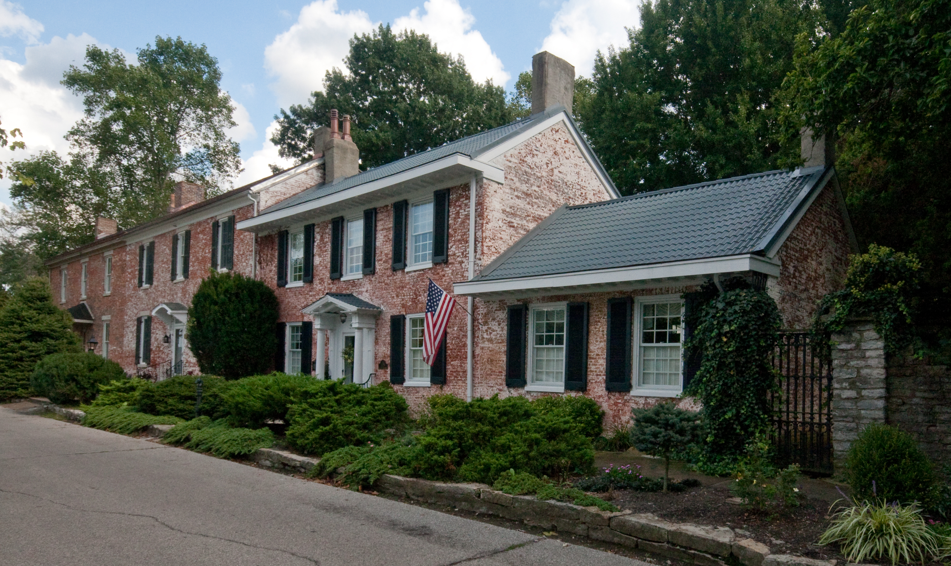
[3] Landmark name Image Date listed Location City or town Summary 1 Augusta College Historic Buildings February 20, 1980 205 Frankfort St. and 204 Bracken St.
38°46′26″N 84°00′15″W / 38.773889°N 84.004167°WAugusta 2 Augusta Historic District March 13, 1984 Roughly bounded by Riverside Dr., 5th, Frankfort, and Williams Sts.
38°46′21″N 84°00′21″W / 38.7725°N 84.005833°WAugusta 3 Baker Vinyard and Wine Cellar December 30, 1974 South of Augusta on KY 1839; also 4465 W. Augusta-Chatham Rd.
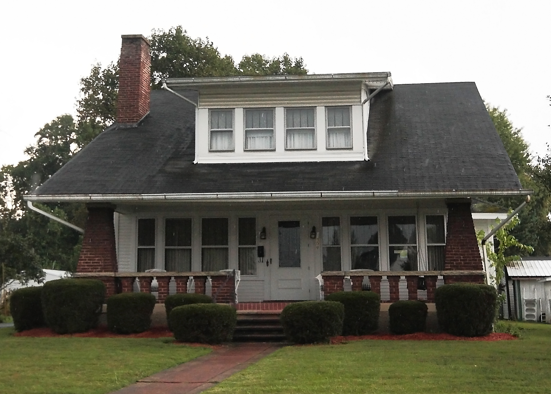
38°46′04″N 83°59′37″W / 38.767778°N 83.993611°WAugusta Augusta-Chatham Road address represents a boundary increase 4 George W. Barkley Farm June 18, 2003 KY 8
38°46′40″N 83°57′59″W / 38.777778°N 83.966389°WAugusta 5 Bracken County Infirmary April 16, 1979 Northeast of Chatham on KY 19
38°43′02″N 84°00′48″W / 38.717222°N 84.013333°WChatham 6 Bradford School House June 18, 2003 KY 8 and KY 1109
38°46′56″N 84°08′25″W / 38.782222°N 84.140278°WFoster 7 Brothers-O'Neil House 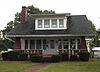
May 22, 1984 308 Seminary Rd.
38°46′22″N 84°00′00″W / 38.772778°N 84.0°WAugusta 8 Mordecai Chalfant House January 8, 1987 KY 8
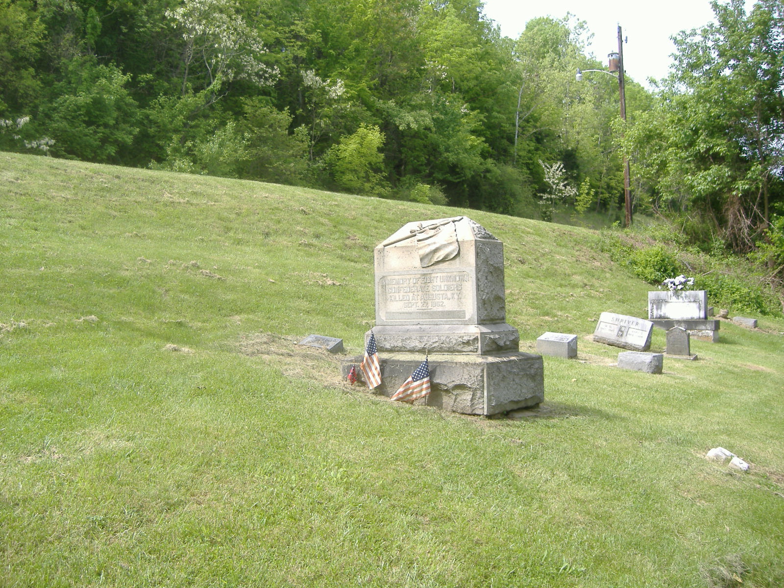
38°45′59″N 84°05′00″W / 38.766389°N 84.083333°WAugusta 9 Confederate Monument in Augusta 
July 17, 1997 Payne Cemetery, north of KY 8
38°46′09″N 84°00′44″W / 38.769167°N 84.012222°WAugusta 10 John Gregg Fee House August 26, 1980 Northwest of Germantown
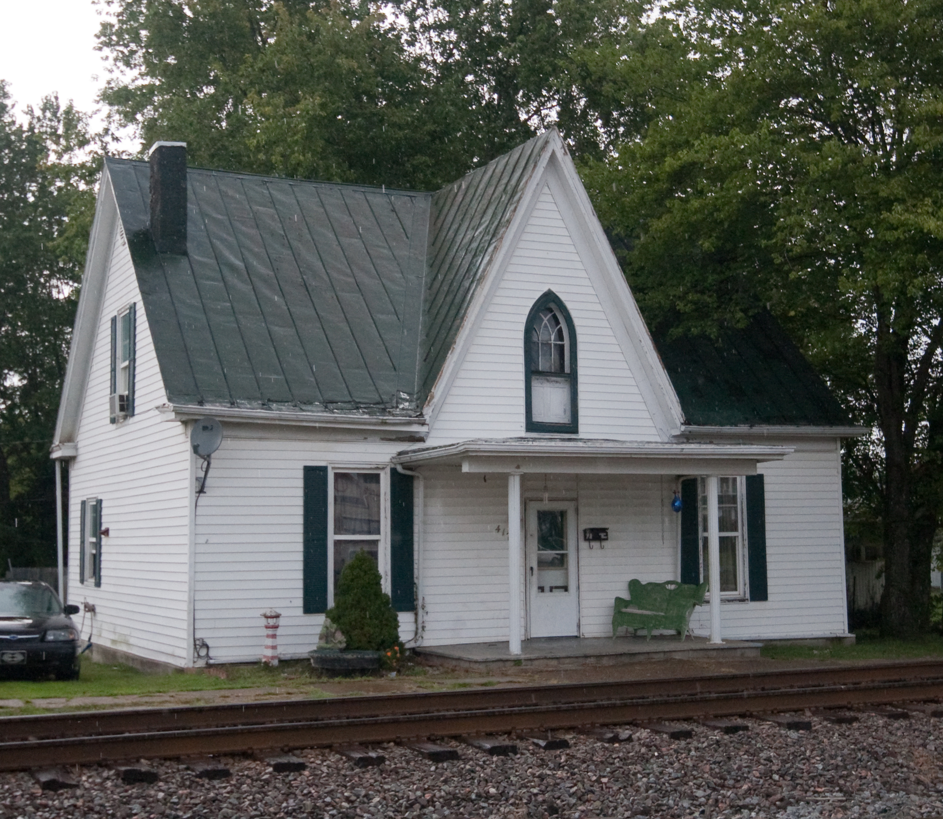
38°41′32″N 83°59′37″W / 38.692222°N 83.993611°WGermantown 11 Evan Griffith's Grocery May 22, 1984 415 Railroad Ave.
38°46′25″N 84°00′03″W / 38.773611°N 84.000833°WAugusta 12 Alfonso McKibben House May 22, 1984 202 4th St.
38°46′13″N 84°00′30″W / 38.770278°N 84.008333°WAugusta 13 J. R. Minor House May 22, 1984 204 2nd St.
38°46′24″N 84°00′34″W / 38.773333°N 84.009444°WAugusta 14 Rock Spring Warehouse January 8, 1987 KY 8
38°46′09″N 84°05′34″W / 38.769167°N 84.092778°WWellsburg 15 Snag Creek Site (15BK2) November 14, 1985 Address Restricted Willow Grove 16 Stone House on Bracken Creek January 8, 1987 Off KY 435
38°45′11″N 83°57′57″W / 38.753056°N 83.965833°WAugusta 17 Stroube House January 8, 1987 KY 616
38°45′17″N 83°59′07″W / 38.754722°N 83.985278°WAugusta 18 Turtle Creek Site (15BK13) November 14, 1985 Address Restricted Augusta 19 Walcott Covered Bridge 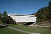
June 10, 1975 3.5 miles north of Brooksville on KY 1159 over Locust Creek
38°44′00″N 84°06′02″W / 38.733333°N 84.100556°WBrooksville 20 Water Street Historic District 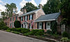
September 24, 1975 River Side Drive east to Frankfort Street and west to Ferry Street
38°46′28″N 84°00′28″W / 38.774444°N 84.007778°WAugusta 21 James Weldon House 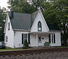
May 22, 1984 417 Railroad St.
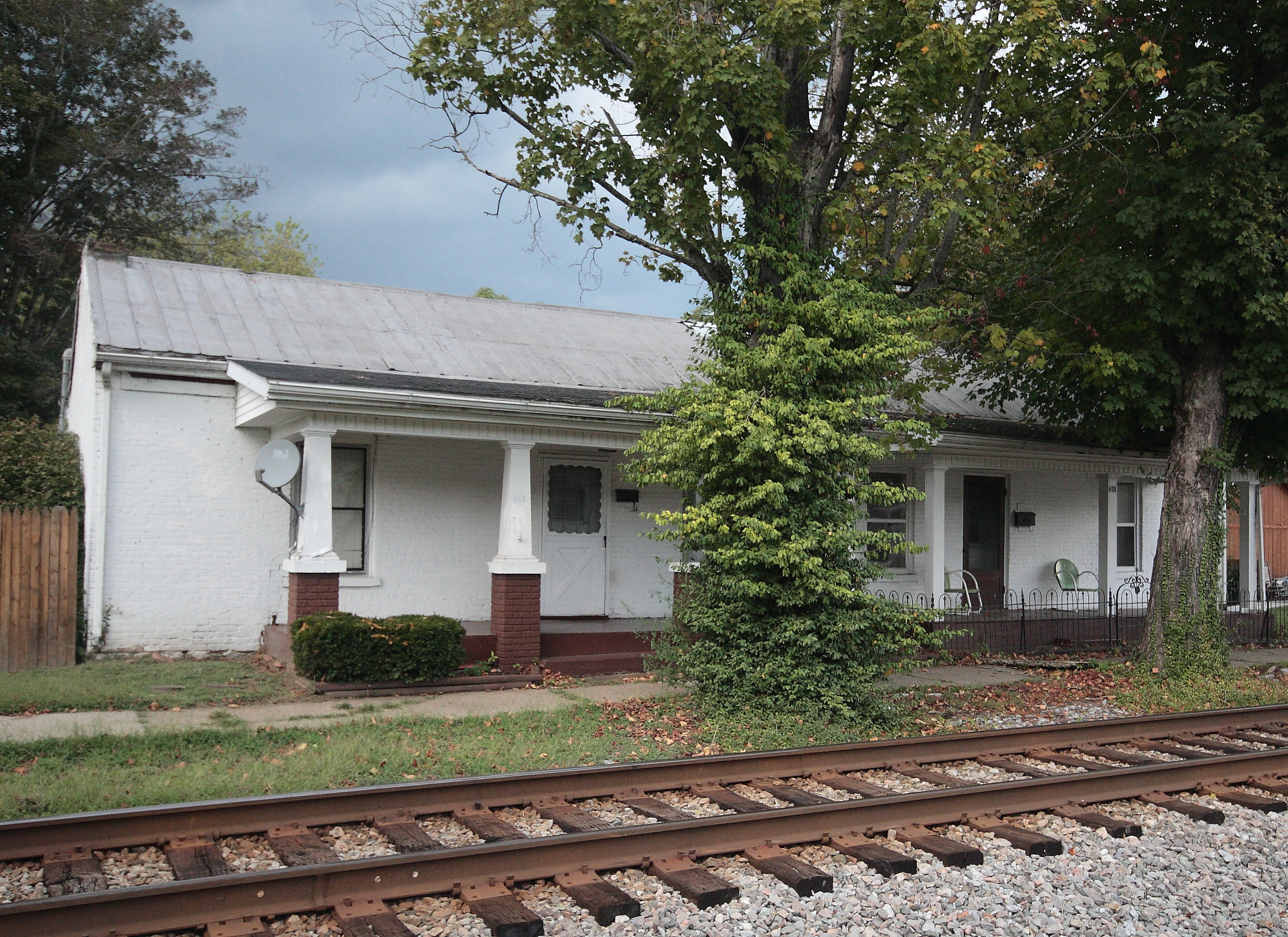
38°46′25″N 84°00′03″W / 38.773611°N 84.000833°WAugusta 22 Wells-Keith House 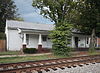
May 22, 1984 411-413 3rd St.
38°46′24″N 84°00′05″W / 38.773333°N 84.001389°WAugusta See also
- List of National Historic Landmarks in Kentucky
- National Register of Historic Places listings in Kentucky
References
- ^ The latitude and longitude information provided in this table was derived originally from the National Register Information System, which has been found to be fairly accurate for about 99% of listings. For about 1% of NRIS original coordinates, experience has shown that one or both coordinates are typos or otherwise extremely far off; some corrections may have been made. A more subtle problem causes many locations to be off by up to 150 yards, depending on location in the country: most NRIS coordinates were derived from tracing out latitude and longitudes off of USGS topographical quadrant maps created under North American Datum of 1927, which differs from the current, highly accurate GPS system used by Google maps. Chicago is about right, but NRIS longitudes in Washington are higher by about 4.5 seconds, and are lower by about 2.0 seconds in Maine. Latitudes differ by about 1.0 second in Florida. Some locations in this table may have been corrected to current GPS standards.
- ^ "National Register of Historic Places: Weekly List Actions". National Park Service, United States Department of the Interior. Retrieved on November 10, 2011.
- ^ Numbers represent an ordering by significant words. Various colorings, defined here, differentiate National Historic Landmark sites and National Register of Historic Places Districts from other NRHP buildings, structures, sites or objects.
U.S. National Register of Historic Places Topics Lists by states Alabama • Alaska • Arizona • Arkansas • California • Colorado • Connecticut • Delaware • Florida • Georgia • Hawaii • Idaho • Illinois • Indiana • Iowa • Kansas • Kentucky • Louisiana • Maine • Maryland • Massachusetts • Michigan • Minnesota • Mississippi • Missouri • Montana • Nebraska • Nevada • New Hampshire • New Jersey • New Mexico • New York • North Carolina • North Dakota • Ohio • Oklahoma • Oregon • Pennsylvania • Rhode Island • South Carolina • South Dakota • Tennessee • Texas • Utah • Vermont • Virginia • Washington • West Virginia • Wisconsin • WyomingLists by territories Lists by associated states Other  Category:National Register of Historic Places •
  Portal:National Register of Historic Places
Municipalities and communities of Bracken County, Kentucky County seat: Brooksville Cities  Categories:
- National Register of Historic Places in Kentucky by county
- Bracken County, Kentucky
-


Wikimedia Foundation. 2010.