- National Register of Historic Places listings in Meade County, Kentucky
-
 Location of Meade County in Kentucky
This is a list of the National Register of Historic Places listings in Meade County, Kentucky.
This is intended to be a complete list of the properties and districts on the National Register of Historic Places in Meade County, Kentucky, United States. The locations of National Register properties and districts for which the latitude and longitude coordinates are included below, may be seen in a Google map.[1]
There are 13 properties and districts listed on the National Register in the county.
-
- This National Park Service list is complete through NPS recent listings posted November 10, 2011.[2]
Current listings
[3] Landmark name Image Date listed Location City or town Summary 1 Brandenburg Commercial District 
March 27, 1986 Main St.
38°00′11″N 86°10′10″W / 38.003056°N 86.169444°WBrandenburg 2 Brandenburg Methodist Episcopal Church 
August 14, 1984 215 Broadway
37°59′59″N 86°10′09″W / 37.999722°N 86.169167°WBrandenburg 3 Clarkson House May 24, 1983 Clarkson Rd.
37°48′48″N 86°06′20″W / 37.813333°N 86.105556°WFlaherty 4 Doe Run Creek Historic District 
December 19, 1978 Southeast of Brandenburg off KY 448
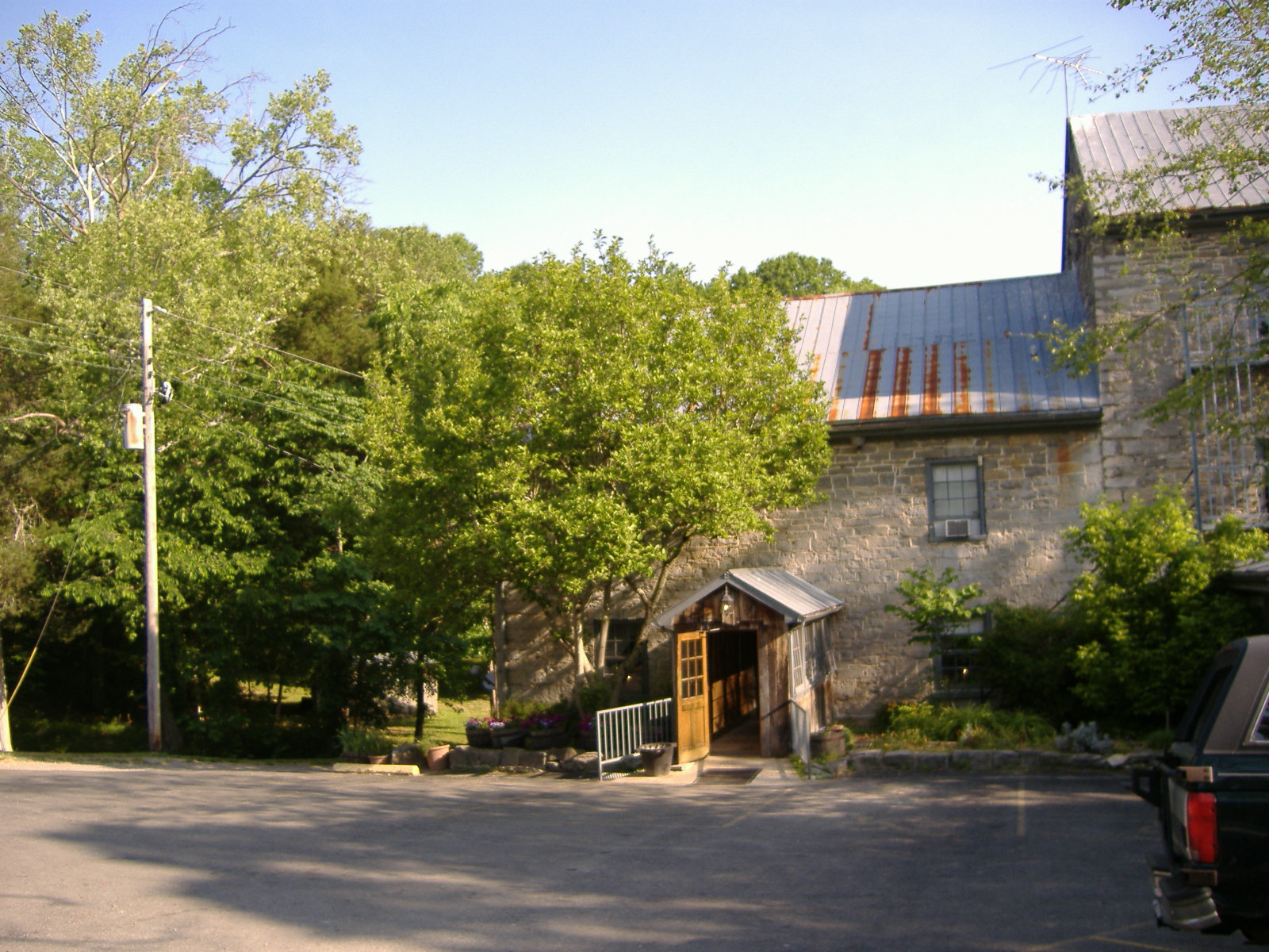
37°57′09″N 86°07′34″W / 37.9525°N 86.126111°WBrandenburg 5 Doe Run Mill October 6, 1987 Kentucky Route 1638 on Doe Run Creek
37°57′35″N 86°07′19″W / 37.959722°N 86.121944°WBrandenburg 6 Goff-Baskett House 
August 14, 1984 550 Lawrence St.
38°00′21″N 86°10′37″W / 38.005833°N 86.176944°WBrandenburg 7 Jones-Willis House 
August 14, 1984 321 Main St.
38°00′07″N 86°10′11″W / 38.001944°N 86.169722°WBrandenburg 8 Meade County Clerk Office-Rankin House 
August 14, 1984 205 Lafayette St.
38°00′13″N 86°10′00″W / 38.003611°N 86.166667°WBrandenburg 9 Meade County Jail 
August 14, 1984 125 Main St.
38°00′16″N 86°10′05″W / 38.004444°N 86.168056°WBrandenburg 10 Payneville Petroglyphs (15MD308) September 8, 1989 Address Restricted Payneville 11 Richardson House 
August 14, 1984 547 Lawrence St.
38°00′18″N 86°10′38″W / 38.005°N 86.177222°WBrandenburg 12 St. Theresa Roman Catholic Church November 17, 1977 3 miles northwest of Rhodelia on KY 144
38°01′48″N 86°26′20″W / 38.03°N 86.438889°WRhodelia 13 Edward Yeakel House 
August 14, 1984 116 Decatur St.
38°00′08″N 86°10′08″W / 38.002222°N 86.168889°WBrandenburg See also
- List of National Historic Landmarks in Kentucky
- National Register of Historic Places listings in Kentucky
References
- ^ The latitude and longitude information provided in this table was derived originally from the National Register Information System, which has been found to be fairly accurate for about 99% of listings. For about 1% of NRIS original coordinates, experience has shown that one or both coordinates are typos or otherwise extremely far off; some corrections may have been made. A more subtle problem causes many locations to be off by up to 150 yards, depending on location in the country: most NRIS coordinates were derived from tracing out latitude and longitudes off of USGS topographical quadrant maps created under the North American Datum of 1927, which differs from the current, highly accurate WGS84 GPS system used by Google maps. Chicago is about right, but NRIS longitudes in Washington are higher by about 4.5 seconds, and are lower by about 2.0 seconds in Maine. Latitudes differ by about 1.0 second in Florida. Some locations in this table may have been corrected to current GPS standards.
- ^ "National Register of Historic Places: Weekly List Actions". National Park Service, United States Department of the Interior. Retrieved on November 10, 2011.
- ^ Numbers represent an ordering by significant words. Various colorings, defined here, differentiate National Historic Landmark sites and National Register of Historic Places Districts from other NRHP buildings, structures, sites or objects.
U.S. National Register of Historic Places Topics Lists by states Alabama • Alaska • Arizona • Arkansas • California • Colorado • Connecticut • Delaware • Florida • Georgia • Hawaii • Idaho • Illinois • Indiana • Iowa • Kansas • Kentucky • Louisiana • Maine • Maryland • Massachusetts • Michigan • Minnesota • Mississippi • Missouri • Montana • Nebraska • Nevada • New Hampshire • New Jersey • New Mexico • New York • North Carolina • North Dakota • Ohio • Oklahoma • Oregon • Pennsylvania • Rhode Island • South Carolina • South Dakota • Tennessee • Texas • Utah • Vermont • Virginia • Washington • West Virginia • Wisconsin • WyomingLists by territories Lists by associated states Other Municipalities and communities of Meade County, Kentucky Cities Brandenburg | Ekron | Muldraugh‡

CDP Unincorporated
communitiesBattletown | Flaherty | Guston | Payneville | Rhodelia
Footnotes ‡This populated place also has portions in an adjacent county or counties
Categories:- National Register of Historic Places in Kentucky by county
- Meade County, Kentucky
-


Wikimedia Foundation. 2010.