- National Register of Historic Places listings in Meade County, South Dakota
-
 Location of Meade County in South Dakota
This is a list of the National Register of Historic Places listings in Meade County, South Dakota.
This is intended to be a complete list of the properties and districts on the National Register of Historic Places in Meade County, South Dakota, United States. The locations of National Register properties and districts for which the latitude and longitude coordinates are included below, may be seen in a Google map.[1]
There are 27 properties and districts listed on the National Register in the county, including 1 National Historic Landmark.
-
- This National Park Service list is complete through NPS recent listings posted November 10, 2011.[2]
Current listings
[3] Landmark name [4] Image Date listed Location City or town Summary 1 Archeological Site No. 39MD20 August 6, 1993 Address Restricted Tilford 2 Archeological Site No. 39MD81 April 14, 1994 Address Restricted Sturgis 3 Archeological Site No. 39MD82 April 14, 1994 Address Restricted Sturgis 4 Joseph Baker House April 30, 1986 County Road 19A Hereford 5 L.L. Bartlett House April 30, 1986 County Road 26 Stoneville 6 Bear Butte 
June 19, 1973 Northeast of Sturgis
44°28′25″N 103°25′33″W / 44.473611°N 103.425833°WSturgis 7 Bethel Lutheran Church April 30, 1986 Main and 5th Sts.
45°01′10″N 102°02′19″W / 45.019444°N 102.038611°WFaith 8 Black Hawk Elementary School April 30, 1986 Main and Elm Sts.
44°09′04″N 103°18′35″W / 44.151111°N 103.309722°WBlackhawk 9 Covered Wagon Resort November 20, 2007 14189 County Road 79 Piedmont 10 Erskine School August 16, 1984 Sherman St.
44°24′45″N 103°30′52″W / 44.4125°N 103.514444°WSturgis 11 John and Coralin Evans Ranch April 30, 1986 County Road 4 Piedmont 12 Fort Meade District May 22, 1973 East of Sturgis on Highway 34
44°24′46″N 103°28′22″W / 44.412778°N 103.472778°WSturgis 13 Frozenman Stage Station June 18, 1992 Address Restricted Bison 14 Stephen and Maria Graf House October 31, 2002 1233 Main St.
44°24′52″N 103°30′49″W / 44.414444°N 103.513611°WSturgis 15 H O Ranch Log House June 21, 1990 3 miles west of Marcus
44°39′49″N 102°20′10″W / 44.663611°N 102.336111°WMarcus 16 Ole and Carris Johnson Ranch April 30, 1986 County Road 7 Blackhawk 17 Minneapolis Brewing Company Beer Warehouse February 9, 2001 Highway 212
45°01′24″N 102°02′07″W / 45.023333°N 102.035278°WFaith 18 Municipal Building-City Hall June 22, 2000 206 Main St.
45°01′26″N 102°02′17″W / 45.023889°N 102.038056°WFaith 19 Elias B. Olsen Ranch April 30, 1986 County Road 6 Elm Springs 20 Jacob and Elizabeth Raskob Ranch April 30, 1986 Highway 34
44°28′12″N 103°20′54″W / 44.47°N 103.348333°WSturgis 21 South Dakota Dept. of Transportation Bridge No. 47-151-389 December 9, 1993 Local road over Bear Butte Creek Sturgis 22 Stevens Ranch April 30, 1986 County Road 4 Piedmont 23 Stomprude Trail Ruts June 18, 1992 Address Restricted Bison 24 Sturgis Commercial Block June 20, 1975 1000-1028 Main St.
44°24′50″N 103°30′33″W / 44.413889°N 103.509167°WSturgis 25 Sturgis High School August 16, 2000 1425 Cedar St.
44°24′35″N 103°31′16″W / 44.409722°N 103.521111°WSturgis 26 Annie Tallent House May 28, 1976 1603 Main St.
44°24′53″N 103°31′01″W / 44.414722°N 103.516944°WSturgis 27 John G. Wenke House May 28, 1976 1340 Junction Ave.
44°24′39″N 103°30′30″W / 44.410833°N 103.508333°WSturgis See also
- List of National Historic Landmarks in South Dakota
- National Register of Historic Places listings in South Dakota
References
- ^ The latitude and longitude information provided in this table was derived originally from the National Register Information System, which has been found to be fairly accurate for about 99% of listings. For about 1% of NRIS original coordinates, experience has shown that one or both coordinates are typos or otherwise extremely far off; some corrections may have been made. A more subtle problem causes many locations to be off by up to 150 yards, depending on location in the country: most NRIS coordinates were derived from tracing out latitude and longitudes off of USGS topographical quadrant maps created under North American Datum of 1927, which differs from the current, highly accurate GPS system used by Google maps. Chicago is about right, but NRIS longitudes in Washington are higher by about 4.5 seconds, and are lower by about 2.0 seconds in Maine. Latitudes differ by about 1.0 second in Florida. Some locations in this table may have been corrected to current GPS standards.
- ^ "National Register of Historic Places: Weekly List Actions". National Park Service, United States Department of the Interior. Retrieved on November 10, 2011.
- ^ Numbers represent an ordering by significant words. Various colorings, defined here, differentiate National Historic Landmark sites and National Register of Historic Places Districts from other NRHP buildings, structures, sites or objects.
- ^ "National Register Information System". National Register of Historic Places. National Park Service. . http://nrhp.focus.nps.gov/natreg/docs/All_Data.html.
U.S. National Register of Historic Places Topics Lists by states Alabama • Alaska • Arizona • Arkansas • California • Colorado • Connecticut • Delaware • Florida • Georgia • Hawaii • Idaho • Illinois • Indiana • Iowa • Kansas • Kentucky • Louisiana • Maine • Maryland • Massachusetts • Michigan • Minnesota • Mississippi • Missouri • Montana • Nebraska • Nevada • New Hampshire • New Jersey • New Mexico • New York • North Carolina • North Dakota • Ohio • Oklahoma • Oregon • Pennsylvania • Rhode Island • South Carolina • South Dakota • Tennessee • Texas • Utah • Vermont • Virginia • Washington • West Virginia • Wisconsin • WyomingLists by territories Lists by associated states Other  Category:National Register of Historic Places •
  Portal:National Register of Historic Places
Municipalities and communities of Meade County, South Dakota County seat: Sturgis Cities 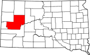
CDPs Unincorporated
communitiesElm Springs | Enning | Howes | Mud Butte | White Owl
Indian reservations Footnotes ‡This populated place also has portions in an adjacent county or counties
Categories:- Meade County, South Dakota
- National Register of Historic Places in South Dakota by county
- Buildings and structures in Meade County, South Dakota
-


Wikimedia Foundation. 2010.