- National Register of Historic Places listings in Hughes County, South Dakota
-
 Location of Hughes County in South Dakota
This is a list of the National Register of Historic Places listings in Hughes County, South Dakota.
This is intended to be a complete list of the properties and districts on the National Register of Historic Places in Hughes County, South Dakota, United States. The locations of National Register properties and districts for which the latitude and longitude coordinates are included below, may be seen in a Google map.[1]
There are 40 properties and districts listed on the National Register in the county, including 1 National Historic Landmark.
-
- This National Park Service list is complete through NPS recent listings posted November 10, 2011.[2]
Current listings
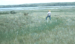
[3] Landmark name [4] Image Date listed Location City or town Summary 1 Archeological Site 39HU66 February 23, 1984 Address Restricted Canning 2 Archeological Site 39HU189 February 23, 1984 Address Restricted Macs Corner 3 Archeological Site 39HU201 February 23, 1984 Address Restricted Pierre 4 Arzberger Site 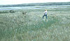
October 15, 1966 Address Restricted Pierre 5 Dr. William and Elizabeth Blackburn House May 9, 1997 219 S. Tyler Ave.
44°21′44″N 100°19′37″W / 44.362222°N 100.326944°WPierre 6 Brink-Wagner House April 26, 1978 110 E. 4th St. Pierre 7 Cedar Islands Archeological District August 14, 1986 Address Restricted Pierre 8 Central Block 
January 19, 1989 321-325 S. Pierre St.
44°21′56″N 100°21′19″W / 44.365556°N 100.355278°WPierre 9 Chicago and North Western Railroad Bridge 
November 19, 1998 North of U.S. Routes 14/83 over the Missouri River
44°22′25″N 100°22′12″W / 44.373611°N 100.37°WPierre 10 Crawford-Pettyjohn House 
September 22, 1977 129 S. Washington St.
44°21′49″N 100°20′09″W / 44.363611°N 100.335833°WPierre 11 Farr House 
December 4, 1980 106 E. Wynoka St.
44°22′17″N 100°20′56″W / 44.371389°N 100.348889°WPierre 12 Fort George Creek Archeological District August 14, 1986 Address Restricted Pierre 13 I. W. Goodner House 
March 23, 1995 216 E. Prospect Ave.
44°22′44″N 100°20′59″W / 44.378889°N 100.349722°WPierre 14 Mentor Graham House December 13, 1976 U.S. Route 14
44°30′45″N 99°59′22″W / 44.5125°N 99.989444°WBlunt 15 Peter Hansen House 
February 10, 1999 1123 E. Capitol St.
44°22′23″N 100°20′09″W / 44.373056°N 100.335833°WPierre 16 Harrold School October 24, 2003 206 S. Nixon Ave.
44°31′29″N 99°44′01″W / 44.524722°N 99.733611°WHarrold 17 Hilger Block 
May 31, 2006 361 S. Pierre
44°22′05″N 100°21′19″W / 44.368056°N 100.355278°WPierre 18 John E. and Ruth Hipple House 
June 6, 2001 219 N. Highland
44°22′09″N 100°20′51″W / 44.369167°N 100.3475°WPierre 19 Horner-Hyde House 
December 20, 1988 100 W. Capitol Ave.
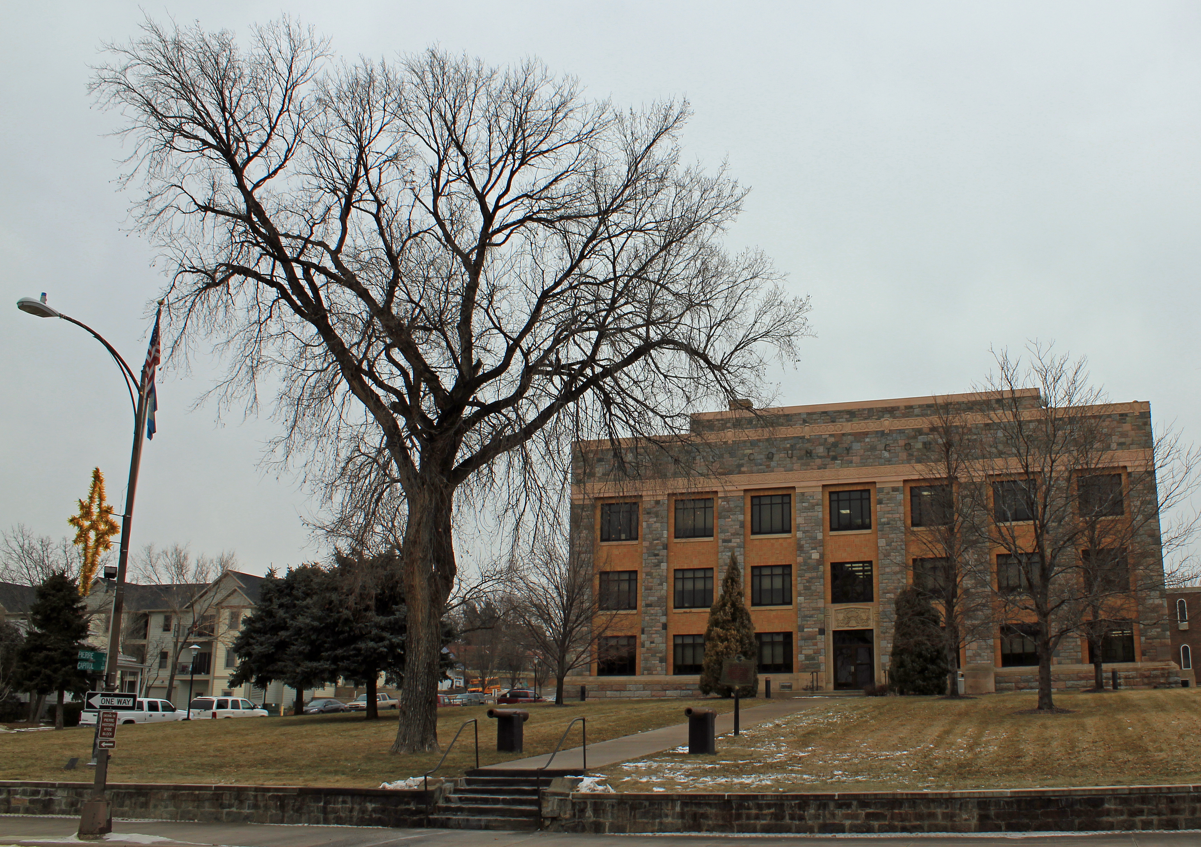
44°22′10″N 100°21′05″W / 44.369444°N 100.351389°WPierre 20 Hughes County Courthouse 
February 10, 1993 Capitol Ave. between Grand and Euclid Aves.
44°22′09″N 100°21′02″W / 44.369167°N 100.350556°WPierre 21 Hyde Buildings February 1, 1983 101½, 105, 108½, and 109 S. Pierre St., and 105½ Capitol Ave.
44°22′07″N 100°21′05″W / 44.368611°N 100.351389°WPierre 22 Karcher Block 
August 17, 1993 366 S. Pierre St.
44°21′57″N 100°21′16″W / 44.365833°N 100.354444°WPierre 23 Karcher-Sahr House 
September 22, 1977 222 E. Prospect St.
44°22′09″N 100°20′45″W / 44.369167°N 100.345833°WPierre 24 McClure Site (39HU7) August 14, 1986 Address Restricted Pierre 25 Henry M. McDonald House October 19, 1989 1906 E. Erskine
44°21′48″N 100°19′30″W / 44.363333°N 100.325°WPierre 26 George McMillen House 
August 18, 1983 111 E. Broadway
44°22′15″N 100°20′58″W / 44.370833°N 100.349444°WPierre 27 Judge C. D. Meade House 
October 7, 1977 106 W. Prospect St.
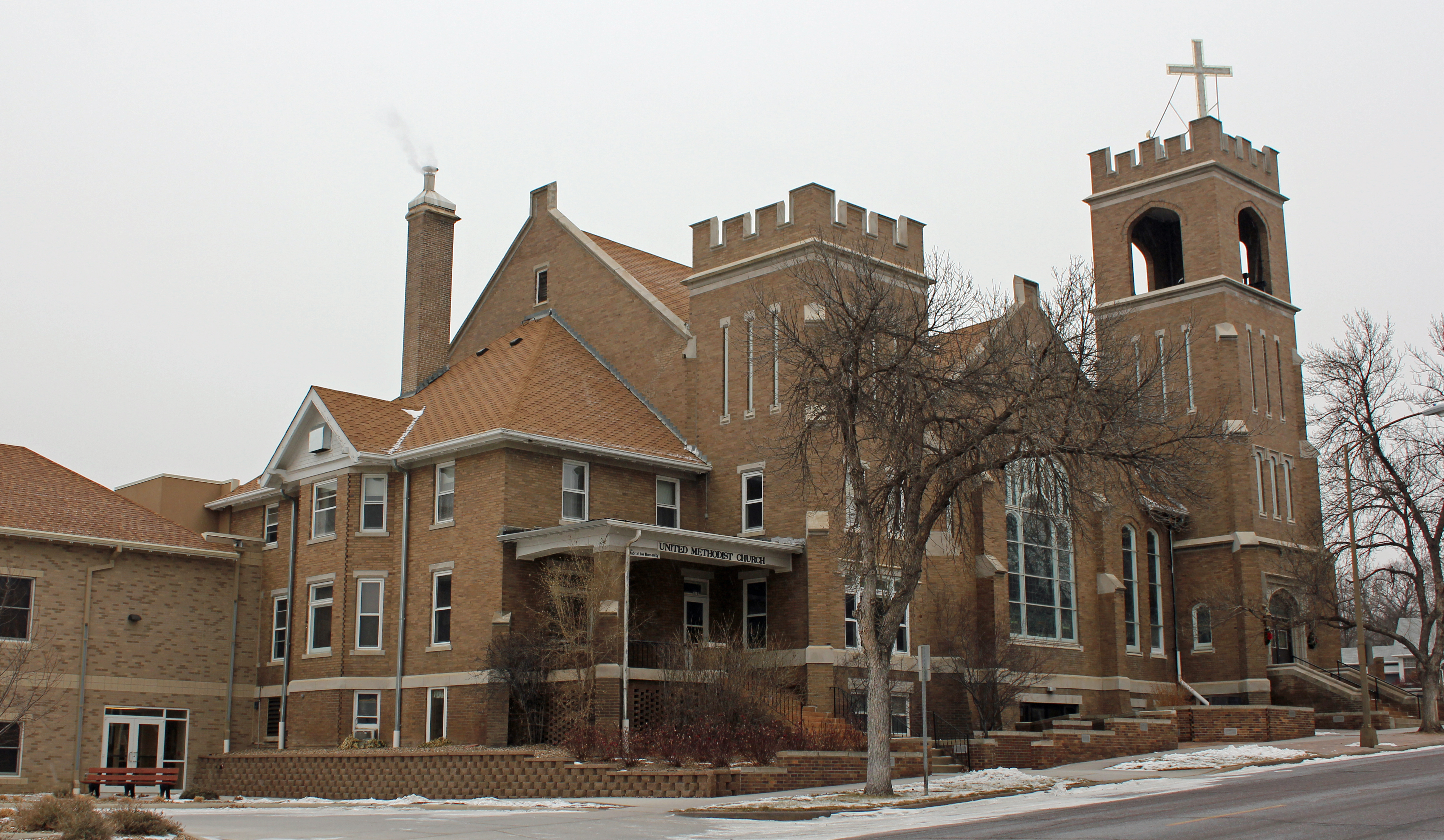
44°22′13″N 100°21′02″W / 44.370278°N 100.350556°WPierre 28 Medicine Creek Archeological District August 14, 1986 Address Restricted Lower Brule Extends into Lyman County 29 Methodist Episcopal Church 
May 9, 1997 117 Central Ave., N.
44°22′16″N 100°21′12″W / 44.371111°N 100.353333°WPierre 30 Oahe Addition Historic District June 2, 2000 Roughly bounded by N. Poplar, LaBarge Ct., and 3rd and 4th Sts.
44°22′43″N 100°21′26″W / 44.378611°N 100.357222°WPierre 31 Oahe Chapel 
June 6, 1980 Northwest of Pierre
44°27′29″N 100°23′08″W / 44.458056°N 100.385556°WPierre 32 Old Fort Sully Site (39HU52) August 14, 1986 Address Restricted Pierre 33 Pierre Hill Residential Historic District 
February 23, 1998 Roughly bounded by Huron Ave., Elizabeth St., Euclid Ave., and Broadway
44°22′20″N 100°20′52″W / 44.372222°N 100.347778°WPierre 34 Pierre Masonic Lodge 
June 10, 2009 210 W. Capitol Ave. Pierre 35 Rowe House 
February 9, 2001 1118 E. Capitol
44°21′52″N 100°20′08″W / 44.364444°N 100.335556°WPierre 36 St. Charles Hotel 
May 7, 1980 207 E. Capitol Ave.
44°22′06″N 100°21′01″W / 44.368333°N 100.350278°WPierre 37 Kenneth R. Scurr House August 5, 1993 121 S. Washington Ave.
44°21′54″N 100°19′36″W / 44.365°N 100.326667°WPierre 38 Soldiers & Sailors World War Memorial 
January 27, 1983 Capitol Ave.
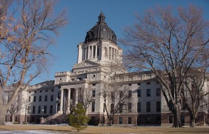
44°21′58″N 100°20′49″W / 44.366111°N 100.346944°WPierre 39 South Dakota State Capitol 
September 1, 1976 Bounded by Broadway, Washington, and Capitol Aves.
44°22′43″N 100°21′17″W / 44.378611°N 100.354722°WPierre 40 Stephens-Lucas House 
May 26, 1977 123 N. Nicollette
44°22′07″N 100°20′43″W / 44.368611°N 100.345278°WPierre See also
- List of National Historic Landmarks in South Dakota
- National Register of Historic Places listings in South Dakota
References
- ^ The latitude and longitude information provided in this table was derived originally from the National Register Information System, which has been found to be fairly accurate for about 99% of listings. For about 1% of NRIS original coordinates, experience has shown that one or both coordinates are typos or otherwise extremely far off; some corrections may have been made. A more subtle problem causes many locations to be off by up to 150 yards, depending on location in the country: most NRIS coordinates were derived from tracing out latitude and longitudes off of USGS topographical quadrant maps created under the North American Datum of 1927, which differs from the current, highly accurate WGS84 GPS system used by Google maps. Chicago is about right, but NRIS longitudes in Washington are higher by about 4.5 seconds, and are lower by about 2.0 seconds in Maine. Latitudes differ by about 1.0 second in Florida. Some locations in this table may have been corrected to current GPS standards.
- ^ "National Register of Historic Places: Weekly List Actions". National Park Service, United States Department of the Interior. Retrieved on November 10, 2011.
- ^ Numbers represent an ordering by significant words. Various colorings, defined here, differentiate National Historic Landmark sites and National Register of Historic Places Districts from other NRHP buildings, structures, sites or objects.
- ^ "National Register Information System". National Register of Historic Places. National Park Service. . http://nrhp.focus.nps.gov/natreg/docs/All_Data.html.
U.S. National Register of Historic Places Topics Lists by states Alabama • Alaska • Arizona • Arkansas • California • Colorado • Connecticut • Delaware • Florida • Georgia • Hawaii • Idaho • Illinois • Indiana • Iowa • Kansas • Kentucky • Louisiana • Maine • Maryland • Massachusetts • Michigan • Minnesota • Mississippi • Missouri • Montana • Nebraska • Nevada • New Hampshire • New Jersey • New Mexico • New York • North Carolina • North Dakota • Ohio • Oklahoma • Oregon • Pennsylvania • Rhode Island • South Carolina • South Dakota • Tennessee • Texas • Utah • Vermont • Virginia • Washington • West Virginia • Wisconsin • WyomingLists by territories Lists by associated states Other Municipalities and communities of Hughes County, South Dakota Cities 
Town Indian reservation Footnotes ‡This populated place also has portions in an adjacent county or counties
Categories:- Hughes County, South Dakota
- National Register of Historic Places in South Dakota by county
- Buildings and structures in Hughes County, South Dakota
-


Wikimedia Foundation. 2010.