- National Register of Historic Places listings in Iowa County, Iowa
-
 Location of Iowa County in Iowa
This is a list of the National Register of Historic Places listings in Iowa County, Iowa.
This is intended to be a complete list of the properties and districts on the National Register of Historic Places in Iowa County, Iowa, United States. Latitude and longitude coordinates are provided for many National Register properties and districts; these locations may be seen together in a Google map.[1]
There are 11 properties and districts listed on the National Register in the county, including 1 National Historic Landmark.
-
- This National Park Service list is complete through NPS recent listings posted November 10, 2011.[2]
Current listings
[3] Landmark name [4] Image Date listed Location City or town Summary 1 Amana Villages 
October 15, 1966 Northeastern Iowa County
41°47′59″N 91°55′15″W / 41.799722°N 91.920833°WMiddle Amana 2 E.J. Baird House February 25, 1982 Jackson and Fremont Sts.
41°34′21″N 92°09′31″W / 41.5725°N 92.158611°WMillersburg 3 David and M. Maria Hughes House June 28, 1996 101 W. Penn St.
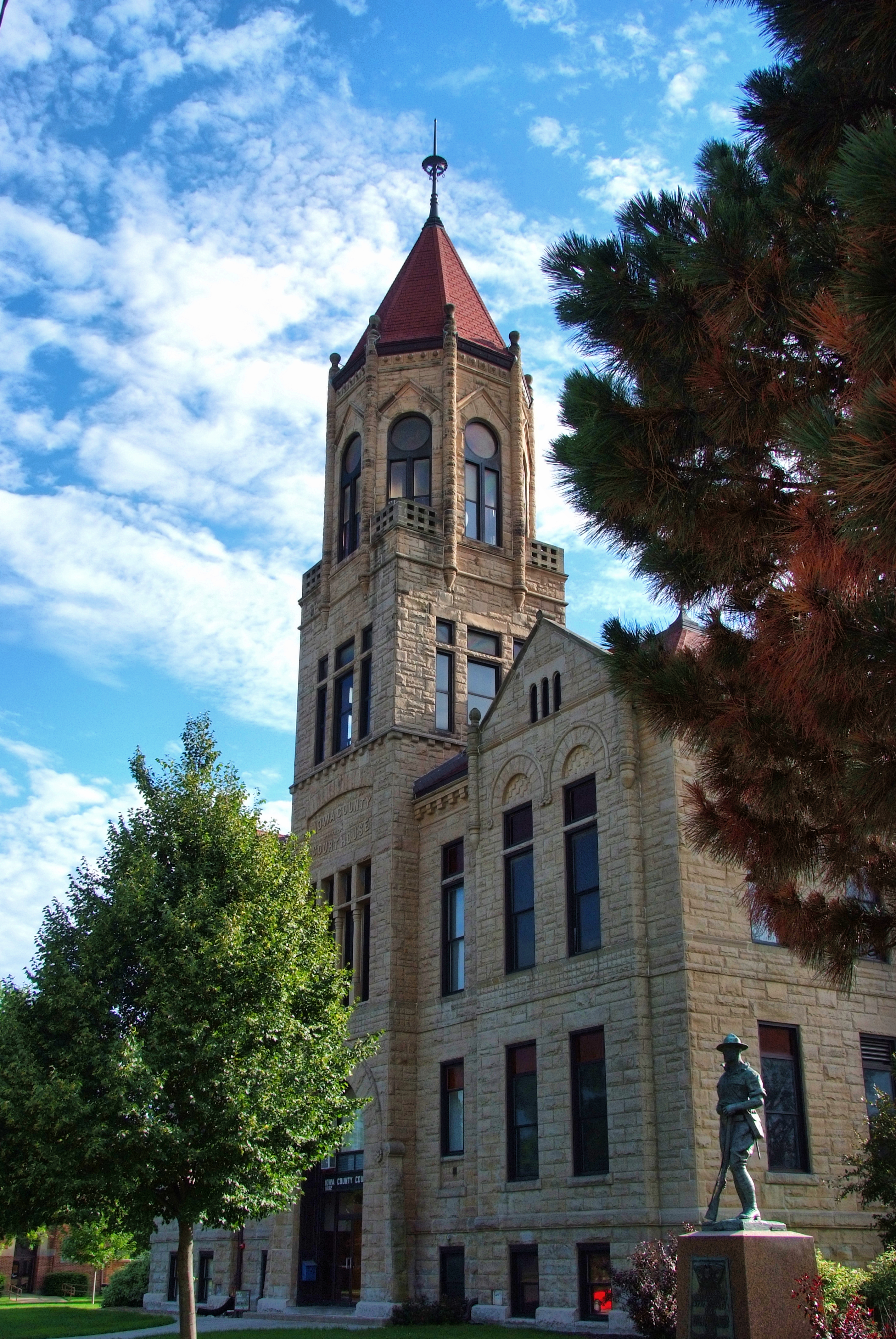
41°39′34″N 92°00′27″W / 41.659444°N 92.0075°WWilliamsburg 4 Indian Fish Weir July 21, 1988 Address Restricted Middle Amana 5 Iowa County Courthouse 
July 2, 1981 Court Ave.
41°47′53″N 92°04′14″W / 41.798056°N 92.070556°WMarengo 6 Ladora Savings Bank 
August 3, 1990 811 Pacific St.
41°45′17″N 92°11′01″W / 41.754722°N 92.183611°WLadora 7 Lenox Township Church of the New Jersalem September 29, 1983 South of Norway
41°50′50″N 91°55′41″W / 41.847222°N 91.928056°WLenox Township 8 Pilot Grove November 17, 1977 Southwest of Williamsburg
41°37′49″N 92°05′03″W / 41.630278°N 92.084167°WWilliamsburg 9 Plagmann Round Barn June 30, 1986 Off Iowa Highway 209
41°43′30″N 92°03′11″W / 41.725°N 92.053056°WConroy 10 St. Michael's Church, Cemetery, Rectory and Ancient Order of Hibernians Hall January 20, 1983 East of Parnell on F 52
41°35′24″N 91°54′48″W / 41.59°N 91.913333°WParnell 11 Fred G. Turner House June 27, 1985 Iowa Highway 149
41°33′25″N 92°03′56″W / 41.556944°N 92.065556°WNorth English See also
References
- ^ The latitude and longitude information provided in this table was derived originally from the National Register Information System, which has been found to be fairly accurate for about 99% of listings. For about 1% of NRIS original coordinates, experience has shown that one or both coordinates are typos or otherwise extremely far off; some corrections may have been made. A more subtle problem causes many locations to be off by up to 150 yards, depending on location in the country: most NRIS coordinates were derived from tracing out latitude and longitudes off of USGS topographical quadrant maps created under the North American Datum of 1927, which differs from the current, highly accurate WGS84 GPS system used by Google maps. Chicago is about right, but NRIS longitudes in Washington are higher by about 4.5 seconds, and are lower by about 2.0 seconds in Maine. Latitudes differ by about 1.0 second in Florida. Some locations in this table may have been corrected to current GPS standards.
- ^ "National Register of Historic Places: Weekly List Actions". National Park Service, United States Department of the Interior. Retrieved on November 10, 2011.
- ^ Numbers represent an ordering by significant words. Various colorings, defined here, differentiate National Historic Landmark sites and National Register of Historic Places Districts from other NRHP buildings, structures, sites or objects.
- ^ "National Register Information System". National Register of Historic Places. National Park Service. . http://nrhp.focus.nps.gov/natreg/docs/All_Data.html.
U.S. National Register of Historic Places Topics Lists by states Alabama • Alaska • Arizona • Arkansas • California • Colorado • Connecticut • Delaware • Florida • Georgia • Hawaii • Idaho • Illinois • Indiana • Iowa • Kansas • Kentucky • Louisiana • Maine • Maryland • Massachusetts • Michigan • Minnesota • Mississippi • Missouri • Montana • Nebraska • Nevada • New Hampshire • New Jersey • New Mexico • New York • North Carolina • North Dakota • Ohio • Oklahoma • Oregon • Pennsylvania • Rhode Island • South Carolina • South Dakota • Tennessee • Texas • Utah • Vermont • Virginia • Washington • West Virginia • Wisconsin • WyomingLists by territories Lists by associated states Other Municipalities and communities of Iowa County, Iowa Cities Ladora | Marengo | Millersburg | North English‡ | Parnell | Victor‡ | Williamsburg

Unincorporated
communitiesFootnotes ‡This populated place also has portions in an adjacent county or counties
Categories:- National Register of Historic Places in Iowa by county
- Iowa County, Iowa
- Buildings and structures in Iowa County, Iowa
-


Wikimedia Foundation. 2010.