- Iowa County, Iowa
Infobox U.S. County
county = Iowa County
state = Iowa
seallink =
map size = 250
founded = 1843
seat = Marengo
largest city =
area_total_sq_mi = 587
area_total_km2 = 1521
area_land_sq_mi = 586
area_land_km2 = 1519
area_water_sq_mi = 1
area_water_km2 = 2
area percentage = 0.15%
census yr = 2000
pop = 15671
density_sq_mi = 27
density_km2 = 10
time zone = Central
UTC offset = -6
DST offset= -5
footnotes =
web = www.co.iowa.ia.us|Iowa County is a
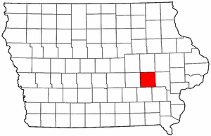
county located in theU.S. state ofIowa . As of 2000, the population is 15,671. Itscounty seat is Marengo.GR|6Geography
According to the
U.S. Census Bureau , the county has a total area of 587square mile s (1,521km² ), of which, 586 square miles (1,519 km²) of it is land and 1 square miles (2 km²) of it (0.15%) is water.Major highways
*
*
*
*
*
*
*Adjacent counties
*Benton County (north)
*Johnson County (east)
*Washington County (southeast)
*Keokuk County (south)
*Poweshiek County (west)
*Linn County (northeast)
*Tama County (northwest)History
Iowa County was formed on February 17, 1843. It was named for the
Iowa River , which flows through the county. [ [http://www.co.iowa.ia.us/history.htm History ] ]The first courthouse was a log cabin built in 1847. This was rented by the county until 1850 when a second courthouse was completed. In 1861 construction of a third courthouse was begun. The current courthouse was built in 1892 after the county had outgrown the previous one. [ [http://www.iowacounties.org/Corporate%20Opportunities/About%20Us/AboutCoGov/County%20Pages/Iowa.htm Iowa County] at Iowa State Association of Counties, retrieved July 26, 2008.]
Demographics
USCensusPop
1900= 19544
1910= 18409
1920= 18600
1930= 17332
1940= 17016
1950= 15835
1960= 16396
1970= 15419
1980= 15429
1990= 14630
2000= 15671
footnote= [http://www.census.gov/population/cencounts/ia190090.txt IA Counties 1900-1990] As of thecensus GR|2 of 2000, there were 15,671 people, 6,163 households, and 4,301 families residing in the county. Thepopulation density was 27 people per square mile (10/km²). There were 6,545 housing units at an average density of 11 per square mile (4/km²). The racial makeup of the county was 98.70% White, 0.17% Black or African American, 0.06% Native American, 0.30% Asian, 0.03% Pacific Islander, 0.36% from other races, and 0.38% from two or more races. 0.97% of the population were Hispanic or Latino of any race.There were 6,163 households out of which 32.80% had children under the age of 18 living with them, 60.10% were married couples living together, 6.60% had a female householder with no husband present, and 30.20% were non-families. 25.90% of all households were made up of individuals and 12.50% had someone living alone who was 65 years of age or older. The average household size was 2.50 and the average family size was 3.03.
In the county the population was spread out with 26.40% under the age of 18, 6.30% from 18 to 24, 27.80% from 25 to 44, 22.40% from 45 to 64, and 17.10% who were 65 years of age or older. The median age was 39 years. For every 100 females there were 95.00 males. For every 100 females age 18 and over, there were 93.20 males.
The median income for a household in the county was $41,222, and the median income for a family was $48,946. Males had a median income of $31,220 versus $24,652 for females. The
per capita income for the county was $18,884. About 3.40% of families and 5.00% of the population were below thepoverty line , including 4.50% of those under age 18 and 5.40% of those age 65 or over.Cities and towns
*Ladora
*Marengo
*Millersburg
*North English
*Parnell
*Victor
*WilliamsburgOther places
*Conroy
*Genoa Bluff
*South AmanaNotes
External links
* [http://www.co.iowa.ia.us/ Iowa County's Website]
Wikimedia Foundation. 2010.