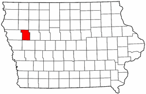
- Ida County, Iowa
Infobox U.S. County
county = Ida County
state = Iowa
seallink =
map size = 250
founded = 1851
seat = Ida Grove
largest city =
area_total_sq_mi = 432
area_total_km2 = 1119
area_land_sq_mi = 432
area_land_km2 = 1118
area_water_sq_mi = <1
area_water_km2 = 1
area percentage = 0.12%
census yr = 2000
pop = 7837
density_sq_mi = 18
density_km2 = 7
time zone = Central
UTC offset = -6
DST offset= -5
footnotes =
web = |Ida County is a
county located in theU.S. state ofIowa . As of 2000, the population is 7,837. Itscounty seat is Ida Grove.GR|6Geography
According to the
U.S. Census Bureau , the county has a total area of 432square mile s (1,119km² ), of which, 432 square miles (1,118 km²) of it is land and 1 square miles (1 km²) of it (0.12%) is water.Major highways
*
*
*
*Adjacent counties
*Cherokee County (north)
*Sac County (east)
*Crawford County (south)
*Woodbury County (west)History
Ida County was formed on January 15, 1851. It was probably named after "Ida Smith", the first child of European immigrants to be born in this region.
Demographics
USCensusPop
1900= 12327
1910= 11296
1920= 11689
1930= 11933
1940= 11047
1950= 10697
1960= 10269
1970= 9190
1980= 8908
1990= 8365
2000= 7837
footnote= [http://www.census.gov/population/cencounts/ia190090.txt IA Counties 1900-1990] As of thecensus GR|2 of 2000, there were 7,837 people, 3,213 households, and 2,184 families residing in the county. Thepopulation density was 18 people per square mile (7/km²). There were 3,506 housing units at an average density of 8 per square mile (3/km²). The racial makeup of the county was 99.02% White, 0.10% Black or African American, 0.06% Native American, 0.24% Asian, 0.15% from other races, and 0.42% from two or more races. 0.47% of the population were Hispanic or Latino of any race.There were 3,213 households out of which 29.40% had children under the age of 18 living with them, 59.50% were married couples living together, 5.90% had a female householder with no husband present, and 32.00% were non-families. 29.30% of all households were made up of individuals and 15.90% had someone living alone who was 65 years of age or older. The average household size was 2.39 and the average family size was 2.95.
In the county the population was spread out with 25.50% under the age of 18, 6.10% from 18 to 24, 24.00% from 25 to 44, 22.70% from 45 to 64, and 21.80% who were 65 years of age or older. The median age was 42 years. For every 100 females there were 93.90 males. For every 100 females age 18 and over, there were 91.40 males.
The median income for a household in the county was $34,805, and the median income for a family was $43,179. Males had a median income of $29,002 versus $19,417 for females. The
per capita income for the county was $18,675. About 5.70% of families and 8.80% of the population were below thepoverty line , including 9.10% of those under age 18 and 8.60% of those age 65 or over.Cities and towns
*Arthur
*Battle Creek
*Galva
*Holstein
*Ida Grove
Wikimedia Foundation. 2010.