- Jasper County, Iowa
-
Jasper County, Iowa  Jasper County Courthouse in Newton
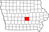
Location in the state of Iowa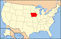
Iowa's location in the U.S.Founded 1846 Seat Newton Area
- Total
- Land
- Water
732.93 sq mi (1,898 km²)
729.99 sq mi (1,891 km²)
2.94 sq mi (8 km²), 0.40%Population
- (2010)
- Density
36,842
50/sq mi (19/km²)Time zone Central: UTC-6/-5 Website www.co.jasper.ia.us Footnotes: Population[1] Jasper County is a county located in the US state of Iowa. It was organized in 1846 and is named after Sergeant William Jasper, Revolutionary War hero. The population was 36,842 in the 2010 census, a decline from 37,213 in the 2000 census.[1][2] Jasper was the 19th most populous county of Iowa's 99 total counties in the 2000 census, however even with the decline in population in the 2010 census it moved up to 18th. The county seat is Newton[3]. Jasper County is the only county in the Newton Micropolitan Statistical Area, which is part of the Des Moines-Newton-Pella Combined Statistical Area.[4]
Contents
Geography
According to the 2000 census, the county has a total area of 732.93 square miles (1,898.3 km2), of which 729.99 square miles (1,890.7 km2) (or 99.60%) is land and 2.94 square miles (7.6 km2) (or 0.40%) is water.[5] The North and South Skunk River flow through the county. Bodies of water include Lake Mariposa and Rock Creek.
Major highways
 Interstate 80
 U.S. Highway 6
 U.S. Highway 65
 Iowa Highway 14
 Iowa Highway 117
 Iowa Highway 163
 Iowa Highway 224
 Iowa Highway 330
Adjacent counties
- Marshall County (north)
- Poweshiek County, (east)
- Mahaska County, (southeast)
- Marion County, (south)
- Polk County, (west)
- Story County, (northwest)
Demographics
Historical populations Census Pop. %± 1850 1,280 — 1860 9,883 672.1% 1870 22,116 123.8% 1880 25,963 17.4% 1890 24,943 −3.9% 1900 26,976 8.2% 1910 27,034 0.2% 1920 27,855 3.0% 1930 32,936 18.2% 1940 31,496 −4.4% 1950 32,305 2.6% 1960 35,282 9.2% 1970 35,425 0.4% 1980 36,425 2.8% 1990 34,795 −4.5% 2000 37,213 6.9% 2010 36,842 −1.0% Iowa Data Center[2] 2010 census
The 2010 census recorded a population of 36,842 in the county, with a population density of 50.4692/sq mi (19.4863/km2). There were 16,181 housing units, of which 14,806 were occupied.[1]
2000 census
 2000 Census Age Pyramid for Jasper County
As of the census[6] of 2000, there were 37,213 people, 14,689 households, and 10,267 families residing in the county. The population density was 51 people per square mile (20/km²). There were 15,659 housing units at an average density of 22 per square mile (8/km²). The racial makeup of the county was 97.58% White, 0.83% Black or African American, 0.22% Native American, 0.44% Asian, 0.05% Pacific Islander, 0.26% from other races, and 0.62% from two or more races. 1.01% of the population were Hispanic or Latino of any race.
There were 14,689 households out of which 31.70% had children under the age of 18 living with them, 59.30% were married couples living together, 7.40% had a female householder with no husband present, and 30.10% were non-families. 26.10% of all households were made up of individuals and 11.80% had someone living alone who was 65 years of age or older. The average household size was 2.42 and the average family size was 2.92.
In the county, the population was spread out with 24.60% under the age of 18, 7.40% from 18 to 24, 28.60% from 25 to 44, 23.40% from 45 to 64, and 16.00% who were 65 years of age or older. The median age was 38 years. For every 100 females there were 101.60 males. For every 100 females age 18 and over, there were 99.70 males.
The median income for a household in the county was $41,683, and the median income for a family was $50,071. Males had a median income of $36,001 versus $24,770 for females. The per capita income for the county was $19,622. About 4.80% of families and 6.50% of the population were below the poverty line, including 7.10% of those under age 18 and 7.00% of those age 65 or over.
Government and infrastructure
The Iowa Department of Corrections Newton Correctional Facility is in an unincorporated area in Jasper County, near Newton.[7]
Localities
Cities
Unincorporated communities
See also
References
- ^ a b c "Population & Housing Occupancy Status 2010". United States Census Bureau American FactFinder. http://factfinder2.census.gov/faces/tableservices/jsf/pages/productview.xhtml?pid=DEC_10_PL_GCTPL2.ST05&prodType=table. Retrieved May 18, 2011.
- ^ a b "Data from the 2010 Census". State Data Center of Iowa. http://www.iowadatacenter.org/archive/2011/02/feb10. Retrieved May 18, 2011.
- ^ "Find a County". National Association of Counties. http://www.naco.org/Counties/Pages/FindACounty.aspx. Retrieved 2011-06-07.
- ^ United States Office of Management and Budget. "Update of Statistical Area Definitions and Guidance on Their Uses" (PDF). pp. 5, 36.. Archived from the original on 2006-05-14. http://web.archive.org/web/20060514003222/http://www.whitehouse.gov/omb/bulletins/fy2006/b06-01.pdf. Retrieved 2006-07-21.
- ^ "Census 2000 U.S. Gazetteer Files: Counties". United States Census. http://www.census.gov/tiger/tms/gazetteer/county2k.txt. Retrieved 2011-02-13.
- ^ "American FactFinder". United States Census Bureau. http://factfinder.census.gov. Retrieved 2008-01-31.
- ^ "Newton Correctional Facility." Iowa Department of Corrections. Retrieved on November 24, 2010. "Newton Correctional Facility 307 S. 60th Avenue W. P. O. Box 218 Newton, IA 50208"
External links

Story County Marshall County Polk County 
Poweshiek County  Jasper County, Iowa

Marion County Mahaska County Municipalities and communities of Jasper County, Iowa Cities Baxter | Colfax | Kellogg | Lambs Grove | Lynnville | Mingo | Mitchellville‡ | Monroe | Newton | Oakland Acres | Prairie City | Reasnor | Sully | Valeria

Township Unincorporated
communitiesFootnotes ‡This populated place also has portions in an adjacent county or counties
Coordinates: 41°41′17″N 93°03′41″W / 41.68806°N 93.06139°W
Categories:- Iowa counties
- Jasper County, Iowa
- 1846 establishments in the United States


Wikimedia Foundation. 2010.