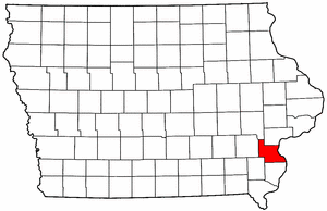
- Louisa County, Iowa
Infobox U.S. County
county = Louisa County
state = Iowa
seallink =
map size = 250
founded =
seat = Wapello
largest city =
area_total_sq_mi = 418
area_total_km2 = 1082
area_land_sq_mi = 402
area_land_km2 = 1041
area_water_sq_mi = 16
area_water_km2 = 41
area percentage = 3.77%
census yr = 2000
pop = 12183
density_sq_mi = 30
density_km2 = 12
time zone = Central
UTC offset = -6
DST offset= -5
footnotes =
web = www.louisacountyiowa.org|Louisa County is a
county located in theU.S. state ofIowa . As of 2000, the population is 12,183. Itscounty seat is Wapello.GR|6 In Iowa, it is pronounced as low-WHY-zuh (and not as loo-WHEEZE-uh).Louisa County is part of the Muscatine Micropolitan Statistical Area.
Geography
According to the
U.S. Census Bureau , the county has a total area of 418square mile s (1,082km² ), of which, 402 square miles (1,041 km²) of it is land and 16 square miles (41 km²) of it (3.77%) is water.Major highways
*
*
*
*Adjacent counties
*Johnson County (northwest)
*Muscatine County (north)
*Rock Island County, Illinois (northeast), across theMississippi River
*Mercer County, Illinois (east), across the Mississippi River
*Des Moines County (south)
*Henry County (southwest)
*Washington County (west)National
protected area *
Port Louisa National Wildlife Refuge History
Louisa County was formed on December 7, 1836. It was named after
Louisa Massey , who was very well-known here at the time because she avenged the murder of her brother when she shot the party responsible.The first courthouse was a simple wood-framed building. In 1840, a second courthouse, measuring 40' x 20' (about 12 x 6 m), was constructed of stone. In 1854, a third structure was built. The courthouse used today was erected in 1928. [ [http://www.louisacountyiowa.org/ Louisa County, Iowa ] ]
Demographics
USCensusPop
1900= 13516
1910= 12855
1920= 12179
1930= 11575
1940= 11384
1950= 11101
1960= 10290
1970= 10682
1980= 12055
1990= 11592
2000= 12183
footnote= [http://www.census.gov/population/cencounts/ia190090.txt IA Counties 1900-1990] As of thecensus GR|2 of 2000, there were 12,183 people, 4,519 households, and 3,316 families residing in the county. Thepopulation density was 30 people per square mile (12/km²). There were 5,133 housing units at an average density of 13 per square mile (5/km²). The racial makeup of the county was 93.91% White, 0.25% Black or African American, 0.18% Native American, 0.20% Asian, 0.02% Pacific Islander, 4.56% from other races, and 0.88% from two or more races. 12.62% of the population were Hispanic or Latino of any race.There were 4,519 households out of which 35.00% had children under the age of 18 living with them, 61.30% were married couples living together, 8.20% had a female householder with no husband present, and 26.60% were non-families. 22.50% of all households were made up of individuals and 10.40% had someone living alone who was 65 years of age or older. The average household size was 2.66 and the average family size was 3.11.
In the county the population was spread out with 27.70% under the age of 18, 7.90% from 18 to 24, 28.70% from 25 to 44, 21.70% from 45 to 64, and 14.10% who were 65 years of age or older. The median age was 36 years. For every 100 females there were 98.90 males. For every 100 females age 18 and over, there were 96.00 males.
The median income for a household in the county was $39,086, and the median income for a family was $43,972. Males had a median income of $31,293 versus $22,085 for females. The
per capita income for the county was $17,644. About 7.00% of families and 9.30% of the population were below thepoverty line , including 12.40% of those under age 18 and 7.90% of those age 65 or over.Cities and towns
*Columbus City
*Columbus Junction
*Cotter
*Fredonia
*Grandview
*Letts
*Morning Sun
*Oakville
*WapelloNotes
Wikimedia Foundation. 2010.