- Mills County, Iowa
-
Mills County, Iowa 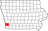
Location in the state of Iowa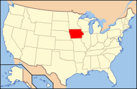
Iowa's location in the U.S.Founded 1851 Seat Glenwood Area
- Total
- Land
- Water
439.67 sq mi (1,139 km²)
436.53 sq mi (1,131 km²)
3.13 sq mi (8 km²), 0.71%Population
- (2010)
- Density
15,059
34/sq mi (13/km²)Time zone Central: UTC-6/-5 Website www.millscoia.us Footnotes: Population [1] Mills County is a county located in the U.S. state of Iowa. The population was 15,059 in the 2010 census, an increase from 14,547 in the 2000 census.[1][2] The county seat is Glenwood.[3] It is one of three Iowa counties in the eight-county Omaha-Council Bluffs Metropolitan Statistical Area.[4]
Contents
Geography
According to the 2000 census, the county has a total area of 439.67 square miles (1,138.7 km2), of which 436.53 square miles (1,130.6 km2) (or 99.29%) is land and 3.13 square miles (8.1 km2) (or 0.71%) is water.[5]
Major highways
 Interstate 29
 U.S. Highway 34
 U.S. Highway 59
 U.S. Highway 275
Adjacent counties
- Pottawattamie County (north)
- Montgomery County (east)
- Fremont County (south)
- Cass County, Nebraska (southwest)
- Sarpy County, Nebraska (west)
History
Mills County was formed in 1851. It was named for Major Frederick Mills of Burlington, Iowa who was killed at the Battle of Churubusco during the Mexican-American War.[6]
Demographics
Historical populations Census Pop. %± 1860 4,481 — 1870 8,718 94.6% 1880 14,137 62.2% 1890 14,548 2.9% 1900 16,764 15.2% 1910 15,811 −5.7% 1920 15,422 −2.5% 1930 15,866 2.9% 1940 15,064 −5.1% 1950 14,064 −6.6% 1960 13,050 −7.2% 1970 11,832 −9.3% 1980 13,406 13.3% 1990 13,202 −1.5% 2000 14,547 10.2% 2010 15,059 3.5% Iowa Data Center [2] 2010 census
The 2010 census recorded a population of 15,059 in the county, with a population density of 34.4971/sq mi (13.3194/km2). There were 6,109 housing units, of which 5,605 were occupied.[1]
2000 census
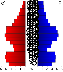 2000 Census Age Pyramid for Mills County
As of the census[7] of 2000, there were 14,547 people, 5,324 households, and 3,939 families residing in the county. The population density was 33 people per square mile (13/km²). There were 5,671 housing units at an average density of 13 per square mile (5/km²). The racial makeup of the county was 97.97% White, 0.28% Black or African American, 0.27% Native American, 0.29% Asian, 0.01% Pacific Islander, 0.36% from other races, and 0.82% from two or more races. 1.23% of the population were Hispanic or Latino of any race.
There were 5,324 households out of which 34.80% had children under the age of 18 living with them, 61.70% were married couples living together, 8.90% had a female householder with no husband present, and 26.00% were non-families. 22.30% of all households were made up of individuals and 10.10% had someone living alone who was 65 years of age or older. The average household size was 2.60 and the average family size was 3.04.
In the county the population was spread out with 26.80% under the age of 18, 7.00% from 18 to 24, 28.10% from 25 to 44, 25.50% from 45 to 64, and 12.60% who were 65 years of age or older. The median age was 38 years. For every 100 females there were 100.60 males. For every 100 females age 18 and over, there were 96.70 males.
The median income for a household in the county was $42,428, and the median income for a family was $49,592. Males had a median income of $31,721 versus $24,938 for females. The per capita income for the county was $18,736. About 5.80% of families and 8.30% of the population were below the poverty line, including 10.30% of those under age 18 and 7.60% of those age 65 or over.
Communities

Cities
Unincorporated communities
See also
References
- ^ a b c "Population & Housing Occupancy Status 2010". United States Census Bureau American FactFinder. http://factfinder2.census.gov/faces/tableservices/jsf/pages/productview.xhtml?pid=DEC_10_PL_GCTPL2.ST05&prodType=table. Retrieved May 12, 2011.
- ^ a b "Data from the 2010 Census". State Data Center of Iowa. http://www.iowadatacenter.org/archive/2011/02/feb10. Retrieved May 12, 2011.
- ^ "Find a County". National Association of Counties. http://www.naco.org/Counties/Pages/FindACounty.aspx. Retrieved 2011-06-07.
- ^ United States Office of Management and Budget. "Update of Statistical Area Definitions and Guidance on Their Uses" (PDF). pp. 5, 36.. Archived from the original on 2006-05-14. http://web.archive.org/web/20060514003222/http://www.whitehouse.gov/omb/bulletins/fy2006/b06-01.pdf. Retrieved 2006-07-21.
- ^ "Census 2000 U.S. Gazetteer Files: Counties". United States Census. http://www.census.gov/tiger/tms/gazetteer/county2k.txt. Retrieved 2011-02-13.
- ^ Mills County
- ^ "American FactFinder". United States Census Bureau. http://factfinder.census.gov. Retrieved 2008-01-31.
External links
- Official Mills County Government website
- Mills County Conservation Board website
- Mills County Public Health website

Pottawattamie County Sarpy County, Nebraska 
Montgomery County  Mills County, Iowa

Cass County, Nebraska Fremont County Municipalities and communities of Mills County, Iowa Cities Emerson | Glenwood | Hastings | Henderson | Malvern | Pacific Junction | Silver City | Tabor‡

Unincorporated
communitiesHillside | Mineola
Footnotes ‡This populated place also has portions in an adjacent county or counties
National Register of Historic Places in Mills County, Iowa Anderson Township Nishnabotna River Bridge

Oak Township Pony Creek Park
Plattville Township See also: National Register of Historic Places listings in Mills County, Iowa and List of National Historic Landmarks in IowaMetropolitan area of Omaha-Council Bluffs Primary Cities NebraskaIowa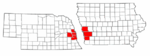
Cities over 10,000
(per 2000 Census)NebraskaCities of 5,000 to 10,000
(per 2000 Census)NebraskaIowaCities of 1,000 to 5,000
(per 2000 Census)NebraskaIowaCensus-designated places NebraskaCities and villages
of fewer than 1,000
(per 2000 Census)NebraskaAlvo · Avoca · Bennington · Boys Town · Cedar Bluffs · Cedar Creek · Ceresco · Colon · Elmwood · Fort Calhoun · Greenwood · Herman · Ithaca · Kennard · Leshara · Malmo · Manley · Mead · Memphis · Morse Bluff · Murdock · Murray · Nehawka · Prague · South Bend · Union · Valparaiso · Washington · Waterloo · WestonIowaCounties NebraskaIowaCoordinates: 41°01′59″N 95°37′08″W / 41.03306°N 95.61889°W
Categories:- Iowa counties
- Mills County, Iowa
- 1851 establishments in the United States
- Iowa counties on the Missouri River


Wikimedia Foundation. 2010.