- Douglas County, Nebraska
-
Douglas County, Nebraska 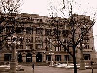 Douglas County Courthouse in Omaha
Seal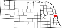
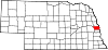
Location in the state of Nebraska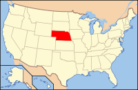
Nebraska's location in the U.S.Founded 1854 Seat Omaha Largest city Omaha Area
- Total
- Land
- Water
340 sq mi (881 km²)
331 sq mi (857 km²)
9 sq mi (23 km²), 2.54%Population
- (2010)
- Density
517,110
1,401/sq mi (541/km²)Time zone Central: UTC-6/-5 Website www.douglascounty-ne.gov Douglas County is a county located in the U.S. state of Nebraska. It is the state's most populous county, home to over one-fourth of Nebraska's residents. As of the 2010 census, the population was 517,110.[1] Its county seat is Omaha,[2] the state's largest city. It is one of five Nebraska counties in the eight-county Omaha-Council Bluffs Metropolitan Statistical Area.[3]
In the Nebraska license plate system, Douglas County was represented by the prefix "1" (as it had the largest number of vehicles registered in the county when the license plate system was established in 1922). In 2002, the state discontinued the 1922 system in the three most populous counties: Douglas, Sarpy, and Lancaster counties.
Contents
History
Douglas County was established in 1855. It was named after Stephen A. Douglas (1813–1861), U.S. Senator from Illinois.[4]
Geography
According to the United States Census Bureau, the county has a total area of 340 square miles (880.6 km2), of which 331 square miles (857.3 km2) is land and 9 square miles (23.3 km2) (2.54%) is water.
Major highways
 Interstate 80
 Interstate 480
 Interstate 680
 U.S. Highway 6
 U.S. Highway 75
 U.S. Highway 275
 Nebraska Highway 31
 Nebraska Highway 36
 Nebraska Highway 50
 Nebraska Highway 64
 Nebraska Highway 85
 Nebraska Highway 92
 Nebraska Highway 133
Adjacent counties
- Dodge County - (northwest)
- Washington County - (north)
- Pottawattamie County, Iowa - (east)
- Sarpy County - (south)
- Saunders County - (west)

Dodge County Washington County Saunders County 
Pottawattamie County, Iowa  Douglas County, Nebraska

Sarpy County Demographics
Historical populations Census Pop. %± 1860 4,328 — 1870 19,982 361.7% 1880 37,645 88.4% 1890 158,008 319.7% 1900 140,590 −11.0% 1910 168,546 19.9% 1920 204,524 21.3% 1930 232,982 13.9% 1940 247,562 6.3% 1950 281,020 13.5% 1960 343,490 22.2% 1970 389,455 13.4% 1980 397,038 1.9% 1990 416,444 4.9% 2000 463,585 11.3% 2010 517,110 11.5% U.S. Decennial Census As of the census[5] of 2000, there were 463,585 people, 182,194 households, and 115,146 families residing in the county. The population density was 1,401 people per square mile (541/km²). There were 192,672 housing units at an average density of 582 per square mile (225/km²). The racial makeup of the county was 80.96% White, 11.50% Black or African American, 0.61% Native American, 1.71% Asian, 0.05% Pacific Islander, 3.40% from other races, and 1.76% from two or more races. 6.67% of the population were Hispanic or Latino of any race. 26.3% were of German, 11.5% Irish and 6.2% English ancestry according to Census 2000.
There were 182,194 households out of which 32.00% had children under the age of 18 living with them, 47.50% were married couples living together, 12.10% had a female householder with no husband present, and 36.80% were non-families. 29.80% of all households were made up of individuals and 8.70% had someone living alone who was 65 years of age or older. The average household size was 2.48 and the average family size was 3.12.
In the county the population was spread out with 26.60% under the age of 18, 10.30% from 18 to 24, 31.20% from 25 to 44, 21.00% from 45 to 64, and 11.00% who were 65 years of age or older. The median age was 34 years. For every 100 females there were 95.70 males. For every 100 females age 18 and over, there were 92.90 males.
The median income for a household in the county was $43,209, and the median income for a family was $54,651. Males had a median income of $36,577 versus $27,265 for females. The per capita income for the county was $22,879. About 6.70% of families and 9.80% of the population were below the poverty line, including 13.00% of those under age 18 and 7.20% of those age 65 or over.
Government
Douglas County is governed by a board of seven county commissioners, elected to four year terms. County courthouse positions are also elected on a partisan basis. Most of the county's offices are located at the Douglas County Courthouse.
District Commissioner 1 Mike Boyle 2 Pam Tusa 3 Chris Rodgers (Chair) 4 Kyle Hutchings 5 Marc Kraft 6 Mary Ann Borgeson 7 Clare Duda Office Officeholder County Assessor Roger Morrissey County Attorney Donald Kleine County Clerk Tom Cavanaugh Clerk of the District Court John Friend County Engineer Tom Doyle Register of Deeds Diane Battiato County Sheriff Tim Dunning County Treasurer John W. Ewing Public Defender Tom Riley Communities
Cities
Villages
Precincts
Douglas County is divided into the following divisions, which, except for the City of Omaha, are called precincts.
- Benson
- Chicago
- Douglas
- Elkhorn
- Florence
- Jefferson
- McArdle
- Millard
- City of Omaha
- Platte Valley
- Union
- Waterloo
See also
References
- ^ http://www.omaha.com/article/20110301/NEWS01/110309991/0
- ^ "Find a County". National Association of Counties. http://www.naco.org/Counties/Pages/FindACounty.aspx. Retrieved 2011-06-07.
- ^ United States Office of Management and Budget. "Update of Statistical Area Definitions and Guidance on Their Uses" (PDF). pp. 5, 36.. Archived from the original on 2006-05-14. http://web.archive.org/web/20060514003222/http://www.whitehouse.gov/omb/bulletins/fy2006/b06-01.pdf. Retrieved 2006-07-21.
- ^ "About Douglas County: History." Douglas County. Retrieved 9/17/07.
- ^ "American FactFinder". United States Census Bureau. http://factfinder.census.gov. Retrieved 2008-01-31.
External links
Municipalities and communities of Douglas County, Nebraska Cities Bennington | Omaha | Ralston | Valley
Villages Metropolitan area of Omaha-Council Bluffs Primary Cities NebraskaIowa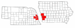
Cities over 10,000
(per 2000 Census)NebraskaCities of 5,000 to 10,000
(per 2000 Census)NebraskaIowaCities of 1,000 to 5,000
(per 2000 Census)NebraskaIowaCensus-designated places NebraskaCities and villages
of fewer than 1,000
(per 2000 Census)NebraskaAlvo · Avoca · Bennington · Boys Town · Cedar Bluffs · Cedar Creek · Ceresco · Colon · Elmwood · Fort Calhoun · Greenwood · Herman · Ithaca · Kennard · Leshara · Malmo · Manley · Mead · Memphis · Morse Bluff · Murdock · Murray · Nehawka · Prague · South Bend · Union · Valparaiso · Washington · Waterloo · WestonIowaCounties NebraskaIowaCategories:- Nebraska counties
- Douglas County, Nebraska
- Nebraska counties on the Missouri River


Wikimedia Foundation. 2010.