- Nuckolls County, Nebraska
-
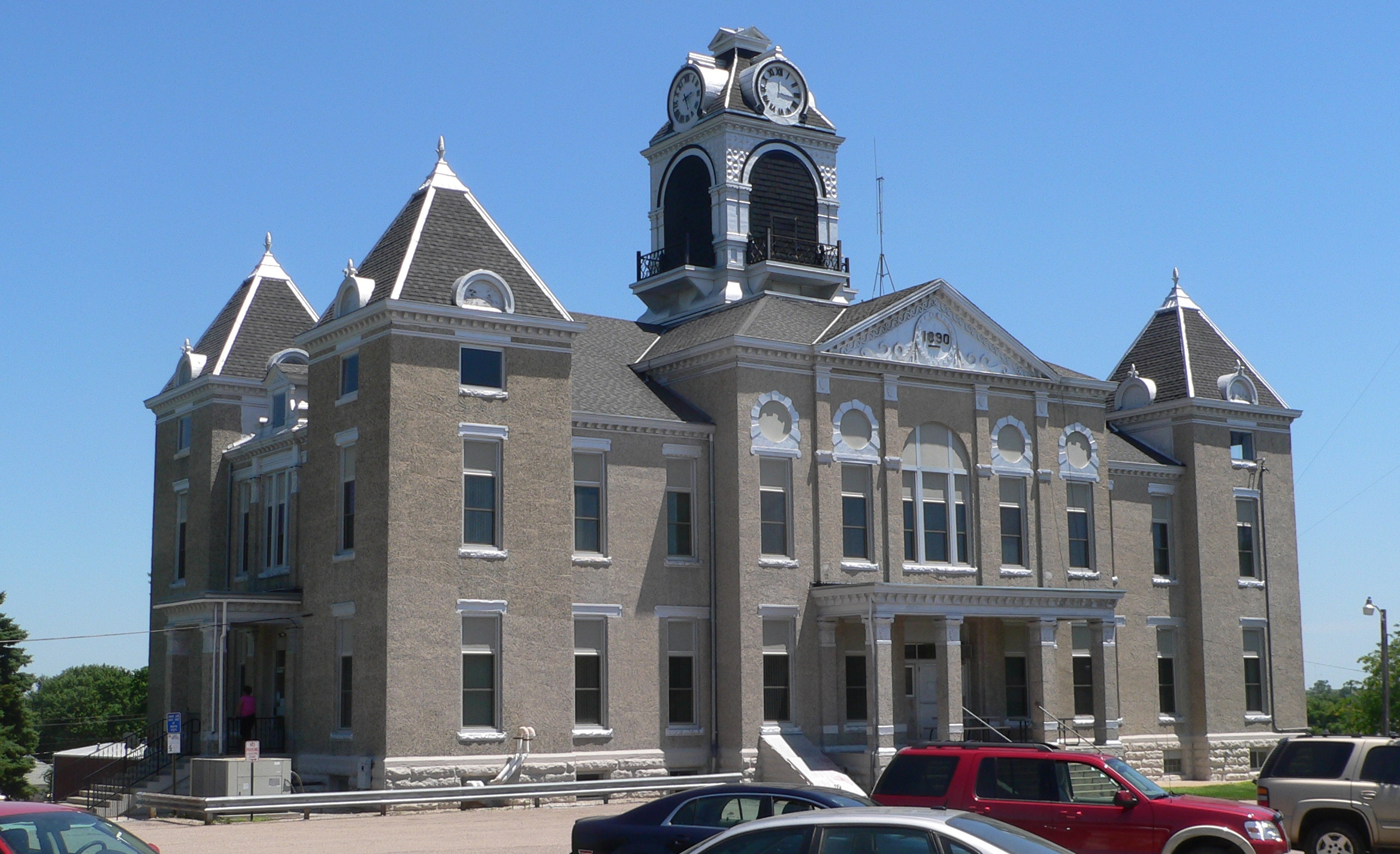
Nuckolls County, Nebraska 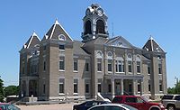 Nuckolls County Courthouse in Nelson, Nebraska
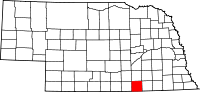
Location in the state of Nebraska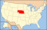
Nebraska's location in the U.S.Founded 1860 Seat Nelson Largest city Superior Area
- Total
- Land
- Water
576 sq mi (1,492 km²)
575 sq mi (1,489 km²)
1 sq mi (3 km²), 0.11%Population
- (2010)
- Density
4,500
8/sq mi (3/km²)Website www.NuckollsCounty.NE.gov Nuckolls County is a county located in the U.S. state of Nebraska. As of the 2010 census, the county population was 4,500.[1] Its county seat is Nelson[2].
In the Nebraska license plate system, Nuckolls County is represented by the prefix 42 (it had the forty-second-largest number of vehicles registered in the county when the license plate system was established in 1922).
Contents
History
19th century
Nuckolls County was formed in 1860. It was named after Stephen F. Nuckolls, an early pioneer in this area.[3]
In 1887, Atchison, Topeka and Santa Fe Railway built a branch line from Neva (3 miles west of Strong City) to Superior, Nebraska. This branch line connected Strong City, Neva, Rockland, Diamond Springs, Burdick, Lost Springs, Jacobs, Hope, Navarre, Enterprise, Abilene, Talmage, Manchester, Longford, Oak Hill, Miltonvale, Aurora, Huscher, Concordia, Kackley, Courtland, Webber, Superior. At some point, the line from Neva to Lost Springs was pulled but the right of way has not been abandoned. This branch line was originally called "Strong City and Superior line" but later the name was shortened to the "Strong City line". In 1996, the Atchison, Topeka and Santa Fe Railway merged with Burlington Northern Railroad and renamed to the current BNSF Railway. Most locals still refer to this railroad as the "Santa Fe".
Geography
According to the U.S. Census Bureau, the county has a total area of 576 square miles (1,490 km2), of which, 575 square miles (1,490 km2) of it is land and 1-square-mile (2.6 km2) of it (0.11%) is water.
Adjacent counties
- Clay County, Nebraska - north
- Fillmore County, Nebraska - northeast
- Thayer County, Nebraska - east
- Republic County, Kansas - southeast
- Jewell County, Kansas - southwest
- Webster County, Nebraska - west
Cities and villages
Demographics
Historical populations Census Pop. %± 1860 22 — 1870 8 −63.6% 1880 4,235 52,837.5% 1890 11,417 169.6% 1900 12,414 8.7% 1910 13,019 4.9% 1920 13,236 1.7% 1930 12,629 −4.6% 1940 12,781 1.2% 1950 10,973 −14.1% 1960 8,217 −25.1% 1970 7,404 −9.9% 1980 6,726 −9.2% 1990 7,586 12.8% 2000 5,057 −33.3% 2010 4,500 −11.0% U.S. Decennial Census As of the census[4] of 2000, there were 5,057 people, 2,218 households, and 1,443 families residing in the county. The population density was 9 people per square mile (3/km²). There were 2,530 housing units at an average density of 4 per square mile (2/km²). The racial makeup of the county was 98.91% White, 0.02% Black or African American, 0.06% Native American, 0.16% Asian, 0.53% from other races, and 0.32% from two or more races. 1.01% of the population were Hispanic or Latino of any race.
There were 2,218 households out of which 26.50% had children under the age of 18 living with them, 58.80% were married couples living together, 4.60% had a female householder with no husband present, and 34.90% were non-families. 32.30% of all households were made up of individuals and 18.00% had someone living alone who was 65 years of age or older. The average household size was 2.26 and the average family size was 2.86.
In the county the population was spread out with 23.40% under the age of 18, 5.40% from 18 to 24, 22.50% from 25 to 44, 24.30% from 45 to 64, and 24.40% who were 65 years of age or older. The median age was 44 years. For every 100 females there were 92.50 males. For every 100 females age 18 and over, there were 91.90 males.
The median income for a household in the county was $28,958, and the median income for a family was $35,018. Males had a median income of $24,533 versus $17,806 for females. The per capita income for the county was $15,608. About 6.50% of families and 11.20% of the population were below the poverty line, including 16.70% of those under age 18 and 8.90% of those age 65 or over.
Transportation
- Major highways
 U.S. Highway 136
 Nebraska Highway 4
 Nebraska Highway 8
 Nebraska Highway 14
Notable people
Thomas E. Trowbridge (1930-2009), a member of both houses of the Wyoming State Legislature (1979-1986), was born in Nuckolls County. His father, Elton Trowbridge, also served in the Wyoming House of Representatives (1961-1974, his death). Elton Trowbridge lived in Nuckolls County at least from 1930-1935, probably earlier.
See also
References
- ^ "2010 County Population and Housing Occupancy Status". U.S. Census Bureau. http://factfinder2.census.gov/faces/tableservices/jsf/pages/productview.xhtml?pid=DEC_10_PL_GCTPL2.ST05&prodType=table. Retrieved April 20, 2011.
- ^ "Find a County". National Association of Counties. http://www.naco.org/Counties/Pages/FindACounty.aspx. Retrieved 2011-06-07.
- ^ [1] Retrieved on March 15, 2008.
- ^ "American FactFinder". United States Census Bureau. http://factfinder.census.gov. Retrieved 2008-01-31.
External links

Clay County Fillmore County Webster County 
Thayer County  Nuckolls County, Nebraska

Jewell County, Kansas Republic County, Kansas Municipalities and communities of Nuckolls County, Nebraska Cities 
Villages Community Categories:- Nebraska counties
- Nuckolls County, Nebraska


Wikimedia Foundation. 2010.