- Strong City, Kansas
Infobox Settlement
official_name = Strong City, Kansas
settlement_type =City
nickname =
motto =
imagesize =
image_caption =
image_
imagesize =
image_caption =
image_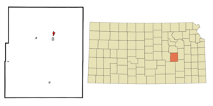
mapsize = 250px
map_caption = Location of Strong City, Kansas
mapsize1 =
map_caption1 =subdivision_type = Country
subdivision_name =United States
subdivision_type1 = State
subdivision_name1 =Kansas
subdivision_type2 = County
subdivision_name2 = Chase
government_footnotes =
government_type =
leader_title =
leader_name =
leader_title1 =
leader_name1 =
established_title =
established_date =unit_pref = Imperial
area_footnotes =area_magnitude =
area_total_km2 = 1.4
area_land_km2 = 1.4
area_water_km2 = 0.0
area_total_sq_mi = 0.5
area_land_sq_mi = 0.5
area_water_sq_mi = 0.0population_as_of = 2000
population_footnotes =
population_total = 584
population_density_km2 = 418.6
population_density_sq_mi = 1084.3timezone = Central (CST)
utc_offset = -6
timezone_DST = CDT
utc_offset_DST = -5
elevation_footnotes =
elevation_m = 365
elevation_ft = 1198
latd = 38 |latm = 23 |lats = 41 |latNS = N
longd = 96 |longm = 32 |longs = 15 |longEW = Wpostal_code_type =
ZIP code
postal_code = 66869
area_code = 620
blank_name = FIPS code
blank_info = 20-68650GR|2
blank1_name = GNIS feature ID
blank1_info = 0477264GR|3
website =
footnotes =Strong City is a city in Chase County,
Kansas ,United States . The population was 584 at the 2000 census. It is named after railroad magnateWilliam Barstow Strong . Thecenter of population of Kansas is located 4.5mile s north of Strong City [http://www.census.gov/geo/www/cenpop/statecenters.txt] at coor dms|38|27|15|N|96|32|10|W.Strong City is part of the Emporia Micropolitan Statistical Area.
The small Kansas town surprised many communities when it announced its intensions to apply for an Amtrak station on Amtrak's proposed extension of the Heartland Flyer from Oklahoma City to Kansas City, Missouri. If the town should receive a station it would be one of the smallest towns in the Amtrak system to have a station.
Geography
Strong City is located at coor dms|38|23|41|N|96|32|15|W|city (38.394620, -96.537491)GR|1.
According to the
United States Census Bureau , the city has a total area of 0.5square mile s (1.4km² ), all of it land.Demographics
As of the
census GR|2 of 2000, there were 584 people, 247 households, and 163 families residing in the city. Thepopulation density was 1,084.3 people per square mile (417.6/km²). There were 287 housing units at an average density of 532.9/sq mi (205.2/km²). The racial makeup of the city was 97.77% White, 1.03% African American, 0.17% Asian, and 1.03% from two or more races. Hispanic or Latino of any race were 1.37% of the population.There were 247 households out of which 28.7% had children under the age of 18 living with them, 49.4% were married couples living together, 9.3% had a female householder with no husband present, and 34.0% were non-families. 30.8% of all households were made up of individuals and 13.0% had someone living alone who was 65 years of age or older. The average household size was 2.36 and the average family size was 2.90.
In the city the population was spread out with 25.0% under the age of 18, 8.9% from 18 to 24, 26.4% from 25 to 44, 24.3% from 45 to 64, and 15.4% who were 65 years of age or older. The median age was 38 years. For every 100 females there were 110.8 males. For every 100 females age 18 and over, there were 104.7 males.
The median income for a household in the city was $30,192, and the median income for a family was $35,833. Males had a median income of $23,523 versus $20,938 for females. The
per capita income for the city was $13,807. About 5.8% of families and 14.9% of the population were below thepoverty line , including 21.4% of those under age 18 and 13.6% of those age 65 or over.References
External links
*
Tallgrass Prairie National Preserve http://skyways.lib.ks.us/towns/StrongCity/gov.html City website
Wikimedia Foundation. 2010.