- Matfield Green, Kansas
-
Matfield Green, Kansas — City — Location of Matfield Green, Kansas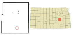 Detailed map of Matfield Green, Kansas
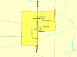
Coordinates: 38°9′35″N 96°33′43″W / 38.15972°N 96.56194°WCoordinates: 38°9′35″N 96°33′43″W / 38.15972°N 96.56194°W Country  United States
State  Kansas
County Chase Platted Incorporated Government – Type Mayor–Council Area – Total 0.2 sq mi (0.5 km2) – Land 0.2 sq mi (0.5 km2) – Water 0.0 sq mi (0.0 km2) Elevation 1,316 ft (401 m) Population (2010)[1] – Total 47 – Density 235/sq mi (90.7/km2) Time zone Central (CST) (UTC-6) – Summer (DST) CDT (UTC-5) ZIP code 66862 Area code(s) 620 FIPS code 20-45150[2] GNIS feature ID 0477807[3] Matfield Green is a city in Chase County, Kansas, United States. As of the 2010 census, the city population was 47.[1]
Contents
Geography
 Knute Rockne memorial at Kansas Turnpike Authority rest stop
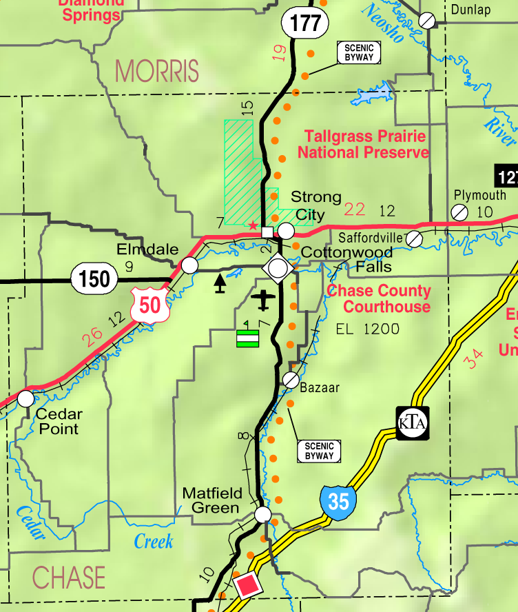
Matfield Green is located at 38°09′35″N 96°33′43″W / 38.159609°N 96.562013°W (38.159609, -96.562013).[4], in the scenic Flint Hills[5] of the Great Plains. According to the United States Census Bureau, the city has a total area of 0.2 square miles (0.52 km2), all of it land.
Area attractions
Matfield Green has two ranches on the National Register of Historic Places (NRHP).
- Crocker Ranch[6] (NRHP).
- 1908-1940 Pioneer Bluffs Ranch[7] (NRHP), approximately 1 mile north on K-177 Highway. It is listed on the National Register of Historic Places. Pioneer Bluffs is an early twentieth century ranch, consisting of one dozen vintage farm buildings.[8][9]
Demographics
Historical populations Census Pop. %± 1960 95 — 1970 77 −18.9% 1980 71 −7.8% 1990 33 −53.5% 2000 60 81.8% 2010 47 −21.7% U.S. Decennial Census As of the census[2] of 2000, there were 60 people, 31 households, and 18 families residing in the city. The population density was 314.9 people per square mile (121.9/km2). There were 34 housing units at an average density of 178.4 per square mile (69.1/km2). The racial makeup of the city was 100.00% White.
There were 31 households out of which 29.0% had children under the age of 18 living with them, 45.2% were married couples living together, and 41.9% were non-families. 38.7% of all households were made up of individuals and 22.6% had someone living alone who was 65 years of age or older. The average household size was 1.94 and the average family size was 2.56.
In the city the population was spread out with 20.0% under the age of 18, 1.7% from 18 to 24, 23.3% from 25 to 44, 31.7% from 45 to 64, and 23.3% who were 65 years of age or older. The median age was 49 years. For every 100 females there were 114.3 males. For every 100 females age 18 and over, there were 128.6 males.
The median income for a household in the city was $27,500, and the median income for a family was $29,375. Males had a median income of $23,750 versus $14,375 for females. The per capita income for the city was $17,642. There were 19.0% of families and 19.4% of the population living below the poverty line, including 35.7% of under eighteens and none of those over 64.
Matfield Green is part of the Emporia Micropolitan Statistical Area.
Government
The Matfield Green government consists of a mayor and five council members. The council meets the 1st Monday of each month at 7PM.[10]
- City Hall, 302 Orient Street.
Education
Primary and secondary education
Cottonwood Falls is part of Unified School District 284.[11][12] All students attend schools in Cottonwood Falls.
- Chase County Junior/Senior High School, 600 Main St in Cottonwood Falls.
- Chase County Elementary School, 401 Maple St in Cottonwood Falls.
Infrastructure

Transportation
K-177 highway and BNSF Railway both pass through Matfield Green. Even though the Kansas Turnpike toll road is somewhat close to Matfield Green, a driver must travel to the toll plaza in Cassoday to enter.
Utilities
- Internet
- TV
- Satellite TV is provided by DirecTV, Dish Network.
- Free over-the-air ATSC digital TV.
References
- ^ a b "2010 City Population and Housing Occupancy Status". U.S. Census Bureau. http://factfinder2.census.gov/faces/tableservices/jsf/pages/productview.xhtml?pid=DEC_10_PL_GCTPL2.ST13&prodType=table. Retrieved March 6, 2011.
- ^ a b "American FactFinder". United States Census Bureau. http://factfinder.census.gov. Retrieved 2008-01-31.
- ^ "US Board on Geographic Names". United States Geological Survey. 2007-10-25. http://geonames.usgs.gov. Retrieved 2008-01-31.
- ^ "US Gazetteer files: 2010, 2000, and 1990". United States Census Bureau. 2011-02-12. http://www.census.gov/geo/www/gazetteer/gazette.html. Retrieved 2011-04-23.
- ^ Flint Hills Tourism Coalition
- ^ National Register of Historic Places - Crocker Ranch
- ^ National Register of Historic Places - Pioneer Bluffs Ranch
- ^ Pioneer Bluffs Ranch web site
- ^ 'PrairyErth' returns home; The Wichita Eagle, July 17, 2010
- ^ Matfield Green - Directory of Public Officials
- ^ USD 284
- ^ Kansas School District Boundary Map
External links
- City
- Schools
- USD 284, school district for all of Chase County.
- Historical
- Matfield Green, a "Quiet" town in Chase County, Kansas, History and photographs.
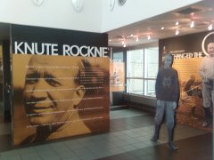
- TWA Flight 599 Memorial, Knute Rockne crash site.
- Maps
- Matfield Green City Map, KDOT
- Chase County Map, KDOT
- Topo Map of Matfield Green area, USGS
Municipalities and communities of Chase County, Kansas Cities Cedar Point | Cottonwood Falls | Elmdale | Matfield Green | Strong City

Townships Bazaar | Cedar | Cottonwood | Diamond Creek | Falls | Homestead | Matfield | Strong | Toledo
Unincorporated
communitiesGhost towns Elk | Ellinor | Neva | Thurman
Categories:- Cities in Kansas
- Populated places in Chase County, Kansas
- Emporia micropolitan area


Wikimedia Foundation. 2010.