- Washington County, Kansas
Infobox U.S. County
county=Washington County
state=Kansas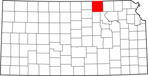
founded=February 20, 1857
seat=Washington
area_total_km2=2328|area_total_sq_mi=899
area_land_km2=2327|area_land_sq_mi=898
area_water_km2=1|area_water_sq_mi=0
area percentage=0.04%
census estimate yr=2005
pop=6009
density_km2=2.6|density_sq_mi=6.7
time zone=Central
UTC offset=-6
DST offset=-5|Washington County (standard abbreviation: WS) is a
county located in theU.S. state ofKansas . As of 2000, the population is 6,483. Itscounty seat and largest town is the city of Washington.GR|6Law and government
Washington County was a prohibition, or "dry", county until the
Kansas Constitution was amended in 1986 and voters approved the sale of alcoholic liquor by the individual drink with a 30% food sales requirement. [Cite web| url=http://www.ksrevenue.org/abcwetdrymap.htm| title=Map of Wet and Dry Counties| publisher=Alcoholic Beverage Control, Kansas Department of Revenue| month=November | year=2006| accessdate=2007-12-28]Geography
According to the
U.S. Census Bureau , the county has a total area of 899square mile s (2,328km² ), of which, 898 square miles (2,327 km²) of it is land and 0 square miles (1 km²) of it (0.04%) is water.Adjacent counties
*Jefferson County,
Nebraska (north)
*Gage County,Nebraska (northeast)
*Marshall County (east)
*Riley County (southeast)
*Clay County (south)
*Cloud County (southwest)
*Republic County (west)
*Thayer County,Nebraska (northwest)Demographics
As of the
census GR|2 of 2000, there were 6,483 people, 2,673 households, and 1,780 families residing in the county. Thepopulation density was 7 people per square mile (3/km²). There were 3,142 housing units at an average density of 4 per square mile (1/km²). The racial makeup of the county was 98.90% White, 0.11% Black or African American, 0.34% Native American, 0.05% Asian, 0.09% from other races, and 0.51% from two or more races. 0.65% of the population were Hispanic or Latino of any race.There were 2,673 households out of which 26.60% had children under the age of 18 living with them, 59.40% were married couples living together, 4.20% had a female householder with no husband present, and 33.40% were non-families. 31.20% of all households were made up of individuals and 17.80% had someone living alone who was 65 years of age or older. The average household size was 2.35 and the average family size was 2.96.
In the county the population was spread out with 23.70% under the age of 18, 5.40% from 18 to 24, 22.90% from 25 to 44, 23.00% from 45 to 64, and 25.10% who were 65 years of age or older. The median age was 44 years. For every 100 females there were 100.80 males. For every 100 females age 18 and over, there were 97.80 males.
The median income for a household in the county was $29,363, and the median income for a family was $37,260. Males had a median income of $25,074 versus $18,000 for females. The
per capita income for the county was $15,515. About 7.30% of families and 10.10% of the population were below thepoverty line , including 12.20% of those under age 18 and 12.40% of those age 65 or over.Cities and towns
Incorporated cities
Name and population (2004 estimate):
*Washington, 1,162 (county seat)
*Hanover, 603
*Clifton, 516, of which a portion lies in Clay County
*Linn, 395
*Greenleaf, 333
*Haddam, 160
*Morrowville, 159
*Barnes, 144
*Palmer, 102
*Mahaska, 101
*Vining, 56, of which a portion lies in Clay County
*Hollenberg, 29Townships
Washington County is divided into twenty-five townships. The city of Washington is considered "governmentally independent" and is excluded from the census figures for the townships. In the following table, the population center is the largest city (or cities) included in that township's population total, if it is of a significant size.
Education
Unified school districts
* Washington County USD 108 ( [http://www.usd108.org/ Web site] ) serves the cities of Haddam, Greenleaf, Mahaska, Morrowville, and Washington
* Barnes-Hanover-Linn USD 223 ( [http://www.usd223.org/ Web site] )
* Clifton-Clyde USD 224 ( [http://www.usd224.com/ Web site] )References
External links

Wikimedia Foundation. 2010.