- Barber County, Kansas
Infobox U.S. County
county=Barber County
state=Kansas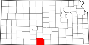
founded=February 26 ,1867
seat=Medicine Lodge
area_total_km2=2943|area_total_sq_mi=1136
area_land_km2=2937|area_land_sq_mi=1134
area_water_km2=5|area_water_sq_mi=2
area percentage=0.18%
census estimate yr=2006
pop=4974
density_km2=1.7|density_sq_mi=4.4
time zone=Central
UTC offset=-6
DST offset=-5
named for= Thomas W. BarberBarber County (county code BA) is a county located in South Central
Kansas , in the CentralUnited States . The population was 5,307 at the 2000 census, and it was estimated to be formatnum:LookupUSEstPop|20007|EST in the year LookupUSEstPop|20007|EYR. Itscounty seat and most populous city is Medicine Lodge.GR|6Law and government
Although the
Kansas Constitution was amended in 1986 to allow the sale of alcoholic liquor by the individual drink with the approval of voters, Barber County has remained a prohibition, or "dry", county. [Cite web| url=http://www.ksrevenue.org/abcwetdrymap.htm| title=Map of Wet and Dry Counties| publisher=Alcoholic Beverage Control, Kansas Department of Revenue| month=November | year=2006| accessdate=2007-12-26]Geography
According to the
U.S. Census Bureau , the county has a total area of 1,136 square miles (2,943 km²), of which 1,134 square miles (2,937 km²) is land and 2 square miles (5 km²), or 0.18%, is water.GR|2Adjacent counties
*Pratt County (north)
*Kingman County (northeast)
*Harper County (east)
*Alfalfa County,Oklahoma (southeast)
*Woods County,Oklahoma (southwest)
*Comanche County (west)
*Kiowa County (northwest)Major highways
Sources: National Atlas [ [http://www.nationalatlas.gov/ National Atlas] ] , U.S. Census Bureau [ [http://www.census.gov/geo/www/tiger U.S. Census Bureau TIGER shape files] ]
*U.S. Route 160
*U.S. Route 281
* Kansas Highway 2
* Kansas Highway 14Demographics
Barber County's population was estimated to be formatnum:LookupUSEstPop|20007|EST in the year LookupUSEstPop|20007|EYR, LookupUSEstPop|20007|TXT.Cite web| url=http://www.census.gov/popest/estimates.php| title=Population Estimates| publisher=U.S. Census Bureau, Population Division| Annual estimates of the population to 20007|EDT. Released 20007|RDT. Population change is from 20007|IDT to 20007|EDT.]
As of the U.S. Census in 2000,GR|2 there were 5,307 people, 2,235 households, and 1,510 families residing in the county. The
population density was 5 people per square mile (2/km²). There were 2,740 housing units at an average density of 2 per square mile (1/km²). The racial makeup of the county was 97.06% White, 0.38% Black orAfrican American , 0.58% Native American, 0.09% Asian, 0.89% from other races, and 1.00% from two or more races.Hispanic orLatino of any race were 2.02% of the population.There were 2,235
household s out of which 28.70% had children under the age of 18 living with them, 58.70% were married couples living together, 6.50% had a female householder with no husband present, and 32.40% were non-families. 29.90% of all households were made up of individuals and 17.00% had someone living alone who was 65 years of age or older. The average household size was 2.35 and the average family size was 2.91.In the county the population was spread out with 25.00% under the age of 18, 5.80% from 18 to 24, 23.20% from 25 to 44, 24.50% from 45 to 64, and 21.50% who were 65 years of age or older. The median age was 43 years. For every 100 females there were 92.40 males. For every 100 females age 18 and over, there were 89.40 males.
The median income for a household in the county was $33,407, and the median income for a family was $40,234. Males had a median income of $29,806 versus $20,046 for females. The
per capita income for the county was $16,627. About 7.50% of families and 10.10% of the population were below thepoverty line , including 12.60% of those under age 18 and 4.90% of those age 65 or over.Cities and towns
Incorporated cities
Name and population (LookupUSEstPop|2045500|EYR estimate):Cite web| url=http://www.census.gov/popest/estimates.php| title=Population Estimates| publisher=U.S. Census Bureau, Population Division| Annual estimates of the population to 2045500|EDT. Released 2045500|RDT.]
*Medicine Lodge, formatnum:LookupUSEstPop|2045500|EST (county seat)
*Kiowa, formatnum:LookupUSEstPop|2037125|EST
*Sharon, formatnum:LookupUSEstPop|2064325|EST
*Hardtner, formatnum:LookupUSEstPop|2030000|EST
*Hazelton, formatnum:LookupUSEstPop|2031150|EST
*Isabel, formatnum:LookupUSEstPop|2034550|EST
*Sun City, formatnum:LookupUSEstPop|2069275|ESTUnincorporated places
*Aetna
*Deerhead
*Lake City
*Stubbs
*Pixley (no longer exists)Townships
Barber County is divided into eighteen townships. None of the cities within the county are considered "governmentally independent", and all figures for the townships include those of the cities. In the following table, the population center is the largest city (or cities) included in that township's population total, if it is of a significant size.
Education
Unified school districts
* Barber County North USD 254
* South Barber County USD 255ee also
References
External links
Official sites
* [http://www.barbercounty.net/ Barber County Development, Inc.]Additional information
* [http://skyways.lib.ks.us/counties/BA/ Blue Skyways - Barber County]
* [http://www.ku.edu/pri/ksdata/county.shtml Kansas Statistical Abstract]

Wikimedia Foundation. 2010.