- Norton County, Kansas
-
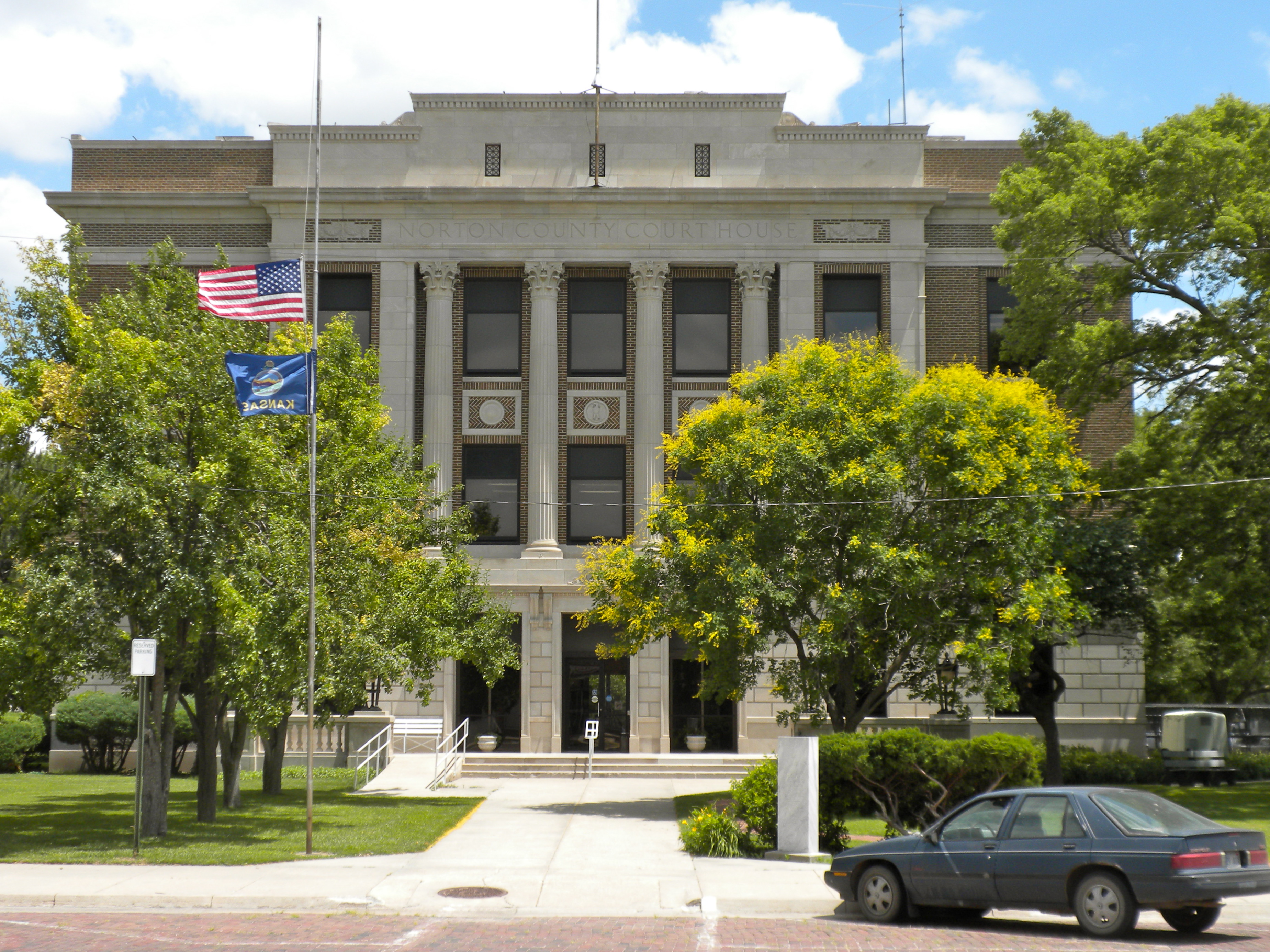
Norton County, Kansas  Norton County Courthouse
Location in the state of Kansas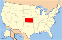
Kansas's location in the U.S.Founded February 26, 1867 Seat Norton Area
- Total
- Land
- Water
881.39 sq mi (2,283 km²)
877.84 sq mi (2,274 km²)
3.55 sq mi (9 km²), 0.40%Population
- (2010)
- Density
5,671
6.5/sq mi (2.5/km²)Time zone Central: UTC-6/-5 Website NortonCounty.net Norton County (standard abbreviation: NT) is a county located in the U.S. state of Kansas. As of the 2010 census, the county population was 5,671.[1] The largest city and county seat is Norton.
Contents
Law and government
Following amendment to the Kansas Constitution in 1986, the county remained a prohibition, or "dry", county until 1992, when voters approved the sale of alcoholic liquor by the individual drink with a 30% food sales requirement.[2]
Geography
According to the 2000 census, the county has a total area of 881.39 square miles (2,282.8 km2), of which 877.84 square miles (2,273.6 km2) (or 99.60%) is land and 3.55 square miles (9.2 km2) (or 0.40%) is water.[3]
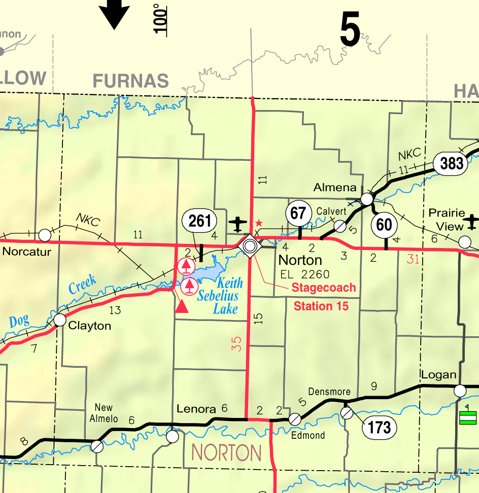
Adjacent counties
- Furnas County, Nebraska (north)
- Harlan County, Nebraska (northeast)
- Phillips County (east)
- Graham County (south)
- Sheridan County (southwest)
- Decatur County (west)
Demographics
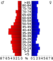 Age pyramid
Historical populations Census Pop. %± 1900 11,325 — 1910 11,614 2.6% 1920 11,423 −1.6% 1930 11,701 2.4% 1940 9,831 −16.0% 1950 8,808 −10.4% 1960 8,035 −8.8% 1970 7,279 −9.4% 1980 6,689 −8.1% 1990 5,947 −11.1% 2000 5,953 0.1% 2010 5,671 −4.7% U.S. Decennial Census As of the census[4] of 2000, there were 5,953 people, 2,266 households, and 1,470 families residing in the county. The population density was 7 people per square mile (3/km²). There were 2,673 housing units at an average density of 3 per square mile (1/km²). The racial makeup of the county was 93.35% White, 4.05% Black or African American, 0.44% Native American, 0.42% Asian, 0.02% Pacific Islander, 1.02% from other races, and 0.71% from two or more races. 2.37% of the population were Hispanic or Latino of any race.
There were 2,266 households out of which 28.20% had children under the age of 18 living with them, 55.50% were married couples living together, 7.00% had a female householder with no husband present, and 35.10% were non-families. 32.30% of all households were made up of individuals and 17.90% had someone living alone who was 65 years of age or older. The average household size was 2.28 and the average family size was 2.89.
In the county the population was spread out with 22.00% under the age of 18, 7.70% from 18 to 24, 28.30% from 25 to 44, 22.30% from 45 to 64, and 19.60% who were 65 years of age or older. The median age was 40 years. For every 100 females there were 122.10 males. For every 100 females age 18 and over, there were 122.90 males.
The median income for a household in the county was $31,050, and the median income for a family was $37,036. Males had a median income of $25,983 versus $20,381 for females. The per capita income for the county was $16,835. About 6.10% of families and 10.50% of the population were below the poverty line, including 12.70% of those under age 18 and 8.20% of those age 65 or over.
Cities and towns
Incorporated cities
Name and population (2004 estimate):
Townships
Norton County is divided into five townships. The city of Norton is considered governmentally independent and is excluded from the census figures for the townships. In the following table, the population center is the largest city (or cities) included in that township's population total, if it is of a significant size.
Sources: 2000 U.S. Gazetteer from the U.S. Census Bureau. Township FIPS Population
centerPopulation Population
density
/km² (/sq mi)Land area
km² (sq mi)Water area
km² (sq mi)Water % Geographic coordinates Almena-District 4 01450 614 2 (6) 278 (107) 0 (0) 0 % 39°53′10″N 99°41′2″W / 39.88611°N 99.68389°W Center-District 1 12260 1,382 2 (5) 654 (253) 0 (0) 0.08% 39°53′43″N 99°57′2″W / 39.89528°N 99.95056°W Harrison-District 6 30460 12 0 (0) 93 (36) 0 (0) 0.02% 39°56′54″N 99°48′25″W / 39.94833°N 99.80694°W Highland-District 2 32060 737 1 (3) 748 (289) 9 (3) 1.13% 39°41′24″N 100°1′49″W / 39.69°N 100.03028°W Solomon-District 3 66410 196 0 (1) 496 (192) 0 (0) 0.02% 39°40′38″N 99°45′56″W / 39.67722°N 99.76556°W Education
Unified school districts
- Norton Community USD 211
- Northern Valley USD 212
- West Solomon USD 213 (elementary school only; students in grades 6-12 attend schools in Norton)
See also
Information on this and other counties in Kansas
- List of counties in Kansas
- National Register of Historic Places listings in Kansas
- Kansas locations by per capita income
Other information for Kansas
- List of cities in Kansas
- List of unified school districts in Kansas
- List of colleges and universities in Kansas
References
- ^ "2010 County Population and Housing Occupancy Status". U.S. Census Bureau. http://factfinder2.census.gov/faces/tableservices/jsf/pages/productview.xhtml?pid=DEC_10_PL_GCTPL2.ST05&prodType=table. Retrieved March 31, 2011.
- ^ "Map of Wet and Dry Counties". Alcoholic Beverage Control, Kansas Department of Revenue. November 2006. http://www.ksrevenue.org/abcwetdrymap.htm. Retrieved 2007-12-26.
- ^ "Census 2000 U.S. Gazetteer Files: Counties". United States Census. http://www.census.gov/tiger/tms/gazetteer/county2k.txt. Retrieved 2011-02-13.
- ^ "American FactFinder". United States Census Bureau. http://factfinder.census.gov. Retrieved 2008-01-31.
Further reading
- History of the State of Kansas; William G. Cutler; A.T. Andreas Publisher; 1883. (Online HTML eBook)
- Kansas : A Cyclopedia of State History, Embracing Events, Institutions, Industries, Counties, Cities, Towns, Prominent Persons, Etc; 3 Volumes; Frank W. Blackmar; Standard Publishing Co; 944 / 955 / 824 pages; 1912. (Volume1 - Download 54MB PDF eBook),(Volume2 - Download 53MB PDF eBook), (Volume3 - Download 33MB PDF eBook)
External links
- Official
- General Information
- County Level Data
- Maps
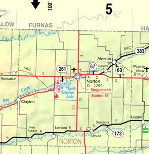
- Norton County Map, KDOT
- Kansas Highway Map, KDOT
- Kansas Railroad Map, KDOT
- Kansas School District Boundary Map, KSDE

Red Willow County, Nebraska Furnas County, Nebraska Harlan County, Nebraska Decatur County 
Phillips County  Norton County, Kansas

Sheridan County Graham County Rooks County Municipalities and communities of Norton County, Kansas Cities 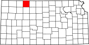
Unincorporated
communityFootnotes ‡This populated place also has portions in an adjacent county or counties
Categories:- Kansas counties
- Norton County, Kansas
- 1867 establishments


Wikimedia Foundation. 2010.