- Sumner County, Kansas
Infobox U.S. County
county=Sumner County
state=Kansas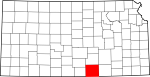
founded=20 December 1870
seat=Wellington
area_total_km2=3069|area_total_sq_mi=1185
area_land_km2=3061|area_land_sq_mi=1182
area_water_km2=8|area_water_sq_mi=3
area percentage=0.25%
census estimate yr=2005
pop=24797
density_km2=8.1|density_sq_mi=21.0
time zone=Central
UTC offset=-6
DST offset=-5|Sumner County (standard abbreviation: SU) is a
county located in theU.S. state ofKansas . As of 2000, the population was 25,946. Itscounty seat is Wellington.GR|6Sumner County is part of the
Wichita, Kansas Metropolitan Statistical Area.Law and government
Following amendment to the
Kansas Constitution in 1986, the county remained a prohibition, or "dry", county until 1992, when voters approved the sale of alcoholic liquor by the individual drink with a 30% food sales requirement. [Cite web| url=http://www.ksrevenue.org/abcwetdrymap.htm| title=Map of Wet and Dry Counties| publisher=Alcoholic Beverage Control, Kansas Department of Revenue| month=November | year=2006| accessdate=2007-12-26]Geography
According to the
U.S. Census Bureau , the county has a total area of 1,185square mile s (3,069km² ), of which, 1,182 square miles (3,061 km²) of it is land and 3 square miles (8 km²) of it (0.25%) is water.Adjacent counties
*Sedgwick County (north)
*Butler County (northeast)
*Cowley County (east)
*Kay County,Oklahoma (southeast)
*Grant County,Oklahoma (southwest)
*Harper County (west)
*Kingman County (northwest)Demographics
As of the
census GR|2 of 2000, there were 25,946 people, 9,888 households, and 7,089 families residing in the county. Thepopulation density was 22 people per square mile (8/km²). There were 10,877 housing units at an average density of 9 per square mile (4/km²). The racial makeup of the county was 94.62% White, 0.71% Black or African American, 1.05% Native American, 0.22% Asian, 0.05% Pacific Islander, 1.29% from other races, and 2.06% from two or more races. 3.58% of the population were Hispanic or Latino of any race.There were 9,888 households out of which 34.50% had children under the age of 18 living with them, 59.90% were married couples living together, 8.00% had a female householder with no husband present, and 28.30% were non-families. 25.60% of all households were made up of individuals and 12.40% had someone living alone who was 65 years of age or older. The average household size was 2.58 and the average family size was 3.10.
In the county the population was spread out with 28.50% under the age of 18, 7.50% from 18 to 24, 26.20% from 25 to 44, 22.40% from 45 to 64, and 15.50% who were 65 years of age or older. The median age was 38 years. For every 100 females there were 96.80 males. For every 100 females age 18 and over, there were 93.90 males.
The median income for a household in the county was $39,415, and the median income for a family was $46,739. Males had a median income of $36,616 versus $23,020 for females. The
per capita income for the county was $18,305. About 7.20% of families and 9.50% of the population were below thepoverty line , including 11.20% of those under age 18 and 6.80% of those age 65 or over.Cities and towns
Incorporated cities
Name and population (2004 estimate):
*Wellington, 8,277 (county seat)
*Belle Plaine, 1,649
*Conway Springs, 1,281
*Caldwell, 1,242
*Oxford, 1,134
*Argonia, 511
*South Haven, 378
*Geuda Springs, 210 (of which a small portion lies in Cowley County)
*Milan, 135
*Mayfield, 111
*Mulvane, 5,755
*Hunnewell, 82Unincorporated places
Townships
Sumner County is divided into thirty townships. The cities of Caldwell and Wellington are considered "governmentally independent" and are excluded from the census figures for the townships. In the following table, the population center is the largest city (or cities) included in that township's population total, if it is of a significant size.
Education
Unified school districts
* Mulvane USD 263
* Wellington USD 353
* Conway Springs USD 356
* Belle Plaine USD 357
* Oxford USD 358
* Argonia USD 359
* Caldwell USD 360
* South Haven USD 509References
External links
;Official website:* [http://www.co.sumner.ks.us/ Official website] ;General information on Sumner County:* [http://www.co.sumner.ks.us/ Sumner County official website] :* [http://skyways.lib.ks.us/counties/SU/ Blue Skyways]
;Kansas County Data:* [http://www.ku.edu/pri/ksdata/county.shtml Kansas Statistical Abstract]
;Sumner County local history and genealogy:* [http://www.rootsweb.com/~ksscgs/ Sumner County Historical and Genealogical Society] :* [http://www.rootsweb.com/~kscthgc/cthgc.htm Sumner County Historical and Genealogical Research Center] :* [http://skyways.lib.ks.us/genweb/sumner/ Sumner County GenWeb] :* [http://www.kshs.org/genealogists/places/counties.php?county=SU Kansas State Historical Society] :* [http://www.kancoll.org/books/cutler/sumner/ William G. Cutler's History of the State of Kansas]

Wikimedia Foundation. 2010.