- Miami County, Kansas
-
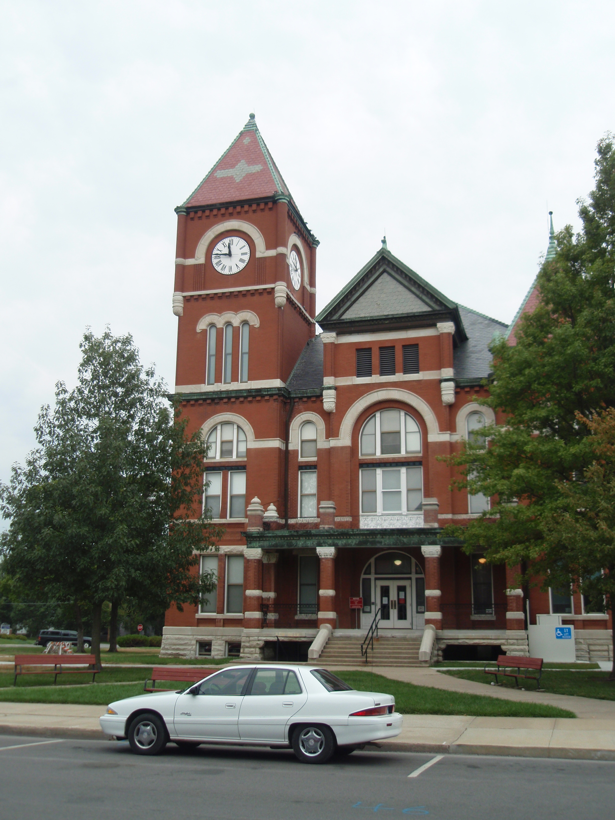
Miami County, Kansas 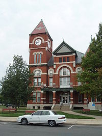 Miami County Courthouse in Paola
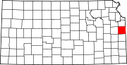
Location in the state of Kansas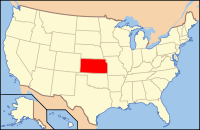
Kansas's location in the U.S.Founded August 25, 1855 Seat Paola Area
- Total
- Land
- Water
590.15 sq mi (1,528 km²)
576.72 sq mi (1,494 km²)
13.43 sq mi (35 km²), 2.28%Population
- (2010)
- Density
32,787
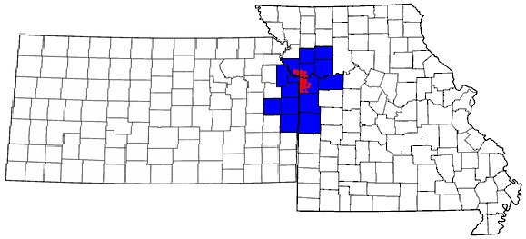
53.7/sq mi (21/km²)Time zone Central: UTC-6/-5 Website MiamiCountyKS.org Miami County (county code MI) is a county located in East Central Kansas, in the Central United States. As of the 2010 census, the county population was 32,787.[1] Its county seat and most populous city is Paola.[2] Miami County is a part of the Kansas City Metropolitan Area.
Contents
History
Native Americans
The first settlements of the area were by native American Indian tribes, primarily in the 1820s through the 1840s. This was due to their removal from areas east (Ohio, Illinois and Indiana)and the designation of the area as part of the Indian Territory. The tribes included were the Miami and Shawnee, and the Pottawatomie, Piankeshaw, Kaskaskia, Wea and Peoria, which comprised the Confederated Tribes. The original Miami reservation consisted of approximately 500,000 acres (2,000 km2). Early white settlers during that time were primarily serving as missionaries to the tribes. Over time, other settlers continued to arrive to build homes on the Miami reservation, and by 1854, the U.S. Government purchased all but 72,000 acres (290 km2) from the Miami tribe.[citation needed]
Two notable members of the Confederated Tribes were Christmas Dagnette, and Baptiste Peoria. Dagnette was born in 1800, and was a nephew of a Wea chief, originally from Indiana. He had received some formal education, spoke several of the native American languages, and additionally spoke English, French and Spanish. He had served as an interpreter to the U.S. Government by the age of sixteen. Having moved to the area that is now Miami County with the Wea tribe, he served as chief for several years before his death in 1848. Baptiste Peoria was also born around 1800, and while he didn't receive formal education like Dagnette, he learned the languages of the Shawnee, Delaware, Pottawatomie, and several more of the Confederated Tribes. In addition, he spoke English and French.[3] Peoria was of both French and native American Indian ethnicity, and like Dagnette, served as an interpreter and as a chief for some time. Baptiste Peoria became a respected member of the Paola Town Company, and was instrumental in the founding and development of the city of Paola in the early and mid 1860's. He moved (to what is now Oklahoma) with his tribe in 1868, when they were once again removed to a newly designated Indian territory, and died there in 1878. Some of the native American Indians stayed in the area (Miami County), and became citizens of the United States.[4]
Pre-Civil War Period
When Kansas Territory was incorporated in 1854 due to the Kansas-Nebraska Act,the Missouri Compromise of 1820 was essentially repealed. Bordering the slave state of Missouri to its east, the county (Miami) and surrounding areas became a location for violence between abolitionists and the "Border Ruffians" of Missouri. These acts of violence and battles that took place primarily from 1854–1858, became known as border wars, and Kansas became known as Bleeding Kansas. Kansas Territory was not yet a state, and it was a battle on which forces would become dominant, slave or free. Many abolitionists came from other states to live in the area and ensure Kansas' entry as a state as a free, or anti-slavery one. The county's most notable abolitionist was John Brown, who moved to Osawatomie,making it the headquarters for he and his anti-slavery forces. As a result of this, Osawatomie, as well as the surrounding countryside and communities became the center for several battles and acts of violence during this period.[3]
Etymology
The county was originally established in 1855 as Lykins County, after Dr. David Lykins. Lykins was a Baptist missionary to the Native American Indian tribes in the area, and had built a school for them in what is now rural Miami County. He also served as a member of the territorial council, and was pro-slavery. By January 1861, the anti-slavery forces had been established as dominant, and Kansas entered the union as a free state. As a result of Dr. Lykins' views on slavery, Lykins County's name was changed to Miami County on June 3, 1861. The new name was in honor of the predominant Native American tribe that settled the area, the Miami.[5]
Natural gas
In 1882, a large deposit of natural gas was discovered in rural Miami County, 7 miles (11 km) east of Paola. By 1886 a pipeline was completed to the town's square, where it illuminated lamps there. By 1887, Paola had its street lamps lighted with lamps using natural gas. Other fields of natural gas were discovered throughout Miami County by 1887, and for a time, the area around Paola was considered to be a gas belt. In the summer of 1887, a Natural Gas Jubilee was held, which was a celebration for people to come and marvel at the use of natural gas.[3]
Community
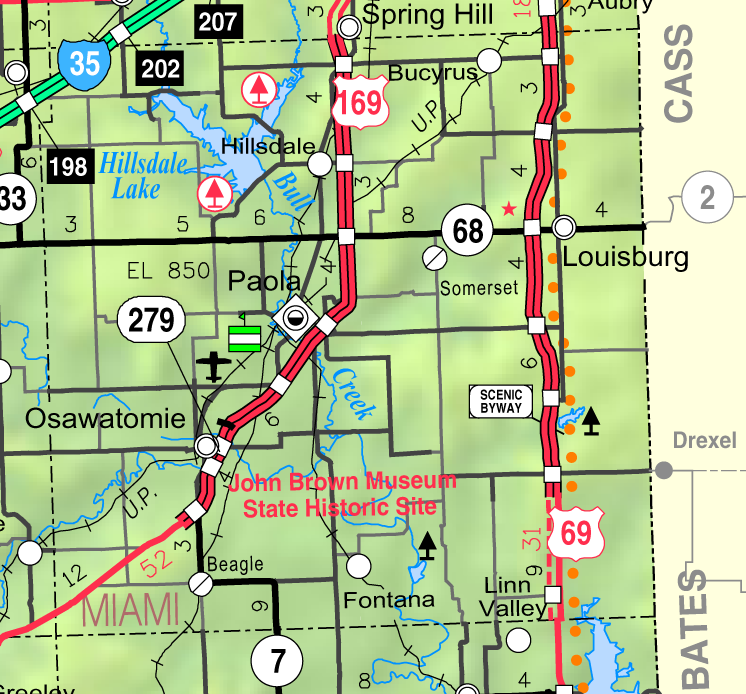
The location of Miami County, a short drive south of Kansas City,allows it to offer residents and visitors aspects of both city and rural lifestyles. Miami County and its cities, Paola, Louisburg, Spring Hill, Osawatomie, and Fontana offer a variety of activities and hobbies. Among them are golf, hiking, camping, fishing, hunting, horseback riding, water sports, astronomy and a variety of community festivals and events that take place throughout the year. There are also historical places and museums to study its history.[4]
Miami County Farm Tour
In the spring of each year, various Miami County farms and farm businesses participate in the Miami County Farm Tour. The public is invited to come to each farm with their families as part of a free self-guided driving tour. The goal is to experience and learn about the operations, produce and/or animals at each farm stop. Visitors, and residents from Miami County, have made the farm tour an annual event.[4]
Lakes
- Hillsdale Lake - The largest lake in Miami County, this lake is also diverse in what it offers. Among the activities at Hillsdale are camping, fishing, swimming, boating, hunting, and hiking. Hoseback riding is also largely available, with 32 miles (51 km) of marked trails on the lake's east side. Model airplane flying also has its own special designated area.[4]
- Louisburg Middle Creek Lake - It is located 7 miles south of Louisburg, Kansas on Metcalf road. It is a prime source of water for the city of Louisburg. In addition the lake offers superb fishing and camping. Fishing boats are allowed on the lake but swimming and water sports are prohibited. The lake is managed by the Kansas Department of Wildlife and Parks. Species stocked in the lake include Bluegill, Channel, Flathead, Large and Smallmouth Bass, Crappie, Saugeye, Walleye, White Bass and Sunfish. The Lake and camp sites are open to the public at no charge. Great place to get away.[citation needed]
Other lakes in Miami County, each with specific restrictions and activities to offer, include:
- Miola Lake
- Miami County State Lake
- Osawatomie Lake
- Paola Lake
- Hunters Lake
- Wagstaff Lake[6]

Law and government
Miami County was a prohibition, or "dry", county until the Kansas Constitution was amended in 1986 and voters approved the sale of alcoholic liquor by the individual drink with a 30% food sales requirement.[7]
Geography
According to the 2000 census, the county has a total area of 590.15 square miles (1,528.5 km2), of which 576.72 square miles (1,493.7 km2) (or 97.72%) is land and 13.43 square miles (34.8 km2) (or 2.28%) is water.[8]
Adjacent counties
- Johnson County (north)
- Cass County, Missouri (east)
- Bates County, Missouri (southeast)
- Linn County (south)
- Anderson County (southwest)
- Franklin County (west)
- Douglas County (northwest)
Demographics
Historical populations Census Pop. %± 1900 21,641 — 1910 20,030 −7.4% 1920 19,809 −1.1% 1930 21,243 7.2% 1940 19,489 −8.3% 1950 19,698 1.1% 1960 19,884 0.9% 1970 19,254 −3.2% 1980 21,618 12.3% 1990 23,466 8.5% 2000 28,351 20.8% 2010 32,787 15.6% U.S. Decennial Census As of the U.S. Census in 2000,[9] there were 28,351 people, 10,365 households, and 7,794 families residing in the county. The population density was 49 people per square mile (19/km²). There were 10,984 housing units at an average density of 19 per square mile (7/km²). The racial makeup of the county was 95.96% White, 1.54% Black or African American, 0.52% Native American, 0.17% Asian, 0.01% Pacific Islander, 0.44% from other races, and 1.36% from two or more races. Hispanic or Latino of any race were 1.59% of the population.
There were 10,365 households out of which 37.00% had children under the age of 18 living with them, 63.50% were married couples living together, 8.00% had a female householder with no husband present, and 24.80% were non-families. 21.00% of all households were made up of individuals and 8.80% had someone living alone who was 65 years of age or older. The average household size was 2.66 and the average family size was 3.09.
In the county the population was spread out with 27.90% under the age of 18, 7.30% from 18 to 24, 29.70% from 25 to 44, 23.10% from 45 to 64, and 11.90% who were 65 years of age or older. The median age was 37 years. For every 100 females there were 97.80 males. For every 100 females age 18 and over, there were 96.00 males.
The median income for a household in the county was $46,665, and the median income for a family was $55,830. Males had a median income of $37,441 versus $27,271 for females. The per capita income for the county was $21,408. About 3.60% of families and 5.50% of the population were below the poverty line, including 5.40% of those under age 18 and 8.40% of those age 65 or over.
Cities and towns
Incorporated cities
Name and population (2004 estimate):
- Paola , 5,161
- Osawatomie, 4,600
- Spring Hill, 4,159, of which only about 2 km2 (1 sq mi) is inside the county, the majority being in Johnson County
- Louisburg, 2,998
- Fontana, 149
Townships
Miami County is divided into thirteen townships. The cities of Louisburg, Osawatomie, Paola, and Spring Hill are considered governmentally independent and are excluded from the census figures for the townships. In the following table, the population center is the largest city (or cities) included in that township's population total, if it is of a significant size.
Township FIPS Population
centerPopulation Population
density
/km² (/sq mi)Land area
km² (sq mi)Water area
km² (sq mi)Water % Geographic coordinates Marysville 45100 2,575 20 (51) 131 (50) 12 (5) 8.28% 38°40′48″N 94°51′31″W / 38.68°N 94.85861°W Miami 46100 506 4 (10) 126 (48) 1 (0) 0.53% 38°27′56″N 94°44′47″W / 38.46556°N 94.74639°W Middle Creek 46225 1,649 11 (28) 151 (58) 1 (1) 0.89% 38°34′8″N 94°42′32″W / 38.56889°N 94.70889°W Mound 48700 705 8 (22) 83 (32) 0 (0) 0.06% 38°25′32″N 94°58′56″W / 38.42556°N 94.98222°W Osage 53175 649 6 (16) 106 (41) 0 (0) 0.46% 38°26′0″N 94°50′58″W / 38.433333°N 94.84944°W Osawatomie 53250 794 9 (23) 90 (35) 0 (0) 0.12% 38°29′7″N 94°58′53″W / 38.48528°N 94.98139°W Paola 54275 1,100 16 (40) 71 (27) 0 (0) 0.65% 38°33′48″N 94°51′44″W / 38.56333°N 94.86222°W Richland 59475 1,758 11 (27) 166 (64) 16 (6) 8.89% 38°40′23″N 95°0′11″W / 38.67306°N 95.00306°W Stanton 67925 925 9 (23) 103 (40) 0 (0) 0.37% 38°32′51″N 95°0′32″W / 38.5475°N 95.00889°W Sugar Creek 68825 449 4 (11) 104 (40) 1 (0) 0.63% 38°26′40″N 94°40′14″W / 38.44444°N 94.67056°W Ten Mile 70125 1,259 10 (27) 121 (47) 1 (0) 0.51% 38°40′12″N 94°45′41″W / 38.67°N 94.76139°W Valley 72950 1,478 16 (41) 93 (36) 0 (0) 0.37% 38°30′54″N 94°52′25″W / 38.515°N 94.87361°W Wea 76225 1,836 16 (41) 117 (45) 1 (0) 0.43% 38°39′39″N 94°40′49″W / 38.66083°N 94.68028°W Sources: "Census 2000 U.S. Gazetteer Files". U.S. Census Bureau, Geography Division. http://www.census.gov/geo/www/gazetteer/places2k.html. Education
Unified school districts
- Osawatomie USD 367
- Paola USD 368
- Louisburg USD 416
See also
Information on this and other counties in Kansas
- List of counties in Kansas
- National Register of Historic Places listings in Kansas
- Kansas locations by per capita income
Other information for Kansas
- List of cities in Kansas
- List of unified school districts in Kansas
- List of colleges and universities in Kansas
References
- ^ "2010 County Population and Housing Occupancy Status". U.S. Census Bureau. http://factfinder2.census.gov/faces/tableservices/jsf/pages/productview.xhtml?pid=DEC_10_PL_GCTPL2.ST05&prodType=table. Retrieved March 31, 2011.
- ^ "Find a County". National Association of Counties. http://www.naco.org/Counties/Pages/FindACounty.aspx. Retrieved 2011-06-07.
- ^ a b c "Miami County History". Swan River Museum. http://www.thinkmiamicountyhistory.com/Home.html/. Retrieved 2009-12-21.[dead link]
- ^ a b c d "Miami County 2009 Visitors Guide"
- ^ "Kansas Counties". Kansas Sate Historical Society. http://www.kshs.org/genealogists/places/counties.php?county=MI. Retrieved 2009-12-21.[dead link]
- ^ "Miami County Lakes". Fishing Works. http://www.fishingworks.com/. Retrieved 2009-12-22.
- ^ "Map of Wet and Dry Counties". Alcoholic Beverage Control, Kansas Department of Revenue. November 2006. http://www.ksrevenue.org/abcwetdrymap.htm. Retrieved 2007-12-28.
- ^ "Census 2000 U.S. Gazetteer Files: Counties". United States Census. http://www.census.gov/tiger/tms/gazetteer/county2k.txt. Retrieved 2011-02-13.
- ^ "American FactFinder". United States Census Bureau. http://factfinder.census.gov. Retrieved 2008-01-31.
Further reading
- History of the State of Kansas; William G. Cutler; A.T. Andreas Publisher; 1883. (Online HTML eBook)
- Kansas : A Cyclopedia of State History, Embracing Events, Institutions, Industries, Counties, Cities, Towns, Prominent Persons, Etc; 3 Volumes; Frank W. Blackmar; Standard Publishing Co; 944 / 955 / 824 pages; 1912. (Volume1 - Download 54MB PDF eBook),(Volume2 - Download 53MB PDF eBook), (Volume3 - Download 33MB PDF eBook)
External links
- Official sites
- Additional information
- Maps
- 2008 Miami County Map, KDOT
- 2011 Kansas Highway Map, KDOT
- 2011 Kansas Railroad Map, KDOT
- 2005 Kansas School District Boundary Map, KSDE

Douglas County Johnson County Cass County, Missouri Franklin County 
 Miami County, Kansas

Anderson County Linn County Bates County, Missouri Municipalities and communities of Miami County, Kansas Cities Fontana | Louisburg | Osawatomie | Paola | Spring Hill‡
Unincorporated
communitiesBucyrus | Hillsdale
Footnotes ‡This populated place also has portions in an adjacent county or counties
Kansas City Metropolitan Area's cities and counties Central city 
Largest cities (over 100,000 in 2000) Medium-sized cities (10,000 to 100,000 in 2000) Blue Springs • Belton • Excelsior Springs • Gladstone • Grandview • Lansing • Leawood • Leavenworth • Lee's Summit • Lenexa • Liberty • Merriam • Ottawa • Prairie Village • Raymore • Raytown • ShawneeCounties Categories:- Kansas counties
- Miami County, Kansas
- 1855 establishments in the United States


Wikimedia Foundation. 2010.