- Lane County, Kansas
Infobox U.S. County
county=Lane County
state=Kansas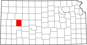
founded=March 20 ,1873
seat=Dighton
area_total_km2=1858|area_total_sq_mi=717
area_land_km2=1858|area_land_sq_mi=717
area_water_km2=1|area_water_sq_mi=0
area percentage=0.03%
census estimate yr=2005
pop=1894
density_km2=1.0|density_sq_mi=2.6
time zone=Central
UTC offset=-6
DST offset=-5|Lane County (standard abbreviation: LE) is a county located in the
U.S. state ofKansas . As of 2000, the population is 2,155. Thecounty seat is Dighton, the only city in the county. Lane County was named after James H. Lane who was a leader of theJayhawker abolitionist movement and served as one of the first U.S. Senators from Kansas.Law and government
Although the
Kansas Constitution was amended in 1986 to allow the sale of alcoholic liquor by the individual drink with the approval of voters, Lane County has remained a prohibition, or "dry", county. [Cite web| url=http://www.ksrevenue.org/abcwetdrymap.htm| title=Map of Wet and Dry Counties| publisher=Alcoholic Beverage Control, Kansas Department of Revenue| month=November | year=2004| accessdate=2007-01-21]Geography
According to the
U.S. Census Bureau , the county has a total area of 717square mile s (1,858km² ), of which, 717 square miles (1,858 km²) of it is land and 0 square miles (1 km²) of it (0.03%) is water.Adjacent counties
*Gove County (north)
*Ness County (east)
*Finney County (south)
*Scott County (west)Demographics
As of the
census GR|2 of 2000, there were 2,155 people, 910 households, and 613 families residing in the county. Thepopulation density was 3 people per square mile (1/km²). There were 1,065 housing units at an average density of 2 per square mile (1/km²). The racial makeup of the county was 97.73% White, 0.05% Native American, 0.09% Asian, 0.05% Pacific Islander, 0.51% from other races, and 1.58% from two or more races. 1.44% of the population were Hispanic or Latino of any race.There were 910 households out of which 29.50% had children under the age of 18 living with them, 59.10% were married couples living together, 5.10% had a female householder with no husband present, and 32.60% were non-families. 30.30% of all households were made up of individuals and 16.50% had someone living alone who was 65 years of age or older. The average household size was 2.34 and the average family size was 2.91.
In the county the population was spread out with 25.40% under the age of 18, 5.40% from 18 to 24, 24.60% from 25 to 44, 24.10% from 45 to 64, and 20.50% who were 65 years of age or older. The median age was 42 years. For every 100 females there were 100.30 males. For every 100 females age 18 and over, there were 97.70 males.
The median income for a household in the county was $36,047, and the median income for a family was $41,892. Males had a median income of $29,429 versus $20,446 for females. The
per capita income for the county was $18,606. About 5.40% of families and 8.20% of the population were below thepoverty line , including 11.40% of those under age 18 and 7.60% of those age 65 or over.Cities and towns
Incorporated cities
Name and population (2004 estimate):
*Dighton, 1,138 (county seat)Unincorporated places
Townships
Lane County is divided into five townships. None of the cities within the county are considered "governmentally independent", and all figures for the townships include those of the cities. In the following table, the population center is the largest city (or cities) included in that township's population total, if it is of a significant size.
Education
Unified school districts
* Healy USD 468
* Dighton USD 482Museums
* Lane County Historical Museum, 333 N. Main St, Dighton,
Kansas .Newspapers
* Dighton Herald, 113 E. Long St, Dighton,
Kansas Books
Ellen May Stanley has written several books about Lane County:
* Cowboy Josh: Adventures of a Real Cowboy
* Early Lane County History: 12,000 B.C. - A.D. 1884
* Early Lane County Development
* Golden Age, Great Depression, and Dust Bowlee also
*
Dry counties References
External links
;General county information:* [http://skyways.lib.ks.us/counties/LE/ Blue Skyways]
;County level data:* [http://www.ku.edu/pri/ksdata/county.shtml Kansas Statistical Abstract]

Wikimedia Foundation. 2010.