- Ottawa, Kansas
-
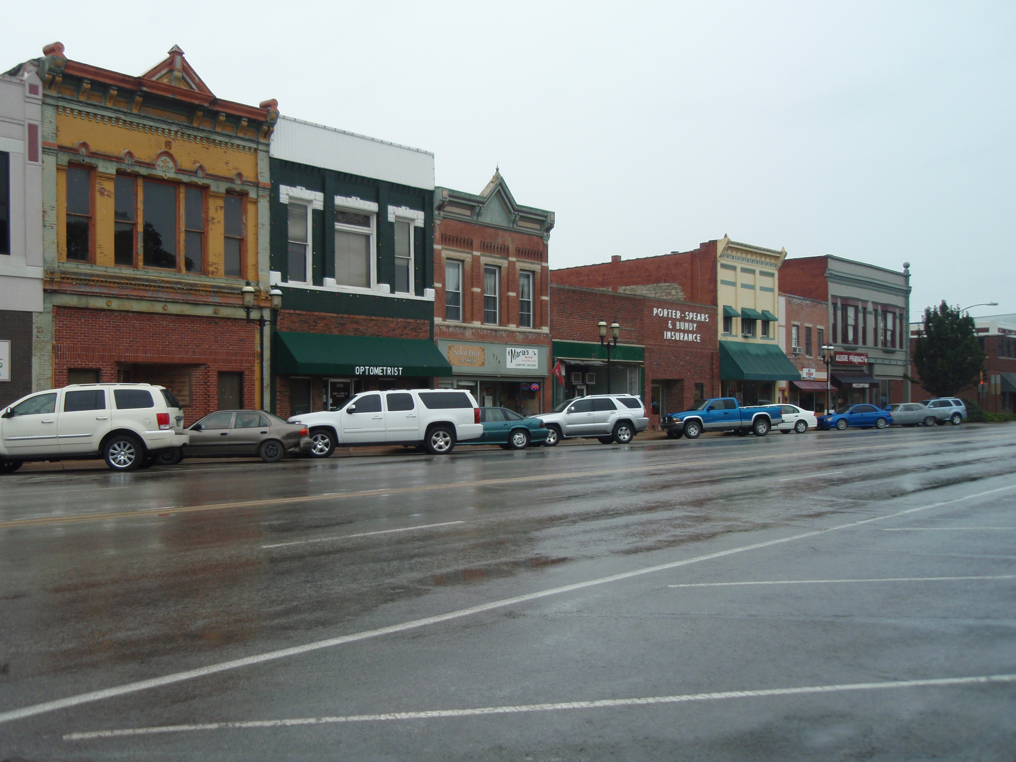
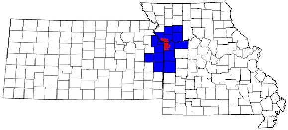
Ottawa, Kansas — City — Business District of Ottawa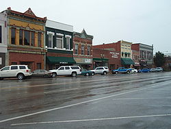 Location of Ottawa in Kansas.
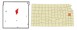
Coordinates: 38°36′43″N 95°15′59″W / 38.61194°N 95.26639°WCoordinates: 38°36′43″N 95°15′59″W / 38.61194°N 95.26639°W Country United States State Kansas County Franklin Founded 1865 Government – City Manager Richard Nienstedt Area – Total 6.7 sq mi (17.4 km2) – Land 6.7 sq mi (17.3 km2) – Water 0.0 sq mi (0.0 km2) 0.15% Elevation 902 ft (275 m) Population (2010)[1] – Total 12,649 – Density 1,887.9/sq mi (728.9/km2) Time zone CST (UTC-6) – Summer (DST) CDT (UTC-5) ZIP code 66067 Area code(s) 785 FIPS code 20-53550[2] GNIS feature ID 0479367[3] Website www.OttawaKansas.net Ottawa is a city situated along the Marais des Cygnes River in the central part of Franklin County, located in east-central Kansas, 50 miles southwest of Kansas City, Mo., in the central United States. As of the 2010 census, the city population was 12,649.[1] It is the county seat[4] and most populous city of Franklin County. Ottawa is included in the Kansas City Metropolitan Area.
Contents
History
 Old Depot Museum.
The town grew up around Ottawa Indian settlements. The tribe lived in the area from 1837 to 1867 and donated land for Ottawa University. The town and university were named for the tribe.[5]
The city of Ottawa has a history of flooding due to the Marais Des Cygnes river. One of the first big floods which was noted happened in 1844, twenty years before the city's founding in 1864. No official measurements were taken, though was estimated to be at 40 feet (12 m). A flood in 1928 had a crest point of 38.65 in which 6 people died. Other flood years include 1904, with a crest of 35.8 feet (10.9 m); 1909, cresting at 36.3 feet (11.1 m); 1915, cresting at 31 feet (9.4 m), and 1944 cresting at 36.5 feet (11.1 m).[citation needed]
However, it is the Great Flood of 1951 which is the most famous. It was about five inches higher than the 1928 flood. The flood of 1951 affected much of Missouri and Kansas and 41 people died. 1/3 of Ottawa was covered because of this flood.[citation needed]
It is unlikely that Ottawa will suffer major damage due to a flood again thanks to a series of levees and pumping stations built by the U.S. Army Corps of Engineers in the 1960s. It is actually part of a larger system of flood systems to regulate the Marais Des Cygnes river all the way to the Missouri River. The levees built along the river are inspected on an annual basis to insure their quality.[citation needed]
In 1943, German and Italian prisoners of World War II were brought to Kansas and other Midwest states as a means of solving the labor shortage caused by American men serving in the war effort. Large internment camps were established in Kansas: Camp Concordia, Camp Funston (at Fort Riley), Camp Phillips (at Salina under Fort Riley). Fort Riley established 12 smaller branch camps, including Ottawa.[6]
Geography
Ottawa is located at 38°36′43″N 95°15′59″W / 38.61194°N 95.26639°W (38.612044, -95.266513).[7] The city is situated along the Marais des Cygnes River. It is located 58 miles (93 km) southwest of Kansas City at the junction of U.S. Route 59 and K-68. U.S. Route 50 and Interstate 35 bypass to the south of the city with the business route for US-50 passing through the city.
According to the United States Census Bureau, the city has a total area of 6.7 square miles (17 km2), of which 6.7 square miles (17 km2) is land and 0.15% is water.
Climate
Over the course of a year, temperatures range from an average low of about 20 °F (−7 °C) in January to an average high over 90 °F (32 °C) in July. The maximum temperature reaches 90 °F (32 °C) an average of 52 days per year and reaches 100 °F (38 °C) an average of 6 days per year. The minimum temperature falls below the freezing point (32°F) an average of 105 days per year. Typically the first fall freeze occurs between the beginning of October and early November, and the last spring freeze occurs between the end of March and late April.[citation needed]
The area receives nearly 40 inches (1,000 mm) of precipitation during an average year with the largest share being received in May and June—the April–June period averages 29 days of measurable precipitation. During a typical year the total amount of precipitation may be anywhere from 28 to 51 inches (1,300 mm). There are on average 87 days of measurable precipitation per year. Winter snowfall averages almost 16 inches, but the median is less than 9 inches (230 mm). Measurable snowfall occurs an average of 8 days per year with at least an inch of snow being received on five of those days. Snow depth of at least an inch occurs an average of 6 days per year.[citation needed]
Source: Monthly Station Climate Summaries, 1971–2000, U.S. National Climatic Data Center Month Jan Feb Mar Apr May Jun Jul Aug Sep Oct Nov Dec Year Temperatures (°F) Mean high 40.1 46.6 58.0 68.5 77.1 85.7 91.1 89.9 82.0 70.9 55.1 43.3 67.4 Mean low 20.6 25.8 35.4 45.6 55.4 64.8 69.6 67.4 58.8 47.5 35.6 25.2 46.0 Highest recorded 76
(1950)84
(1981)93
(1910)96
(1910)101
(2000)108
(1980)118
(1954)113
(1936)111
(1947)98
(1939)86
(1980)75
(1939)118
(1954)Lowest recorded −20
(1947)−28
(1905)−9
(1948)11
(1920)21
(1907)41
(1946)47
(1972)42
(1910)27
(1908)16
(1925)1
(1932)−22
(1989)−28
(1905)Precipitation (inches) Median 1.06 1.09 2.50 3.22 5.10 4.80 3.25 3.94 3.75 3.55 2.95 1.57 39.34 Mean number of days 5.3 4.8 7.3 9.0 10.4 9.1 7.4 7.6 7.2 7.2 6.2 5.6 87.1 Highest monthly 3.60
(1982)4.17
(1997)10.14
(1973)9.08
(1994)11.67
(1995)12.84
(1981)10.49
(1993)8.43
(1996)12.06
(1986)7.48
(1985)8.83
(1992)4.10
(1971)Snowfall (inches) Median 3.3 4.0 0.0 0.0 0.0 0.0 0.0 0.0 0.0 0.0 0.0 1.2 8.5 Mean number of days 3.0 2.1 0.9 0.1 0.0 0.0 0.0 0.0 0.0 0.0 0.5 1.8 8.4 Highest monthly 22.3
(1985)14.8
(1980)7.0
(1975)0.8
(1994)0.0 0.0 0.0 0.0 0.0 trace
(1993)9.0
(1975)15.0
(1983)Notes: Temperatures are in degrees Fahrenheit. Precipitation includes rain and melted snow or sleet in inches; median values are provided for precipitation and snowfall because mean averages may be misleading. Mean and median values are for the 30-year period 1971–2000; temperature extremes are for the station's period of record (1900–2001). The station is located in Ottawa at 38°37′N 95°17′W, elevation 900 feet (270 m). Demographics
Historical populations Census Pop. %± 1870 2,941 — 1880 4,032 37.1% 1890 6,248 55.0% 1900 6,934 11.0% 1910 7,650 10.3% 1920 9,018 17.9% 1930 9,563 6.0% 1940 10,193 6.6% 1950 10,081 −1.1% 1960 10,673 5.9% 1970 11,036 3.4% 1980 11,016 −0.2% 1990 10,667 −3.2% 2000 11,921 11.8% 2010 12,649 6.1% U.S. Decennial Census As of the U.S. Census in 2000,[2] there were 11,921 people, 4,697 households, and 3,034 families residing in the city. The population density was 1,781.0 people per square mile (688.0/km²). There were 5,080 housing units at an average density of 759.0 per square mile (293.2/km²). The racial makeup of the city was 92.77% White, 2.31% Black or African American, 1.22% Native American or Alaska Native, 0.53% Asian, 0.01% Pacific Islander, 1.31% from other races, and 1.86% from two or more races. Hispanic or Latino of any race were 4.16% of the population.
There were 4,697 households out of which 33.2% had children under the age of 18 living with them, 49.1% were married couples living together, 10.9% had a female householder with no husband present, and 35.4% were non-families. 30.5% of all households were made up of individuals, and 14.4% had someone living alone who was 65 years of age or older. The average household size was 2.43 and the average family size was 3.00.
In the city the population was spread out with 26.6% under the age of 18, 11.5% from 18 to 24, 27.7% from 25 to 44, 18.3% from 45 to 64, and 15.8% who were 65 years of age or older. The median age was 34 years. For every 100 females there were 95.1 males. For every 100 females age 18 and over, there were 89.0 males.
The median income for a household in the city was $34,071, and the median income for a family was $41,710. Males had a median income of $30,050 versus $22,891 for females. The per capita income for the city was $16,840. About 6.8% of families and 9.0% of the population were below the poverty line, including 10.0% of those under age 18 and 8.1% of those age 65 or over.
Law and government
Ottawa was governed by a Mayor-Council system until 1913 when the City became a Commission form of government. In 1970 voters established the City Manager form of government with a five member Commission that annually selects a Mayor from its ranks. The citizens of Ottawa elect commissioners at-large. Three seats on the Commission are open every odd numbered year. Two Commissioners are elected to four-year terms and one is elected to a two-year term.[citation needed]
Newspapers
There are two publications which serve the city of Ottawa, the Ottawa Herald and the Ottawa Times. The Ottawa Herald was founded in 1869 and is currently owned by Harris Enterprises Inc.[citation needed]
A monthly publication for seniors also serves Ottawa:
Radio
Ottawa has four radio stations, 1 AM and 3 FM. KOFO-AM broadcasts on 1220 with the tagline "Your Newssource for East-Central Kansas. KOFO airs country music from across the decades, and specializes in local news. KCHZ broadcasts from Ottawa on 95.7, with the actual studios in Kansas City, Missouri. 88.9 is home to the Ottawa University student station, KTJO-FM. 90.5FM features the Ottawa-based KRBW's Christian programming.
Education
Ottawa is served by USD 290 for public education. The private four year university, Ottawa University, is also located within Ottawa. Ottawa is also home to a branch campus of Neosho County Community College.
USD 290 public education schools:
- Ottawa High School
- Ottawa Middle School
- Eisenhower Elementary School
- Garfield Elementary School
- Lincoln Elementary School
- Eugene Field Elementary school
Several private schools are also located in Ottawa.
- Sacred Heart Catholic Elementary School
- Pilgrim Bible Academy
- Ottawa Christian Academy
Notable people
- Steve Grogan, former New England Patriots quarterback, led Ottawa to a runner-up place in state football and to a state championship in basketball.
- Don Harrison, news anchor, one of the original anchors of CNN Headline News
- Gary Hart, former Democratic U. S. Senator from Colorado and Presidential Candidate in 1984 and 1988
- Steve Hawley, American astronaut (considers Salina as his hometown)
- Isaac Smith Kalloch, signatory of Ottawa's original town company charter, later became Mayor of San Francisco
- Jerry Voorhis, U. S. Representative for California's 12th congressional district from 1937–1947
- John G. Thompson, a prominent mathematician.
- Stanley Sheldon, bassist and vocalist for Peter Frampton, most notably on Frampton's Frampton Comes Alive! album.
- Brett Staneart, recipient of a Daytime Emmy Award for Outstanding Drama Series Writing Team and Writers Guild Award (Guiding
See also
References
- ^ a b "2010 City Population and Housing Occupancy Status". U.S. Census Bureau. http://factfinder2.census.gov/faces/tableservices/jsf/pages/productview.xhtml?pid=DEC_10_PL_GCTPL2.ST13&prodType=table. Retrieved March 6, 2011.
- ^ a b "American FactFinder". United States Census Bureau. http://factfinder.census.gov. Retrieved 2008-01-31.
- ^ "US Board on Geographic Names". United States Geological Survey. 2007-10-25. http://geonames.usgs.gov. Retrieved 2008-01-31.
- ^ "Find a County". National Association of Counties. http://www.naco.org/Counties/Pages/FindACounty.aspx. Retrieved 2011-06-07.
- ^ Dixon, Rhonda. "The Ottawa Tribe of Oklahoma." Ottawa Tribe of Oklahoma. (16 Feb 2009).
- ^ List of Prisoner Of War (POW) Camps in Kansas
- ^ "US Gazetteer files: 2010, 2000, and 1990". United States Census Bureau. 2011-02-12. http://www.census.gov/geo/www/gazetteer/gazette.html. Retrieved 2011-04-23.
- ^ Awards for Brett Staneart, IMDB
- ^ Allan, Jeremiah, "Standing on the Picket Line", The Campus, Ottawa University
External links
Official sites
- City of Ottawa
- Ottawa Area Chamber of Commerce
- Ottawa Main Street Association
- Ottawa University
- Franklin County Convention Visitors Bureau
Additional information
Municipalities and communities of Franklin County, Kansas Cities Lane | Ottawa | Pomona | Princeton | Rantoul | Richmond | Wellsville | Williamsburg
Townships Unincorporated
communitiesCentropolis | Homewood | Imes | LeLoup | Norwood | Peoria | Ransomville | Richter
Ghost town Silkville
Kansas City Metropolitan Area's cities and counties Central city 
Largest cities (over 100,000 in 2000) Medium-sized cities (10,000 to 100,000 in 2000) Blue Springs • Belton • Excelsior Springs • Gladstone • Grandview • Lansing • Leawood • Leavenworth • Lee's Summit • Lenexa • Liberty • Merriam • Ottawa • Prairie Village • Raymore • Raytown • ShawneeCounties Categories:- Cities in Kansas
- County seats in Kansas
- Populated places in Franklin County, Kansas


Wikimedia Foundation. 2010.