- Reno County, Kansas
Infobox U.S. County
county=Reno County
state=Kansas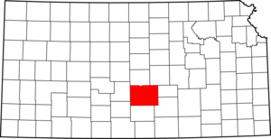
founded=February 26 ,1867
seat=Hutchinson
area_total_km2=3293|area_total_sq_mi=1271
area_land_km2=3249|area_land_sq_mi=1254
area_water_km2=44|area_water_sq_mi=17
area percentage=1.32%
census estimate yr=2005
pop=63558
density_km2=19.6|density_sq_mi=50.7
time zone=Central
UTC offset=-6
DST offset=-5
web=www.renogov.org
named for=Jesse Lee Reno Reno County (standard abbreviation: RN) is a county located in the
U.S. state ofKansas . As of 2000, the population was 64,790. The largest city andcounty seat is Hutchinson.The Hutchinson
Micropolitan Statistical Area includes all of Reno County.Law and government
Reno County was a prohibition, or "dry", county until the
Kansas Constitution was amended in 1986 and voters approved the sale of alcoholic liquor by the individual drink with a 30% food sales requirement. The food sales requirement was removed with voter approval in 2004. [Cite web| url=http://www.ksrevenue.org/abcwetdrymap.htm| title=Map of Wet and Dry Counties| publisher=Alcoholic Beverage Control, Kansas Department of Revenue| month=November | year=2006| accessdate=2007-12-28]Geography
According to the
U.S. Census Bureau , the county has a total area of 1,271square mile s (3,293km² ), of which, 1,254 square miles (3,249 km²) of it is land and 17 square miles (44 km²) of it (1.32%) is water.Adjacent counties
*Rice County (north)
*McPherson County (northeast)
*Harvey County (east)
*Sedgwick County (southeast)
*Kingman County (south)
*Pratt County (southwest)
*Stafford County (west)National
protected area *
Quivira National Wildlife Refuge (part)Demographics
As of the
census GR|2 of 2000, there were 64,790 people, 25,498 households, and 17,313 families residing in the county. Thepopulation density was 52 people per square mile (20/km²). There were 27,625 housing units at an average density of 22 per square mile (8/km²). The racial makeup of the county was 91.56% White, 2.88% Black or African American, 0.58% Native American, 0.45% Asian, 0.04% Pacific Islander, 2.69% from other races, and 1.81% from two or more races. 5.65% of the population were Hispanic or Latino of any race.There were 25,498 households out of which 30.30% had children under the age of 18 living with them, 55.90% were married couples living together, 8.70% had a female householder with no husband present, and 32.10% were non-families. 27.90% of all households were made up of individuals and 12.10% had someone living alone who was 65 years of age or older. The average household size was 2.41 and the average family size was 2.94.
In the county the population was spread out with 24.50% under the age of 18, 9.30% from 18 to 24, 26.90% from 25 to 44, 22.90% from 45 to 64, and 16.40% who were 65 years of age or older. The median age was 38 years. For every 100 females there were 100.90 males. For every 100 females age 18 and over, there were 99.00 males.
The median income for a household in the county was $35,510, and the median income for a family was $42,643. Males had a median income of $31,495 versus $21,329 for females. The
per capita income for the county was $18,520. About 8.10% of families and 10.90% of the population were below thepoverty line , including 13.90% of those under age 18 and 8.50% of those age 65 or over.Cities and towns
Incorporated cities
Name and population (2004 estimate):
*Hutchinson, 41,047 (county seat)
*South Hutchinson, 2,488
*Buhler, 1,337
*Haven, 1,175
*Nickerson, 1,172
*Pretty Prairie, 601
*Arlington, 441
*Turon, 435
*Sylvia, 297
*Partridge, 266
*Abbyville, 126
*Plevna, 99
*Willowbrook, 88
*Langdon, 72Unincorporated places
*Medora
*YoderTownships
Reno County is divided into thirty-one townships. The cities of Hutchinson and Nickerson are considered "governmentally independent" and are excluded from the census figures for the townships. In the following table, the population center is the largest city (or cities) included in that township's population total, if it is of a significant size.
Education
Unified school districts
* Hutchinson USD 308
* Nickerson USD 309
* Fairfield USD 310
* Pretty Prairie USD 311
* Haven USD 312
* Buhler USD 313ee also
References
* [http://factfinder.census.gov/servlet/DTTable?_bm=y&-context=dt&-ds_name=DEC_2000_SF1_U&-CHECK_SEARCH_RESULTS=N&-CONTEXT=dt&-mt_name=DEC_2000_SF1_U_P001&-tree_id=4001&-transpose=N&-all_geo_types=Y&-redoLog=true&-_caller=geoselect&-geo_id=07000US201550087557700&-geo_id=07000US201550235002325&-geo_id=07000US201551205054700&-geo_id=07000US201552802579425&-geo_id=07000US201553075030725&-geo_id=07000US201553362533625&-geo_id=07000US201553852538500&-geo_id=07000US201554155009200&-geo_id=07000US201554612571800&-geo_id=07000US201555052550525&-geo_id=07000US201555675056725&-geo_id=07000US201555897566750&-geo_id=07000US201556115057700&-geo_id=07000US201556982569800&-geo_id=07000US201557717500100&-geo_id=NBSP&-search_results=07000US201557717500100&-format=&-_lang=en&-show_geoid=Y Places in Reno County, Kansas] United States Census Bureau
External links
;Local History and Genealogy:* [http://www.kancoll.org/books/cutler/reno/reno-co-p1.html Cutler's History of Reno County, Kansas] :* [http://skyways.lib.ks.us/genweb/reno/index.html Reno County GenWeb] ;Official websites:* [http://www.renocomuseum.org/ Reno County Museum] ;General county information:* [http://skyways.lib.ks.us/counties/RN/ Blue Skyways] ;County Level Data:* [http://www.ku.edu/pri/ksdata/county.shtml Kansas Statistical Abstract]

Wikimedia Foundation. 2010.