- Pottawatomie County, Kansas
Infobox U.S. County
county=Pottawatomie County
state=Kansas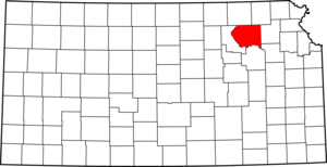
founded=February 20 ,1857
seat=Westmoreland
area_total_km2=2233|area_total_sq_mi=862
area_land_km2=2187|area_land_sq_mi=844
area_water_km2=46|area_water_sq_mi=18
area percentage=2.07%
census estimate yr=2005
pop=19129
density_km2=8.7|density_sq_mi=22.7
time zone=Central
UTC offset=-6
DST offset=-5|Pottawatomie County (standard abbreviation: PT) is a
county located in theU.S. state ofKansas . As of 2000, the population is 18,209. Thecounty seat is Westmoreland.Among the famous natives of Pottawatomie County is Heavyweight Champion
Jess Willard .Pottawatomie County is part of the Manhattan,
Kansas Micropolitan Statistical Area.Law and government
Pottawatomie County was a prohibition, or "dry", county until the
Kansas Constitution was amended in 1986 and voters approved the sale of alcoholic liquor by the individual drink with a 30% food sales requirement. [Cite web| url=http://www.ksrevenue.org/abcwetdrymap.htm| title=Map of Wet and Dry Counties| publisher=Alcoholic Beverage Control, Kansas Department of Revenue| month=November | year=2006| accessdate=2007-12-28]Geography
According to the
U.S. Census Bureau , the county has a total area of 862square mile s (2,233km² ), of which, 844 square miles (2,187 km²) of it is land and 18 square miles (46 km²) of it (2.07%) is water.Adjacent counties
*Marshall County (north)
*Nemaha County (northeast)
*Jackson County (east)
*Shawnee County (southeast)
*Wabaunsee County (south)
*Riley County (west)Demographics
As of the
census GR|2 of 2000, there were 18,209 people, 6,771 households, and 4,929 families residing in the county. Thepopulation density was 22 people per square mile (8/km²). There were 7,311 housing units at an average density of 9 per square mile (3/km²). The racial makeup of the county was 96.32% White, 0.66% Black or African American, 0.59% Native American, 0.32% Asian, 0.01% Pacific Islander, 0.60% from other races, and 1.50% from two or more races. 2.26% of the population were Hispanic or Latino of any race.There were 6,771 households out of which 36.40% had children under the age of 18 living with them, 62.40% were married couples living together, 7.20% had a female householder with no husband present, and 27.20% were non-families. 23.20% of all households were made up of individuals and 9.70% had someone living alone who was 65 years of age or older. The average household size was 2.65 and the average family size was 3.15.
In the county the population was spread out with 29.50% under the age of 18, 7.70% from 18 to 24, 27.70% from 25 to 44, 21.60% from 45 to 64, and 13.50% who were 65 years of age or older. The median age was 36 years. For every 100 females there were 98.00 males. For every 100 females age 18 and over, there were 96.70 males.
The median income for a household in the county was $40,176, and the median income for a family was $47,261. Males had a median income of $31,368 versus $23,238 for females. The
per capita income for the county was $17,785. About 6.40% of families and 9.70% of the population were below thepoverty line , including 14.10% of those under age 18 and 10.30% of those age 65 or over.Cities and towns
Incorporated cities
Name and population (2004 estimate):
*Wamego, 4,224
*St. Marys, 2,246
*Onaga, 686
*Westmoreland, 643 (county seat)
*St. George, 475
*Emmett, 274
*Belvue, 224
*Louisville, 211
*Olsburg, 185
*Havensville, 147
*Wheaton, 92Pottawatomie County also contains a small part of the city of Manhattan.
Townships
Pottawatomie County is divided into twenty-three townships. The city of Manhattan is considered "governmentally independent" and is excluded from the census figures for the townships. In the following table, the population center is the largest city (or cities) included in that township's population total, if it is of a significant size.
Education
Unified school districts
* Wamego USD 320
* Kaw Valley USD 321
* Onaga USD 322
*Rock Creek Schools (Westmoreland and St. George) USD 323ee also
References
External links
* [http://www.pottcounty.org/ Official Website] ;General county information:* [http://skyways.lib.ks.us/counties/PT/ Blue Skyways]
;County Level Data:* [http://www.ku.edu/pri/ksdata/county.shtml Kansas Statistical Abstract]

Wikimedia Foundation. 2010.