- Olsburg, Kansas
-
Olsburg, Kansas — City — Location of Olsburg, Kansas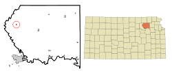
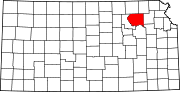
Coordinates: 39°25′52″N 96°36′52″W / 39.43111°N 96.61444°WCoordinates: 39°25′52″N 96°36′52″W / 39.43111°N 96.61444°W Country United States State Kansas County Pottawatomie Area – Total 0.1 sq mi (0.4 km2) – Land 0.1 sq mi (0.4 km2) – Water 0.0 sq mi (0.0 km2) Elevation 1,424 ft (434 m) Population (2000) – Total 192 – Density 1,282.7/sq mi (495.3/km2) Time zone Central (CST) (UTC-6) – Summer (DST) CDT (UTC-5) ZIP code 66520 Area code(s) 785 FIPS code 20-52825[1] GNIS feature ID 0484938[2] Olsburg is a city in Pottawatomie County, Kansas, United States. The population was 192 at the 2000 census, unchanged from 1990. It is part of the Manhattan, Kansas Metropolitan Statistical Area.
Geography
Olsburg is located at 39°25′52″N 96°36′52″W / 39.43111°N 96.61444°W (39.431052, -96.614439)[3].
According to the United States Census Bureau, the city has a total area of 0.2 square miles (0.52 km2), all of it land.
Demographics
Historical populations Census Pop. %± 1990 192 — 2000 192 0% U.S. Decennial Census As of the census[1] of 2000, there are 192 people, 80 households, and 63 families residing in the city. The population density is 1,282.7 people per square mile (494.2/km²). There are 85 housing units at an average density of 567.9 per square mile (218.8/km²). The racial makeup of the city is 99.48% White and 0.52% Native American.
There are 80 households out of which 26.3% have children under the age of 18 living with them, 68.8% are married couples living together, 7.5% have a female householder with no husband present, and 21.3% are non-families. 18.8% of all households are made up of individuals and 5.0% have someone living alone who is 65 years of age or older. The average household size is 2.40 and the average family size is 2.75.
In the city the population is spread out with 21.4% under the age of 18, 9.9% from 18 to 24, 24.5% from 25 to 44, 17.7% from 45 to 64, and 26.6% who are 65 years of age or older. The median age is 42 years. For every 100 females there are 100.0 males. For every 100 females age 18 and over, there are 104.1 males.
The median income for a household in the city is $37,969, and the median income for a family is $39,531. Males have a median income of $27,386 versus $23,281 for females. The per capita income for the city is $14,268. 5.0% of the population and 7.2% of families are below the poverty line. Out of the total population, none of those under the age of 18 and 19.1% of those 65 and older are living below the poverty line.
References
- ^ a b "American FactFinder". United States Census Bureau. http://factfinder.census.gov. Retrieved 2008-01-31.
- ^ "US Board on Geographic Names". United States Geological Survey. 2007-10-25. http://geonames.usgs.gov. Retrieved 2008-01-31.
- ^ "US Gazetteer files: 2010, 2000, and 1990". United States Census Bureau. 2011-02-12. http://www.census.gov/geo/www/gazetteer/gazette.html. Retrieved 2011-04-23.
Municipalities and communities of Pottawatomie County, Kansas Cities Belvue | Emmett | Havensville | Louisville | Manhattan‡ | Olsburg | Onaga | St. George | St. Marys‡ | Wamego | Westmoreland | Wheaton
Unincorporated
communityFostoria
Footnotes ‡This populated place also has portions in an adjacent county or counties
Categories:- Populated places in Pottawatomie County, Kansas
- Cities in Kansas
- Manhattan, Kansas metropolitan area


Wikimedia Foundation. 2010.