- Wamego, Kansas
Infobox Settlement
official_name = Wamego, Kansas
settlement_type =City
nickname =
motto =
imagesize =
image_caption =
image_
imagesize =
image_caption =
image_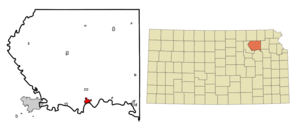
mapsize = 250px
map_caption = Location of Wamego, Kansas
mapsize1 =
map_caption1 =subdivision_type = Country
subdivision_name =United States
subdivision_type1 = State
subdivision_name1 =Kansas
subdivision_type2 = County
subdivision_name2 = Pottawatomie
government_footnotes =
government_type =
leader_title =
leader_name =
leader_title1 =
leader_name1 =
established_title =
established_date =unit_pref = Imperial
area_footnotes =
area_magnitude =
area_total_km2 = 4.3
area_land_km2 = 4.2
area_water_km2 = 0.1
area_total_sq_mi = 1.7
area_land_sq_mi = 1.6
area_water_sq_mi = 0.0population_as_of = 2000
population_footnotes =
population_total = 4246
population_density_km2 = 1009.8
population_density_sq_mi = 2615.3timezone = Central (CST)
utc_offset = -6
timezone_DST = CDT
utc_offset_DST = -5
elevation_footnotes =
elevation_m = 302
elevation_ft = 991
latd = 39 |latm = 12 |lats = 15 |latNS = N
longd = 96 |longm = 18 |longs = 30 |longEW = Wpostal_code_type =
ZIP code
postal_code = 66547
area_code = 785
blank_name = FIPS code
blank_info = 20-75325GR|2
blank1_name = GNIS feature ID
blank1_info = 0476420GR|3
website =
footnotes =Wamego (pronEng|wɔˈmiɡo) is a city in Pottawatomie County,
Kansas ,United States . The population was 4,246 at the 2000 census. It is part of theManhattan, Kansas Micropolitan Statistical Area.History
On
7 November 2000 , the U.S.Drug Enforcement Administration discovered one of the country's largestLSD lab inside a converted military missile silo in Wamego. [ [http://www2.ljworld.com/news/2000/nov/22/lsd_lab_rivals "LSD lab rivals largest in U.S."] , "Lawrence Journal-World ",2000-11-22 . Accessed2007-08-07 .]Geography
Wamego is located at coor dms|39|12|15|N|96|18|30|W|city (39.204074, -96.308328)GR|1.
According to the
United States Census Bureau , the city has a total area of 1.7square mile s (4.3km² ), of which, 1.6 square miles (4.2 km²) of it is land and 0.04 square miles (0.1 km²) of it (2.40%) is water.Wamego is located at the intersection of U.S. Route 24 and K-99. It is about 26km (17mi) east of Manhattan, home of
Kansas State University ; and about 75km (35 mi) west-northwest of Topeka, the state capital. TheKansas River flows along the southern edge of the city.Demographics
As of the
census GR|2 of 2000, there were 4,246 people, 1,630 households, and 1,155 families residing in the city. Thepopulation density was 2,615.3 people per square mile (1,012.0/km²). There were 1,740 housing units at an average density of 1,071.7/sq mi (414.7/km²). The racial makeup of the city was 96.75% White, 0.73% African American, 0.35% Native American, 0.12% Asian, 0.78% from other races, and 1.27% from two or more races. Hispanic or Latino of any race were 1.88% of the population.There were 1,630 households out of which 38.3% had children under the age of 18 living with them, 56.7% were married couples living together, 10.8% had a female householder with no husband present, and 29.1% were non-families. 25.1% of all households were made up of individuals and 11.8% had someone living alone who was 65 years of age or older. The average household size was 2.57 and the average family size was 3.09.
In the city the population was spread out with 29.4% under the age of 18, 8.9% from 18 to 24, 29.3% from 25 to 44, 17.8% from 45 to 64, and 14.6% who were 65 years of age or older. The median age was 34 years. For every 100 females there were 93.3 males. For every 100 females age 18 and over, there were 88.7 males.
The median income for a household in the city was $38,115, and the median income for a family was $46,017. Males had a median income of $29,881 versus $21,974 for females. The
per capita income for the city was $16,307. About 5.7% of families and 8.6% of the population were below thepoverty line , including 9.1% of those under age 18 and 18.0% of those age 65 or over.Industry
The primary industry of the area is
agriculture . The broad river valley is used to growalfalfa ,sweetcorn ,maize andwheat . In the hills around the city, rocky pastures support herds ofcattle . There is a processing plant foralfalfa in Wamego. The other major industry is a factory which produces attachments for earth-moving and other heavy construction equipment, wholly owned byCaterpillar, Inc. . Many of the residents of the city commute to nearby areas for employment, chiefly Manhattan and Topeka.Education
Wamego is served by Unified School District 320, which provides Kindergarten through 12th grade public education. Highland Community College has a branch facility in the city.
Oz
Wamego is fast approaching the status of "Oz Capital of the World" due to the The Wizard of Oz [ [http://www.ozmuseum.com/ The OZ Museum - Wamego, Kansas ] ] Museum, and other local Oz-related businesses. The Oz Museum was founded in April 2004 and houses one of the largest public displays of Oz memorabilia in existence. The majority of the collection belongs to Todd Machin, who began collecting Oz memorabilia while doing a term paper on
The Wonderful Wizard of Oz in college. Other oz-related businesses in Wamego are "Toto's Tacos," the "Scizzors of Ahhhz," the "Emerald City Market", the "Flying Monkey Business", and the "Oz Winery". A stretch of highway 99 that passes through Wamego is called "The Road to Oz Highway." Every October, Wamego hosts Oztoberfest.Filmmaking
Wamego served as the backdrop for the independent film production of
Steve Balderson 's surrealist crime drama, "Firecracker". Named onRoger Ebert 's list of the year's best films (2005), the film is based on a true crime that happened in Wamego. Balderson, a Wamego-native, used actual locations where the crime occurred.ports in Wamego
Wamego supports a recreation department that hosts soccer, volleyball, and basketball. In addition, they have an independent swim team that recorded over 75 members in 2006.Fact|date=September 2007
Points of interest
*
The Columbian Theatre
*The Oz Museum
*Wamego City Park and WindmillNotable natives and residents
*
Steve Balderson , filmmaker
*Walter Chrysler , automobile manufacturer
*Travis Metcalf , professional baseball playerReferences
External links
;Official websites:* [http://www.visitWamego.com/ Visit Wamego] :* [http://www.wamego.org/ City of Wamego] :* [http://www.usd320.k12.ks.us/ Unified School District 320]
Wikimedia Foundation. 2010.