- Leawood, Kansas
Infobox Settlement
official_name = Leawood, Kansas
settlement_type =City
nickname =
motto =
imagesize =
image_caption =
image_
imagesize =
image_caption =
image_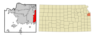
mapsize = 250x200px
map_caption = Location of Leawood, Kansas
mapsize1 =
map_caption1 =subdivision_type = Country
subdivision_name =United States
subdivision_type1 = State
subdivision_name1 =Kansas
subdivision_type2 = County
subdivision_name2 = Johnson
government_footnotes =
government_type =
leader_title =
leader_name =
leader_title1 =
leader_name1 =
established_title =
established_date =unit_pref = Imperial
area_footnotes =area_magnitude =
area_total_km2 = 39.1
area_land_km2 = 39.1
area_water_km2 = 0.0
area_total_sq_mi = 15.1
area_land_sq_mi = 15.1
area_water_sq_mi = 0.0population_as_of = 2000
population_footnotes =
population_total = 27656
population_density_km2 = 707.9
population_density_sq_mi = 1833.4timezone = Central (CST)
utc_offset = -6
timezone_DST = CDT
utc_offset_DST = -5
elevation_footnotes =
elevation_m = 287
elevation_ft = 942
latd = 38 |latm = 55 |lats = 15 |latNS = N
longd = 94 |longm = 37 |longs = 20 |longEW = Wpostal_code_type =
postal_code =
area_code = 913
blank_name = FIPS code
blank_info = 20-39075GR|2
blank1_name = GNIS feature ID
blank1_info = 0479275GR|3
website =
footnotes =Leawood is a city in Johnson County,
Kansas ,United States and is part of theKansas City Metropolitan Area . The population was 27,656 at the 2000 census.Geography
Leawood is located at coor dms|38|55|15|N|94|37|20|W|city (38.920802, -94.622118)GR|1.
According to the
United States Census Bureau , the city has a total area of 15.1square mile s (39.1km² ), of which, 15.1 square miles (39.1 km²) of it is land and 0.07% is water.Demographics
As of the
census GR|2 of 2000, there were 27,656 people, 9,841 households, and 8,118 families residing in the city. Thepopulation density was 1,833.4 people per square mile (708.1/km²). There were 10,129 housing units at an average density of 671.5/sq mi (259.3/km²). The racial makeup of the city was 95.19% White, 1.46% African American, 0.14% Native American, 2.18% Asian, 0.01% Pacific Islander, 0.25% from other races, and 0.77% from two or more races. Hispanic or Latino of any race were 1.30% of the population.There were 9,841 households out of which 41.4% had children under the age of 18 living with them, 76.0% were married couples living together, 5.1% had a female householder with no husband present, and 17.5% were non-families. 15.2% of all households were made up of individuals and 6.5% had someone living alone who was 65 years of age or older. The average household size was 2.81 and the average family size was 3.14.
In the city the population was spread out with 30.2% under the age of 18, 4.2% from 18 to 24, 23.2% from 25 to 44, 29.8% from 45 to 64, and 12.6% who were 65 years of age or older. The median age was 41 years. For every 100 females there were 96.1 males. For every 100 females age 18 and over, there were 93.3 males.
The median income for a household in the city was $102,496, and the median income for a family was $113,058. Males had a median income of $90,546 versus $43,933 for females. The
per capita income for the city was $49,139. About 0.5% of families and 1.3% of the population were below thepoverty line , including 0.5% of those under age 18 and 2.8% of those age 65 or over.Libraries
The [http://www.jocolibrary.org Johnson County Library] serves the residents of Leawood. Its [http://www.jocolibrary.org/index.asp?DisplayPageID=324 Pioneer Library] branch is in Leawood.
Government
The current mayor of Leawood is Peggy Dunn. [cite web |url=http://www.leawood.org/council/default.aspx |title=Leawood City Council |accessdate=2008-03-29 Fact|date=July 2007]
Fast food
For many years, Leawood upheld a ban on fast food establishments within the city limits. Since the late 1990s the ordinances prohibiting gas stations and fast food restaurants have been revoked.
References
External links
* [http://www.leawood.org/ City of Leawood website]
* [http://www.google.com/maps?q=leawood,Kansas+66209&ll=38.916504,-94.639440&spn=0.125999,0.180416&t=k&hl=en Satellite Image] of Leawood, Kansas
Wikimedia Foundation. 2010.