- South Sioux City, Nebraska
Infobox Settlement
official_name = South Sioux City, Nebraska
settlement_type =City
nickname =
motto =
imagesize =
image_caption =
image_
imagesize =
image_caption =
image_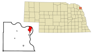
mapsize = 250px
map_caption = Location of South Sioux City, Nebraska
mapsize1 =
map_caption1 =subdivision_type = Country
subdivision_name =United States
subdivision_type1 = State
subdivision_name1 =Nebraska
subdivision_type2 = County
subdivision_name2 = Dakota
government_footnotes =
government_type =
leader_title =
leader_name =
leader_title1 =
leader_name1 =
established_title =
established_date =unit_pref = Imperial
area_footnotes =area_magnitude =
area_total_km2 = 13.5
area_land_km2 = 12.7
area_water_km2 = 0.8
area_total_sq_mi = 5.2
area_land_sq_mi = 4.9
area_water_sq_mi = 0.3population_as_of = 2000
population_footnotes =
population_total = 11925
population_density_km2 = 938.8
population_density_sq_mi = 2431.6timezone = Central (CST)
utc_offset = -6
timezone_DST = CDT
utc_offset_DST = -5
elevation_footnotes =
elevation_m = 336
elevation_ft = 1102
latd = 42 |latm = 28 |lats = 16 |latNS = N
longd = 96 |longm = 24 |longs = 53 |longEW = Wpostal_code_type =
ZIP code
postal_code = 68776
area_code = 402
blank_name = FIPS code
blank_info = 31-46030GR|2
blank1_name = GNIS feature ID
blank1_info = 0833621GR|3
website =
footnotes =South Sioux City is a city in Dakota County,
Nebraska , in theUnited States . It is part of the Sioux City/Iowa /Nebraska /South Dakota Metropolitan Statistical Area . As of the 2000 census, the city population was 11,925.South Sioux City is located immediately across the
Missouri River fromSioux City, Iowa , and is part of the Sioux City metropolitan area.History
Meriwether Lewis and William Clark passed through the South Sioux City area in1804 .Geography
South Sioux City is located at coor dms|42|28|16|N|96|24|53|W|city (42.471095, -96.414732)GR|1.
According to the
United States Census Bureau , the city has a total area of 5.2square mile s (13.5km² ), of which, 4.9 square miles (12.7 km²) of it is land and 0.3 square miles (0.8 km²) of it (5.77%) is water.In contrast to its hilly larger neighbor, South Sioux City is extremely flat. The difference in elevation across most of the city is less than 10 feet, generally ranging between 1,093 and 1,103 feet above
sea level .fact|date=April 2007Transportation
Highways
Several highways serve South Sioux City:
*Interstate 129 is a short east-west spur beginning atInterstate 29 in Sioux City. It enters South Sioux City via a bridge over theMissouri River , and crosses the southern end of South Sioux City with interchanges at Dakota Avenue (the city's main street) andU.S. Highway 77 . Interstate 129 is multiplexed withU.S. Highway 20 andU.S. Highway 75 .
*U.S. Highway 77 is a north-south highway whose northern terminus is atInterstate 29 in Sioux City. From there, it enters South Sioux City via the Veterans Memorial Bridge, follows Dakota Avenue to 9th Street, then arcs west and south as a four-lane bypass around the city. In 1989, a large strip mall anchored byWal-Mart andHy-Vee opened along the bypass and effectively shifted the city's primary retail district from Dakota Avenue, in the center of town, to the western edge of the city.Public transit
Local bus service to South Sioux City is provided by the Sioux City Transit System.
Aviation
The nearest commercial airport is Sioux Gateway Airport/Colonel Bud Day Field (SUX) in Sioux City. A smaller general-aviation airport, Martin Field (7K8), is located just west of South Sioux City along
U.S. Highway 20 .Demographics
As of the
census GR|2 of 2000, there were 11,925 people, 4,304 households, and 2,961 families residing in the city.Of the 11,925 people, 48.6% are male and 51.4% are female.Thepopulation density was 2,431.6 people per square mile (939.6/km²). There were 4,557 housing units at an average density of 929.2/sq mi (359.1/km²). The racial makeup of the city was 75.88% White, 0.86% African American, 2.36% Native American, 3.19% Asian, 0.09% Pacific Islander, 14.57% from other races, and 3.05% from two or more races. Hispanic or Latino of any race were 24.81% of the population.There were 4,304 households out of which 38.9% had children under the age of 18 living with them, 49.7% were married couples living together, 13.7% had a female householder with no husband present, and 31.2% were non-families. 25.6% of all households were made up of individuals and 10.3% had someone living alone who was 65 years of age or older. The average household size was 2.72 and the average family size was 3.26.
In the city the population was spread out with 29.8% under the age of 18, 11.1% from 18 to 24, 29.6% from 25 to 44, 19.2% from 45 to 64, and 10.4% who were 65 years of age or older. The median age was 31 years. For every 100 females there were 94.6 males. For every 100 females age 18 and over, there were 92.0 males.
The median income for a household in the city was $36,493, and the median income for a family was $42,712. Males had a median income of $27,259 versus $21,709 for females. The
per capita income for the city was $16,165. About 10.1% of families and 11.5% of the population were below thepoverty line , including 14.9% of those under age 18 and 8.3% of those age 65 or over.Education
For population 25 years and over in South Sioux City
* High school or higher: 72.7%
* Bachelor's degree or higher: 12.7%
* Graduate or professional degree: 4.8%
* Unemployed: 4.1%
* Mean travel time to work: 15.3 minutesOther
According to research there were 36 registered sex offenders living in South Sioux City in early 2007.The ratio of number of residents in South Sioux City to the number of sex offenders is 333 to 1.
References
External links
* [http://www.casde.unl.edu/history/counties/dakota/southsioux/southsioux.htm/ A brief history of South Sioux City]
* [http://www.southsiouxcity.org/ City of South Sioux City]
Wikimedia Foundation. 2010.