- Lost Springs, Kansas
Infobox Settlement
official_name = Lost Springs, Kansas
settlement_type =City
nickname =
motto =
imagesize =
image_caption =
image_
imagesize =
image_caption =
image_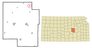
mapsize = 250px
map_caption = Location of Lost Springs, Kansas
mapsize1 =
map_caption1 =subdivision_type = Country
subdivision_name =United States
subdivision_type1 = State
subdivision_name1 =Kansas
subdivision_type2 = County
subdivision_name2 = Marion
government_footnotes =
government_type =
leader_title =
leader_name =
leader_title1 =
leader_name1 =
established_title =
established_date =unit_pref = Imperial
area_footnotes =area_magnitude =
area_total_km2 = 0.6
area_land_km2 = 0.6
area_water_km2 = 0.0
area_total_sq_mi = 0.2
area_land_sq_mi = 0.2
area_water_sq_mi = 0.0population_as_of = 2000
population_footnotes =
population_total = 71
population_density_km2 = 119.0
population_density_sq_mi = 308.3timezone = Central (CST)
utc_offset = -6
timezone_DST = CDT
utc_offset_DST = -5
elevation_footnotes =
elevation_m = 455
elevation_ft = 1493
latd = 38 |latm = 33 |lats = 59 |latNS = N
longd = 96 |longm = 57 |longs = 55 |longEW = Wpostal_code_type =
ZIP code
postal_code = 66859
area_code = 785
blank_name = FIPS code
blank_info = 20-42825GR|2
blank1_name = GNIS feature ID
blank1_info = 0477142GR|3
website =
footnotes =Lost Springs is a city in Marion County,
Kansas ,United States . The population was 71 at the 2000 census.Geography
Lost Springs is located at coor dms|38|33|59|N|96|57|55|W|city (38.566495, -96.965225)GR|1.
According to the
United States Census Bureau , the city has a total area of 0.2square mile s (0.6km² ), all of it land.Demographics
As of the
census GR|2 of 2000, there were 71 people, 30 households, and 23 families residing in the city. Thepopulation density was 308.3 people per square mile (119.2/km²). There were 34 housing units at an average density of 147.6/sq mi (57.1/km²). The racial makeup of the city was 92.96% White, 1.41% Native American, 2.82% from other races, and 2.82% from two or more races. Hispanic or Latino of any race were 7.04% of the population.There were 30 households out of which 36.7% had children under the age of 18 living with them, 56.7% were married couples living together, 16.7% had a female householder with no husband present, and 23.3% were non-families. 23.3% of all households were made up of individuals and 13.3% had someone living alone who was 65 years of age or older. The average household size was 2.37 and the average family size was 2.70.
In the city the population was spread out with 28.2% under the age of 18, 5.6% from 18 to 24, 25.4% from 25 to 44, 28.2% from 45 to 64, and 12.7% who were 65 years of age or older. The median age was 39 years. For every 100 females there were 91.9 males. For every 100 females age 18 and over, there were 82.1 males.
The median income for a household in the city was $15,455, and the median income for a family was $16,250. Males had a median income of $15,625 versus $11,250 for females. The
per capita income for the city was $7,227. There were 15.8% of families and 21.7% of the population living below thepoverty line , including 29.4% of under eighteens and none of those over 64.Railroads
Lost Springs is served by the
Union Pacific Railroad , formerly theOklahoma, Kansas and Texas Railroad , and prior, theChicago, Rock Island and Pacific Railroad . Lost Springs is located on UP's Texas main line toFort Worth, Texas . Arail siding is located there for meets with passing trains, before entering UP'sHerington, Kansas yard. The Burlington Northern Santa Fe Railway, formerly theAtchison, Topeka and Santa Fe Railway, also has a line that enters the area, and connects with the UP at the Northeast corner of town. At one time this line crossed over the UP at adiamond crossing , and continued east towardsBurdick, Kansas , but this has since been torn out.References
External links
Wikimedia Foundation. 2010.