- Marion, Kansas
-
Marion, Kansas — City — Marion County Courthouse, 2009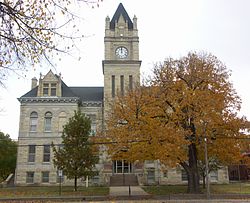 Location of Marion, Kansas
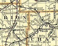
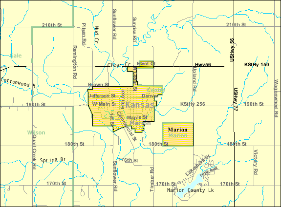
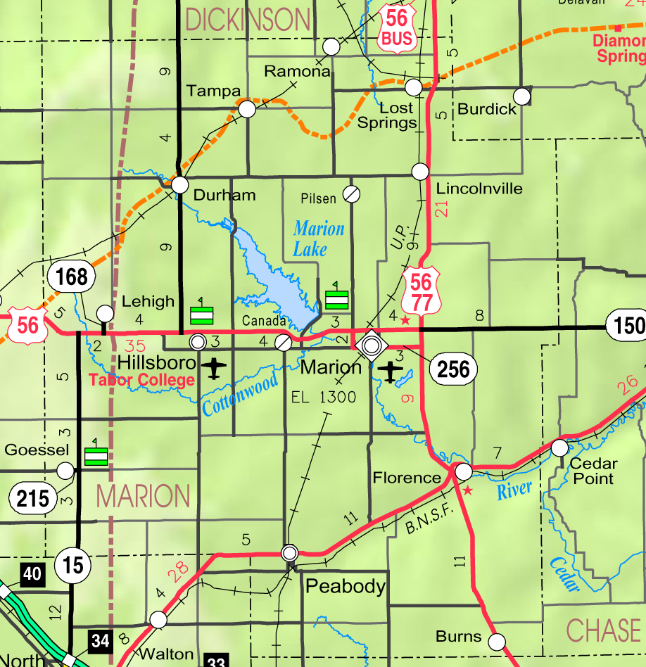
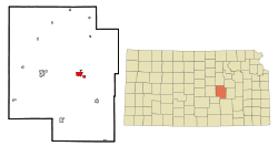 Detailed map of Marion, Kansas area
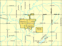
Coordinates: 38°20′56″N 97°0′58″W / 38.34889°N 97.01611°WCoordinates: 38°20′56″N 97°0′58″W / 38.34889°N 97.01611°W Country  United States
State  Kansas
County Marion Platted 1866, 1871, 1873 Incorporated 1888 Government – Type Mayor–Council – Mayor Mary Olson[1] – City Clerk Angela Lange[1] Area – Total 2.2 sq mi (5.8 km2) – Land 2.2 sq mi (5.8 km2) – Water 0.0 sq mi (0.0 km2) Elevation 1,312 ft (400 m) Population (2010)[2] – Total 1,927 Time zone Central (CST) (UTC-6) – Summer (DST) CDT (UTC-5) ZIP code 66861 Area code(s) 620 FIPS code 20-44750[3] GNIS feature ID 0477366[4] Website www.MarionKS.com W i k i p e d i a Marion is a city in and the county seat of Marion County, Kansas, United States.[5] It was named in honor of Francis Marion, a Brigadier General of the American Revolutionary War, known as the "Swamp Fox".[6] As of the 2010 census, the city population was 1,927.[2]
Contents
History
19th century
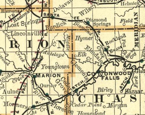
 1893 Railroad Map.
For millennia, the land that is currently Kansas was inhabited by Native Americans. In 1803, most of modern Kansas was secured by the United States as part of the Louisiana Purchase. In 1806, Zebulon Pike led the Pike expedition westward from St Louis, Missouri, of which part of their journey followed the Cottonwood River through Marion County near the current towns of Florence, Marion, Durham.[7]
In 1855, Marion County, where Marion is located, was founded. The city of Marion Centre was founded in 1860, became the county seat, and later the name was shortened to Marion.
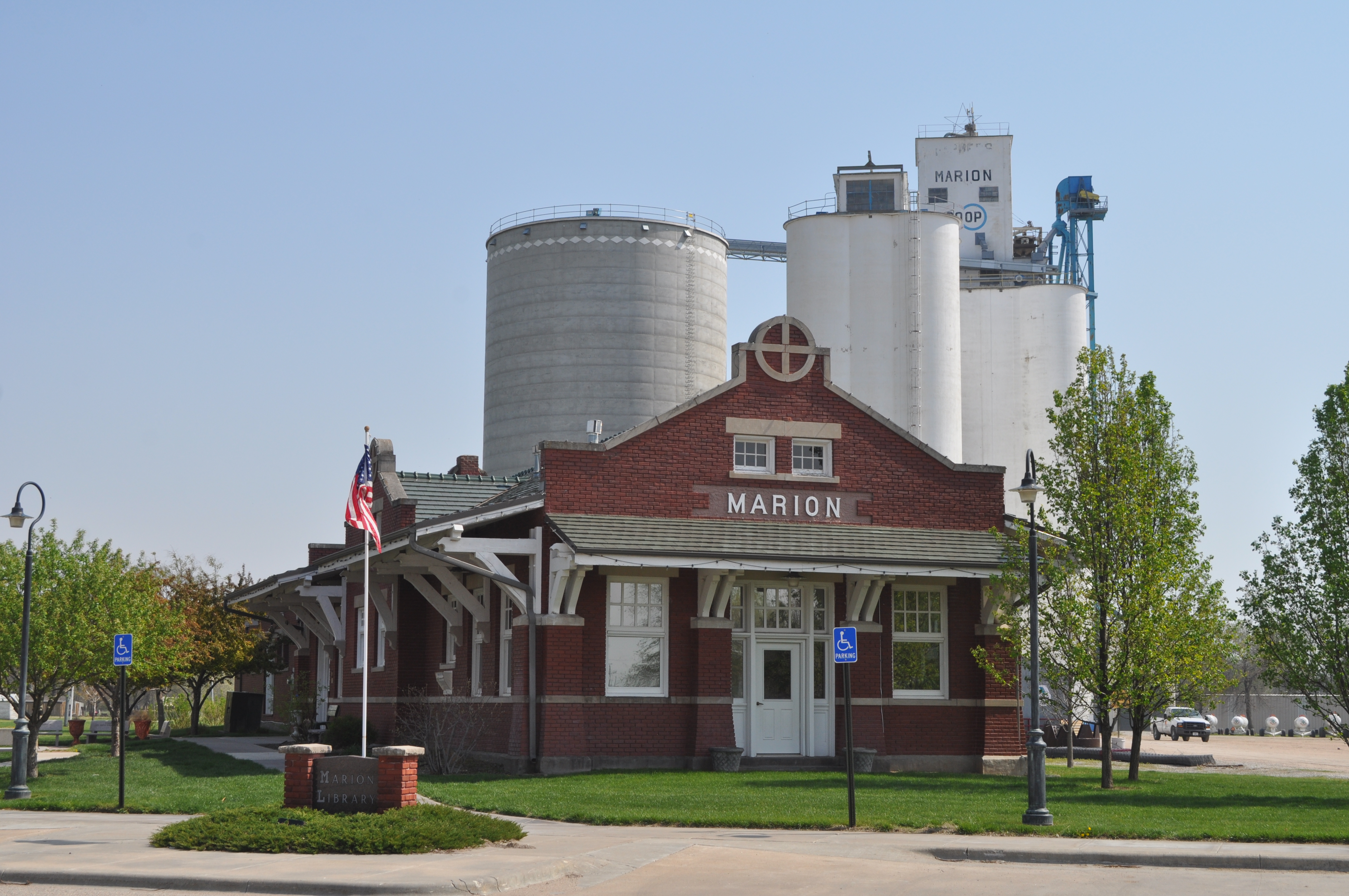
As early as 1875, city leaders of Marion held a meeting to consider a branch railroad from Florence. In 1878, Atchison, Topeka and Santa Fe Railway and parties from Marion County and McPherson County chartered the Marion and McPherson Railway Company.[8] In 1879, a branch line was built from Florence to McPherson, in 1880 it was extended to Lyons, in 1881 it was extended to Ellinwood.[9] The line was leased and operated by the Atchison, Topeka and Santa Fe Railway. The line from Florence to Marion, was abandoned in 1968.[10] In 1992, the line from Marion to McPherson was sold to Central Kansas Railway. In 1993, after heavy flood damage, the line from Marion to McPherson was abandoned. The original branch line connected Florence, Marion, Canada, Hillsboro, Lehigh, Canton, Galva, McPherson, Conway, Windom, Little River, Mitchell, Lyons, Chase, Ellinwood. Later, the Santa Fe depot building was converted into the Marion Library. Most locals still refer to this railroad as the "Santa Fe".
In 1887, the Chicago, Kansas and Nebraska Railway built a branch line north-south from Herington through Marion to Caldwell.[11] It foreclosed in 1891 and was taken over by Chicago, Rock Island and Pacific Railway, which shut down in 1980 and reorganized as Oklahoma, Kansas and Texas Railroad, merged in 1988 with Missouri Pacific Railroad, and finally merged in 1997 with Union Pacific Railroad. Most locals still refer to this railroad as the "Rock Island".
In 1889, the Marion Belt and Chingawasa Springs Railroad built a 4.5-mile (7.2 km) railroad from Marion north-east to Chingawasa Springs. A hotel was built near the site of the spa at Chingawasa Springs, and a depot and eatery as well. Both Santa Fe and Rock Island offered round trip fares from Chicago and western cities to Chingawasa Springs. An economic panic in 1893 closed down the health spa and hotel, and quarry business along the tracks never developed sufficiently. In 1893, the railroad ceased operations, and tracks were removed in 1910.[12][13]
20th century
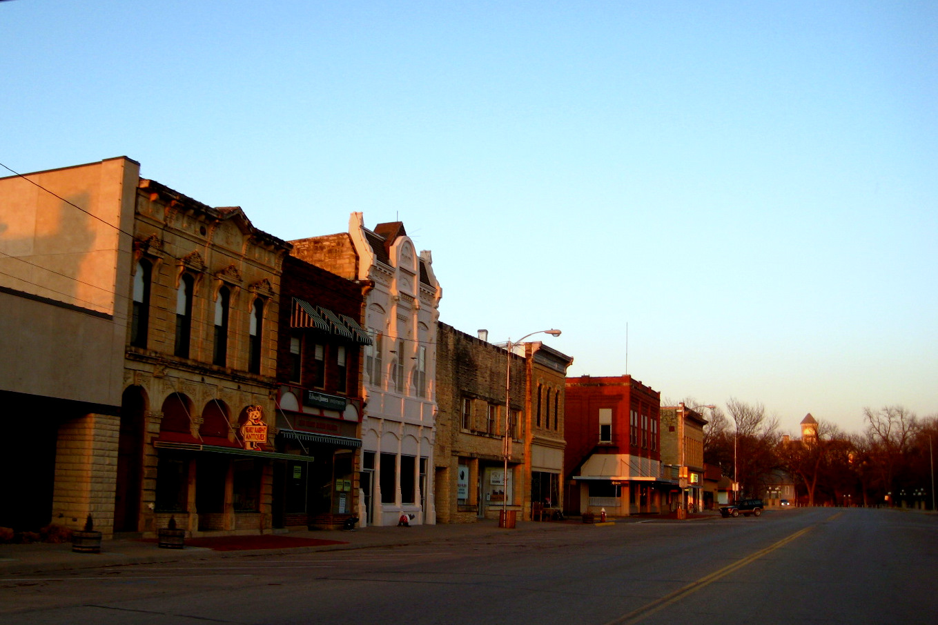
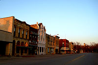 Marion business district, 2009
The National Old Trails Road, also known as the Ocean-to-Ocean Highway, was established in 1912, and was routed through Lehigh, Hillsboro, Marion, Lost Springs.
In 1937, the Marion County Park and Lake was completed by the Civilian Conservation Corps south-east of Marion for the purpose of recreation. There has been numerous floods during the early history of Marion. In June and July 1951, due to heavy rains, rivers and streams flooded numerous cities in Kansas, including Marion. Many reservoirs and levees were built in Kansas as part of a response to the Great Flood of 1951. From 1964 to 1968, the Marion Reservoir was constructed north-west of Marion. Downstream from the Marion Reservoir, levee's were built in the low areas of Marion and Florence.
21st century
In 2010, the Keystone-Cushing Pipeline (Phase II) was constructed west of Marion, north to south through Marion County, with much controversy over road damage, tax exemption, and environmental concerns (if a leak ever occurs).[14][15][16]
Geography
Marion is located at 38°20′56″N 97°0′58″W / 38.34889°N 97.01611°W (38.348952, -97.016037)[17], in the scenic Flint Hills. According to the United States Census Bureau, the city has a total area of 2.2 square miles (5.7 km2), all of it land except the Cottonwood River.
Area events
Area attractions
Marion has five listings on the National Register of Historic Places (NRHP).
- Elgin Hotel[18] (NRHP), 115 North 3rd Street. Currently a Bed and Breakfast.
- First Presbyterian Church[19] (NRHP), 610 East Lawrence Street.
- Hill Grade School[20] (NRHP), 601 East Main Street.
- Marion County Courthouse[21] (NRHP), 200 South 3rd Street.
- Marion County Museum, 623 East Main Street. Formerly the First Baptist Church from 1882 to mid-1950s.
- Marion County Park and Lake, 1-mile (1.6 km) east of Marion on 190th Street (Main) then 1.75 miles (2.82 km) south on Upland Road.
- Marion Reservoir, exits closest to farther from Marion along US-56: Marion cove and Cottonwood Point cove (Pawnee Road), Overlook and Dam (Old Mill Road), Hillsboro cove (Nighthawk Road), French Creek cove (Limestone Road).
Demographics
Historical populations Census Pop. %± 1880 857 — 1890 2,047 138.9% 1900 1,824 −10.9% 1960 2,169 — 1970 2,052 −5.4% 1980 1,951 −4.9% 1990 1,906 −2.3% 2000 2,110 10.7% 2010 1,927 −8.7% U.S. Decennial Census As of the census[3] of 2000, there were 2,110 people, 859 households, and 556 families residing in the city. The population density was 948.6 people per square mile (367.0/km²). There were 968 housing units at an average density of 435.2 per square mile (168.4/km²). The racial makeup of the city was 97.58% White, 0.05% African American, 0.81% Native American, 0.09% Asian, 0.24% from other races, and 1.23% from two or more races. Hispanic or Latino of any race were 1.37% of the population.
There were 859 households out of which 29.7% had children under the age of 18 living with them, 55.8% were married couples living together, 5.8% had a female householder with no husband present, and 35.2% were non-families. 31.9% of all households were made up of individuals and 20.8% had someone living alone who was 65 years of age or older. The average household size was 2.34 and the average family size was 2.94.
In the city the population was spread out with 25.5% under the age of 18, 5.5% from 18 to 24, 22.8% from 25 to 44, 19.6% from 45 to 64, and 26.6% who were 65 years of age or older. The median age was 42 years. For every 100 females there were 86.4 males. For every 100 females age 18 and over, there were 83.0 males.
The median income for a household in the city was $32,125, and the median income for a family was $42,202. Males had a median income of $30,907 versus $23,929 for females. The per capita income for the city was $16,464. About 5.3% of families and 6.7% of the population were below the poverty line, including 8.5% of those under age 18 and 7.5% of those age 65 or over.
Government
City
The Marion government consists of a mayor and four council members. The council meets every other Monday at 4:30PM.[1]
- City Hall, 203 N 3rd St.
- Police and Fire Department, 112 N 5th St.
County
- Marion County Courthouse, 203 S 4th St.
U.S.
- U.S. Post Office, 423 E Main St.
- U.S. Consolidated Farm Service Agency, 301 Eisenhower Dr.
Education
Primary and secondary education
Marion is part of Unified School District 408.[22][23] The high school is a member of T.E.E.N., a shared video teaching network between five area high schools.[24]
- Marion High School (Kansas), 701 E Main St.
- Marion Middle School, 125 S Lincoln St.
- Marion Elementary School, 1400 E Lawrence St.
Sports
The Marion High School mascot is a Warrior. All high school athletic and non-athletic competition is overseen by the Kansas State High School Activities Association. For 2010/2011 seasons, the football team competes as Class 3A.[25] Recently the City of Marion and Unified School District 408 jointly build a gymnasium and indoor swimming pool. Located just south of Marion Elementary School, the pool is open all year round and the gym features a walking track above a sunken gymnasium floor.[26] The bond issue that financed the project also built a new auditorium on the Marion High School campus.[citation needed]
Library
Each USD 408 school has a library for student access. The city is served by the Marion City Library at 101 Library Street. The library is a member of the North Central Kansas Libraries System, which provides an inter-library book loan service between its members.
Media
Print
- Marion County RECORD, local newspaper in Marion.
- The Wichita Eagle, major regional newspaper in Wichita.
Radio
Marion is served by numerous radio stations of the Wichita-Hutchinson listening market area,[27] and satellite radio. See Media in Wichita, Kansas.
Television
Marion is served by over-the-air ATSC digital TV of the Wichita-Hutchinson viewing market area,[28] cable TV, and satellite TV. See Media in Wichita, Kansas.
Infrastructure
Transportation
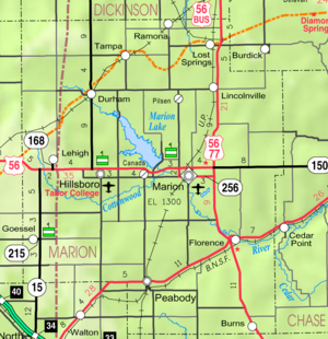
U.S. Route 56 runs along the city's northern side, and U.S. Route 77 is 2 miles (3.2 km) east of the city. Kansas Highway 256 runs through the center of town as Main Street, past the east end business section, Marion High School and the downtown business district. A regional Kansas Department of Transportation office is located on the north side of Marion at the corner of U.S. Route 56 and Cedar Street. The Oklahoma Kansas Texas (OKT)[29] line of the Union Pacific Railroad runs north-south through the city. Marion Municipal Airport, FAA:43K,[30] is located south-east of Marion and centered at 38°20′15″N 96°59′30″W / 38.337500°N 96.991666°W.[31]
Utilities
- Internet
- Cable is provided by Eagle Communications.
- Satellite is provided by HughesNet, StarBand, WildBlue.
- TV
- Cable is provided by Eagle Communications.
- Satellite is provided by DirecTV, Dish Network.
- Terrestrial is provided by regional digital TV stations.
- Electricity
- City is provided by City of Marion.
- Rural is provided by Flint Hills RECA.
- Water
- City is provided by City of Marion.
- Rural is provided by Marion County RWD #4.
- Sewer is provided by City of Marion.
- Trash is provided by City of Marion.
Notable people
- Levi Billings, (18xx-18xx), Kansas House of Representatives[32]
- Orley C. Billings, (1869-19xx), Kansas House of Representatives,[32] Lumber
- Charles O. Fuller, (1825–1879), Kansas House of Representatives,[32] Businessman, Farmer
- Ferdinand J. Funk, (1860-19xx) Kansas House of Representatives,[32] Farmer, Printer, Realtor
- Edward Wallis Hoch, (1849–1925), Kansas House of Representatives,[32] 17th Governor of Kansas, editor of Marion County Record
- Homer Hoch, (1879–1949), U.S. Congressman, member of Kansas Supreme Court, Lawyer, editor of Marion County Record
- Braden C. Johnston, (1889-19xx), Kansas House of Representatives,[32] Lawyer
- Horace Greeley Kyle, (1861-19xx), Kansas House of Representatives,[32] Farmer[33]
- Eric K. Meyer, (born 1953), journalism professor at University of Illinois, Pulitzer Prize nominee, president and majority owner of Hoch Publishing Co (in Marion)
- Atlantic "Lank" Abraham Moore, (1834-1xxx), Kansas House of Representatives,[32] Rancher
- Samuel R. Peters, (1842–1910), Kansas House of Representatives,[32] Kansas State Senate, Judge of 9th District, Captain in Union Army, Lawyer, Newton Postmaster, Editor
- John H. Riddle, (1899–1995), Kansas House of Representatives,[32] Civil Engineer
- Taylor Riddle, (18xx-19xx), Kansas House of Representatives[32]
- Reuben Riggs, (18xx-1xxx), Kansas House of Representatives,[32] Lawyer
- Dallas Rogers, (18xx-1xxx), Kansas House of Representatives[32]
- J. Newton Rogers, (18xx-1xxx), Kansas House of Representatives,[32] Physician
- Carla Stovall Steckline, (born 1957), Kansas Attorney General
- Charles W. Thompson, (18xx-19xx), Kansas House of Representatives,[32] Merchant
See also
- Marion High School
- National Register of Historic Places listings in Marion County, Kansas
- Historical Maps of Marion County, Kansas
- Great Flood of 1951
- National Old Trails Road
Further reading
- Marion County
- Marion County Kansas - Past and Present; Sondra Van Meter; MB Publishing House in Hillsboro, KS; LCCN 72-92041; 344 pages; 1972.
- Standard Atlas of Marion County, Kansas; Geo A. Ogle & Co; 1902.[34]
- World War Roll of Honor, Marion County Kansas, 1917-1920; Mrs Alexander and Mrs Dean of Marion, Kansas; 221 pages; 1920.[35]
- Kansas
- Kansas: A Cyclopedia Of State History, Embracing Events, Institutions, Industries, Counties, Cities, Towns, Prominent Persons, Etc; Frank W. Blackmar; Standard Publishing Co; 1912.[36][37][38]
- History Of The State of Kansas; William G. Cutler; A.T. Andreas Publisher; 1883.[39]
- USA
- The National Old Trails Road To Southern California, Part 1 (LA to KC); Automobile Club Of Southern California; 64 pages; 1916. (Download 6.8MB PDF eBook)
References
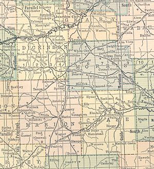 1914 railroad map.
- ^ a b c Marion - Directory of Public Officials
- ^ a b "2010 City Population and Housing Occupancy Status". U.S. Census Bureau. http://factfinder2.census.gov/faces/tableservices/jsf/pages/productview.xhtml?pid=DEC_10_PL_GCTPL2.ST13&prodType=table. Retrieved March 6, 2011.
- ^ a b "American FactFinder". United States Census Bureau. http://factfinder.census.gov. Retrieved 2008-01-31.
- ^ "US Board on Geographic Names". United States Geological Survey. 2007-10-25. http://geonames.usgs.gov. Retrieved 2008-01-31.
- ^ "Find a County". National Association of Counties. http://www.naco.org/Counties/Pages/FindACounty.aspx. Retrieved 2011-06-07.
- ^ Francis Marion
- ^ 1806 Pike Expedition map through Marion County.
- ^ Marion County Kansas : Past and Present; Sondra Van Meter; MB Publishing House; LCCN 72-92041; 344 pages; 1972.
- ^ Fourth Annual Report of the Board of Railroad Commissioners for the Year Ending December 1, 1886 in State of Kansas; Kansas Publishing House; 1886.
- ^ Railway Abandonment 1968
- ^ Rock Island Rail History
- ^ The Marion Belt and Chingawasa Springs Railroad - 117 Year Old Passenger Car Exists Today
- ^ Chingawasa Springs (1 of 2)
- ^ Keystone Pipeline - Marion County Commission calls out Legislative Leadership on Pipeline Deal; April 18, 2010.
- ^ Keystone Pipeline - TransCanada inspecting pipeline; December 10, 2010.
- ^ Keystone Pipeline - County ask TransCanada for pipeline emergency plan; Hillsboro Free Press; February 15, 2011.
- ^ "US Gazetteer files: 2010, 2000, and 1990". United States Census Bureau. 2011-02-12. http://www.census.gov/geo/www/gazetteer/gazette.html. Retrieved 2011-04-23.
- ^ National Register of Historic Places - Elgin Hotel
- ^ National Register of Historic Places - First Presbyterian Church
- ^ National Register of Historic Places - Hill Grade School
- ^ National Register of Historic Places - Marion County Courthouse
- ^ USD 408
- ^ Kansas School District Boundary Map
- ^ T.E.E.N. video teaching network
- ^ KSHSAA Football Class Size Assignments
- ^ Marion USD 408 Sports and Aquatic Center; City of Marion.
- ^ Wichita-Hutchinson Radio market.
- ^ Wichita-Hutchinson TV market.
- ^ "UP Railroad Common Line Names". Union Pacific Railroad. http://www.uprr.com/aboutup/maps/attachments/upcomnam.pdf. Retrieved 2010-08-02.
- ^ Marion Municipal Airport map
- ^ Marion Municipal Airport information
- ^ a b c d e f g h i j k l m n o Kansas Legislators Past & Present
- ^ Horace Kyle - History
- ^ Standard Atlas of Marion County, Kansas; 1902. (Download eBook)
- ^ World War Roll of Honor, Marion County Kansas, 1917-1920; 1920. (Downlaod eBook)
- ^ Kansas: A Cyclopedia Of State History, Embracing Events, Institutions, Industries, Counties, Cities, Towns, Prominent Persons, Etc - Vol 1; 1912. (Download eBook)
- ^ Kansas: A Cyclopedia Of State History, Embracing Events, Institutions, Industries, Counties, Cities, Towns, Prominent Persons, Etc - Vol 2; 1912.
- ^ Kansas: A Cyclopedia Of State History, Embracing Events, Institutions, Industries, Counties, Cities, Towns, Prominent Persons, Etc - Vol 3; 1912.
- ^ History Of The State of Kansas; 1883. (Download eBook)
External links
- City
- Schools
- USD 408, school district for Marion, Florence, Eastshore, Canada, Aulne, nearby rural areas of Marion County
- Photos and Videos
- KWCH 'One of a Kind' Kansas road trip in 2011: Photos, Video 1, Video 2. Towns included were Coldwater, Sterling, Atwood, Lucas, Marion.
- Historical
- Historic Images of Marion, Special Photo Collections at Wichita State University Library
- KsGenWeb Marion County cemetery list
- Lodging
- Maps
- Marion City Map, KDOT
- Marion County Map, KDOT
- Topo Map of Marion / Aulne / Canada area, USGS
- Topo Map of Marion to Florence area, USGS
Municipalities and communities of Marion County, Kansas Cities 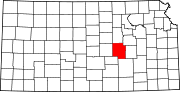
Townships Blaine | Catlin | Centre | Clark | Clear Creek | Colfax | Doyle | Durham Park | East Branch | Fairplay | Gale | Grant | Lehigh | Liberty | Logan | Lost Springs | Menno | Milton | Moore | Peabody | Risley | Summit | West Branch | Wilson
Unincorporated
communitiesAntelope | Aulne | Canada | Eastshore | Pilsen
Ghost towns Gnadenau | Horners | Oursler | Waldeck | Watchorn
Footnotes ‡This populated place also has portions in an adjacent county or counties
Categories:- Cities in Kansas
- County seats in Kansas
- Populated places in Marion County, Kansas
- Populated places established in 1860


Wikimedia Foundation. 2010.