- Ellinwood, Kansas
Infobox Settlement
official_name = Ellinwood, Kansas
settlement_type =City
nickname =
motto =
imagesize =
image_caption =
image_
imagesize =
image_caption =
image_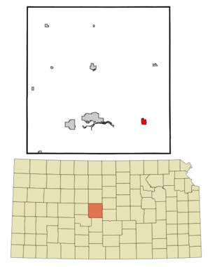
mapsize = 250px
map_caption = Location of Ellinwood, Kansas
mapsize1 =
map_caption1 =subdivision_type = Country
subdivision_name =United States
subdivision_type1 = State
subdivision_name1 =Kansas
subdivision_type2 = County
subdivision_name2 = Barton
government_footnotes =
government_type =
leader_title =
leader_name =
leader_title1 =
leader_name1 =
established_title =
established_date =unit_pref = Imperial
area_footnotes =area_magnitude =
area_total_km2 = 2.8
area_land_km2 = 2.8
area_water_km2 = 0.0
area_total_sq_mi = 1.1
area_land_sq_mi = 1.1
area_water_sq_mi = 0.0population_as_of = 2000
population_footnotes =
population_total = 2164
population_density_km2 = 770.9
population_density_sq_mi = 1996.8timezone = Central (CST)
utc_offset = -6
timezone_DST = CDT
utc_offset_DST = -5
elevation_footnotes =
elevation_m = 546
elevation_ft = 1791
latd = 38 |latm = 21 |lats = 22 |latNS = N
longd = 98 |longm = 34 |longs = 51 |longEW = Wpostal_code_type =
ZIP code
postal_code = 67526
area_code = 620
blank_name = FIPS code
blank_info = 20-20425GR|2
blank1_name = GNIS feature ID
blank1_info = 0475775GR|3
website =
footnotes =Ellinwood is a city in the southeast corner of Barton County,
Kansas ,United States . The population was 2,164 at the 2000 census.Geography
Ellinwood is located at coor dms|38|21|22|N|98|34|51|W|city (38.356226, -98.580873)GR|1.
According to the
United States Census Bureau , the city has a total area of 1.1square mile s (2.8km² ), all of it land.The city is situated along the path of the historic Santa Fe Trail. Ellinwood is also located just north of the Arkansas River, roughly in the area where it makes its "great bend" to the southeast en route to its final destination, the Mississippi River.
Demographics
As of the
census GR|2 of 2000, there were 2,164 people, 906 households, and 594 families residing in the city. Thepopulation density was 1,996.8 people per square mile (773.6/km²). There were 1,034 housing units at an average density of 954.1/sq mi (369.7/km²). The racial makeup of the city was 96.90% White, 0.23% African American, 0.83% Native American, 0.05% Asian, 0.60% from other races, and 1.39% from two or more races. Hispanic or Latino of any race were 1.85% of the population.There were 906 households out of which 31.5% had children under the age of 18 living with them, 53.1% were married couples living together, 9.7% had a female householder with no husband present, and 34.4% were non-families. 31.9% of all households were made up of individuals and 17.8% had someone living alone who was 65 years of age or older. The average household size was 2.33 and the average family size was 2.95.
In the city the population was spread out with 26.2% under the age of 18, 6.3% from 18 to 24, 23.8% from 25 to 44, 21.7% from 45 to 64, and 22.0% who were 65 years of age or older. The median age was 41 years. For every 100 females there were 85.6 males. For every 100 females age 18 and over, there were 82.2 males.
The median income for a household in the city was $29,596, and the median income for a family was $42,292. Males had a median income of $29,792 versus $19,194 for females. The
per capita income for the city was $15,811. About 7.3% of families and 10.0% of the population were below thepoverty line , including 9.0% of those under age 18 and 15.1% of those age 65 or over.Notable natives
*
Walter Joseph Hickel ,Governor of Alaska andUnited States Secretary of the Interior References
External links
* [http://ellinwood.info Community news and information]
* [http://www.ellinwoodchamber.com Chamber of Commerce]
* [http://skyways.lib.ks.us/towns/Ellinwood Blue Skyways - Ellinwood]
Wikimedia Foundation. 2010.