- National Register of Historic Places listings in Barton County, Kansas
-
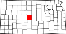 Location of Barton County in Kansas
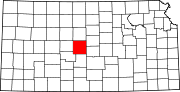
This is a list of the National Register of Historic Places listings in Barton County, Kansas.
This is intended to be a complete list of the properties on the National Register of Historic Places in Barton County, Kansas, United States. The locations of National Register properties for which the latitude and longitude coordinates are included below, may be seen in a Google map.[1]
There are 17 properties listed on the National Register in the county.
-
- This National Park Service list is complete through NPS recent listings posted November 10, 2011.[2]
Current listings
[3] Landmark name [4] Image Date listed Location City or town Summary 1 Abel House March 2, 2001 2601 Passeo
38°22′39″N 98°46′21″W / 38.3775°N 98.7725°WGreat Bend 2 Beaver Creek Native Stone Bridge April 16, 2008 NE. 50 Ave. S. and NE 230 Rd.
38°41′41″N 98°40′57″W / 38.694722°N 98.6825°WBeaver 3 Bridge No. 218-Off System Bridge April 16, 2008 NE. 60 Ave. S. and NE. 220 Rd.
38°40′53″N 98°39′58″W / 38.681389°N 98.666111°WBeaver 4 Bridge No. 222-Off System Bridge July 2, 2008 NE. 60 Ave., S. and NE. 210 Rd., 1/8 mile east on 210 Rd.
38°41′01″N 98°39′49″W / 38.683611°N 98.663611°WBeaver 5 Bridge No. 640-Federal Aid Highway System Bridge July 2, 2008 NE 60 Ave., 1/8 mile north of NE 210 Rd.
38°40′06″N 98°39′50″W / 38.668333°N 98.663889°WBeaver 6 Bridge No. 650-Federal Aid Highway System Bridge July 2, 2008 NE 60 Ave., 1/12 mile south of NE 220 Rd.
38°40′48″N 98°39′50″W / 38.68°N 98.663889°WBeaver 7 Crest Theater February 9, 2005 1905 Lakin Ave.
38°21′59″N 98°45′50″W / 38.366389°N 98.763889°WGreat Bend 8 Hitschmann Cattle Underpass Bridge April 16, 2008 NE. 110 Ave. S. & NE. 190 Rd.
38°38′16″N 98°34′20″W / 38.637778°N 98.572222°WHitschmann 9 Hitschmann Double Arch Bridge April 16, 2008 NE. 110 Ave. S. & NE. 190 Rd.
38°38′16″N 98°34′20″W / 38.637778°N 98.572222°WHitschmann 10 Hoisington High School November 15, 2005 218 E. 7th St.
38°31′19″N 98°46′34″W / 38.521944°N 98.776111°WHoisington 11 Nagel House March 2, 2001 1411 Wilson St.
38°21′57″N 98°47′42″W / 38.365833°N 98.795°WGreat Bend 12 Pawnee Rock December 29, 1970 0.2 miles north of Pawnee Rock off U.S. 56
38°16′20″N 98°58′53″W / 38.272222°N 98.981389°WPawnee Rock 13 US Post Office-Hoisington October 17, 1989 121 E. 2nd St.
38°30′52″N 98°46′34″W / 38.514444°N 98.776111°WHoisington 14 Walnut Creek Bridge January 4, 1990 Over Walnut Creek, northwest of Heizer
38°25′54″N 98°53′40″W / 38.431667°N 98.894444°WHeizer 15 Walnut Creek Crossing April 26, 1972 Along Walnut Creek above its confluence with the Arkansas River, east of Great Bend
38°21′28″N 98°42′7″W / 38.35778°N 98.70194°W[5]Great Bend Township 16 Wolf Hotel November 7, 2002 104 E. Santa Fe
38°21′13″N 98°34′50″W / 38.353611°N 98.580556°WEllinwood 17 Wolf Park Band Shell August 4, 2003 Lots 12 and 13, Block 2, 200 block of N. Main
38°21′23″N 98°34′49″W / 38.356389°N 98.580278°WEllinwood See also
- List of National Historic Landmarks in Kansas
- National Register of Historic Places listings in Kansas
References
- ^ The latitude and longitude information provided in this table was derived originally from the National Register Information System, which has been found to be fairly accurate for about 99% of listings. For about 1% of NRIS original coordinates, experience has shown that one or both coordinates are typos or otherwise extremely far off; some corrections may have been made. A more subtle problem causes many locations to be off by up to 150 yards, depending on location in the country: most NRIS coordinates were derived from tracing out latitude and longitudes off of USGS topographical quadrant maps created under the North American Datum of 1927, which differs from the current, highly accurate WGS84 GPS system used by Google maps. Chicago is about right, but NRIS longitudes in Washington are higher by about 4.5 seconds, and are lower by about 2.0 seconds in Maine. Latitudes differ by about 1.0 second in Florida. Some locations in this table may have been corrected to current GPS standards.
- ^ "National Register of Historic Places: Weekly List Actions". National Park Service, United States Department of the Interior. Retrieved on November 10, 2011.
- ^ Numbers represent an ordering by significant words. Various colorings, defined here, differentiate National Historic Landmark sites and National Register of Historic Places Districts from other NRHP buildings, structures, sites or objects.
- ^ "National Register Information System". National Register of Historic Places. National Park Service. . http://nrhp.focus.nps.gov/natreg/docs/All_Data.html.
- ^ Location derived from its NRHP nomination form; the NRIS lists the site as "Address Restricted"
Municipalities and communities of Barton County, Kansas Cities Albert | Claflin | Ellinwood | Galatia | Great Bend | Hoisington | Olmitz | Pawnee Rock | Susank
Townships Albion | Beaver | Buffalo | Cheyenne | Clarence | Cleveland | Comanche | Eureka | Fairview | Grant | Great Bend | Independent | Lakin | Liberty | Logan | North Homestead | Pawnee Rock | South Bend | South Homestead | Union | Walnut | Wheatland
Unincorporated
communitiesCategories:- National Register of Historic Places in Kansas by county
- Barton County, Kansas
- Buildings and structures in Barton County, Kansas
-


Wikimedia Foundation. 2010.