- National Register of Historic Places listings in Riley County, Kansas
-
 Location of Riley County in Kansas
This is a list of the National Register of Historic Places listings in Riley County, Kansas.
This is intended to be a complete list of the properties and districts on the National Register of Historic Places in Riley County, Kansas, United States. The locations of National Register properties and districts for which the latitude and longitude coordinates are included below, may be seen in a Google map.[1]
There are 24 properties and districts listed on the National Register in the county, including 1 National Historic Landmark.
-
- This National Park Service list is complete through NPS recent listings posted November 10, 2011.[2]
Current listings
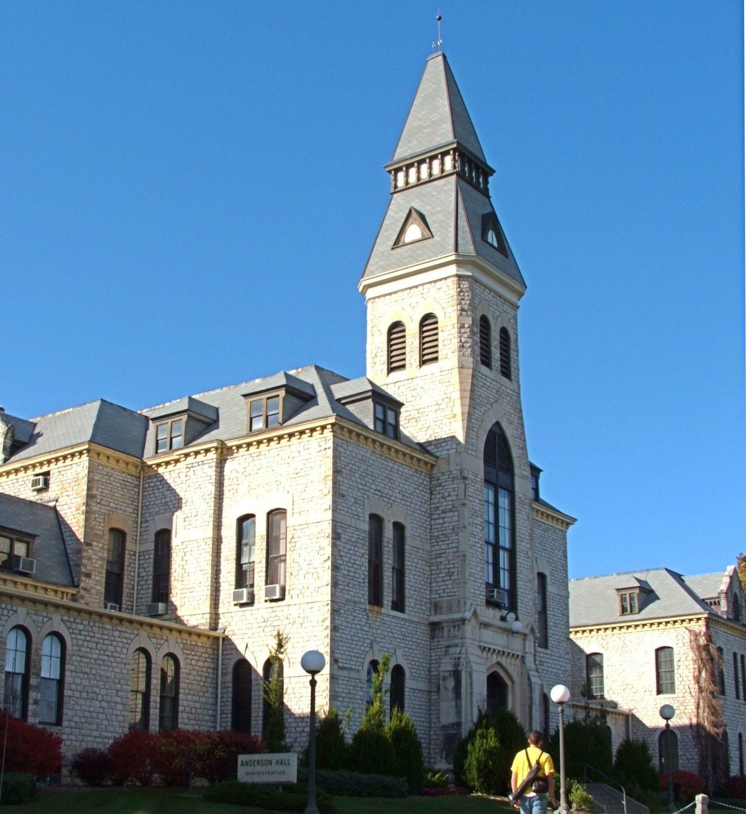
[3] Landmark name [4] Image Date listed Location City or town Summary 1 Anderson Hall 
November 28, 1980 Kansas State University campus
39°11′19″N 96°34′50″W / 39.188611°N 96.580556°WManhattan 2 Community House November 21, 2006 120 N. 4th St.
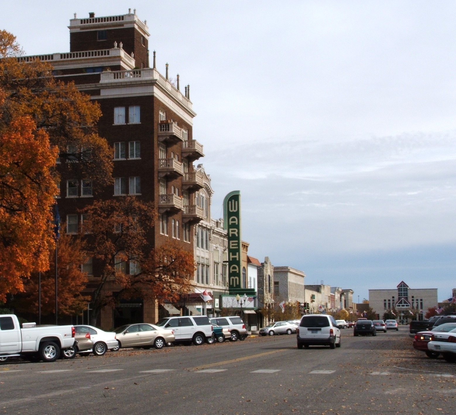
39°10′55″N 96°33′42″W / 39.181944°N 96.561667°WManhattan 3 Downtown Manhattan Historic District 
October 2, 2007 Generally including the blocks between Humboldt and Pierre Sts. from 3rd to 5th Sts.
39°10′44″N 96°33′42″W / 39.178889°N 96.561667°WManhattan 4 Mattie M. Elliot House June 2, 1995 600 Houston St.
39°10′42″N 96°33′55″W / 39.178333°N 96.565278°WManhattan 5 First Congregational Church November 13, 2008 700 Poyntz Ave.
39°10′45″N 96°34′02″W / 39.179167°N 96.567222°WManhattan 6 Leslie A. Fitz House June 8, 2005 1014 Houston St.
39°10′43″N 96°34′21″W / 39.178661°N 96.5725°WManhattan 7 Goodnow House 
February 24, 1971 2301 Claflin Rd.
39°11′34″N 96°35′43″W / 39.192778°N 96.595278°WManhattan 8 Grimes House May 9, 1997 203 Delaware St.
39°10′58″N 96°35′14″W / 39.182778°N 96.587222°WManhattan 9 Houston and Pierre Streets Residential Historic District February 18, 2009 Bounded by S. 5th St., Pierre St., S. 9th St., and Houston St.
39°10′40″N 96°34′01″W / 39.177789°N 96.566825°WManhattan 10 Samuel D. Houston House January 17, 2007 3524 Anderson Ave.
39°11′27″N 96°37′32″W / 39.190833°N 96.625556°WManhattan 11 Hulse-Daughters House June 27, 2007 617 Colorado St.
39°10′41″N 96°33′59″W / 39.178056°N 96.566389°WManhattan 12 KSAC Radio Towers August 27, 1983 Kansas State University campus
39°10′08″N 96°34′54″W / 39.168889°N 96.581667°WManhattan 13 Lyda-Jean Apartments April 28, 2004 501 Houston
39°10′48″N 96°33′50″W / 39.18°N 96.563889°WManhattan 14 Manhattan Carnegie Library Building 
June 25, 1987 5th and Poyntz
39°10′46″N 96°33′48″W / 39.179444°N 96.563333°WManhattan 15 McFarlane-Wareham House July 21, 2004 1906 Leavenworth
39°11′01″N 96°35′13″W / 39.183611°N 96.586944°WManhattan 16 Persons Barn and Granary January 22, 2009 2103 K-18
39°10′24″N 96°35′27″W / 39.173433°N 96.590711°WManhattan 17 Jeremiah Platt House May 20, 1981 2005 Claflin Rd.
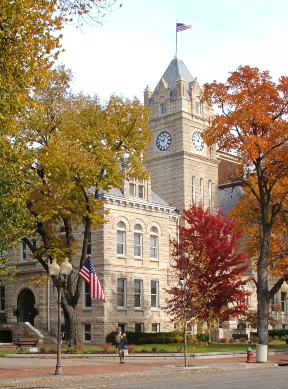
39°11′33″N 96°35′23″W / 39.1925°N 96.589722°WManhattan 18 Riley County Courthouse 
November 15, 2005 100 Courthouse Plaza
39°10′54″N 96°33′47″W / 39.181667°N 96.563056°WManhattan 19 Damon Runyon House December 2, 2004 400 Osage St.
39°11′04″N 96°33′43″W / 39.184444°N 96.561944°WManhattan 20 Seven Dolors Catholic Church 
September 1, 1995 Northeast of the junction of Juliette and Pierre Sts.
39°10′39″N 96°33′57″W / 39.1775°N 96.565833°WManhattan 21 Strasser House July 6, 2010 326 Laramie St.
39°11′05″N 96°33′41″W / 39.184722°N 96.561389°WManhattan 22 Robert Ulrich House September 20, 1978 121 N. 8th St.
39°10′49″N 96°34′06″W / 39.180278°N 96.568333°WManhattan 23 E.A. and Ura Wharton House June 20, 1995 608 Houston St.
39°10′50″N 96°33′56″W / 39.180556°N 96.565556°WManhattan 24 Woman's Club House November 28, 1980 900 Poyntz Ave.
39°10′46″N 96°34′13″W / 39.179444°N 96.570278°WManhattan See also
- List of National Historic Landmarks in Kansas
- National Register of Historic Places listings in Kansas
References
- ^ The latitude and longitude information provided in this table was derived originally from the National Register Information System, which has been found to be fairly accurate for about 99% of listings. For about 1% of NRIS original coordinates, experience has shown that one or both coordinates are typos or otherwise extremely far off; some corrections may have been made. A more subtle problem causes many locations to be off by up to 150 yards, depending on location in the country: most NRIS coordinates were derived from tracing out latitude and longitudes off of USGS topographical quadrant maps created under the North American Datum of 1927, which differs from the current, highly accurate WGS84 GPS system used by Google maps. Chicago is about right, but NRIS longitudes in Washington are higher by about 4.5 seconds, and are lower by about 2.0 seconds in Maine. Latitudes differ by about 1.0 second in Florida. Some locations in this table may have been corrected to current GPS standards.
- ^ "National Register of Historic Places: Weekly List Actions". National Park Service, United States Department of the Interior. Retrieved on November 10, 2011.
- ^ Numbers represent an ordering by significant words. Various colorings, defined here, differentiate National Historic Landmark sites and National Register of Historic Places Districts from other NRHP buildings, structures, sites or objects.
- ^ "National Register Information System". National Register of Historic Places. National Park Service. . http://nrhp.focus.nps.gov/natreg/docs/All_Data.html.
Municipalities and communities of Riley County, Kansas Cities Leonardville | Manhattan‡ | Ogden | Randolph | Riley
CDP Unincorporated
communityFootnotes ‡This populated place also has portions in an adjacent county or counties
Categories:- Riley County, Kansas
- National Register of Historic Places in Kansas by county
- Buildings and structures in Riley County, Kansas
-


Wikimedia Foundation. 2010.