- National Register of Historic Places listings in Wyandotte County, Kansas
-
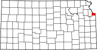 Location of Wyandotte County in Kansas
This is a list of the National Register of Historic Places listings in Wyandotte County, Kansas.
This is intended to be a complete list of the properties and districts on the National Register of Historic Places in Wyandotte County, Kansas, United States. Latitude and longitude coordinates are provided for many National Register properties and districts; these locations may be seen together in a Google map.[1]
There are 31 properties and districts listed on the National Register in the county.
-
- This National Park Service list is complete through NPS recent listings posted November 10, 2011.[2]
Current listings
[3] Landmark name [4] Image Date listed Location City or town Summary 1 Argentine Carnegie Library April 30, 1986 28th St. and Metropolitan Ave.
39°04′27″N 94°39′39″W / 39.074167°N 94.660833°WKansas City 2 Bonner Springs High School July 11, 2002 200 E. 3rd
39°03′28″N 94°52′57″W / 39.057778°N 94.8825°WBonner Springs 3 Castle Rock February 18, 2000 852 Washington Boulevard
39°07′15″N 94°37′55″W / 39.120833°N 94.631944°WKansas City 4 Fairfax Hills Historic District June 30, 2007 Bounded by Esplanade Ave., Brown Ave., and 12th St., including both sides of Parkwood Boulevard, Coronado Rd. and Hilltop Rd. Kansas City 5 Fire Station No. 9 September 5, 1985 2 S. 14th St.
39°06′14″N 94°38′41″W / 39.103889°N 94.644722°WKansas City 6 Judge Louis Gates House December 1, 1980 4146 Cambridge St.
39°03′06″N 94°36′31″W / 39.051667°N 94.608611°WKansas City 7 Granada Theater February 9, 2005 1013-1019 Minnesota Ave.
39°07′03″N 94°38′11″W / 39.1175°N 94.636389°WKansas City 8 Grinter Place 
January 25, 1971 1420 S. 78th St.
39°04′32″N 94°45′36″W / 39.075556°N 94.76°WKansas City 9 H.W. Gates Funeral Home July 6, 2010 1901 Olathe Blvd.
39°03′16″N 94°36′27″W / 39.054444°N 94.6075°WKansas City 10 Hanover Heights Neighborhood Historic District May 17, 1990 Roughly bounded by Olathe Boulevard, Frances St., 43rd Ave., and State Line Rd.
39°03′09″N 94°36′38″W / 39.0525°N 94.610556°WKansas City 11 Huron Cemetery September 3, 1971 On Minnesota Ave. between 6th and 7th Sts.
39°06′53″N 94°37′34″W / 39.114722°N 94.626111°WKansas City 12 Kansas City, Kansas City Hall and Fire Headquarters April 25, 1986 805 and 815 N. 6th St.
39°06′51″N 94°37′24″W / 39.114167°N 94.623333°WKansas City 13 Lake of the Forest Historic District January 22, 1996 K-32 0.9 miles west of Edwardsville
39°03′57″N 94°50′24″W / 39.065833°N 94.84°WBonner Springs 14 Lowell Elementary School January 31, 2008 1040 Orville Ave.
39°06′42″N 94°38′10″W / 39.111667°N 94.636111°WKansas City 15 Northeast Junior High School October 16, 2008 400 Troup Ave.
39°07′38″N 94°37′09″W / 39.127222°N 94.619167°WKansas City 16 Quindaro Townsite May 22, 2002 Parallel Parkway and N. 38th St.
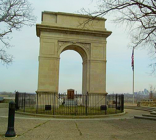
39°7′46″N 94°40′22″W / 39.12944°N 94.67278°W[5]Kansas City 17 Rosedale World War I Memorial Arch 
August 2, 1977 Mt. Marty Park near Booth and Drexel Sts.
39°03′50″N 94°36′54″W / 39.063889°N 94.615°WKansas City 18 St. Augustine Hall February 24, 1971 3301 Parallel Ave.
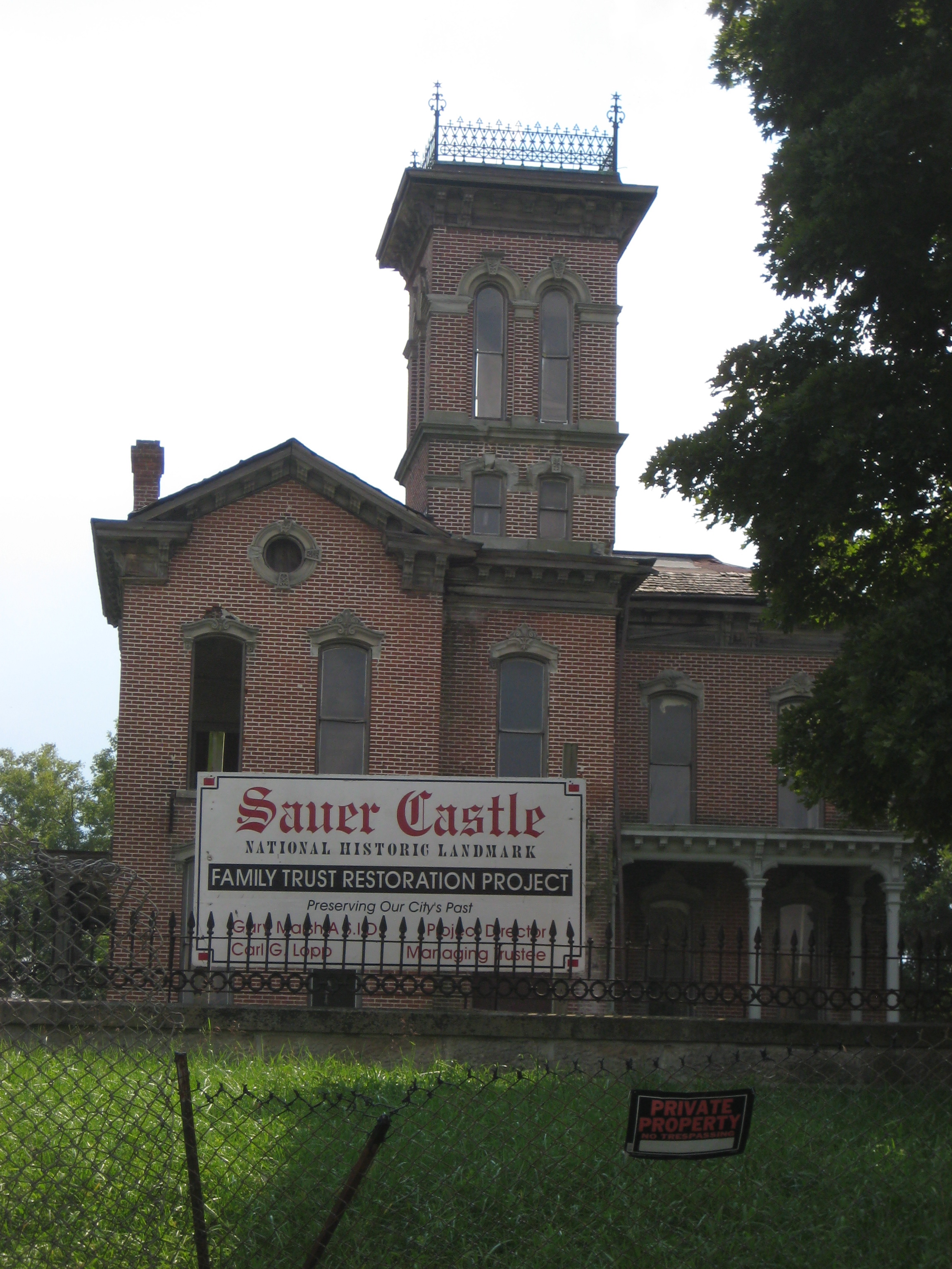
39°07′39″N 94°40′08″W / 39.1275°N 94.668889°WKansas City 19 Sauer Castle 
August 2, 1977 945 Shawnee Dr.
39°04′07″N 94°38′02″W / 39.068611°N 94.633889°WKansas City 20 Schleifer-McAlpine House October 10, 2007 608 Splitlog Ave.
39°06′40″N 94°37′23″W / 39.111111°N 94.623056°WKansas City 21 Scottish Rite Temple 
September 11, 1985 803 N. 7th St.
39°06′50″N 94°37′34″W / 39.113889°N 94.626111°WKansas City 22 Theodore Shafer House February 18, 2000 2518 N. 10th St.
39°08′10″N 94°38′49″W / 39.136111°N 94.646944°WKansas City 23 Shawnee Street Overpass March 8, 1984 Northwest of U.S. Route 35
39°04′19″N 94°37′15″W / 39.071944°N 94.620833°WKansas City 24 Soldiers and Sailors Memorial Building September 5, 1985 600 N. 7th St.
39°06′44″N 94°37′38″W / 39.112222°N 94.627222°WKansas City 25 Sumner High School and Athletic Field September 6, 2005 1610 N. 8th St.
39°07′22″N 94°37′48″W / 39.122778°N 94.63°WKansas City 26 Trowbridge Archeological Site February 24, 1971 Between 61st and 63rd Sts., north of May Ln. and Leavenworth Rd.
39°8′40″N 94°43′20″W / 39.14444°N 94.72222°W[6]Kansas City 27 Westheight Manor District March 26, 1975 Bounded roughly by 18th and 24th Sts. and Oakland and State Aves.; also roughly bounded by State and Wood Aves. and 18th and 25th Sts.
39°07′07″N 94°39′09″W / 39.118611°N 94.6525°WKansas City Second set of addresses represents a boundary increase 28 Whitefeather Spring 
August 27, 1975 3818 Ruby Ave.
39°04′18″N 94°40′25″W / 39.071667°N 94.673611°WKansas City 29 Roy Williamson House April 18, 2007 1865 Edwardsville Dr.
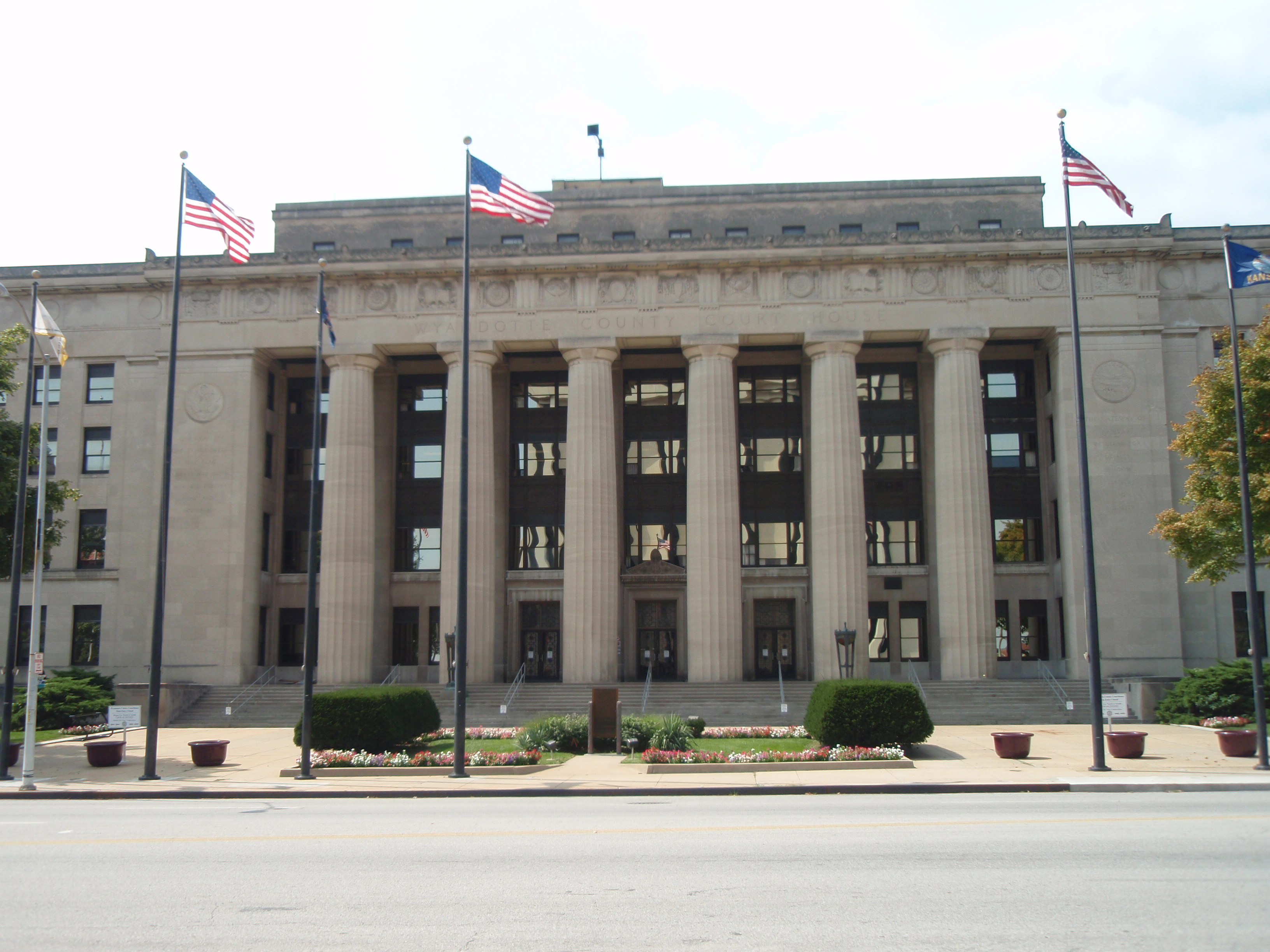
39°04′05″N 94°49′18″W / 39.068056°N 94.821667°WEdwardsville 30 Wyandotte County Courthouse 
April 26, 2002 710 N. 7th St.
39°06′51″N 94°37′38″W / 39.114167°N 94.627222°WKansas City 31 Wyandotte High School 
April 30, 1986 2500 Minnesota Ave.
39°06′52″N 94°39′21″W / 39.114444°N 94.655833°WKansas City See also
- List of National Historic Landmarks in Kansas
- National Register of Historic Places listings in Kansas
References
- ^ The latitude and longitude information provided in this table was derived originally from the National Register Information System, which has been found to be fairly accurate for about 99% of listings. For about 1% of NRIS original coordinates, experience has shown that one or both coordinates are typos or otherwise extremely far off; some corrections may have been made. A more subtle problem causes many locations to be off by up to 150 yards, depending on location in the country: most NRIS coordinates were derived from tracing out latitude and longitudes off of USGS topographical quadrant maps created under the North American Datum of 1927, which differs from the current, highly accurate WGS84 GPS system used by Google maps. Chicago is about right, but NRIS longitudes in Washington are higher by about 4.5 seconds, and are lower by about 2.0 seconds in Maine. Latitudes differ by about 1.0 second in Florida. Some locations in this table may have been corrected to current GPS standards.
- ^ "National Register of Historic Places: Weekly List Actions". National Park Service, United States Department of the Interior. Retrieved on November 10, 2011.
- ^ Numbers represent an ordering by significant words. Various colorings, defined here, differentiate National Historic Landmark sites and National Register of Historic Places Districts from other NRHP buildings, structures, sites or objects.
- ^ "National Register Information System". National Register of Historic Places. National Park Service. . http://nrhp.focus.nps.gov/natreg/docs/All_Data.html.
- ^ Location derived from its GNIS feature record; the NRIS lists the site as "Address Restricted"
- ^ Location derived from page 2 of this Wyandotte County document; the NRIS lists the site as "Address Restricted"
Municipalities and communities of Wyandotte County, Kansas Cities 
Unincorporated
communityFootnotes ‡This populated place also has portions in an adjacent county or counties
Categories:- Wyandotte County, Kansas
- National Register of Historic Places in Kansas by county
- Buildings and structures in Wyandotte County, Kansas
-


Wikimedia Foundation. 2010.