- National Register of Historic Places listings in Cherokee County, Kansas
-
 Location of Cherokee County in Kansas
This is a list of the National Register of Historic Places listings in Cherokee County, Kansas.
This is intended to be a complete list of the properties and districts on the National Register of Historic Places in Cherokee County, Kansas, United States. The locations of National Register properties and districts for which the latitude and longitude coordinates are included below, may be seen in a Google map.[1]
There are 8 properties and districts listed on the National Register in the county.
-
- This National Park Service list is complete through NPS recent listings posted November 10, 2011.[2]
Current listings
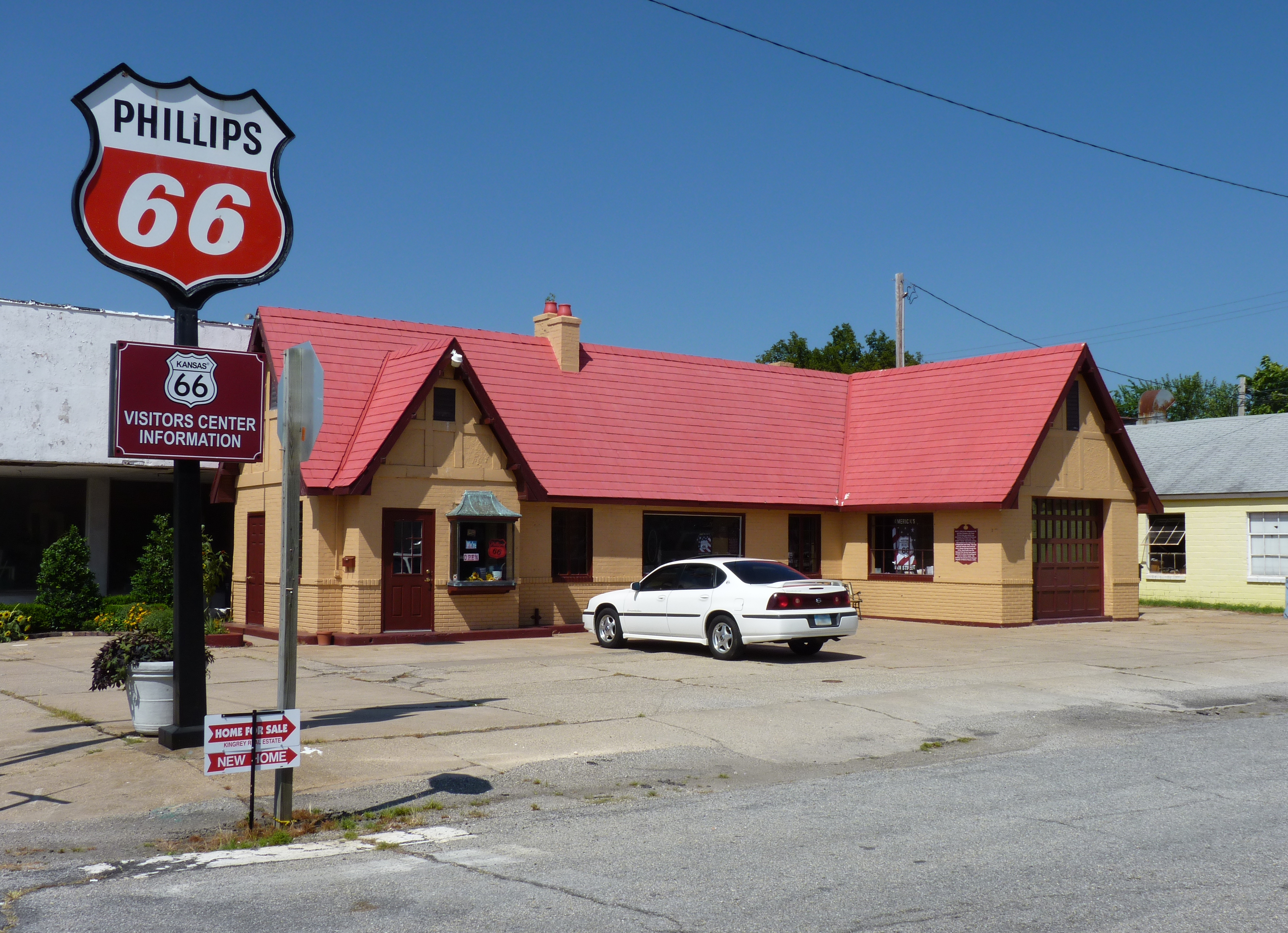
[3] Landmark name [4] Image Date listed Location City or town Summary 1 Baxter Springs Independent Oil and Gas Service Station 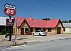
August 29, 2003 940 Military Ave.
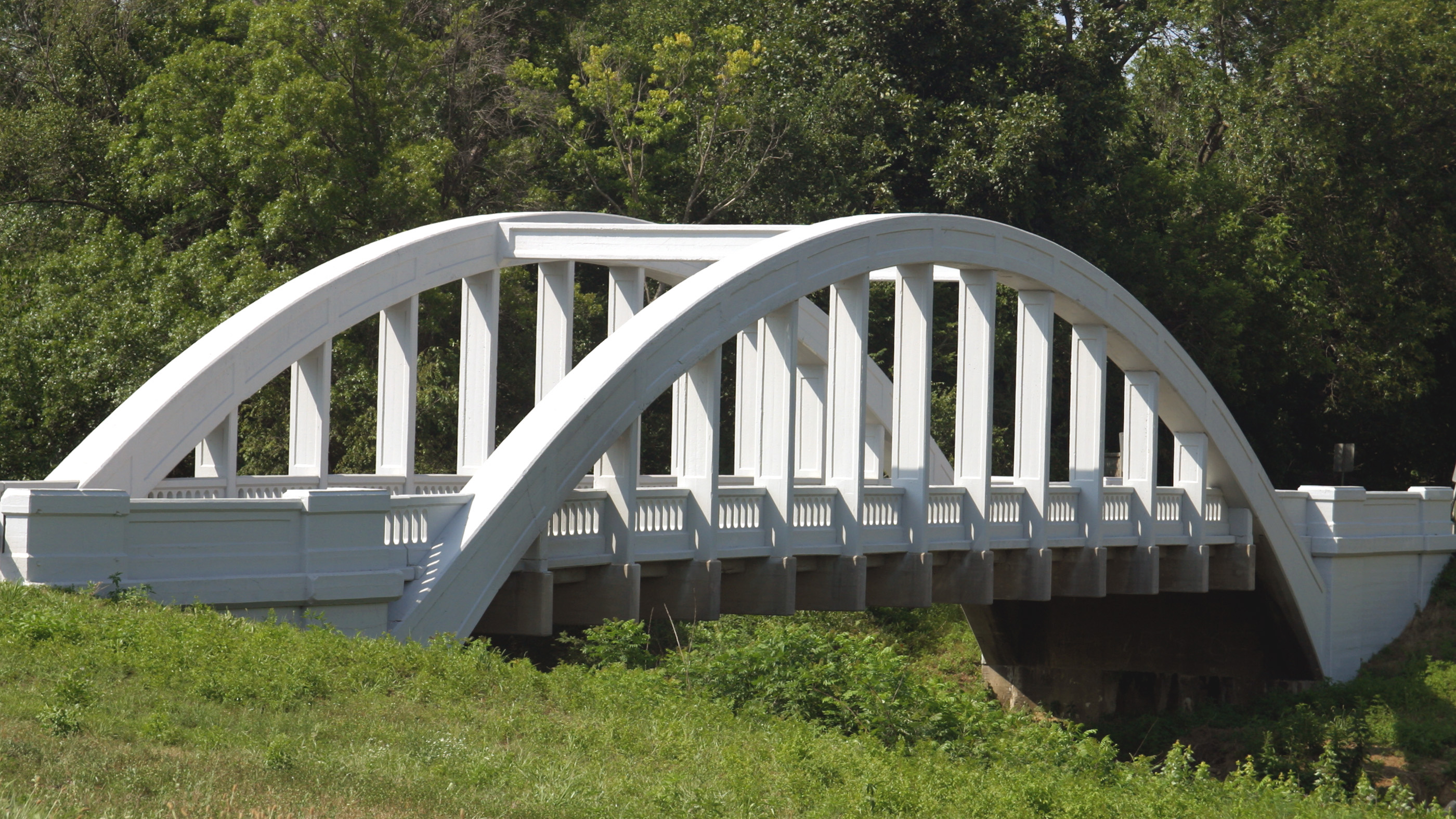
37°01′33″N 94°44′05″W / 37.025833°N 94.734722°WBaxter Springs 2 Brush Creek Bridge 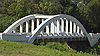
March 10, 1983 North of Baxter Springs
37°04′24″N 94°44′26″W / 37.073333°N 94.740556°WBaxter Springs 3 Columbus Public Carnegie Library June 25, 1987 205 N. Kansas
37°10′22″N 94°50′36″W / 37.172778°N 94.843333°WColumbus 4 Johnston Library 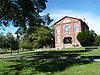
November 21, 1976 210 W. 10th St.
37°01′35″N 94°44′12″W / 37.026389°N 94.736667°WBaxter Springs 5 Kansas Route 66 Historic District-East Galena 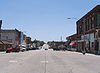
August 29, 2003 U.S. Route 66
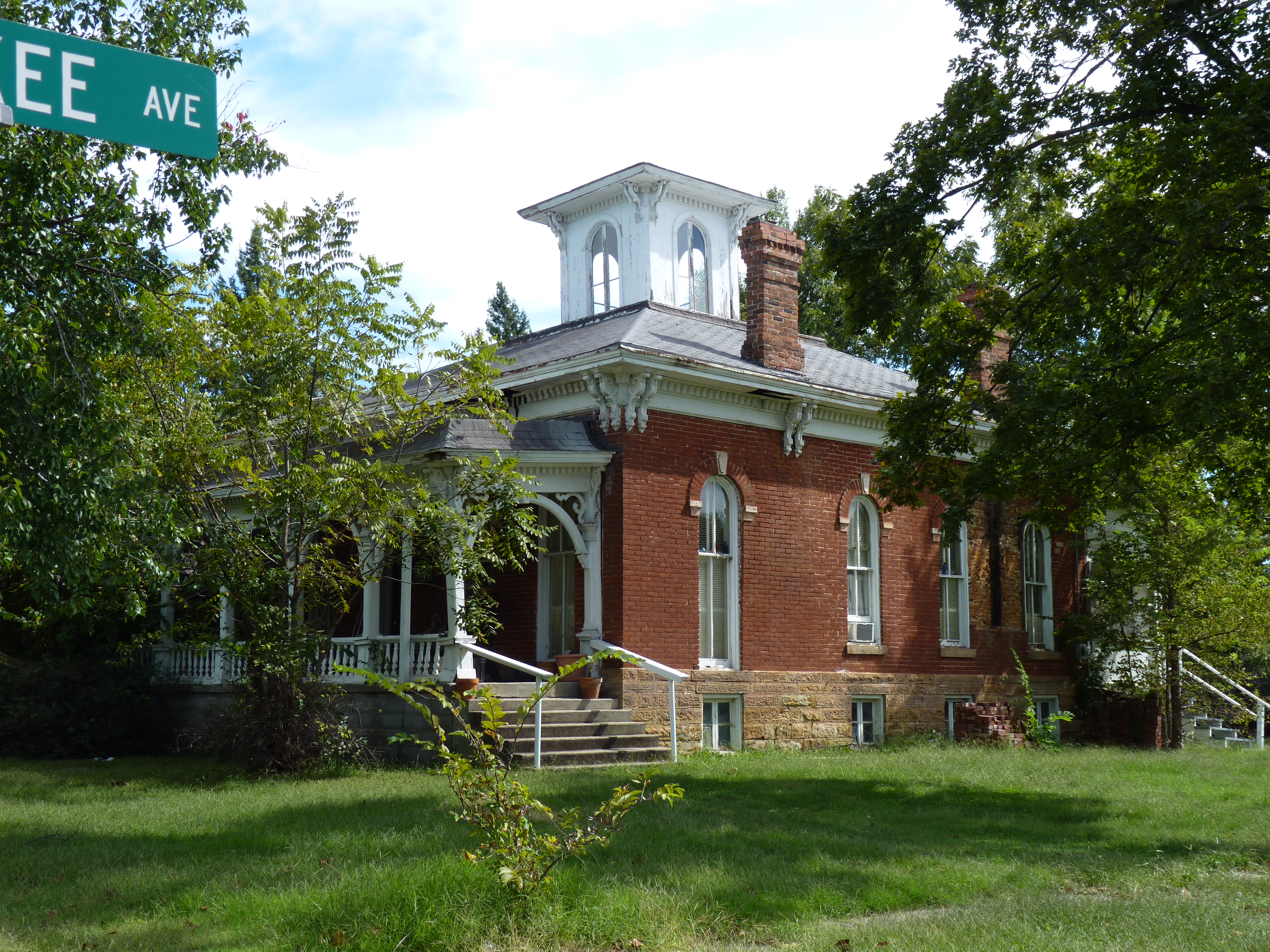
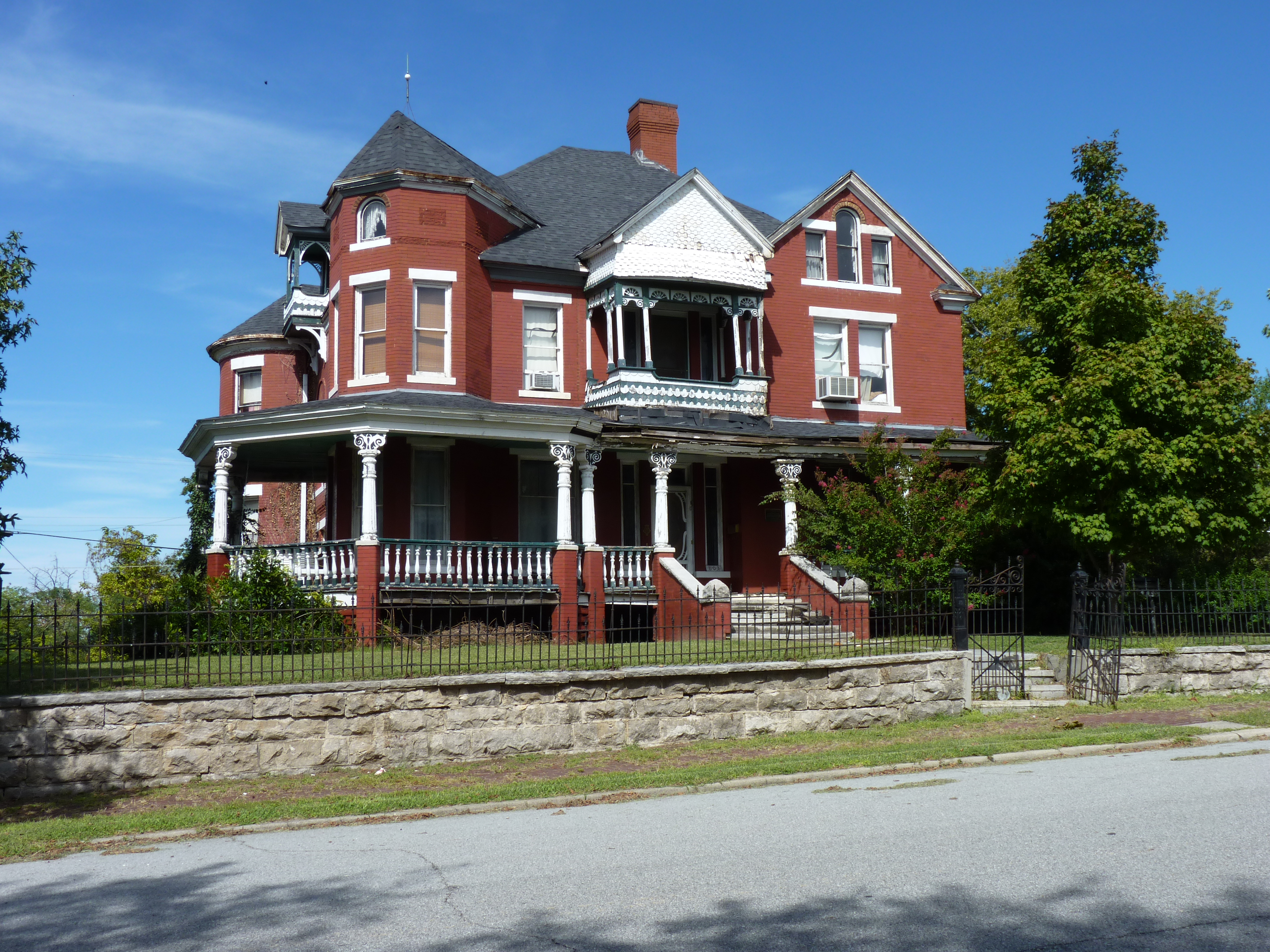
37°05′05″N 94°37′43″W / 37.084722°N 94.628611°WGalena 6 Rial A. Niles House 
September 6, 2006 605 E. 12th St.
37°01′24″N 94°43′43″W / 37.023333°N 94.728611°WBaxter Springs 7 Edgar Backus Schermerhorn House 
August 21, 1989 803 E. 5th St.
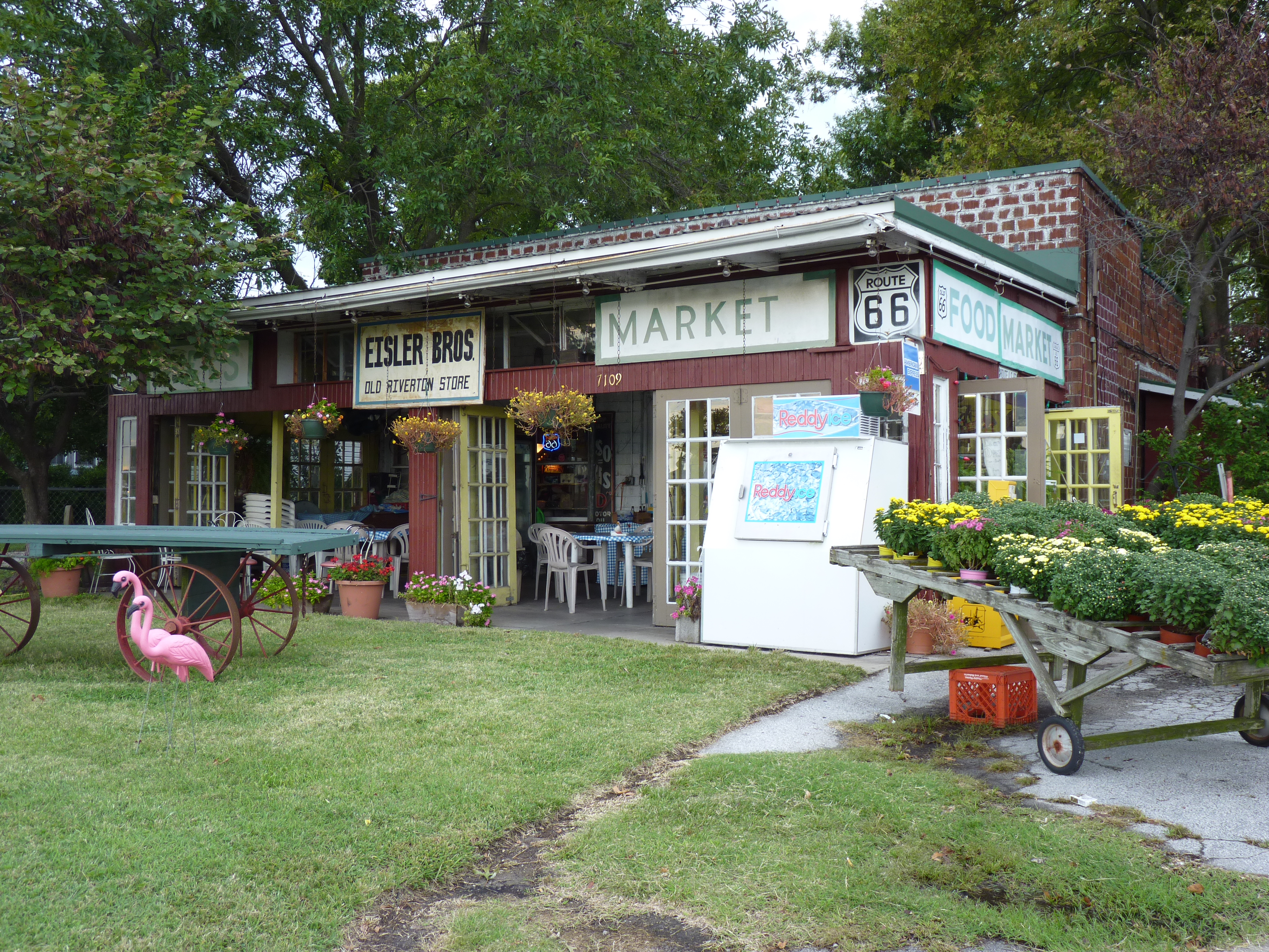
37°04′35″N 94°37′53″W / 37.076389°N 94.631306°WGalena 8 Williams' Store 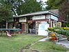
August 29, 2003 7109 SE U.S. Route 66
37°04′30″N 94°42′10″W / 37.075°N 94.702778°WRiverton Now known as Eisler Brothers Old Riverton Store. See also
- List of National Historic Landmarks in Kansas
- National Register of Historic Places listings in Kansas
References
- ^ The latitude and longitude information provided in this table was derived originally from the National Register Information System, which has been found to be fairly accurate for about 99% of listings. For about 1% of NRIS original coordinates, experience has shown that one or both coordinates are typos or otherwise extremely far off; some corrections may have been made. A more subtle problem causes many locations to be off by up to 150 yards, depending on location in the country: most NRIS coordinates were derived from tracing out latitude and longitudes off of USGS topographical quadrant maps created under the North American Datum of 1927, which differs from the current, highly accurate WGS84 GPS system used by Google maps. Chicago is about right, but NRIS longitudes in Washington are higher by about 4.5 seconds, and are lower by about 2.0 seconds in Maine. Latitudes differ by about 1.0 second in Florida. Some locations in this table may have been corrected to current GPS standards.
- ^ "National Register of Historic Places: Weekly List Actions". National Park Service, United States Department of the Interior. Retrieved on November 10, 2011.
- ^ Numbers represent an ordering by significant words. Various colorings, defined here, differentiate National Historic Landmark sites and National Register of Historic Places Districts from other NRHP buildings, structures, sites or objects.
- ^ "National Register Information System". National Register of Historic Places. National Park Service. . http://nrhp.focus.nps.gov/natreg/docs/All_Data.html.
Municipalities and communities of Cherokee County, Kansas Cities Baxter Springs | Columbus | Galena | Roseland | Scammon | Treece | Weir | West Mineral

Townships Unincorporated
communitiesCategories:- National Register of Historic Places in Kansas by county
- Cherokee County, Kansas
- Buildings and structures in Cherokee County, Kansas
-


Wikimedia Foundation. 2010.