- National Register of Historic Places listings in Saline County, Kansas
-
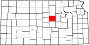
 Location of Saline County in Kansas
This is a list of the National Register of Historic Places listings in Saline County, Kansas.
This is intended to be a complete list of the properties and districts on the National Register of Historic Places in Saline County, Kansas, United States. The locations of National Register properties and districts for which the latitude and longitude coordinates are included below, may be seen in a Google map.[1]
There are 16 properties and districts listed on the National Register in the county, including 1 National Historic Landmark.
-
- This National Park Service list is complete through NPS recent listings posted November 10, 2011.[2]
Current listings
[3] Landmark name [4] Image Date listed Location City or town Summary 1 Brookville Grade School November 2, 1982 Jewitt and Anderson Sts.
38°46′23″N 97°52′13″W / 38.773056°N 97.870278°WBrookville 2 Brookville Hotel January 7, 1972 Perry St.
38°46′23″N 97°52′01″W / 38.773056°N 97.866944°WBrookville 3 Christ Cathedral July 6, 2010 138 South 8th St.
38°50′21″N 97°36′43″W / 38.839167°N 97.611944°WSalina 4 Coronado Heights 
October 20, 2010 12th and Coronado Heights Rd.
38°36′48″N 97°42′12″W / 38.613333°N 97.703333°WLindsborg New Deal-Era Resources of Kansas MPS 5 Flanders-Lee House and Carriage House August 20, 1987 200 S. 7th St.
38°50′17″N 97°36′38″W / 38.838056°N 97.610556°WSalina 6 Fox-Watson Theater Building August 4, 1988 155 S. Santa Fe Ave.
38°50′18″N 97°36′34″W / 38.838333°N 97.609444°WSalina 7 Hobbs Creek Truss Leg Bedstead Bridge October 12, 2004 On Hobbs Creek Rd., 0.6 miles west of its junction with Solomon Rd.
38°38′17″N 97°22′59″W / 38.638056°N 97.383056°WGypsum 8 Lakewood Park Bridge June 9, 2004 One Lakewood Dr., 0.01 miles north of its junction with Iron Ave.
38°50′28″N 97°35′22″W / 38.841111°N 97.589444°WSalina 9 H.D. Lee Company Complex July 3, 2008 248 N. Santa Fe
38°50′38″N 97°36′34″W / 38.843889°N 97.609444°WSalina 10 Masonic Temple March 9, 2000 336 S. Santa Fe Ave.
38°50′05″N 97°36′33″W / 38.834722°N 97.609167°WSalina 11 Mount Barbara April 14, 1995 100 Mt. Barbara
38°50′23″N 97°34′51″W / 38.839722°N 97.580833°WSalina 12 John H. Prescott House May 17, 1976 211 W. Prescott Ave.
38°49′48″N 97°36′40″W / 38.83°N 97.611111°WSalina 13 Roosevelt-Lincoln Junior High School December 20, 2006 210 W. Mulberry St.
38°50′22″N 97°37′00″W / 38.839444°N 97.616667°WSalina 14 A.J. Schwartz House April 13, 1973 636 E. Iron St.
38°50′25″N 97°36′04″W / 38.840278°N 97.601111°WSalina 15 US Post Office and Federal Building-Salina July 18, 1989 211 W. Iron
38°50′25″N 97°36′40″W / 38.840278°N 97.611111°WSalina 16 Whiteford (Price) Archeological Site October 15, 1966 East of Salina
38°51′39″N 97°31′36″W / 38.860833°N 97.526667°WSalina See also
- List of National Historic Landmarks in Kansas
- National Register of Historic Places listings in Kansas
References
- ^ The latitude and longitude information provided in this table was derived originally from the National Register Information System, which has been found to be fairly accurate for about 99% of listings. For about 1% of NRIS original coordinates, experience has shown that one or both coordinates are typos or otherwise extremely far off; some corrections may have been made. A more subtle problem causes many locations to be off by up to 150 yards, depending on location in the country: most NRIS coordinates were derived from tracing out latitude and longitudes off of USGS topographical quadrant maps created under the North American Datum of 1927, which differs from the current, highly accurate WGS84 GPS system used by Google maps. Chicago is about right, but NRIS longitudes in Washington are higher by about 4.5 seconds, and are lower by about 2.0 seconds in Maine. Latitudes differ by about 1.0 second in Florida. Some locations in this table may have been corrected to current GPS standards.
- ^ "National Register of Historic Places: Weekly List Actions". National Park Service, United States Department of the Interior. Retrieved on November 10, 2011.
- ^ Numbers represent an ordering by significant words. Various colorings, defined here, differentiate National Historic Landmark sites and National Register of Historic Places Districts from other NRHP buildings, structures, sites or objects.
- ^ "National Register Information System". National Register of Historic Places. National Park Service. . http://nrhp.focus.nps.gov/natreg/docs/All_Data.html.
Municipalities and communities of Saline County, Kansas Cities Assaria | Brookville | Gypsum | New Cambria | Salina | Smolan | Solomon‡
Unincorporated
communitiesFootnotes ‡This populated place also has portions in an adjacent county or counties
Categories:- Saline County, Kansas
- National Register of Historic Places in Kansas by county
- Buildings and structures in Saline County, Kansas
-


Wikimedia Foundation. 2010.