- National Register of Historic Places listings in Kingman County, Kansas
-
 Location of Kingman County in Kansas
This is a list of the National Register of Historic Places listings in Kingman County, Kansas.
This is intended to be a complete list of the properties on the National Register of Historic Places in Kingman County, Kansas, United States. The locations of National Register properties for which the latitude and longitude coordinates are included below, may be seen in a Google map.[1]
There are 8 properties listed on the National Register in the county.
-
- This National Park Service list is complete through NPS recent listings posted November 10, 2011.[2]
Current listings
[3] Landmark name [4] Image Date listed Location City or town Summary 1 Doney-Clark House May 6, 1994 817 W. Sherman St.
37°38′31″N 98°06′47″W / 37.641944°N 98.113056°WKingman 2 Kingman Carnegie Library June 25, 1987 455 N. Main
37°38′45″N 98°06′47″W / 37.645833°N 98.113056°WKingman 3 Kingman City Building April 13, 1972 Main St. and C Ave.
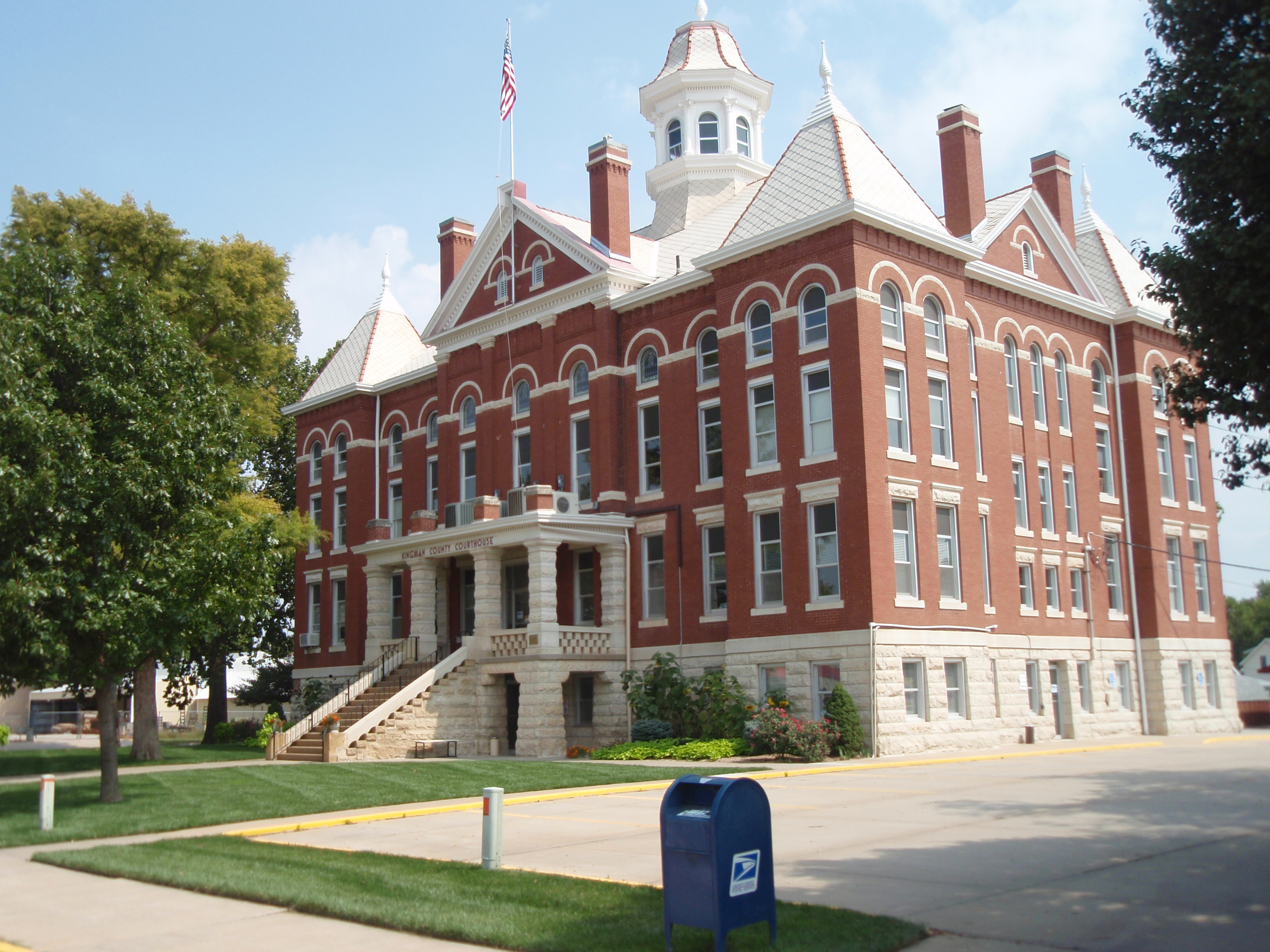
37°38′43″N 98°06′45″W / 37.645278°N 98.1125°WKingman 4 Kingman County Courthouse 
September 11, 1985 120 Spruce St.
37°38′34″N 98°06′40″W / 37.642778°N 98.111111°WKingman 5 Kingman National Guard Armory July 7, 2004 111 S. Main St.
37°38′26″N 98°06′49″W / 37.640556°N 98.113611°WKingman 6 Kingman Santa Fe Depot October 11, 2001 201 East Sherman
37°38′30″N 98°06′41″W / 37.641667°N 98.111389°WKingman 7 Charles M. Prather Barn October 31, 2002 NW 30th St. and NW 60th Ave.
37°41′22″N 98°13′42″W / 37.689444°N 98.228333°WKingman 8 US Post Office-Kingman October 17, 1989 425 N. Main St.
37°38′44″N 98°06′46″W / 37.645556°N 98.112778°WKingman See also
- List of National Historic Landmarks in Kansas
- National Register of Historic Places listings in Kansas
References
- ^ The latitude and longitude information provided in this table was derived originally from the National Register Information System, which has been found to be fairly accurate for about 99% of listings. For about 1% of NRIS original coordinates, experience has shown that one or both coordinates are typos or otherwise extremely far off; some corrections may have been made. A more subtle problem causes many locations to be off by up to 150 yards, depending on location in the country: most NRIS coordinates were derived from tracing out latitude and longitudes off of USGS topographical quadrant maps created under North American Datum of 1927, which differs from the current, highly accurate GPS system used by Google maps. Chicago is about right, but NRIS longitudes in Washington are higher by about 4.5 seconds, and are lower by about 2.0 seconds in Maine. Latitudes differ by about 1.0 second in Florida. Some locations in this table may have been corrected to current GPS standards.
- ^ "National Register of Historic Places: Weekly List Actions". National Park Service, United States Department of the Interior. Retrieved on November 10, 2011.
- ^ Numbers represent an ordering by significant words. Various colorings, defined here, differentiate National Historic Landmark sites and National Register of Historic Places Districts from other NRHP buildings, structures, sites or objects.
- ^ "National Register Information System". National Register of Historic Places. National Park Service. . http://nrhp.focus.nps.gov/natreg/docs/All_Data.html.
Municipalities and communities of Kingman County, Kansas County seat: Kingman Cities 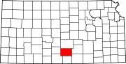
Townships Unincorporated
communitiesCategories:- National Register of Historic Places in Kansas by county
- Kingman County, Kansas
- Buildings and structures in Kingman County, Kansas
-


Wikimedia Foundation. 2010.