National Register of Historic Places listings in McPherson County, Kansas
- National Register of Historic Places listings in McPherson County, Kansas
-

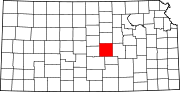
Location of McPherson County in Kansas
This is a list of the National Register of Historic Places listings in McPherson County, Kansas.
This is intended to be a complete list of the properties and districts on the National Register of Historic Places in McPherson County, Kansas, United States. The locations of National Register properties and districts for which the latitude and longitude coordinates are included below, may be seen in a Google map.[1]
There are 22 properties and districts listed on the National Register in the county, including 1 National Historic Landmark.
-
- This National Park Service list is complete through NPS recent listings posted November 10, 2011.[2]
Current listings
| [3] |
Landmark name [4] |
Image |
Date listed |
Location |
City or town |
Summary |
| 1 |
Berquist & Nelson Drugstore Building |
|
02009-04-22April 22, 2009 |
105 N. Main St.
38°34′25″N 97°40′33″W / 38.573564°N 97.675922°W / 38.573564; -97.675922 (Berquist & Nelson Drugstore Building) |
Lindsborg |
|
| 2 |
Canton Township Carnegie Library |
|
01987-06-25June 25, 1987 |
300 N. Main
38°23′17″N 97°25′35″W / 38.388056°N 97.426389°W / 38.388056; -97.426389 (Canton Township Carnegie Library) |
Canton |
|
| 3 |
Clareen-Peterson Restaurant Building |
|
02009-04-22April 22, 2009 |
113 N. Main St.
38°34′25″N 97°40′33″W / 38.573692°N 97.675917°W / 38.573692; -97.675917 (Clareen-Peterson Restaurant Building) |
Lindsborg |
|
| 4 |
Farmers State Bank |
|
02008-10-16October 16, 2008 |
101 S. Main St.
38°34′24″N 97°40′33″W / 38.573333°N 97.675833°W / 38.573333; -97.675833 (Farmers State Bank) |
Lindsborg |
|
| 5 |
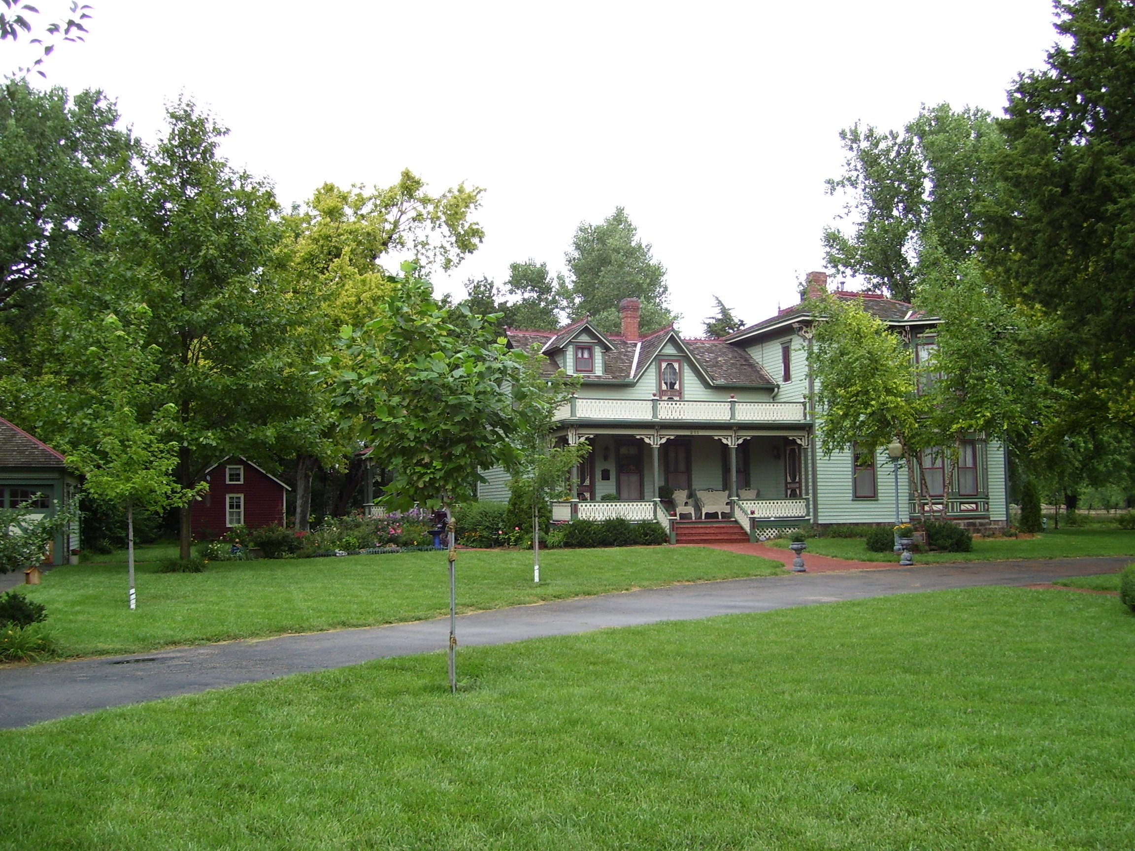
Hans Hanson House |
|
01982-02-19February 19, 1982 |
211 E. 5th St.
38°33′24″N 97°49′54″W / 38.556667°N 97.831667°W / 38.556667; -97.831667 (Hans Hanson House) |
Marquette |
|
| 6 |
Hjerpe Grocery |
|
02010-07-11July 11, 2010 |
110 & 112 N. Main St.
38°34′26″N 97°40′31″W / 38.573889°N 97.675278°W / 38.573889; -97.675278 (Hjerpe Grocery) |
Lindsborg |
|
| 7 |
Holmberg and Johnson Blacksmith Shop |
|
02009-04-22April 22, 2009 |
122 N. Main St.
38°34′26″N 97°40′33″W / 38.573889°N 97.675833°W / 38.573889; -97.675833 (Holmberg and Johnson Blacksmith Shop) |
Lindsborg |
|
| 8 |
Inman I.O.O.F. Hall |
|
02011-04-15April 15, 2011 |
100 N. Main.
38°13′55″N 97°46′32″W / 38.231944°N 97.775556°W / 38.231944; -97.775556 (Inman I.O.O.F. Hall) |
Inman |
|
| 9 |
Johnson House |
|
01998-03-19March 19, 1998 |
226 W. Lincoln
38°34′51″N 97°40′43″W / 38.580833°N 97.678611°W / 38.580833; -97.678611 (Johnson House) |
Lindsborg |
|
| 10 |
Kuns-Collier House |
|
02006-03-08March 8, 2006 |
302 S. Walnut St.
38°22′01″N 97°40′10″W / 38.366944°N 97.669444°W / 38.366944; -97.669444 (Kuns-Collier House) |
McPherson |
|
| 11 |
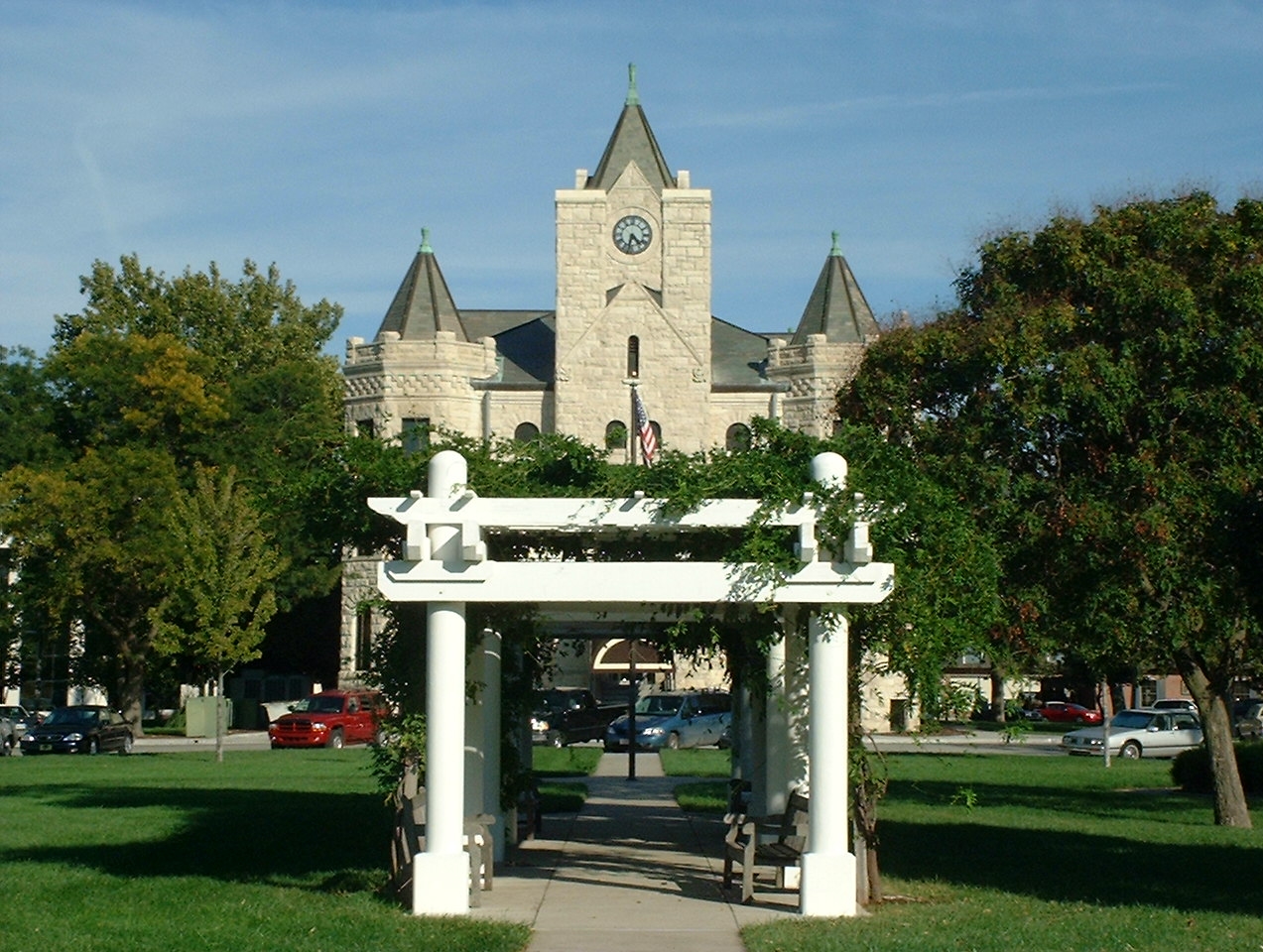
McPherson County Courthouse |
|
01976-11-21November 21, 1976 |
Maple and Kansas Aves.
38°22′12″N 97°40′07″W / 38.37°N 97.668611°W / 38.37; -97.668611 (McPherson County Courthouse) |
McPherson |
|
| 12 |
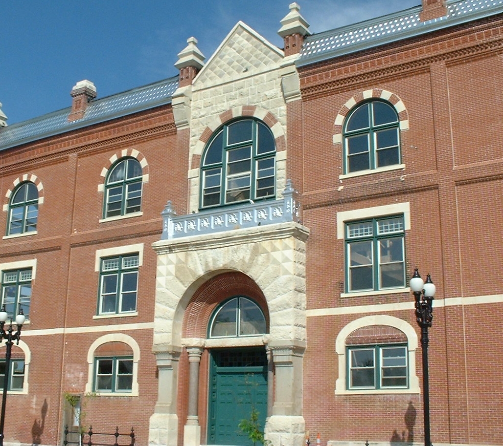
McPherson Opera House |
|
01972-03-16March 16, 1972 |
221 S. Main St.
38°22′02″N 97°39′59″W / 38.367222°N 97.666389°W / 38.367222; -97.666389 (McPherson Opera House) |
McPherson |
|
| 13 |
North Gypsum Creek Truss Leg Bedstead Bridge |
|
02003-05-09May 9, 2003 |
Sioux Rd., 0.2 miles east of intersection with 24th Ave., 1.0 mile south and 2.8 miles west of Roxbury
38°32′12″N 97°28′39″W / 38.536667°N 97.4775°W / 38.536667; -97.4775 (North Gypsum Creek Truss Leg Bedstead Bridge) |
Roxbury |
|
| 14 |
Paint Creek Archeological Site |
|
01972-06-20June 20, 1972 |
Address restricted
|
Lindsborg |
|
| 15 |
Power Plant No. 1 |
|
02007-10-10October 10, 2007 |
414 W. Elizabeth St.
38°22′06″N 97°40′16″W / 38.368333°N 97.671111°W / 38.368333; -97.671111 (Power Plant No. 1) |
McPherson |
|
| 16 |
Heinrich H. Schroeder Barn |
|
02005-09-21September 21, 2005 |
632 29th Ave.
38°16′03″N 97°23′18″W / 38.2675°N 97.388333°W / 38.2675; -97.388333 (Heinrich H. Schroeder Barn) |
Canton |
|
| 17 |
Sharps Creek Archeological Site |
|
01972-06-22June 22, 1972 |
Address restricted
|
Lindsborg |
|
| 18 |
Smoky Valley Roller Mill |
|
01972-02-23February 23, 1972 |
Mill St.
38°34′39″N 97°40′39″W / 38.5775°N 97.6775°W / 38.5775; -97.6775 (Smoky Valley Roller Mill) |
Lindsborg |
|
| 19 |
Swedish Pavilion |
|
01973-03-20March 20, 1973 |
Mill St.
38°34′02″N 97°40′27″W / 38.567222°N 97.674167°W / 38.567222; -97.674167 (Swedish Pavilion) |
Lindsborg |
|
| 20 |
Teichgraeber-Runbeck House |
|
02005-11-15November 15, 2005 |
116 Mill St.
38°33′57″N 97°40′29″W / 38.565833°N 97.674722°W / 38.565833; -97.674722 (Teichgraeber-Runbeck House) |
Lindsborg |
|
| 21 |
US Post Office-Lindsborg |
|
01989-10-17October 17, 1989 |
125 E. Lincoln St.
38°34′27″N 97°39′50″W / 38.574167°N 97.663889°W / 38.574167; -97.663889 (US Post Office-Lindsborg) |
Lindsborg |
|
| 22 |
John R. Wright House |
|
02002-05-02May 2, 2002 |
322 W. Marlin St.
38°22′14″N 97°40′13″W / 38.370556°N 97.670278°W / 38.370556; -97.670278 (John R. Wright House) |
McPherson |
|
See also
References
- ^ The latitude and longitude information provided in this table was derived originally from the National Register Information System, which has been found to be fairly accurate for about 99% of listings. For about 1% of NRIS original coordinates, experience has shown that one or both coordinates are typos or otherwise extremely far off; some corrections may have been made. A more subtle problem causes many locations to be off by up to 150 yards, depending on location in the country: most NRIS coordinates were derived from tracing out latitude and longitudes off of USGS topographical quadrant maps created under the North American Datum of 1927, which differs from the current, highly accurate WGS84 GPS system used by Google maps. Chicago is about right, but NRIS longitudes in Washington are higher by about 4.5 seconds, and are lower by about 2.0 seconds in Maine. Latitudes differ by about 1.0 second in Florida. Some locations in this table may have been corrected to current GPS standards.
- ^ "National Register of Historic Places: Weekly List Actions". National Park Service, United States Department of the Interior. Retrieved on November 10, 2011.
- ^ Numbers represent an ordering by significant words. Various colorings, defined here, differentiate National Historic Landmark sites and National Register of Historic Places Districts from other NRHP buildings, structures, sites or objects.
- ^ "National Register Information System". National Register of Historic Places. National Park Service. . http://nrhp.focus.nps.gov/natreg/docs/All_Data.html.
Categories: - McPherson County, Kansas
- National Register of Historic Places in Kansas by county
- Buildings and structures in McPherson County, Kansas
Wikimedia Foundation.
2010.
Look at other dictionaries:
National Register of Historic Places listings in Douglas County, Kansas — Location of Douglas County in Kansas This is a list of the National Register of Historic Places listings in Douglas County, Kansas. This is intended to be a complete list of the properties and districts on the National Register of Historic Places … Wikipedia
National Register of Historic Places listings in Leavenworth County, Kansas — Location of Leavenworth County in Kansas This is a list of the National Register of Historic Places listings in Leavenworth County, Kansas. This is intended to be a complete list of the properties and districts on the National Register of… … Wikipedia
National Register of Historic Places listings in Sedgwick County, Kansas — Location of Sedgwick County in Kansas This is a list of the National Register of Historic Places listings in Sedgwick County, Kansas. This is intended to be a complete list of the properties and districts on the National Register of Historic… … Wikipedia
National Register of Historic Places listings in Shawnee County, Kansas — Location of Shawnee County in Kansas This is a list of the National Register of Historic Places listings in Shawnee County, Kansas. This is intended to be a complete list of the properties and districts on the National Register of Historic Places … Wikipedia
National Register of Historic Places listings in Wyandotte County, Kansas — Location of Wyandotte County in Kansas This is a list of the National Register of Historic Places listings in Wyandotte County, Kansas. This is intended to be a complete list of the properties and districts on the National Register of Historic… … Wikipedia
National Register of Historic Places listings in Atchison County, Kansas — Location of Atchison County in Kansas This is a list of the National Register of Historic Places listings in Atchison County, Kansas. This is intended to be a complete list of the properties and districts on the National Register of Historic… … Wikipedia
National Register of Historic Places listings in Dickinson County, Kansas — Location of Dickinson County in Kansas This is a list of the National Register of Historic Places listings in Dickinson County, Kansas. This is intended to be a complete list of the properties and districts on the National Register of Historic… … Wikipedia
National Register of Historic Places listings in Doniphan County, Kansas — Location of Doniphan County in Kansas This is a list of the National Register of Historic Places listings in Doniphan County, Kansas. This is intended to be a complete list of the properties and districts on the National Register of Historic… … Wikipedia
National Register of Historic Places listings in Marion County, Kansas — Location of Marion County in Kansas This is a list of the National Register of Historic Places listings in Marion County, Kansas. This is intended to be a complete list of the properties and districts on the National Register of Historic Places… … Wikipedia
National Register of Historic Places listings in Morris County, Kansas — Location of Morris County in Kansas This is a list of the National Register of Historic Places listings in Morris County, Kansas. This is intended to be a complete list of the properties and districts on the National Register of Historic Places… … Wikipedia