- Marquette, Kansas
-
Marquette, Kansas — City — Marquette's Missouri Pacific Railroad stop at the turn of the twentieth century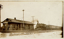 Location of Marquette, Kansas
 Detailed map of Marquette, Kansas
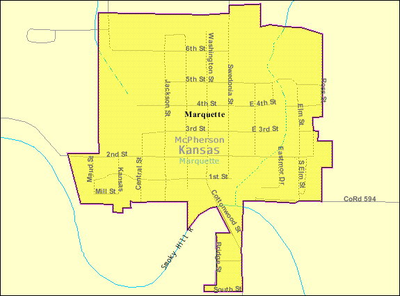
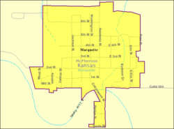
Coordinates: 38°33′14″N 97°50′0″W / 38.55389°N 97.833333°WCoordinates: 38°33′14″N 97°50′0″W / 38.55389°N 97.833333°W Country United States State Kansas County McPherson Platted Incorporated Government – Type Mayor–Council Area – Total 0.4 sq mi (0.9 km2) – Land 0.4 sq mi (0.9 km2) – Water 0.0 sq mi (0.0 km2) Elevation 1,388 ft (423 m) Population (2010)[1] – Total 641 – Density 1,602.5/sq mi (618.7/km2) Time zone Central (CST) (UTC-6) – Summer (DST) CDT (UTC-5) ZIP code 67464 Area code(s) 785 FIPS code 20-44925[2] GNIS feature ID 0477060[3] Website www.Marquetteks.org Marquette is a city located in the northwest corner of McPherson County, Kansas, United States, between K-4 and the Smoky Hill River. The city was settled by Swedish immigrants and chartered on February 9, 1874.[citation needed] As of the 2010 census, the city population was 641.[1]
Contents
Attractions
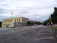
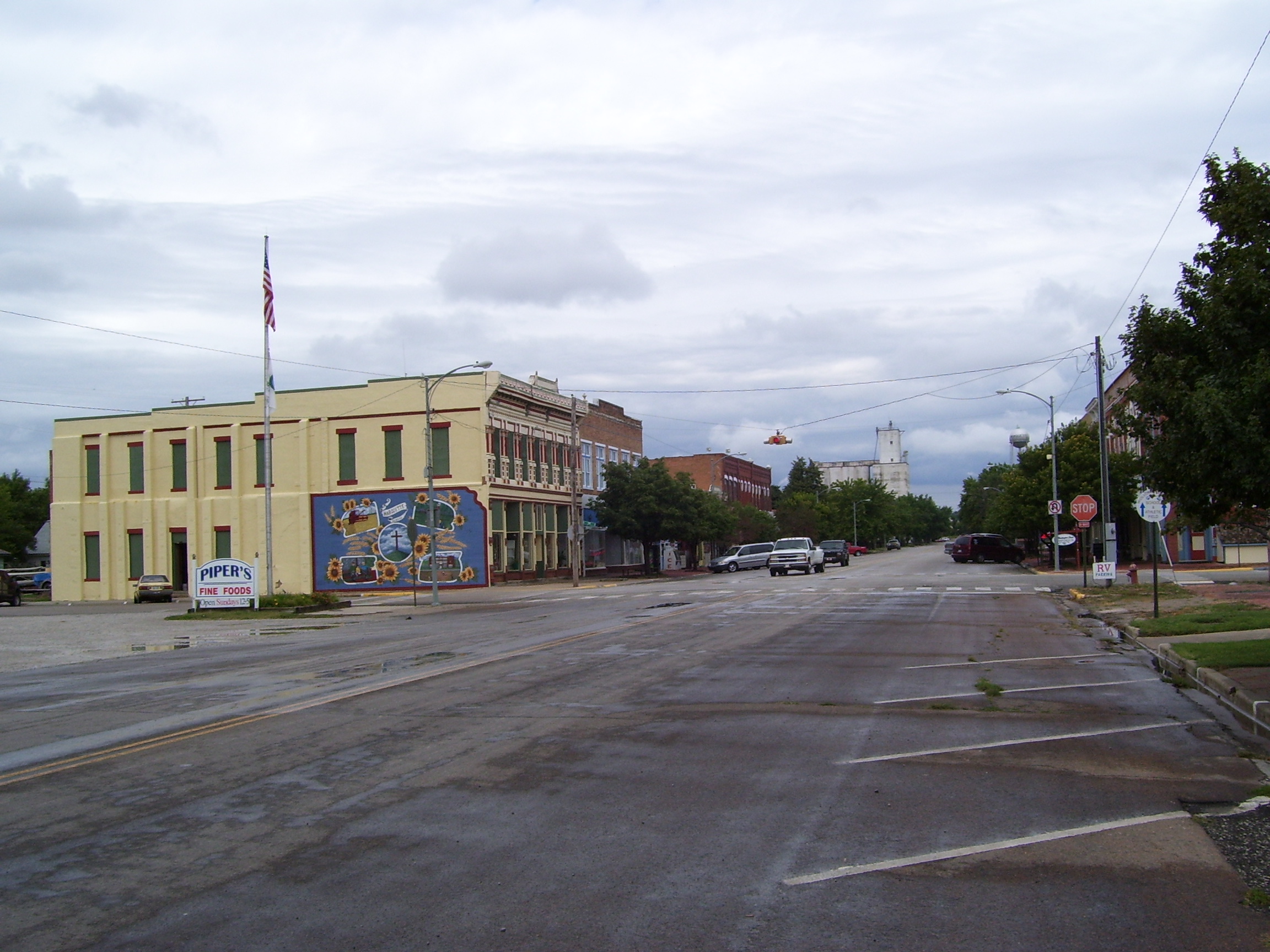
The downtown has a block of late 19th century stores that have been restored and repainted to their original colors. They are part of the Washington Street Historic District, a state historic site.[citation needed]
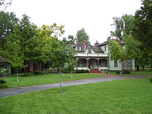
Nearby is the Hanson-Lindfors home, a sixteen-room Victorian style house built in 1888. It is named after Hans Hanson, one of the city founders, and has been restored to its original appearance and listed on the National Register of Historic Places. Located in the backyard of the home is Hanson's original 1871 wood frame cabin, where the city charter was signed.[4]
The downtown area includes the Range School Museum, a one-room 1906 schoolhouse moved there about eighty years later. Each spring and fall, local school children use it for a half day of class.[5]
The Kansas Motorcycle Museum is located downtown on North Washington Street. It was founded in 2004 by National Racing Champion, "Stan the Man" Engdahl, a native of Marquette.[6]
Ten miles away is Kanopolis State Park, the first state park of Kansas. The park, completed in 1948, includes more than 22,000 acres (89 km2) of rolling hills, bluffs and woods and a 3,000 acres (12 km2) lake, offering hunting, fishing, over 25 miles (40 km) of trails, and other recreational activities. Game includes pheasant, quail, prairie chickens, deer, beaver, turkey, squirrels, rabbits, coyotes and waterfowl; fishing for white bass and crappie is popular.
Geography
Marquette is located at 38°33′14″N 97°50′00″W / 38.553824°N 97.833275°W (38.553824, -97.833275),[7] at an elevation of 1385 feet (422 m), in the Smoky Hills region of Kansas. The area is highlighted by outcrops of Cretaceous-era sandstone known as the Dakota Formation. The seas dating back to that era left hills and buttes which rising sharply about the surrounding plains. According to the United States Census Bureau, the city has a total area of 0.4 square miles (1.0 km2), all of it land.
Demographics
Historical populations Census Pop. %± 1960 607 — 1970 578 −4.8% 1980 639 10.6% 1990 593 −7.2% 2000 542 −8.6% 2010 641 18.3% U.S. Decennial Census As of the census[2] of 2000, there were 542 people, 243 households, and 157 families residing in the city, a decline from the total 1990 population of 593. The population density was 1,503.8 people per square mile (581.3/km²). There were 271 housing units at an average density of 751.9 per square mile (290.6/km²). The racial makeup of the city was 98.34% White, 0.37% Native American, 0.18% from other races, and 1.11% from two or more races. 0.18% of the population were Hispanic or Latino of any race.[8][9]
There were 243 households out of which 25.9% had children under the age of 18 living with them, 53.1% were married couples living together, 6.6% had a female householder with no husband present, and 35.0% were non-families. 31.7% of all households were made up of individuals and 17.3% had someone living alone who was 65 years of age or older. The average household size was 2.23 and the average family size was 2.77.
In the city the population was spread out with 22.1% under the age of 18, 6.6% from 18 to 24, 29.0% from 25 to 44, 24.5% from 45 to 64, and 17.7% who were 65 years of age or older. The median age was 41 years. For every 100 females there were 96.4 males. For every 100 females age 18 and over, there were 90.1 males.
The median income for a household in the city was $35,938, and the median income for a family was $44,531. Males had a median income of $30,000 versus $20,208 for females. The per capita income for the city was $17,965. 5.6% of the population and 3.8% of families were below the poverty line. Out of the total population, none of those under the age of 18 and 8.7% of those 65 and older were living below the poverty line.
In May 2003, facing a declining population, Marquette joined at least ten other Kansas cities, including Ellsworth, Kanopolis, Holyrood and Wilson, who offer free land to attract residents. Fifty acres (200,000 m²) of what used to be farmland were developed, furnished with paved streets, water, electric, sewer and gas hookups. In less than one year, twenty-one of the ⅓ acre (1,300 m²) lots created for this purpose were claimed. The program requires the landowners to build a house on the lot within a year, and live in that house for a year.[citation needed]
Education
Primary and secondary education
Marquette is part of Unified School District 400.[10][11]
Gallery
-
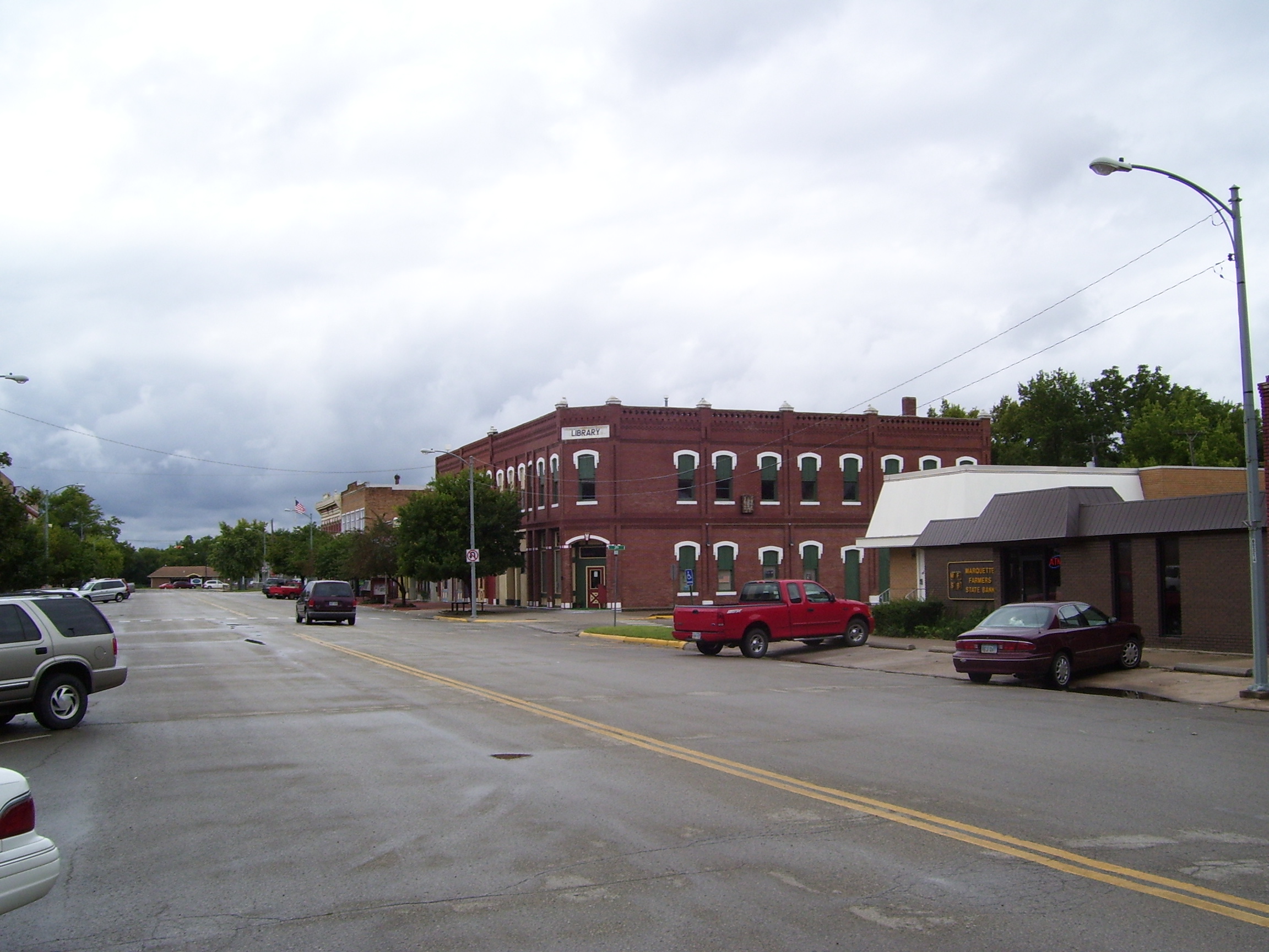
Marquette downtown block.
-

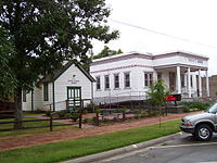
Marquette Library block.
-
Marquette Museum and Range School museum.
-
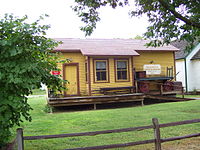
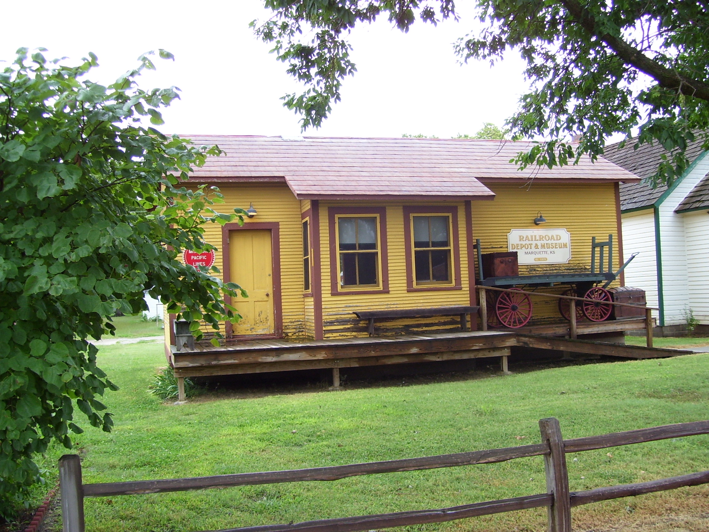
Marquette Railroad depot museum.
-

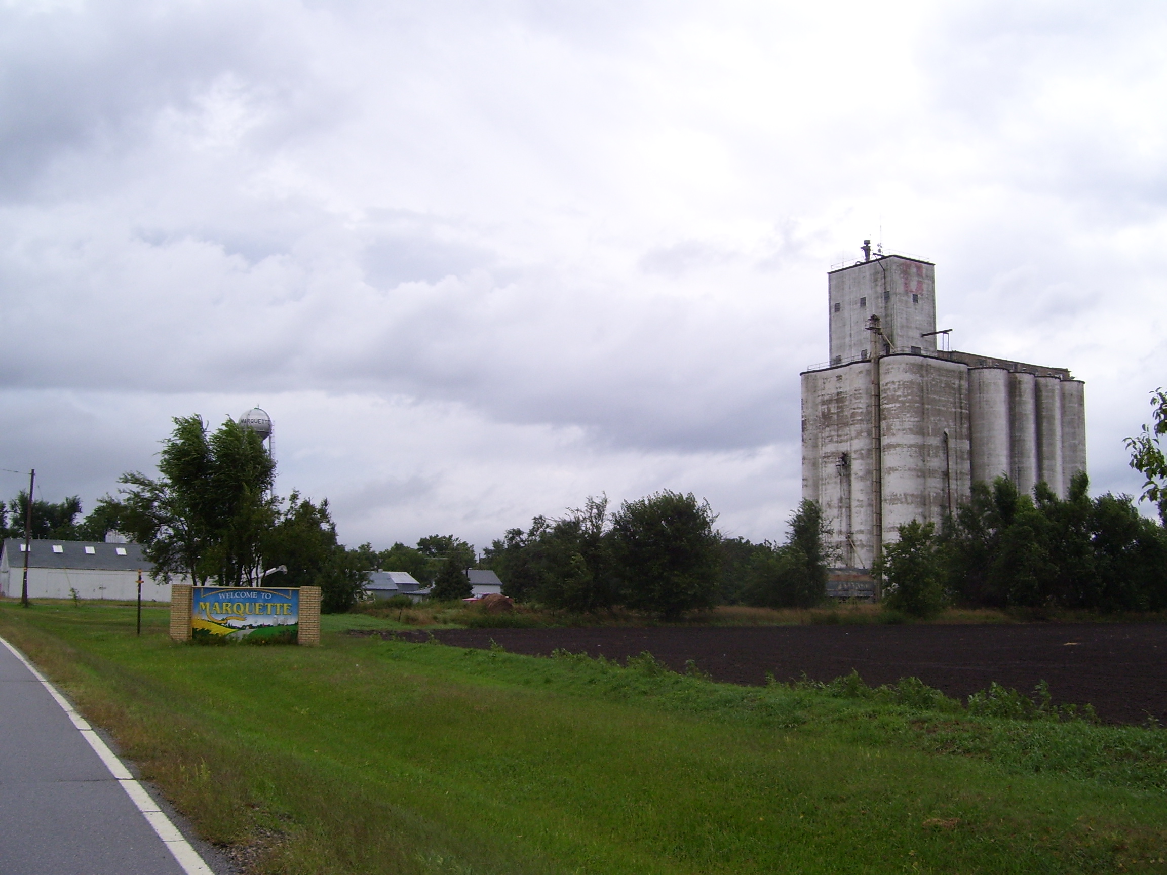
Marquette Grain Elevator.
-
Marquette school.
-

Marquette modern homesteading development.
-

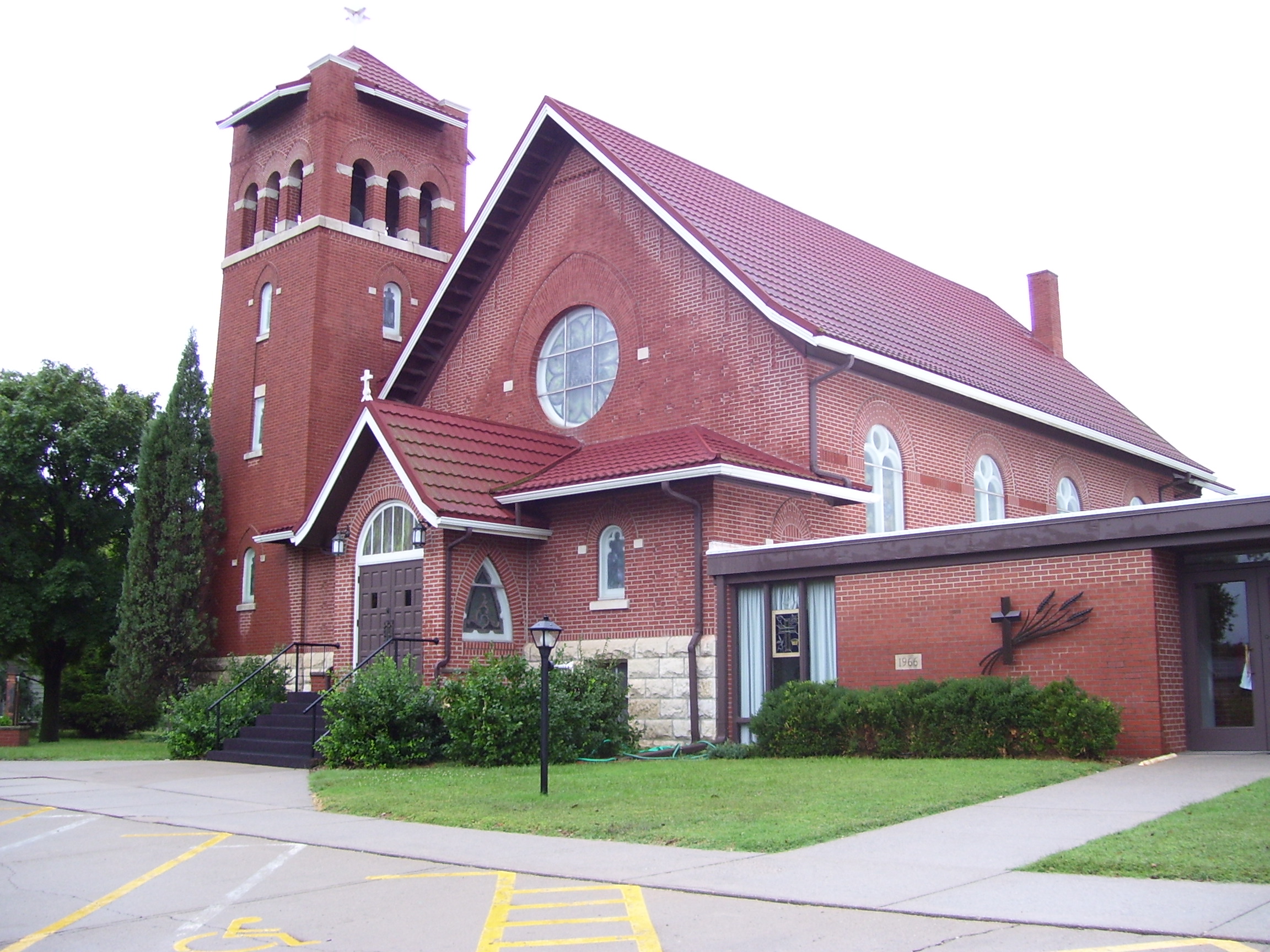
Marquette Lutheran Church.
-
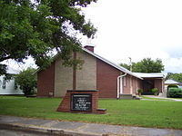
Valley Community Church.
-

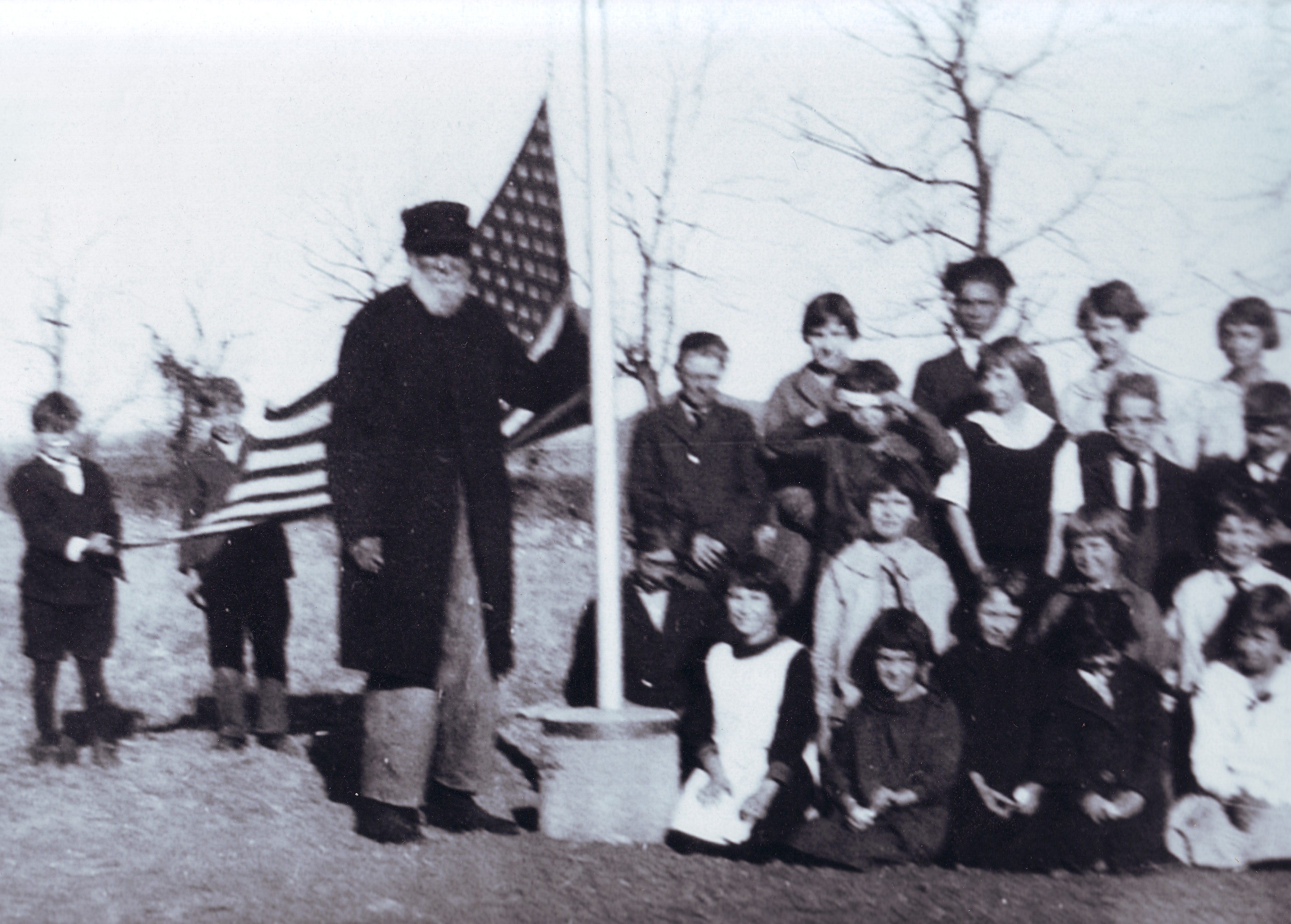
Civil War veteran meeting with children of School #8 in Marquette, 1922.
-
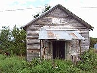
1888 Marquette School #8 in 2008 (now a grain storage building)
See also
References
- ^ a b "2010 City Population and Housing Occupancy Status". U.S. Census Bureau. http://factfinder2.census.gov/faces/tableservices/jsf/pages/productview.xhtml?pid=DEC_10_PL_GCTPL2.ST13&prodType=table. Retrieved March 6, 2011.
- ^ a b "American FactFinder". United States Census Bureau. http://factfinder.census.gov. Retrieved 2008-01-31.
- ^ "US Board on Geographic Names". United States Geological Survey. 2007-10-25. http://geonames.usgs.gov. Retrieved 2008-01-31.
- ^ "National Register Information System". National Register of Historic Places. National Park Service. 2007-01-23. http://nrhp.focus.nps.gov/natreg/docs/All_Data.html.
- ^ Marquette Museums website
- ^ Kansas Motorcycle Museum Website (accessed September 10, 2008)
- ^ "US Gazetteer files: 2010, 2000, and 1990". United States Census Bureau. 2011-02-12. http://www.census.gov/geo/www/gazetteer/gazette.html. Retrieved 2011-04-23.
- ^ U.S. Census Bureau - 2000 Census, Population and Housing Unit Counts for Kansas
- ^ U.S. Census Bureau - 1990 Census, Population and Housing Unit Counts for Kansas
- ^ USD 400
- ^ Kansas School District Boundary Map
External links
- City
- Newspaper
- Schools
- USD 400, local school district
- Maps
- Marquette City Map, KDOT
- McPherson County Map, KDOT
Municipalities and communities of McPherson County, Kansas Cities 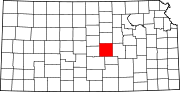
Unincorporated
communitiesGhost towns Christian | Elivon
Footnotes ‡This populated place also has portions in an adjacent county or counties
Categories:- Cities in Kansas
- Populated places in McPherson County, Kansas
-


Wikimedia Foundation. 2010.