- Moundridge, Kansas
-
Moundridge, Kansas — City — Location of Moundridge, Kansas Detailed map of Moundridge, Kansas
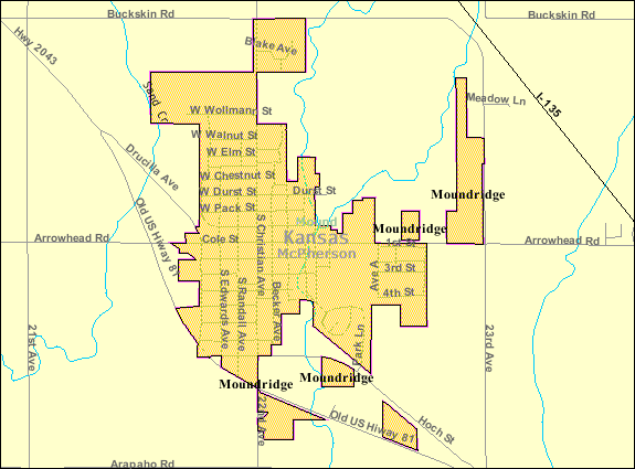
Coordinates: 38°12′9″N 97°31′7″W / 38.2025°N 97.51861°WCoordinates: 38°12′9″N 97°31′7″W / 38.2025°N 97.51861°W Country United States State Kansas County McPherson Platted Incorporated Government – Type Mayor–Council Area – Total 1.0 sq mi (2.7 km2) – Land 1.0 sq mi (2.7 km2) – Water 0.0 sq mi (0.0 km2) Elevation 1,493 ft (455 m) Population (2010)[1] – Total 1,737 – Density 1,737/sq mi (670.7/km2) Time zone Central (CST) (UTC-6) – Summer (DST) CDT (UTC-5) ZIP code 67107 Area code(s) 620 FIPS code 20-48800[2] GNIS feature ID 0477748[3] Website www.Moundridge.com Moundridge is a city in McPherson County, Kansas, United States. As of the 2010 census, the city population was 1,737.[1] The city is named for the settlement that became the incorporated city in 1887 located in Mound Township.[citation needed]
Contents
History
The Moundridge area was settled by Mennonites soon after the completion of the transcontinental railroad in 1869.[citation needed] The museums in nearby Hillsboro and Goessel demonstrate the lives and times of these early settlers.[citation needed]
Between 1874 and 1880, of the approximately 45,000 Mennonites who had been living in South Russia, 10,000 departed for the United States and 8,000 for Manitoba. Available cropland in the central United States was similar to that in their homelands in the Crimean Peninsula. Since the central part of the state was settled, Kansas has enjoyed the reputation as the top wheat-producing state. Settlers in central Kansas, experienced in Russian methods of dryland farming and flour milling, introduced winter wheat in 1873 and quickly saw their industry become dominant.[citation needed]
Language
Virtually all of the original settlers of McPherson County spoke German, many exclusively. With the coming of the automobile and the importance of commercial participation with the English-speaking citizens, the use of German diminished in importance. The participation of the United States in World War I and II dramatically increased the use of English and by the early 1940s, ministers rarely preached in German. As of the year 2000, a very small number of German religious publications are available, primarily for use by elderly congregants.[citation needed]
Geography
Moundridge is located at 38°12′9″N 97°31′7″W / 38.2025°N 97.51861°W (38.202497, -97.518506)[4]. According to the United States Census Bureau, the city has a total area of 1.0 square miles (2.7 km²), all of it land.
Demographics
Historical populations Census Pop. %± 1960 1,214 — 1970 1,271 4.7% 1980 1,453 14.3% 1990 1,531 5.4% 2000 1,593 4.0% 2010 1,737 9.0% U.S. Decennial Census As of the census[2] of 2000, there were 1,593 people, 647 households, and 419 families residing in the city. The population density was 1,519.6 people per square mile (585.8/km²). There were 681 housing units at an average density of 649.6 per square mile (250.4/km²). The racial makeup of the city was 97.24% White, 0.50% African American, 0.88% Native American, 0.06% Asian, 0.75% from other races, and 0.56% from two or more races. Hispanic or Latino of any race were 1.51% of the population.[5][6]
There were 647 households out of which 28.7% had children under the age of 18 living with them, 58.0% were married couples living together, 4.9% had a female householder with no husband present, and 35.1% were non-families. 31.2% of all households were made up of individuals and 17.2% had someone living alone who was 65 years of age or older. The average household size was 2.31 and the average family size was 2.90.
In the city the population was spread out with 22.5% under the age of 18, 6.6% from 18 to 24, 24.9% from 25 to 44, 19.6% from 45 to 64, and 26.4% who were 65 years of age or older. The median age was 42 years. For every 100 females there were 87.9 males. For every 100 females age 18 and over, there were 85.4 males.
The median income for a household in the city was $37,644, and the median income for a family was $44,934. Males had a median income of $34,038 versus $20,223 for females. The per capita income for the city was $19,263. About 2.1% of families and 4.7% of the population were below the poverty line, including 5.0% of those under age 18 and 7.5% of those age 65 or over.
Education
Primary and secondary education
Moundridge is part of Unified School District 423.[7][8]
Infrastructure
Transportation
Interstate I-135 runs along the north-east side of the city. Highway US 81 passes through city.
Moundridge Municipal Field is located approximately 1 mile (1.6 km) east of central Moundridge.[citation needed]
Utilities
- Internet
- Wireless is provided by Pixius Communications.
- Satellite is provided by HughesNet, StarBand, WildBlue.
- TV
- Satellite is provided by DirecTV, Dish Network.
- Terrestrial is provided by regional digital TV stations.
- Electricity
- City is provided by City of Moundridge.
- Natural Gas is provided by City of Moundridge.
- Water
- City is provided by City of Moundridge.
- Rural is provided by Marion County RWD #4.
- Sewer is provided by City of Moundridge.
- Trash is provided by McPherson Area Solid Waste Utility.
References
- ^ a b "2010 City Population and Housing Occupancy Status". U.S. Census Bureau. http://factfinder2.census.gov/faces/tableservices/jsf/pages/productview.xhtml?pid=DEC_10_PL_GCTPL2.ST13&prodType=table. Retrieved March 6, 2011.
- ^ a b "American FactFinder". United States Census Bureau. http://factfinder.census.gov. Retrieved 2008-01-31.
- ^ "US Board on Geographic Names". United States Geological Survey. 2007-10-25. http://geonames.usgs.gov. Retrieved 2008-01-31.
- ^ "US Gazetteer files: 2010, 2000, and 1990". United States Census Bureau. 2011-02-12. http://www.census.gov/geo/www/gazetteer/gazette.html. Retrieved 2011-04-23.
- ^ U.S. Census Bureau - 2000 Census, Population and Housing Unit Counts for Kansas
- ^ U.S. Census Bureau - 1990 Census, Population and Housing Unit Counts for Kansas
- ^ USD 423
- ^ Kansas School District Boundary Map
External links
- City
- Schools
- USD 423, local school district
- Historical
- Maps
- Moundridge City Map, KDOT
- McPherson County Map, KDOT
Municipalities and communities of McPherson County, Kansas Cities 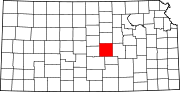
Unincorporated
communitiesGhost towns Christian | Elivon
Footnotes ‡This populated place also has portions in an adjacent county or counties
Categories:- Cities in Kansas
- Populated places in McPherson County, Kansas
- Internet


Wikimedia Foundation. 2010.