- National Register of Historic Places listings in Montgomery County, Kansas
-
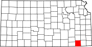
 Location of Montgomery County in Kansas
This is a list of the National Register of Historic Places listings in Montgomery County, Kansas.
This is intended to be a complete list of the properties and districts on the National Register of Historic Places in Montgomery County, Kansas, United States. The locations of National Register properties and districts for which the latitude and longitude coordinates are included below, may be seen in a Google map.[1]
There are 30 properties and districts listed on the National Register in the county.
-
- This National Park Service list is complete through NPS recent listings posted November 10, 2011.[2]
Current listings
[3] Landmark name [4] Image Date listed Location City or town Summary 1 Archeological Site Number 14MY1 July 9, 1982 Address restricted Little River 2 Archeological Site Number 14MY365 July 9, 1982 Address restricted Independence 3 Archeological Site Number 14MY1320 July 9, 1982 Address restricted Independence 4 Archeological Site Number 14MY1385 July 9, 1982 Address restricted Liberty 5 Charles M. Ball House February 7, 2011 702 Spruce St.
37°02′14″N 95°37′20″W / 37.037222°N 95.622222°WCoffeyville 6 Bethel African Methodist Episcopal Church July 28, 1995 202 W. 12th St.
37°01′56″N 95°37′02″W / 37.032222°N 95.617222°WCoffeyville 7 Blakeslee Motor Company Building August 25, 1989 211 W. Myrtle
37°13′32″N 95°42′28″W / 37.225556°N 95.707778°WIndependence 8 Booth Hotel April 28, 1983 201-209 W. Main St.
37°13′22″N 95°42′30″W / 37.222778°N 95.708333°WIndependence 9 Booth Theater October 13, 1988 119 W. Myrtle St.
37°13′31″N 95°42′22″W / 37.225278°N 95.706111°WIndependence 10 Brown Barn April 8, 2009 5879 County Road 4300
37°08′19″N 95°40′27″W / 37.138611°N 95.674167°WIndependence Agriculture-Related Resources of Kansas MPS 11 W.P. Brown Mansion December 12, 1976 S. Walnut and Eldridge Sts.
37°01′13″N 95°36′50″W / 37.020278°N 95.613889°WCoffeyville 12 Cherryvale Carnegie Free Library August 18, 1987 329 E. Main
37°16′01″N 95°32′55″W / 37.266944°N 95.548611°WCherryvale 13 Coffeyville Carnegie Public Library Building June 25, 1987 415 W. Eighth
37°02′09″N 95°37′23″W / 37.035833°N 95.623056°WCoffeyville 14 Condon National Bank January 12, 1973 811 Walnut St.
37°02′08″N 95°36′55″W / 37.035556°N 95.615278°WCoffeyville 15 Cook's Hotel March 8, 2006 113 West Myrtle
37°13′27″N 95°42′24″W / 37.224167°N 95.706667°WIndependence 16 Dewlen-Spohnhauer Bridge March 10, 1983 Old U.S. Route 160
37°13′28″N 95°40′43″W / 37.224444°N 95.678611°WIndependence 17 Elk River Archeological District September 13, 1978 Address restricted Elk City 18 Federal Building-US Post Office October 19, 1988 123 N. 8th
37°13′31″N 95°42′26″W / 37.225278°N 95.707222°WIndependence 19 Hotel Dale January 31, 2008 206 W. 8th St.
37°02′10″N 95°37′02″W / 37.036111°N 95.617222°WCoffeyville 20 Independence Bowstring January 4, 1990 Over the Verdigris River, north of junction of Burns and Myrtle Sts.
37°13′29″N 95°41′37″W / 37.224722°N 95.693611°WIndependence 21 Independence Downtown Historic District July 19, 2006 Chestnut, Laurel, Myrtle, Main, Maple between 5th and 9th
37°13′30″N 95°42′18″W / 37.225°N 95.705°WIndependence 22 Independence Junior High School December 30, 2009 300 W. Locust St.
37°13′40″N 95°42′34″W / 37.227714°N 95.709378°WIndependence 23 Independence Public Carnegie Library January 11, 1988 220 E. Maple
37°13′25″N 95°42′12″W / 37.223611°N 95.703333°WIndependence 24 Infinity Archeological Site March 24, 1971 Address restricted Independence 25 Memorial Hall June 10, 2005 Junction of Pennsylvania Ave. and E. Locust St.
37°13′45″N 95°42′23″W / 37.229167°N 95.706389°WIndependence 26 Midland Theater February 9, 2005 212-214 W. 8th St.
37°02′17″N 95°36′58″W / 37.038056°N 95.616111°WCoffeyville 27 Onion Creek Bridge 
January 4, 1990 Over Onion Creek, south of Coffeyville
37°01′33″N 95°39′23″W / 37.025833°N 95.656389°WCoffeyville 28 Pennsylvania Avenue Rock Creek Bridge July 2, 1985 Pennsylvania Ave. over Rock Creek
37°12′51″N 95°42′24″W / 37.214167°N 95.706667°WIndependence 29 Terminal Building June 14, 1982 717 Walnut
37°02′11″N 95°36′54″W / 37.036389°N 95.615°WCoffeyville 30 Union Implement and Hardware Building-Masonic Temple October 13, 1988 121-123 W. Main
37°13′23″N 95°42′27″W / 37.223056°N 95.7075°WIndependence See also
- List of National Historic Landmarks in Kansas
- National Register of Historic Places listings in Kansas
References
- ^ The latitude and longitude information provided in this table was derived originally from the National Register Information System, which has been found to be fairly accurate for about 99% of listings. For about 1% of NRIS original coordinates, experience has shown that one or both coordinates are typos or otherwise extremely far off; some corrections may have been made. A more subtle problem causes many locations to be off by up to 150 yards, depending on location in the country: most NRIS coordinates were derived from tracing out latitude and longitudes off of USGS topographical quadrant maps created under the North American Datum of 1927, which differs from the current, highly accurate WGS84 GPS system used by Google maps. Chicago is about right, but NRIS longitudes in Washington are higher by about 4.5 seconds, and are lower by about 2.0 seconds in Maine. Latitudes differ by about 1.0 second in Florida. Some locations in this table may have been corrected to current GPS standards.
- ^ "National Register of Historic Places: Weekly List Actions". National Park Service, United States Department of the Interior. Retrieved on November 10, 2011.
- ^ Numbers represent an ordering by significant words. Various colorings, defined here, differentiate National Historic Landmark sites and National Register of Historic Places Districts from other NRHP buildings, structures, sites or objects.
- ^ "National Register Information System". National Register of Historic Places. National Park Service. . http://nrhp.focus.nps.gov/natreg/docs/All_Data.html.
Municipalities and communities of Montgomery County, Kansas Cities Caney | Cherryvale | Coffeyville | Dearing | Elk City | Havana | Independence | Liberty | Tyro
Unincorporated
communityCategories:- Montgomery County, Kansas
- National Register of Historic Places in Kansas by county
- Buildings and structures in Montgomery County, Kansas
-


Wikimedia Foundation. 2010.