- National Register of Historic Places listings in Ellsworth County, Kansas
-
 Location of Ellsworth County in Kansas
This is a list of the National Register of Historic Places listings in Ellsworth County, Kansas.
This is intended to be a complete list of the properties and districts on the National Register of Historic Places in Ellsworth County, Kansas, United States. The locations of National Register properties and districts for which the latitude and longitude coordinates are included below, may be seen in a Google map.[1]
There are 20 properties and districts listed on the National Register in the county.
-
- This National Park Service list is complete through NPS recent listings posted November 10, 2011.[2]
Current listings
[3] Landmark name [4] Image Date listed Location City or town Summary 1 Archeological Site Number 14EW14 July 9, 1982 Address restricted Carneiro 2 Archeological Site Number 14EW17 July 9, 1982 Address restricted Ellsworth 3 Archeological Site Number 14EW33 July 9, 1982 Address restricted Carneiro 4 Archeological Site Number 14EW303 July 9, 1982 Address restricted Ellsworth 5 Archeological Site Number 14EW401 July 9, 1982 Address restricted Ellsworth 6 Archeological Site Number 14EW403 July 9, 1982 Address restricted Carneiro 7 Archeological Site Number 14EW404 July 9, 1982 Address restricted Ellsworth 8 Archeological Site Number 14EW405 July 9, 1982 Address restricted Geneseo 9 Archeological Site Number 14EW406 July 9, 1982 Address restricted Ellsworth 10 Ellsworth Downtown Historic District October 10, 2007 Generally including blocks between N. Main & 3rd Sts. from Lincoln to Kansas Aves. and the west side of Kansas Ave.
38°43′48″N 98°13′50″W / 38.729964°N 98.230447°WEllsworth 11 Fort Harker Guardhouse February 23, 1972 Northwestern corner of Wyoming and Ohio Sts., Fort Harker site
38°42′37″N 98°09′38″W / 38.710278°N 98.160556°WKanopolis 12 Fort Harker Officers' Quarters November 20, 1974 Ohio St. between Kansas and Colorado Sts., Fort Harker site
38°42′37″N 98°09′31″W / 38.710278°N 98.158611°WKanopolis 13 Perry Hodgden House January 29, 1973 104 W. Main St.
38°43′42″N 98°13′57″W / 38.728333°N 98.2325°WEllsworth 14 Holyrood Santa Fe Depot May 17, 2010 Between Main St and Smith St.
38°35′16″N 98°24′39″W / 38.587889°N 98.410719°WHolyrood 15 Indian Hill Site December 31, 1974 Address restricted Marquette 16 Insurance Building July 11, 2006 115 N. Douglas Ave.
38°43′44″N 98°13′50″W / 38.728889°N 98.230556°WEllsworth 17 Arthur Larkin House February 24, 1975 0.25 mile south of Ellsworth off K-45
38°43′20″N 98°14′13″W / 38.722222°N 98.236944°WEllsworth 18 Midland Hotel July 3, 2002 414 26th Ave.
38°49′39″N 98°28′23″W / 38.8275°N 98.473056°WWilson 19 Weinhold House March 2, 2001 2315 C Ave.
38°49′45″N 98°27′57″W / 38.829167°N 98.465833°WWilson 20 Wilson Downtown Historic District No. 3-Southside January 28, 2004 400 block of 27th St., "Old Highway 40"
38°49′35″N 98°28′27″W / 38.826389°N 98.474167°WWilson See also
- List of National Historic Landmarks in Kansas
- National Register of Historic Places listings in Kansas
References
- ^ The latitude and longitude information provided in this table was derived originally from the National Register Information System, which has been found to be fairly accurate for about 99% of listings. For about 1% of NRIS original coordinates, experience has shown that one or both coordinates are typos or otherwise extremely far off; some corrections may have been made. A more subtle problem causes many locations to be off by up to 150 yards, depending on location in the country: most NRIS coordinates were derived from tracing out latitude and longitudes off of USGS topographical quadrant maps created under North American Datum of 1927, which differs from the current, highly accurate GPS system used by Google maps. Chicago is about right, but NRIS longitudes in Washington are higher by about 4.5 seconds, and are lower by about 2.0 seconds in Maine. Latitudes differ by about 1.0 second in Florida. Some locations in this table may have been corrected to current GPS standards.
- ^ "National Register of Historic Places: Weekly List Actions". National Park Service, United States Department of the Interior. Retrieved on November 10, 2011.
- ^ Numbers represent an ordering by significant words. Various colorings, defined here, differentiate National Historic Landmark sites and National Register of Historic Places Districts from other NRHP buildings, structures, sites or objects.
- ^ "National Register Information System". National Register of Historic Places. National Park Service. . http://nrhp.focus.nps.gov/natreg/docs/All_Data.html.
Municipalities and communities of Ellsworth County, Kansas County seat: Ellsworth Cities 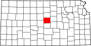
Townships Unincorporated
communitiesBlack Wolf | Carneiro | Langley | Venango | Yankee Run
Categories:- Ellsworth County, Kansas
- National Register of Historic Places in Kansas by county
-


Wikimedia Foundation. 2010.